Report on Etna (Italy) — August 1989
Scientific Event Alert Network Bulletin, vol. 14, no. 8 (August 1989)
Managing Editor: Lindsay McClelland.
Etna (Italy) Explosions and lava flows; tephra reaches the coast
Please cite this report as:
Global Volcanism Program, 1989. Report on Etna (Italy) (McClelland, L., ed.). Scientific Event Alert Network Bulletin, 14:8. Smithsonian Institution. https://doi.org/10.5479/si.GVP.SEAN198908-211060
Etna
Italy
37.748°N, 14.999°E; summit elev. 3357 m
All times are local (unless otherwise noted)
The following preliminary data is from R. Romano.
Strong Strombolian activity from La Voragine and Southeast Crater was followed by an explosive eruption from La Voragine during the late morning of 10 September. Tephra rose 600-700 m, and the resulting plume, carried E by the wind, deposited ash and lapilli along a narrow, well-defined, path that extended to the coast. After strong explosive activity and lava fountaining, lava spilled over the rim of Southeast Crater early the next morning, forming fluid, fast-moving flows that reached the Piano del Lago (on the upper S flank). During the nights of 11, 12, and 13 September, four more episodes of strong activity occurred, feeding lava flows that advanced SE, S, and SW; these were also very fluid and descended ~ 2 km to 2,640 m elevation. During this period, with brief exceptions, a small lava lake remained visible within Southeast Crater, and was the location of lava fountains that reached average heights of a few hundred meters.
A violent explosive episode that began at about 0900 on 13 September ejected incandescent pyroclastic material to more than 1 km height. Winds again carried the plume toward the E, leaving a narrow band of scoria, lapilli and ash that reached the coast. Press reports said that tephra fall lasted for ~ 15 minutes and some of the lapilli reached walnut size. No injuries were reported, but numerous cars were damaged, and traffic was slowed by nearly 4 cm of ash on the lower flanks. During the explosive activity, felt seismicity on the upper flanks increased substantially but subsided after a few hours.
The plume from the explosion at 0900 was not evident on weather satellite images, but data returned 4 hours earlier, at 0500, showed a plume 15-20 km wide extending ~ 100 km E from Etna. The plume had dissipated by about 0800. During the day on 14 September, no eruptive episodes occurred, and the magma column remained low.
Preliminary estimates suggest that an area of ~0.5 km2 was covered by ~ 5x10⁵ m3 of lava. No estimates of the volume of pyroclastic material were available at press time. Similar activity occurred at the NE crater in 1977-78.
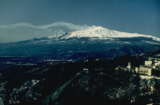
Geological Summary. Mount Etna, towering above Catania on the island of Sicily, has one of the world's longest documented records of volcanism, dating back to 1500 BCE. Historical lava flows of basaltic composition cover much of the surface of this massive volcano, whose edifice is the highest and most voluminous in Italy. The Mongibello stratovolcano, truncated by several small calderas, was constructed during the late Pleistocene and Holocene over an older shield volcano. The most prominent morphological feature of Etna is the Valle del Bove, a 5 x 10 km caldera open to the east. Two styles of eruptive activity typically occur, sometimes simultaneously. Persistent explosive eruptions, sometimes with minor lava emissions, take place from one or more summit craters. Flank vents, typically with higher effusion rates, are less frequently active and originate from fissures that open progressively downward from near the summit (usually accompanied by Strombolian eruptions at the upper end). Cinder cones are commonly constructed over the vents of lower-flank lava flows. Lava flows extend to the foot of the volcano on all sides and have reached the sea over a broad area on the SE flank.
Information Contacts: R. Romano, IIV; A. Brown, NOAA/NESDIS; UPI.