Report on Llaima (Chile) — 20 May-26 May 2009
Smithsonian Institution / US Geological Survey
Weekly Volcanic Activity Report, 20 May-26 May 2009
Managing Editor: Sally Sennert.
Please cite this report as:
Global Volcanism Program, 2009. Report on Llaima (Chile) (Sennert, S, ed.). Weekly Volcanic Activity Report, 20 May-26 May 2009. Smithsonian Institution and US Geological Survey.
Llaima
Chile
38.692°S, 71.729°W; summit elev. 3125 m
All times are local (unless otherwise noted)
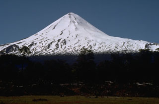
During 12-18 May, SERNAGEOMIN reported sporadic incandescence from an area in the SW part of Llaima's main crater, corresponding to a small active "outcrop of lava." Steam plumes rose from the same area. The Volcano Alert Level remained at Yellow.
Geological Summary. Llaima, one of Chile's largest and most active volcanoes, contains two main historically active craters, one at the summit and the other, Pichillaima, to the SE. The massive, dominantly basaltic-to-andesitic, stratovolcano has a volume of 400 km3. A Holocene edifice built primarily of accumulated lava flows was constructed over an 8-km-wide caldera that formed about 13,200 years ago, following the eruption of the 24 km3 Curacautín Ignimbrite. More than 40 scoria cones dot the volcano's flanks. Following the end of an explosive stage about 7200 years ago, construction of the present edifice began, characterized by Strombolian, Hawaiian, and infrequent subplinian eruptions. Frequent moderate explosive eruptions with occasional lava flows have been recorded since the 17th century.
Source: Servicio Nacional de Geología y Minería (SERNAGEOMIN)