Global Volcanism Program | Image GVP-00105
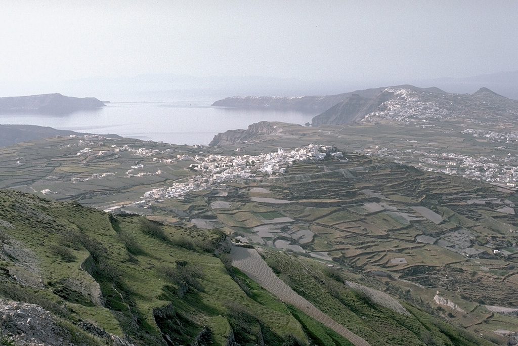
The outer flanks of the Santorini caldera, mantled by deposits of the 3,500-year-old Minoan eruption, provide a setting for croplands and island villages. This view looks NW from Mt. Profitis Ilias, a limestone peak forming the high point of the island of Thera, shows the northern half of the 7.5 x 11 km caldera. The northern rim drops below sea level, leaving a channel between the tip of Thera and the island of Therasia to the left.
Photo by Lee Siebert, 1994 (Smithsonian Institution).
![]() This image is made available under the Public Domain Dedication CC0 license, but proper attribution is appreciated.
This image is made available under the Public Domain Dedication CC0 license, but proper attribution is appreciated.
Keywords: caldera
Santorini