Global Volcanism Program | Image GVP-01683
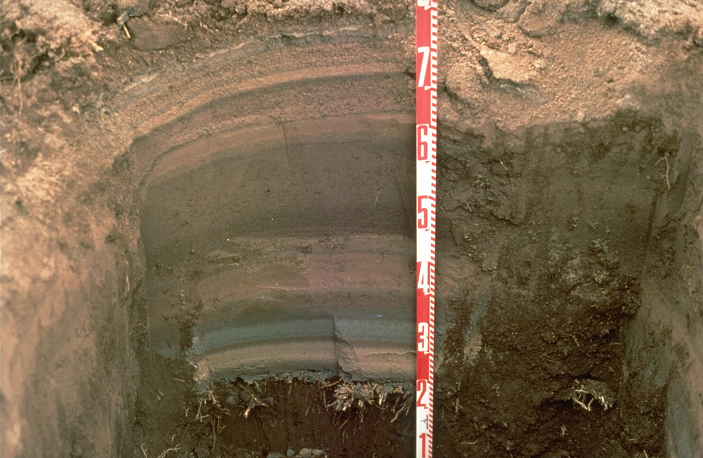
Tephra layers from the 1994 eruption of Rabaul volcano are exposed in this pit dug at the eastern end of Rabaul town in Papua New Guinea. Individual layers are ashfall deposits from discrete explosive eruptions that occurred over three weeks. The light-colored layer near the bottom was produced by an eruption from Vulcan cone at the western end of the caldera. Most other layers originated from periodic explosions at the Tavurvur cone, closer to this site. The numbers on the scale mark 10-cm increments.
Photo by Andy Lockhart, 1994 (U.S. Geological Survey).
![]() This image is made available as a Public Domain Work, but proper attribution is appreciated.
This image is made available as a Public Domain Work, but proper attribution is appreciated.
Galleries: Ash Plumes and Ashfall
Keywords: tephra | field work | deposit | stratigraphy | ash | geology

Rabaul