Global Volcanism Program | Image GVP-02924
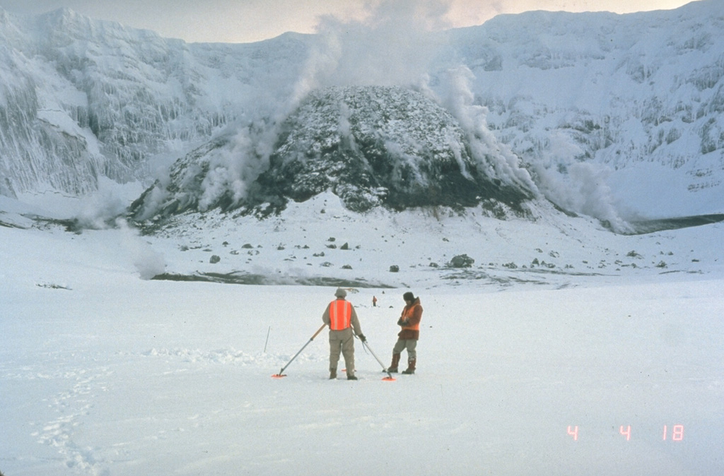
U.S. Geological Survey scientists make precision leveling measurements in the crater of Mount St. Helens in February 1982 with the steaming lava dome in the background. Repeated measurements of deformation was one of several methods used by scientists to successfully forecast later eruptions from the crater.
Photo by Terry Leighley, 1982 (U.S. Geological Survey).
![]() This image is made available as a Public Domain Work, but proper attribution is appreciated.
This image is made available as a Public Domain Work, but proper attribution is appreciated.
Galleries: Volcano Monitoring
Keywords: volcanologist | field work | lava dome | volcano monitoring

St. Helens