Global Volcanism Program | Image GVP-03767
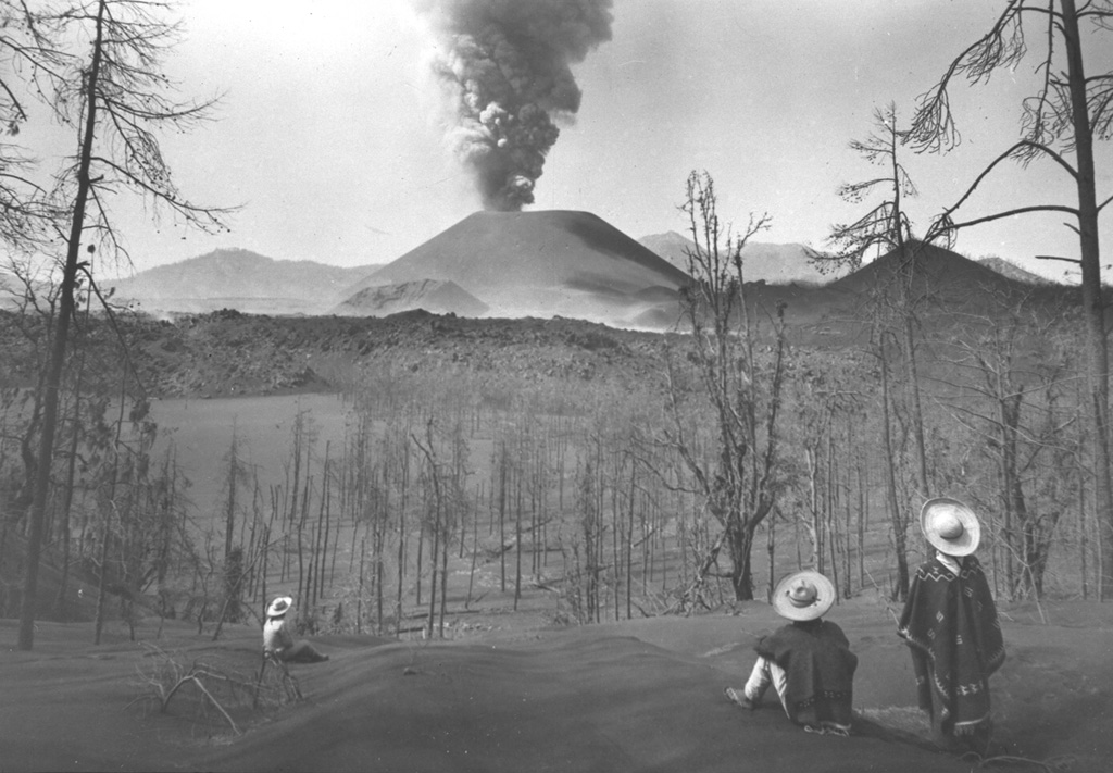
Local Tarascan residents observe Parícutin volcano from Cerro de Equijuata, 2.5 km to the NNE, in March 1944. In this photo taken a little more than a year after the eruption began the Sapichu cone appears at the NE (left-hand) base of Parícutin. The rugged lava flows of June 1943 are visible in the middle of the photo. Heavy ashfall has defoliated trees and a thick ash deposit mantles the landscape.
Photo by Arno Brehme, 1944 (U.S. National Archives, published in Foshag and Gonzáles-Reyna, 1956).
![]() This image is made available under the Public Domain Dedication CC0 license, but proper attribution is appreciated.
This image is made available under the Public Domain Dedication CC0 license, but proper attribution is appreciated.
Galleries: Ash Plumes and Ashfall | Human Impacts | Scoria Cones
Keywords: eruption | ash plume | ash | plume | explosive eruption | volcanic field | human impacts | environmental impact | agriculture | deposit | tephra | scoria cone | crater
Michoacán-Guanajuato