Global Volcanism Program | Image GVP-10187
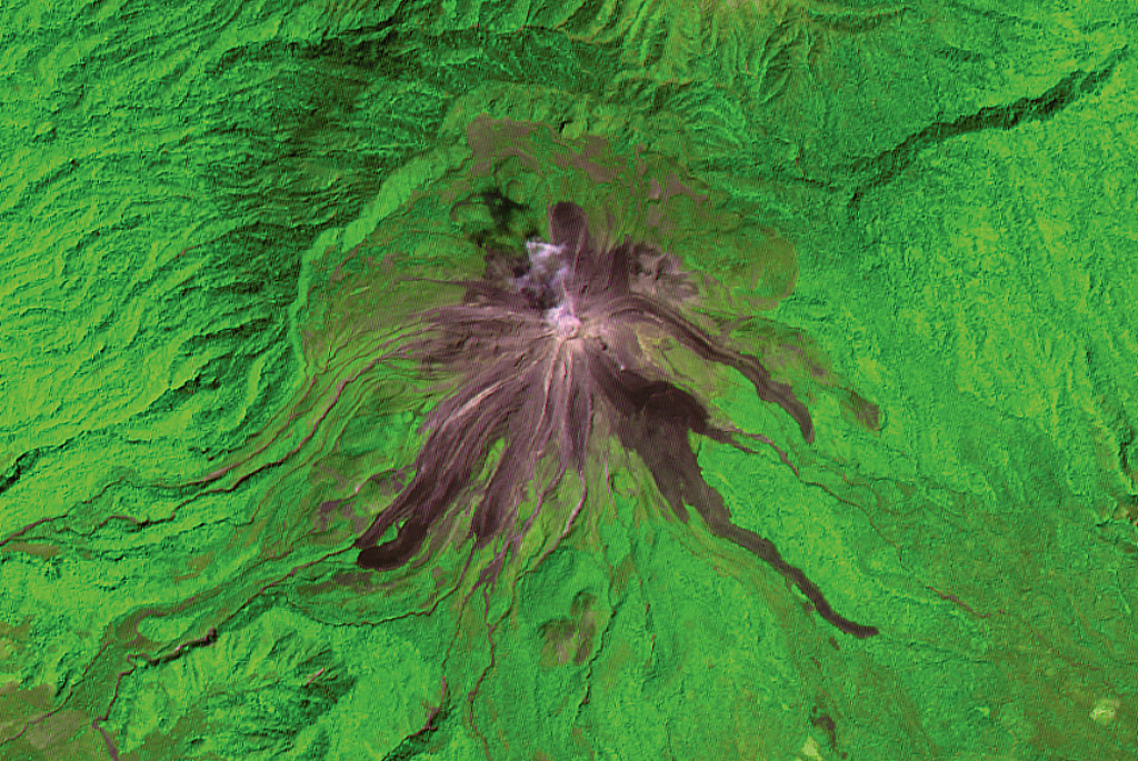
Recent lava flows from Volcán de Colima radiate from the summit in this 2001 ASTER satellite image (N is at the top; this image is approximately 13 km wide). The flows on the E and SE flanks were produced in 1975-76 and reached up to 3.5 km from the summit. The longest flows down the SW flank formed in 1998-99; the three major lobes seen here covered a SW-flank flow from 1991. The headwall of the horseshoe-shaped scarp to the N was produced by collapse of an older edifice.
ASTER satellite image, 2001 (National Aeronautical and Space Administration, processed by Doug Edmonds).
![]() This image is made available under the Creative Commons BY-NC 4.0 license terms.
This image is made available under the Creative Commons BY-NC 4.0 license terms.
Galleries: Lava Flows | Remote Sensing
Keywords: stratovolcano | lava flow | remote sensing | landslide scarp | remote sensing | lava lobe

Colima