Global Volcanism Program | Image GVP-10189
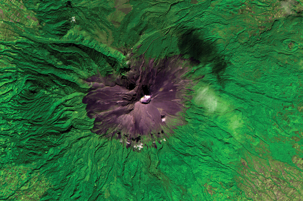
Volcán Popocatépetl is seen in this ASTER satellite image taken in 2001 (N is at the top; this image is approximately 22 km across).. A dilute plume from the summit crater casts a shadow on the upper right flank. The edifice contains the Ventorrillo peak NW of the crater, a remnant of an earlier edifice, and the headwall of the deep Nexpayantla valley down the NW flank. At least three previous major cones were destroyed by gravitational failure during the Pleistocene, producing massive debris avalanche deposits that cover broad areas to the south.
ASTER satellite image, 2001 (National Aeronautical and Space Administration, processed by Doug Edmonds).
![]() This image is made available under the Creative Commons BY-NC 4.0 license terms.
This image is made available under the Creative Commons BY-NC 4.0 license terms.
Keywords: remote sensing | stratovolcano | crater

Popocatépetl