Global Volcanism Program | Image GVP-11030
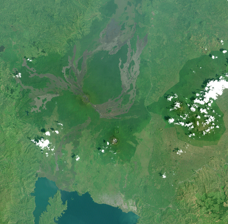
This Landsat image shows a portion of the East African Rift north of Lake Kivu (bottom), with N to the upper left. Unvegetated lava flows descend from vents on the summit and flanks, some reaching the shores of Lake Kivu. The forested volcano below and to the right is Nyiragongo, a volcano that frequently contains an active lava lake. Lava flows from flank fissures in 2002 cut across the city of Goma (the light-colored area at the right-hand side of the lake).
NASA Landsat image, 2001 (courtesy of Simon Carn, TOMS Volcanic Emissions Group, Univ. Maryland, Baltimore County).
![]() This image is made available as a Public Domain Work, but proper attribution is appreciated.
This image is made available as a Public Domain Work, but proper attribution is appreciated.
Keywords: remote sensing | lava flow

Nyamulagira