Global Volcanism Program | Image GVP-11159
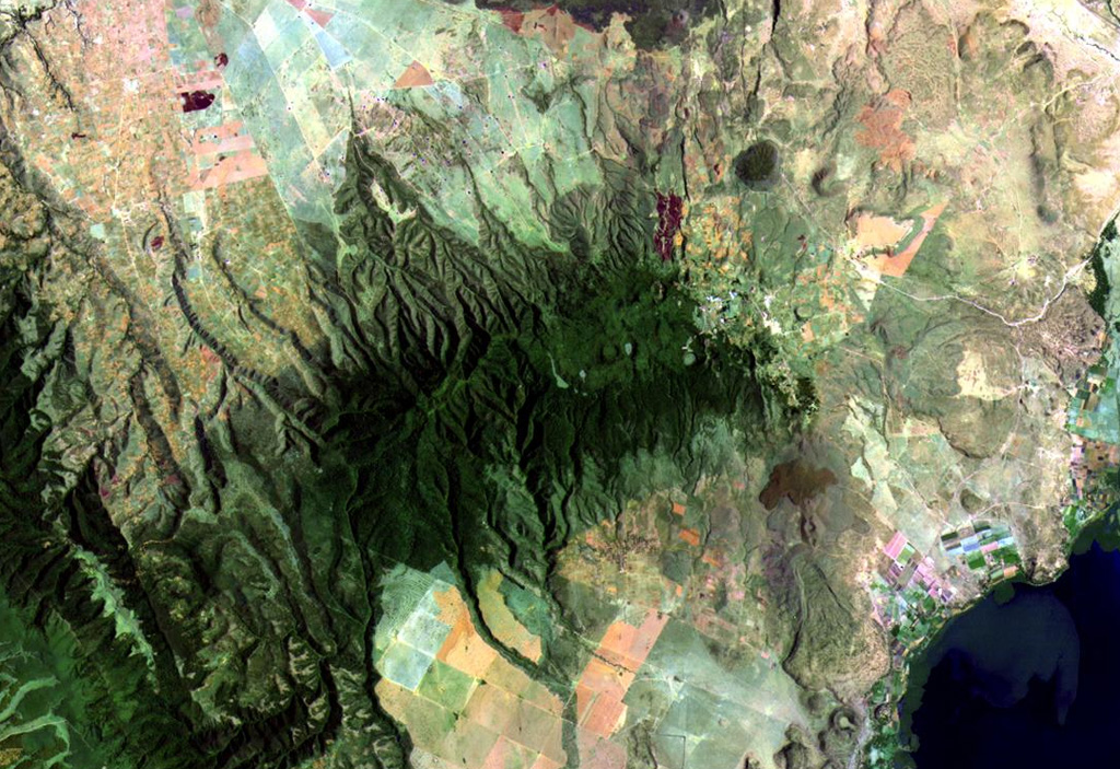
Vegetated Eburru volcano (center) is elongated perpendicular to the Gregory Rift NW of Lake Naivasha (lower right). The E-W-trending main edifice is eroded, but young craters cut the E part of the summit ridge and probably-Holocene rhyolitic domes occur on the E flank. Extensive fumarolic activity occurs at scoria cones and craters constructed along faults cutting the massif. Lava flows of the Elmenteita Badlands are visible at the top-center portion of this Landsat image.
NASA Landsat image, 1999 (courtesy of Hawaii Synergy Project, Univ. of Hawaii Institute of Geophysics & Planetology).
![]() This image is made available as a Public Domain Work, but proper attribution is appreciated.
This image is made available as a Public Domain Work, but proper attribution is appreciated.
Keywords: remote sensing
Ol Doinyo Eburru