Global Volcanism Program | Image GVP-11875
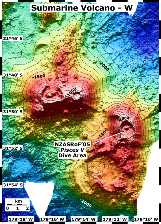
This map view shows two submarine volcanoes known informally as Volcano W. The Pisces V dive area during a 2005 New Zealand-American expedition is indicated on the SE caldera. The contour interval is 100 m and the resolution of the bathymetry data is 25 m. The bathymetry data are proprietary and provided courtesy of Ian Wright, New Zealand National Institute of Water and Atmospheric Research (NIWA).
Image courtesy of New Zealand-American Submarine Ring of Fire 2005 Exploration, NOAA Vents Program.
![]() This image is made available as a Public Domain Work, but proper attribution is appreciated.
This image is made available as a Public Domain Work, but proper attribution is appreciated.
Keywords: submarine volcano | stratovolcano | remote sensing | technology | DEM | map | bathymetry
Wright