Global Volcanism Program | Image GVP-12238
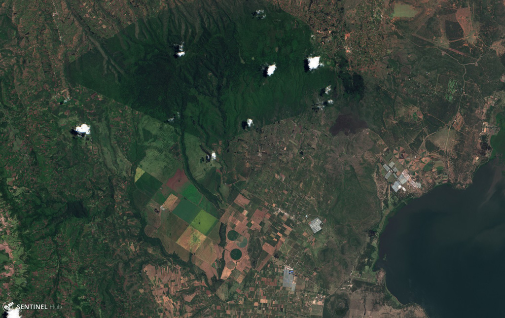
Ol Doinyo Eburru is across the center of this December 2020 Planet Labs satellite image monthly mosaic (N is at the top; this image is approximately 19 km across). It is composed of two eroded eastern (younger) and western (older) edifices, and the smaller vegetated Cedar Hill below the easternmost boundary with visible pressure ridges along the surface (lower right).
Satellite image courtesy of Planet Labs Inc., 2020 (https://www.planet.com/).
Copyrighted image used with permission. All Rights Reserved. Contact photographer for any usage requests.
Ol Doinyo Eburru