Global Volcanism Program | Image GVP-12493
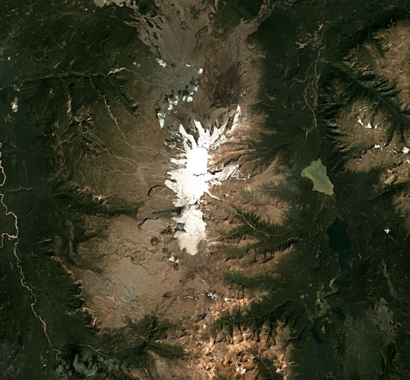
Mount Edziza is an approximately 30-km-long volcanic range that forms the northernmost edifice of the Mount Edziza volcanic complex, and is shown in this July 2018 Planet Labs satellite image monthly mosaic (N is at the top; this image is approximately 42 km across). Many eruptions occurred within ice and water, such as the Tennena cone on the western flank about two-thirds down the ice cap in this view, forming pillow lavas and hydrovolcanic clastic deposits.
Satellite image courtesy of Planet Labs Inc., 2018 (https://www.planet.com/).
Copyrighted image used with permission. All Rights Reserved. Contact photographer for any usage requests.
Edziza