Global Volcanism Program | Image GVP-12557
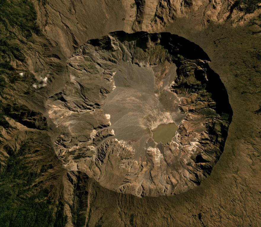
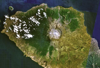
The Tambora caldera formed during the 1815 eruption, after 41 km3 of magma (dense rock equivalent) was expelled, leaving the 6-km-wide and 1-km-deep depression seen in this July 2019 Planet Labs satellite image mosaic (N is to the top). The current area of the caldera is approximately 34.5 km2, with erosion altering the surface and remobilizing material onto the caldera floor.
Satellite image courtesy of Planet Labs Inc., 2019 (https://www.planet.com/).
Copyrighted image used with permission. All Rights Reserved. Contact photographer for any usage requests.
Galleries: Calderas
Keywords: caldera
Tambora