Report on Nyamulagira (DR Congo) — January 1992
Bulletin of the Global Volcanism Network, vol. 17, no. 1 (January 1992)
Managing Editor: Lindsay McClelland.
Nyamulagira (DR Congo) More information and map of late-1991 fissure eruption
Please cite this report as:
Global Volcanism Program, 1992. Report on Nyamulagira (DR Congo) (McClelland, L., ed.). Bulletin of the Global Volcanism Network, 17:1. Smithsonian Institution. https://doi.org/10.5479/si.GVP.BGVN199201-223020
Nyamulagira
DR Congo
1.408°S, 29.2°E; summit elev. 3058 m
All times are local (unless otherwise noted)
The following from N. Zana supplements the reports in 16:9-10. The eruption began . . . from a vent at 1.30°S, 29.27°E, 1,530 m asl and ~15 km NE of the summit crater. For the eruption's first two weeks, lava fountaining was confined to the S end of a fissure ~500 m long. When a team from the CRSN visited the eruption site 21-25 September, a cinder cone (cone 1 on figure 8) had already reached 60 m height and lava was fountaining to as much as 180 m above the surrounding lava field. The new vent was ~6 km ENE of the 1958 Kitsimbanyi cone, and thus the northernmost of Nyamuragira's recent eruption sites. The eruptive fissure trended N34°E, similar to fissures from the 1980 (Gasenyi) and 1987 (Gafuranindi) eruptions (figure 8).
When a CRSN team returned . . . on 24 November, the fissure had propagated ~3 km N and had formed seven cones. Only Cone 5 remained active, with lava emission that was intermittent despite its high rate. Ejecta often reached 240 m height, and 2-3-kg bombs fell 600 m from the vent. The sequence of development of the seven vents is not known but several witnesses reported that they became active at random. Geologists concluded that the fissure had been simultaneously active throughout its length. The two main cinder cones (1 and 5 in figure 8) were ~60-80 m high, with basal diameters of 300-350 m.
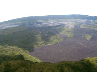
The Mikombe lava flow and those from associated cones advanced over the 1958 and 1980 lava fields. Most of the new lava was aa, with a few benches of pahoehoe, mainly near the cones. During observations 24-27 November, the active lava flow was fed from a tube at the W foot of cone 5, and extended 2.5 km. Flow velocities 1.5 km from the lava fountain were ~40 m/min.
The eruption was preceded by a seismic swarm observed at nearby stations, with the most vigorous activity 13-18 September, but began after a substantial decrease in seismicity. Observations 24-27 November revealed only microtremors associated with the lava extrusion.
Geological Summary. Africa's most active volcano, Nyamulagira (also known as Nyamuragira), is a massive high-potassium basaltic shield about 25 km N of Lake Kivu and 13 km NNW of the steep-sided Nyiragongo volcano. The summit is truncated by a small 2 x 2.3 km caldera that has walls up to about 100 m high. Documented eruptions have occurred within the summit caldera, as well as from the numerous flank fissures and cinder cones. A lava lake in the summit crater, active since at least 1921, drained in 1938, at the time of a major flank eruption. Recent lava flows extend down the flanks more than 30 km from the summit as far as Lake Kivu; extensive lava flows from this volcano have covered 1,500 km2 of the western branch of the East African Rift.
Information Contacts: N. Zana, CRSN, Bukavu.

