Report on Niijima (Japan) — March 1992
Bulletin of the Global Volcanism Network, vol. 17, no. 3 (March 1992)
Managing Editor: Lindsay McClelland.
Niijima (Japan) Earthquake swarm but no surface changes evident
Please cite this report as:
Global Volcanism Program, 1992. Report on Niijima (Japan) (McClelland, L., ed.). Bulletin of the Global Volcanism Network, 17:3. Smithsonian Institution. https://doi.org/10.5479/si.GVP.BGVN199203-284020
Niijima
Japan
34.397°N, 139.27°E; summit elev. 432 m
All times are local (unless otherwise noted)
A seismic swarm recorded between 0200 and 0400 on 19 March consisted of 10 earthquakes beneath and around the island (figure 3). Several of the events were felt by island residents, the largest, M 2.5, at 0349. No surface anomalies were observed.
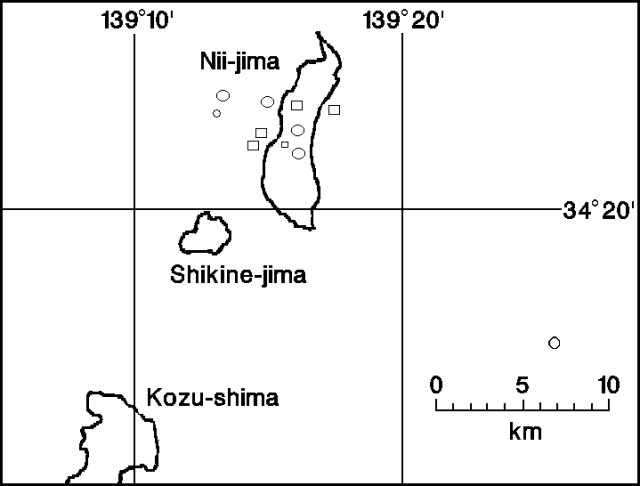 |
Figure 3. Epicenter map of earthquakes near Nii-jima, 19 March 1992. Courtesy of JMA. |
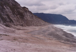
Geological Summary. The elongated island of Niijima, SSW of Oshima, is 11 km long and only 2.5 km wide. Eight low rhyolitic lava domes are clustered in two groups at the northern and southern ends of the island, separated by an area of flat-topped domes and a low isthmus of pyroclastic deposits. The Mukaiyama complex on the south and the Atchiyama lava dome on the north were formed during eruptions in the 9th century CE, the last known activity. Shikineyama and Zinaito domes form small islands immediately to the SW and W, respectively, during earlier stages of volcanism. Earthquake swarms occurred during the 20th century.
Information Contacts: JMA.