Report on Wurlali (Indonesia) — January 1993
Bulletin of the Global Volcanism Network, vol. 18, no. 1 (January 1993)
Managing Editor: Lindsay McClelland.
Wurlali (Indonesia) Landslides and steam emissions triggered by earthquakes
Please cite this report as:
Global Volcanism Program, 1993. Report on Wurlali (Indonesia) (McClelland, L., ed.). Bulletin of the Global Volcanism Network, 18:1. Smithsonian Institution. https://doi.org/10.5479/si.GVP.BGVN199301-265040
Wurlali
Indonesia
7.125°S, 128.675°E; summit elev. 868 m
All times are local (unless otherwise noted)
Landslides and steam emissions on Wurlali volcano were triggered by MM IV-V earthquakes near the [island]. About 4,000 people fled the area, and one of the evacuees died of shock. Staff from VSI observed small landslides and cracks in house walls. There was no volcanic activity observed following the landslides, but the usual white plumes continued to rise 30-50 m above the crater. Tectonic earthquakes were continuing at rates of 14-32/day on 8 February.
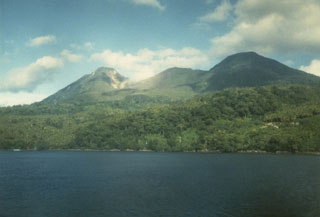
Geological Summary. The andesitic Wurlali stratovolcano, also known as Damar, was constructed at the northern end of a 5-km-wide caldera on the eastern side of Damar Island in the Banda Sea. Fumarolic activity occurs in the twin summit craters and on the SE flanks, producing exploitable sulfur deposits. An explosive eruption was observed in 1892 CE.
Information Contacts: W. Tjetjep, VSI.