Report on Krakatau (Indonesia) — April 1994
Bulletin of the Global Volcanism Network, vol. 19, no. 4 (April 1994)
Managing Editor: Richard Wunderman.
Krakatau (Indonesia) Activity resumes in March after 5 months of quiet; ash clouds and tephra ejection
Please cite this report as:
Global Volcanism Program, 1994. Report on Krakatau (Indonesia) (Wunderman, R., ed.). Bulletin of the Global Volcanism Network, 19:4. Smithsonian Institution. https://doi.org/10.5479/si.GVP.BGVN199404-262000
Krakatau
Indonesia
6.1009°S, 105.4233°E; summit elev. 285 m
All times are local (unless otherwise noted)
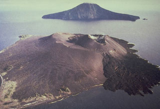
Press reports have described renewed activity . . . from late March through early May. Activity apparently began again on 19 March after about five months of quiet. At the end of March, thick black ash plumes rose 300 m while "red flames and glowing lava" were observed at night to rise 200 m. Eruption noises like thunder could be heard at Carita Beach . . . . Scientists from GMU stated in the newspaper Suara Pembaruan that their seismograph was not operational at the time of the eruption, but began functioning again on 26 March.
Wimpy Tjetjep, Director of VSI, reported to the same newspaper on 6 April that volcanic materials had been thrown within a 3,000-m-radius from the crater. Ash and tephra emissions were continuing, and 160-170 weak volcanic earthquakes had been recorded in the previous week. Officials at the local observatory reportedly described the activity as "spouts of fire" and thick black ash emissions alternating with explosions. Ejection of blocks as large as 1-m-diameter were also reported. Fishermen at Carita Beach described the April activity as "gigantic fireworks floating in the middle of the sea at night."
The most recent report of activity was on 5 May, when VSI volcanologists at the local observatory told the Antara News Agency that an eruption ejected lava 200 m into the air. They also noted that as many as 222 "eruptions" had been recorded on 3 May. All of the reports emphasized that the island remains off-limits to visitors.
Geological Summary. The renowned Krakatau (frequently mis-named as Krakatoa) volcano lies in the Sunda Strait between Java and Sumatra. Collapse of an older edifice, perhaps in 416 or 535 CE, formed a 7-km-wide caldera. Remnants of that volcano are preserved in Verlaten and Lang Islands; subsequently the Rakata, Danan, and Perbuwatan cones were formed, coalescing to create the pre-1883 Krakatau Island. Caldera collapse during the catastrophic 1883 eruption destroyed Danan and Perbuwatan, and left only a remnant of Rakata. This eruption caused more than 36,000 fatalities, most as a result of tsunamis that swept the adjacent coastlines of Sumatra and Java. Pyroclastic surges traveled 40 km across the Sunda Strait and reached the Sumatra coast. After a quiescence of less than a half century, the post-collapse cone of Anak Krakatau (Child of Krakatau) was constructed within the 1883 caldera at a point between the former Danan and Perbuwatan cones. Anak Krakatau has been the site of frequent eruptions since 1927.
Information Contacts: Suara Pembaruan News; Antara News Service; UPI.

