Report on Nyamulagira (DR Congo) — August 1994

Bulletin of the Global Volcanism Network, vol. 19, no. 8 (August 1994)
Managing Editor: Richard Wunderman.
Nyamulagira (DR Congo) Summit caldera observations
Please cite this report as:
Global Volcanism Program, 1994. Report on Nyamulagira (DR Congo) (Wunderman, R., ed.). Bulletin of the Global Volcanism Network, 19:8. Smithsonian Institution. https://doi.org/10.5479/si.GVP.BGVN199408-223020
Nyamulagira
DR Congo
1.408°S, 29.2°E; summit elev. 3058 m
All times are local (unless otherwise noted)
The eruptive activity . . . continued until 27 July, when seismic tremor ended and no more glow was observed. The lava flow moved over the 1971 Rugarama flow and partially filled Lake Magera at the W Precambrian escarpment. Heavy steaming from the unfilled portion of the lake was observed on 23 August during an overflight. Fumarolic activity was also observed along the 1989 fissure (figure 14), and the fresh lava plain in and around the pit crater appeared much larger than before. At the S end of the 1989 fissure a new solfataric area was noticed; a feature not formed during the 1989 or 1991 eruptions. Zairian scientists who visited the crater on 25 August observed ash emission from the 1989 fissure and confirmed that there had been fresh lava extrusion in the central crater. No evidence of lava flows on the S slope of the volcano was observed.
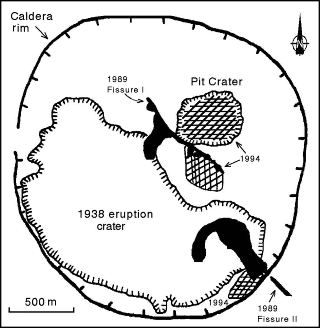 |
Figure 14. Summit caldera of Nyamuragira, 25 August 1994, showing lava flows from 1989 (black) and 1994 (cross-hatched). Courtesy of N. Zana. |
Geological Summary. Africa's most active volcano, Nyamulagira (also known as Nyamuragira), is a massive high-potassium basaltic shield about 25 km N of Lake Kivu and 13 km NNW of the steep-sided Nyiragongo volcano. The summit is truncated by a small 2 x 2.3 km caldera that has walls up to about 100 m high. Documented eruptions have occurred within the summit caldera, as well as from the numerous flank fissures and cinder cones. A lava lake in the summit crater, active since at least 1921, drained in 1938, at the time of a major flank eruption. Recent lava flows extend down the flanks more than 30 km from the summit as far as Lake Kivu; extensive lava flows from this volcano have covered 1,500 km2 of the western branch of the East African Rift.
Information Contacts: N. Zana, Centre de Recherche en Géophysique, Kinshasa.