Report on Nyamulagira (DR Congo) — January 2000
Bulletin of the Global Volcanism Network, vol. 25, no. 1 (January 2000)
Managing Editor: Richard Wunderman.
Nyamulagira (DR Congo) As 27 January eruption began, witnesses assumed they heard artillery fire
Please cite this report as:
Global Volcanism Program, 2000. Report on Nyamulagira (DR Congo) (Wunderman, R., ed.). Bulletin of the Global Volcanism Network, 25:1. Smithsonian Institution. https://doi.org/10.5479/si.GVP.BGVN200001-223020
Nyamulagira
DR Congo
1.408°S, 29.2°E; summit elev. 3058 m
All times are local (unless otherwise noted)
This report covers the period 27 January-early February 2000 at Nyamuragira, ~50 km NW of the town of Goma. The following report was prepared by Akumbi Mbiligi with additional notes and explanations provided by Hiroyuki Hamaguchi, who has collaborated on Virungan volcano research for over 20 years.
Mbiligi learned that an eruption began at 0800 (GMT) on 27 January. During that night the volcano expelled incandescent material and rocks. The area where the venting took place was SE of the summit, near Kagano (29.217°E, 1.433°S), a center active during 1989-98 (see map in SEAN 14:05). Investigations were attempted during 28-29 January. The eruption site could not be reached from Rumangabo, the settlement containing Virunga National Park's main office and the observatory's seismic station, because of security problems in the Park. More specifically, the forest surrounding Nyamuragira has been partly occupied by rebel groups since 1994, a situation that has thwarted geological observations. Mbiligi also visited Kakomero, a small village at the park entrance supporting guides and serving as a past base camp for climbers.
Press reports indicated that the eruptive activity spread panic among people near the eastern Congolese rebel stronghold at Goma. The refugees thought they were under attack. According to press reports seen in the early phases of the eruption, the westerly advancing lava flows had not presented Goma with any immediate threat of encroachment. In addition to the lava flow, the eruption was characterized by ejection of bombs, cinders, and ash from the crater and a strong rumbling. According to Mbiligi and his sources, as of 31 January the volcano's activity had decreased notably.
NOAA infrared satellite imagery illustrated the extent of the lava flow as it appeared beginning around the time of the eruption. One image from 2 February showed a distinct thermal signature interpreted as a hot spot (several pixels in extent) and a possible ash plume trailing off towards the W (see, for example, multichannel color-composite image, number D03304: NOAA-14 POES AVHRR GAC; Channels 3,2,1 at 4-km resolution; acquired at 0456 GMT). As of 10 February satellite imagery continued to indicate high thermal fluxes from fresh lava flows. Around the time of the eruption at least one Earth Probe TOMS image indicated elevated sulfur dioxide concentrations (with a few scattered pixels reaching over 15 milliAtm-cm).
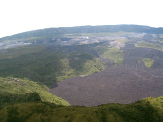
Geological Summary. Africa's most active volcano, Nyamulagira (also known as Nyamuragira), is a massive high-potassium basaltic shield about 25 km N of Lake Kivu and 13 km NNW of the steep-sided Nyiragongo volcano. The summit is truncated by a small 2 x 2.3 km caldera that has walls up to about 100 m high. Documented eruptions have occurred within the summit caldera, as well as from the numerous flank fissures and cinder cones. A lava lake in the summit crater, active since at least 1921, drained in 1938, at the time of a major flank eruption. Recent lava flows extend down the flanks more than 30 km from the summit as far as Lake Kivu; extensive lava flows from this volcano have covered 1,500 km2 of the western branch of the East African Rift.
Information Contacts: Akumbi Mbiligi, Goma Volcano Observatory, Centre de Recherche en Sciences Naturelle, Lwiro, D.S. Bukavu, Democratic Republic of Congo (formerly Zaire); Hiroyuki Hamaguchi, Research Center for Prediction of Earthquakes and Volcanic Eruptions, Graduate School of Science, Tohoku University, Sendai 980-8578, Japan.

