Report on Heard (Australia) — March 2001
Bulletin of the Global Volcanism Network, vol. 26, no. 3 (March 2001)
Managing Editor: Richard Wunderman.
Heard (Australia) Photographs of upper slopes substantiate reports of activity from two distinct vents
Please cite this report as:
Global Volcanism Program, 2001. Report on Heard (Australia) (Wunderman, R., ed.). Bulletin of the Global Volcanism Network, 26:3. Smithsonian Institution. https://doi.org/10.5479/si.GVP.BGVN200103-234010
Heard
Australia
53.106°S, 73.513°E; summit elev. 2745 m
All times are local (unless otherwise noted)
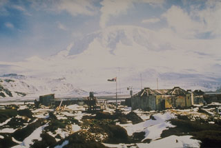
Photographs taken during early February 2001 at Heard (BGVN 26:02) revealed the character and location of the activity there. Figures 5 and 6 were taken on the early morning of 3 February, shortly after midnight against a dark sky. Light from the active vents illuminated the overcast sky and Big Ben stratovolcano. The two distinct light sources pictured in figure 6 evidenced activity from two separate vents. No research-related visits to the remote Heard Island are planned in the immediate future.
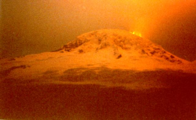 |
Figure 5. View of Big Ben looking SE from Atlas Cove. Copyrighted photo by Stu Fitch, courtesy of Kevin Kiernan. |
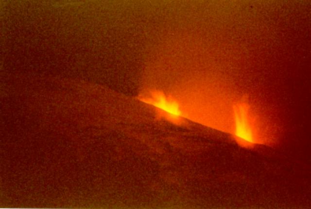 |
Figure 6. Telephoto view of Big Ben's upper slopes looking SE from Atlas Cove. Copyrighted photo by Stu Fitch, courtesy of Kevin Kiernan. |
References. Kiernan, K., and McConnell, A., 2000, ASAC Project 1118, Geomorphological Evolution of Heard Island: Report to Atlas Cove Station Leader, ANARE.
Neumann van Padang, M., 1963, Arabia and the Indian Ocean: Catalogue of the Active Volcanoes of the World, v. 16, p. 1-64.
Quilty, P.G., and Wheller, G., 2000, Heard Island and the McDonald Islands: A window on the Kerguelen Plateau: Papers & Proceedings of the Royal Society of Tasmania, v. 133, no. 2, p. 1-12.
Geological Summary. Heard Island on the Kerguelen Plateau in the southern Indian Ocean consists primarily of the emergent portion of two volcanic structures. The large glacier-covered composite basaltic-to-trachytic cone of Big Ben comprises most of the island, and the smaller Mt. Dixon lies at the NW tip of the island across a narrow isthmus. Little is known about the structure of Big Ben because of its extensive ice cover. The active Mawson Peak forms the island's high point and lies within a 5-6 km wide caldera breached to the SW side of Big Ben. Small satellitic scoria cones are mostly located on the northern coast. Several subglacial eruptions have been reported at this isolated volcano, but observations are infrequent and additional activity may have occurred.
Information Contacts: Stu Fitch, Australian Antarctic Division (AAD); Andrew Lock, AAD; C.J. Klok, Department of Zoology and Entomology, University of Pretoria, Pretoria 0002, South Africa; Kevin Kiernan and Anne McConnell, Geography & Environmental Studies, University of Tasmania, GPO Box 252-79, Hobart TAS 7001, Australia.