Report on Barren Island (India) — September 2006
Bulletin of the Global Volcanism Network, vol. 31, no. 9 (September 2006)
Managing Editor: Richard Wunderman.
Barren Island (India) Ongoing emissions, including lava, but late-September news reports of slowing pace
Please cite this report as:
Global Volcanism Program, 2006. Report on Barren Island (India) (Wunderman, R., ed.). Bulletin of the Global Volcanism Network, 31:9. Smithsonian Institution. https://doi.org/10.5479/si.GVP.BGVN200609-260010
Barren Island
India
12.278°N, 93.858°E; summit elev. 354 m
All times are local (unless otherwise noted)
Our last report on Barren Island discussed events through much of January 2006 (BGVN 31:01); since that time we have only found sporadic reports of activity.
According to a news article by The Indo-Asian News Service, a team of scientists that visited Barren Island around 12 March 2006 found that the volcano was still very active. The height of the volcanic cone had increased by 50 m since eruptive activity began in May 2005. In addition, lava flows covered the NW side of the island.
Since March 2006 there have been only a few satellite images and pilot reports of continued activity. Based on a pilot report and satellite imagery, the Darwin VAAC reported that an ash plume was emitted during 5-6 April that did not rise higher than 4.6 km altitude. On 19 April a low-level plume extending W was visible on satellite imagery.
On 2 May satellite imagery detected a plume from Barren Island near 3.7 km altitude. The following day low-level ash plumes extended N. Based on a pilot report, the Darwin VAAC reported an ash plume at 1230 on 26 May that remained below 3 km altitude and drifted N.
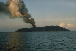
On 23 September a news report in The Hindu stated that Indian Coast Guard officials indicated that the continuing eruption at Barren Island was decreasing in intensity. The news piece cited a surveillance report statement that there was less lava but more "smoke" from the volcano.
Geological Summary. Barren Island, a possession of India in the Andaman Sea about 135 km NE of Port Blair in the Andaman Islands, is the only historically active volcano along the N-S volcanic arc extending between Sumatra and Burma (Myanmar). It is the emergent summit of a volcano that rises from a depth of about 2250 m. The small, uninhabited 3-km-wide island contains a roughly 2-km-wide caldera with walls 250-350 m high. The caldera, which is open to the sea on the west, was created during a major explosive eruption in the late Pleistocene that produced pyroclastic-flow and -surge deposits. Historical eruptions have changed the morphology of the pyroclastic cone in the center of the caldera, and lava flows that fill much of the caldera floor have reached the sea along the western coast.
Information Contacts: The Hindu (URL: http://www.hinduonline.com); Indo-Asian News Service (IANS) (URL: http://www.eians.com/); Geological Survey of India, 27 Jawaharlal Nehru road, Kolkata 700 016, India (URL: https://www.gsi.gov.in/); Indian Coast Guard, National Stadium Complex, New Delhi 110 001, India (URL: http://indiancoastguard.nic.in/indiancoastguard/); Darwin Volcanic Ash Advisory Center, Bureau of Meteorology, Northern Territory Regional Office, PO Box 40050, Casuarina, Northern Territory 0811, Australia (URL: http://www.bom.gov.au/info/vaac/).

