Report on Sangay (Ecuador) — March 2008
Bulletin of the Global Volcanism Network, vol. 33, no. 3 (March 2008)
Managing Editor: Richard Wunderman.
Sangay (Ecuador) Conspicuous ash plumes, October 2006-December 2007
Please cite this report as:
Global Volcanism Program, 2008. Report on Sangay (Ecuador) (Wunderman, R., ed.). Bulletin of the Global Volcanism Network, 33:3. Smithsonian Institution. https://doi.org/10.5479/si.GVP.BGVN200803-352090
Sangay
Ecuador
2.005°S, 78.341°W; summit elev. 5286 m
All times are local (unless otherwise noted)
Our previous report on Sangay (BGVN 21:03) described occasional, but sometimes conspicuous, steam and/or ash plumes between January 2004 and January 2006. The current report continues coverage of plume emissions through December 2007.
Sangay has continued to erupt, sending ash plumes up to an altitude of about 11 km. A summary of plume activity is indicated in table 1. The information is from the Washington Volcanic Ash Advisory Center (VAAC), and is based on reports from the Guayaquil Meteorologic Watch Office, pilot reports, satellite imagery, and the Instituto Geofísico-Departamento de Geofísica (Escuela Politécnica Nacional). We did not receive any report of activity during the period February 2006 through September 2006, or during the first three months of 2008.
Table 1. Ash plume advisories about Sangay activity, October 2006 through December 2007. Courtesy of the Washington VAAC.
| Date | Altitude (km) | Bearing | Remarks |
| 11 Oct 2006 | 2.7 | W | -- |
| 21 Oct 2006 | 6.7 | -- | -- |
| 22 Nov 2006 | -- | WNW | Hotspot visible on satellite imagery |
| 02 Dec 2006 | 8.5 | SW | -- |
| 23 Dec 2006 | 7.6 | -- | -- |
| 01 Jan 2007 | 5.2 | -- | -- |
| 14 Jan 2007 | 6.1 | SW | -- |
| 28 Jan 2007 | 6.4 | -- | -- |
| 06 Feb 2007 | 9.1 | SW | -- |
| 06-10 Feb 2007 | 6.1-9 | Several | Hotspot at summit visible on satellite imagery |
| 13 Feb 2007 | -- | -- | Hotspot at summit visible on satellite imagery |
| 23 Feb 2007 | 10.7 | S | -- |
| 25 Feb 2007 | 6.4 | SW | -- |
| 28 Feb 2007 | 7.6 | -- | -- |
| 02 Mar 2007 | -- | -- | Weak hotspot visible on satellite imagery |
| 05 Mar 2007 | 5.2-6.1 | W | -- |
| 12-13 Mar 2007 | 7 | W | Hotspot visible on satellite imagery |
| 17 Mar 2007 | 5.2 | -- | Hotspot visible on satellite imagery |
| 04 May 2007 | 5.2-7.6 | -- | -- |
| 05 May 2007 | -- | W | Possible narrow plume on satellite imagery |
| 24 May 2007 | 7.3 | -- | -- |
| 03 Jul 2007 | 5.2-7.9 | W | -- |
| 23 Jul 2007 | 5.5 | W | Ash not detected by satellite imagery |
| 24 Jul 2007 | 5.2 | SW | -- |
| 28 Jul 2007 | 6.7-8.2 | -- | Weak hotspot visible on satellite imagery, but ash not detected |
| 02 Aug 2007 | 5.5 | W | Ash not detected by satellite imagery |
| 19 Aug 2007 | -- | -- | Clouds inhibited satellite imagery |
| 08-09 Sep 2007 | -- | -- | Ash not detected by satellite imagery |
| 12 Oct 2007 | 7 | W | -- |
| 26 Dec 2007 | 6.1 | SW | -- |
| 26-27 Dec 2007 | -- | -- | Thermal anomaly seen on satellite imagery |
According to a report from the Instituto Geofísico, activity at Sangay increased at the end of 2006 through the beginning of 2007. They reported that a thermal anomaly was detected by satellite imagery during several days in December 2006. During that time, mountain guides near the volcano observed the fall of incandescent rocks down the volcano's flanks at night and a recent deposit of ash that was sufficiently deep to affect birds, rabbits, and other small animals. The report indicated that the Instituto Geofísico has not installed monitoring instrumentation near Sangay because of a significant logistics problem in maintaining them in this inhospitable area, and also because the area is uninhabited and thus poses no direct human risk. However, the report notes that because ash emissions from Sangay may pose problems for aircraft in the S, SE, and SW parts of the country, the Instituto maintains contact with the civil aviation authority.
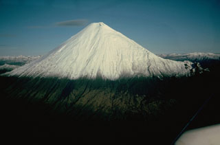
Geological Summary. The isolated Sangay volcano, located east of the Andean crest, is the southernmost of Ecuador's volcanoes and its most active. The steep-sided, glacier-covered, dominantly andesitic volcano grew within the open calderas of two previous edifices which were destroyed by collapse to the east, producing large debris avalanches that reached the Amazonian lowlands. The modern edifice dates back to at least 14,000 years ago. It towers above the tropical jungle on the east side; on the other sides flat plains of ash have been eroded by heavy rains into steep-walled canyons up to 600 m deep. The earliest report of an eruption was in 1628. Almost continuous eruptions were reported from 1728 until 1916, and again from 1934 to the present. The almost constant activity has caused frequent changes to the morphology of the summit crater complex.
Information Contacts: Washington Volcanic Ash Advisory Center, Satellite Analysis Branch (SAB), NOAA/NESDIS E/SP23, NOAA Science Center Room 401, 5200 Auth Rd, Camp Springs, MD 20746, USA (URL: http://www.ospo.noaa.gov/Products/atmosphere/vaac/); P. Ramón, Instituto Geofísico-Departamento de Geofísica (IG), Escuela Politécnica Nacional, Casilla 17-01-2759, Quito, Ecuador.

