Report on Krakatau (Indonesia) — November 2012
Bulletin of the Global Volcanism Network, vol. 37, no. 11 (November 2012)
Managing Editor: Richard Wunderman.
Krakatau (Indonesia) Many earthquakes and some mild eruptions during October-November 2011
Please cite this report as:
Global Volcanism Program, 2012. Report on Krakatau (Indonesia) (Wunderman, R., ed.). Bulletin of the Global Volcanism Network, 37:11. Smithsonian Institution. https://doi.org/10.5479/si.GVP.BGVN201211-262000
Krakatau
Indonesia
6.1009°S, 105.4233°E; summit elev. 285 m
All times are local (unless otherwise noted)
Our previous report (BGVN 36:08) discussed two eruption episodes: one from 25 October 2010 to March 2011, and another from August 2011 to about 1 October 2011. During the last two weeks of September 2011, the volcano produced persistent volcanic earthquake swarms and thin emissions (BGVN 36:08). This report discusses two visits to the volcano in 2011. Scientists that visited on 8 October 2011 reported degassing and an ongoing seismic swarm then consisting chiefly of M ~1 and smaller earthquakes. During 12-13 November 2011 a photographer noted steady degassing, then observed the start of a 12-hour interval of minor but repeated Stombolian eruptions (see next section).
2011 visits by Øystein Lund Andersen. The photographer and guide Øystein Lund Andersen lives in Jakarta, Indonesia and visits Anak Krakatau often. His website... shows one photo of a seismograph at CVGHM's Pasauran Observatory recording part of a prolonged swarm of small earthquakes from 8 October 2011; Youtube features a video he took on the same subject.
His visit... during 12-13 November 2011 took place during an interval of gas emissions devoid of ash. He stayed up all night to observe Anak Krakatau emit a steady, white, ash-free plume. At dusk on 12 November he noticed that the crater glowed bright red and after a few hours a series of mild Strombolian eruptions occurred in a sequence that lasted 12 hours (figure 29). The time between the eruptions was from 30 seconds to a few minutes. Some of Andersen's photos captured glowing pyroclasts arcing tens of meters above the crater rim (figure 29b, c). Andersen saw ash lava bombs in the plume during these eruptions. He noted that the lava bombs ejected over the crater mainly fell back into the crater. During the night the crater remained almost constantly illuminated by the glowing bombs and the fragments they created when they landed. The eruptions were often accompanied by loud sounds from the volcano.
References. Lockwood, J. and Hazlett, R.W., 2010, Volcanoes: global perspectives. Wiley-Blackwell.
Simkin, T. and Fiske, R.S., 1983, Krakatau, 1883--the volcanic eruption and its effects, Smithsonian Institution Press.
Self, S., Rampino, M.R., 1981, The 1883 eruption of Krakatau, Nature, 294, pp. 699-704.
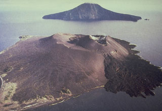
Geological Summary. The renowned Krakatau (frequently mis-named as Krakatoa) volcano lies in the Sunda Strait between Java and Sumatra. Collapse of an older edifice, perhaps in 416 or 535 CE, formed a 7-km-wide caldera. Remnants of that volcano are preserved in Verlaten and Lang Islands; subsequently the Rakata, Danan, and Perbuwatan cones were formed, coalescing to create the pre-1883 Krakatau Island. Caldera collapse during the catastrophic 1883 eruption destroyed Danan and Perbuwatan, and left only a remnant of Rakata. This eruption caused more than 36,000 fatalities, most as a result of tsunamis that swept the adjacent coastlines of Sumatra and Java. Pyroclastic surges traveled 40 km across the Sunda Strait and reached the Sumatra coast. After a quiescence of less than a half century, the post-collapse cone of Anak Krakatau (Child of Krakatau) was constructed within the 1883 caldera at a point between the former Danan and Perbuwatan cones. Anak Krakatau has been the site of frequent eruptions since 1927.
Information Contacts: Center of Volcanology and Geological Hazard Mitigation (CVGHM), Jalan Diponegoro 57, Bandung 40122, Indonesia (URL: http://www.vsi.esdm.go.id/); Øystein Lund Andersen (URL: http://www.oysteinlundandersen.com/).


