Report on Nyamulagira (DR Congo) — March 1977

Natural Science Event Bulletin, vol. 2, no. 3 (March 1977)
Managing Editor: David Squires.
Nyamulagira (DR Congo) Lava flows from a new cone on the S flank
Please cite this report as:
Global Volcanism Program, 1977. Report on Nyamulagira (DR Congo) (Squires, D., ed.). Natural Science Event Bulletin, 2:3. Smithsonian Institution. https://doi.org/10.5479/si.GVP.NSEB197703-223020
Nyamulagira
DR Congo
1.408°S, 29.2°E; summit elev. 3058 m
All times are local (unless otherwise noted)
At about 1200 on 23 December, an eruption began from the NE end of a 1-km-long, N45°E-trending fissure on the SW flank of Nyamuragira. Explosive activity was concentrated at 3 locations along the fissure, building 3 small cinder cones. The cones were breached to the W and a little lava was extruded in that direction (flow l, figure 1). The next night, activity shifted to the SW end of the fissure and a new pyroclastic cone (Murara) began to grow. Cinders and lapilli fell within a 1 km radius of Murara, and a lava flow (flow 2, figure 1) moved southward from a breach in the SW wall of the crater. Extrusion of flows 3 and 4 had begun by 6 and 10 January 1977 respectively.
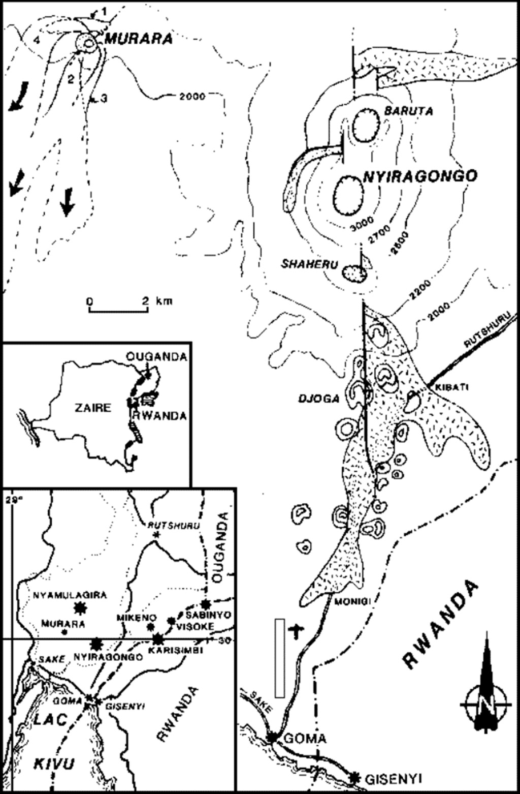 |
Figure 1. Map of eruption sites and lava flows at Nyiragongo and Nyamuragira's 1977 Murara vent. The location of the stippled flow on Nyiragongo was provided by M. Krafft. Courtesy of Y. Pottier. |
On 18 January, Murara was 150 m high, and a flow rate of l0 m/minute was measured 150 m from the vent. The flow rate had slowed to 2-4 m/minute by the next day, and the lava had nearly solidified by evening. Explosions increased in intensity, sending ejecta 500-600 m high every 2 seconds. Lava effusion had resumed from the N foot of Murara by 27 January. On 28 January, six subsidiary craters opened within 200 m of the N foot vent. Lava extruded from these craters rapidly coalesced into a single flow; its front was 6 km from Murara on the 28th. A 60-m-diameter lava lake was observed on 10 February in Murara's crater, and small pahoehoe flows were issuing from the SW foot.
Further Reference. Brousse, R., Cochemé, J.J., Pottier, Y., and Vellutini, P.J., 1979, Eruption and lavas of Murara: new volcano (December 1976-April 1977) in Kivu (Zaire): C.R. Acad. Sci. Paris, serie D, v. 289, p. 809-812.
Geological Summary. Africa's most active volcano, Nyamulagira (also known as Nyamuragira), is a massive high-potassium basaltic shield about 25 km N of Lake Kivu and 13 km NNW of the steep-sided Nyiragongo volcano. The summit is truncated by a small 2 x 2.3 km caldera that has walls up to about 100 m high. Documented eruptions have occurred within the summit caldera, as well as from the numerous flank fissures and cinder cones. A lava lake in the summit crater, active since at least 1921, drained in 1938, at the time of a major flank eruption. Recent lava flows extend down the flanks more than 30 km from the summit as far as Lake Kivu; extensive lava flows from this volcano have covered 1,500 km2 of the western branch of the East African Rift.
Information Contacts: Y. Pottier, IRS; M. Krafft, Cernay; H. Tazieff, CNRS.