Report on Krakatau (Indonesia) — October 1978

Scientific Event Alert Network Bulletin, vol. 3, no. 10 (October 1978)
Managing Editor: David Squires.
Krakatau (Indonesia) Tephra eruption since July from Anak Krakatau
Please cite this report as:
Global Volcanism Program, 1978. Report on Krakatau (Indonesia) (Squires, D., ed.). Scientific Event Alert Network Bulletin, 3:10. Smithsonian Institution. https://doi.org/10.5479/si.GVP.SEAN197810-262000
Krakatau
Indonesia
6.1009°S, 105.4233°E; summit elev. 285 m
All times are local (unless otherwise noted)
An eruption from a summit crater of Anak Krakatau (figure 1) began on 10 July and was continuing in October. Lightning over the summit was seen from a nearby village on 10 July and small amounts of basaltic ash were ejected. Other explosions occurred on 14, 18, 21-23, and 30 July, and on 3 August. During the largest explosions (on 14 and 22 July) tephra clouds, including some bombs, rose 400-500 m above the crater. Activity was confined to vapor emission 11-13, 15-17, and 26-29 July.
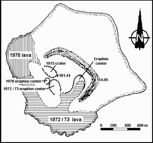 |
Figure 1. Map of Anak Krakatau, 1978. Courtesy of VSI. |
VSI scientists visited the volcano 21-23 July. Tephra emission occurred at intervals of 15 minutes to 6 hours. Ash was always ejected by the explosions but larger tephra was only occasionally present in the eruption clouds.
The eruption had declined by the third week of August but had returned to July levels when the volcano was revisited 2-5 October. Activity was Strombolian, consisting of discrete groups of explosions. Each explosion group lasted an average of 9 minutes, with an observed time interval between first explosions of successive groups ranging from 5 to 27 minutes. The first explosion of each group was always the largest, typically ejecting bombs 75-100 m above the crater. Some bombs fell back into the crater and others described parabolic arcs, falling 300-400 m away and forming impact craters averaging 40 cm in diameter and 10-15 cm deep. Dark gray, ash-laden, cauliflower-shaped clouds ejected with the bombs rose 200-400 m at an average velocity of 5 m/second. Lightning was visible in the ash clouds. Coarse ash fell 500 m from the crater and finer material was blown into Sunda Strait. Water vapor was emitted from cracks and fissures formed along the inner wall of the active crater. Vapor emission appeared to increase 3-5 seconds before the first explosion of each group.
A single component (vertical) Hosaka electromagnet seismograph recorded 554 explosion earthquakes during 77 hours of observation, using a 0.3 second transducer 1 km from the crater. Using the minimum amplifier magnification (about 2,000x) a maximum double amplitude of 15 mm was recorded.
Geological Summary. The renowned Krakatau (frequently mis-named as Krakatoa) volcano lies in the Sunda Strait between Java and Sumatra. Collapse of an older edifice, perhaps in 416 or 535 CE, formed a 7-km-wide caldera. Remnants of that volcano are preserved in Verlaten and Lang Islands; subsequently the Rakata, Danan, and Perbuwatan cones were formed, coalescing to create the pre-1883 Krakatau Island. Caldera collapse during the catastrophic 1883 eruption destroyed Danan and Perbuwatan, and left only a remnant of Rakata. This eruption caused more than 36,000 fatalities, most as a result of tsunamis that swept the adjacent coastlines of Sumatra and Java. Pyroclastic surges traveled 40 km across the Sunda Strait and reached the Sumatra coast. After a quiescence of less than a half century, the post-collapse cone of Anak Krakatau (Child of Krakatau) was constructed within the 1883 caldera at a point between the former Danan and Perbuwatan cones. Anak Krakatau has been the site of frequent eruptions since 1927.
Information Contacts: R. Hadisantono and Suratman (July-Aug activity); L. Pardyanto (October activity), VSI.