Report on Galunggung (Indonesia) — August 1982
Scientific Event Alert Network Bulletin, vol. 7, no. 8 (August 1982)
Managing Editor: Lindsay McClelland.
Galunggung (Indonesia) Frequent explosions continue
Please cite this report as:
Global Volcanism Program, 1982. Report on Galunggung (Indonesia) (McClelland, L., ed.). Scientific Event Alert Network Bulletin, 7:8. Smithsonian Institution. https://doi.org/10.5479/si.GVP.SEAN198208-263140
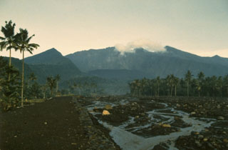
Galunggung
Indonesia
7.25°S, 108.058°E; summit elev. 2168 m
All times are local (unless otherwise noted)
Frequent periods of explosive activity continued through early September . . . . A GMS image on 16 August at 1000 showed a plume that extended S then curved W to about 8°S, 100°E. By the time of the next available image, five hours later, feeding of the plume had ended and only remnants remained, S of Java.
After about ten days of quiescence, explosions resumed early 26 August. Antara radio reported that fire flashes were ejected from the crater for about six minutes starting at 0311, followed by roaring sounds that caused panic in Tasikmalaya. Around dawn, grayish ash rose 7-8 km above the summit and glowing material appeared to slide 200-500 m from the crater. "Flames" rose 50-100 m around the crater. Between 5 and 10 cm of ash fell in Garut. Ash darkened Bandung until 1030, reducing visibility to 3 m even in lighted areas. Residents of Jakarta (Indonesia's capital, about 170 km NW of Galunggung) remained indoors as ash thick enough to cover car windshields fell within a few minutes. GMS images indicated that ash ejection began about 0500 and lasted about two hours. Feeding had clearly stopped by 1000. A smaller explosion started just before midnight and appeared to be continuing on an image returned at 0100. On 30 August at 1015, Galunggung ejected a 5-6-km-high dense black and white eruption cloud followed by a series of thundering sounds and flashes. Heavy ashfall was reported near the volcano, and lighter ashfall occurred in Garut and in Bandung, where it began about 1300. Loud explosions accompanied by flashes of incandescence started again at 0353 on 31 August and continued until about 0930. Heavy tephra fall darkened villages a few km from the volcano and lapilli as large as marbles caused the collapse of two buildings. Satellite images showed a cloud, somewhat larger than many previously ejected by Galunggung, moving SSW. An explosion 2 September at 0400 was followed by a second, more powerful one at 0425. Heavy ashfalls disrupted traffic between Bandung and Cirebon (about 100 km from Bandung and 75 km NNE of the volcano) between 0900 and 1600. No additional explosions had been reported as of early September.
Cloud top temperatures determined from NOAA 7 polar orbiter infrared images have been compared with radiosonde temperature/altitude profiles above 5.95°N, 116.05°E to yield approximate cloud top altitudes (table 1).
Table 1. Galunggung cloud-top temperatures determined from NOAA 7 polar orbiting satellite images, 25 June-29 August 1982, with altitudes calculated from nearby radiosonde temperature/altitude profiles. Courtesy of Michael Matson, NOAA.
| Date | Time | Temperature (°C) | Altitude (km) |
| 25 Jun 1982 | 1400 | -61 | 12.5 |
| 14 Jul 1982 | 0100 | -72 | 16 (at tropopause) |
| 14 Jul 1982 | 1400 | -72 | 16 (at tropopause) |
| 29 Jul 1982 | 0200 | -53 | 11.5 |
| 13 Aug 1982 | 1500 | -72 | 15 |
| 16 Aug 1982 | 1400 | -58 | no radiosonde data |
| 29 Aug 1982 | 1500 | -72 | 15.5 |
Geological Summary. The forested slopes of Galunggung in western Java SE of Bandung are cut by a 2-km-wide collapse scarp open towards the ESE. The "Ten Thousand Hills of Tasikmalaya" dotting the plain below the volcano are debris-avalanche hummocks from the collapse about 4,200 years ago. An eruption in 1822 produced pyroclastic flows and lahars that killed over 4,000 people. A series of major explosive eruptions starting in April 1982 destroyed a number of villages, killed as many as 30 people, and forced over 60,000 to evacuate. Pyroclastic flows and heavy widespread ash caused significant damage. A large passenger jet that encountered the ash plume on 24 June lost power to all four engines but managed to land safely in Jakarta. The 1982 activity destroyed a 1918 dome and formed the Warirang crater, almost as wide as the valley, about 2 km down from the summit.
Information Contacts: D. Haller, O. Karst, and M. Matson, NOAA; Antara News Agency, Jakarta; AFP; BBC.