Report on Nyamulagira (DR Congo) — August 1986
Scientific Event Alert Network Bulletin, vol. 11, no. 8 (August 1986)
Managing Editor: Lindsay McClelland.
Nyamulagira (DR Congo) SSW flank fissure eruption feeds 17 km lava flow
Please cite this report as:
Global Volcanism Program, 1986. Report on Nyamulagira (DR Congo) (McClelland, L., ed.). Scientific Event Alert Network Bulletin, 11:8. Smithsonian Institution. https://doi.org/10.5479/si.GVP.SEAN198608-223020
Nyamulagira
DR Congo
1.408°S, 29.2°E; summit elev. 3058 m
All times are local (unless otherwise noted)
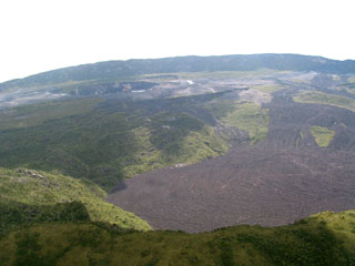
An eruption began on 16 July at 1135 from a SSW-flank fissure ~1.5 km long. The fissure trended SW-NE (the orientation of the regional rift axis) and was located at 2,250 m altitude, 3.5 km SW of the S edge of the caldera [but see 12:8], between the three small cones formed during the 1938 (Tschambene) eruption. A pair of lava fountains 200-250 m high emerged from the fissure, building an elongate cinder cone 150 m high, with a breached crater. Lava flowed to the SSW, around the W side of Shove cone, then continued SW, advancing 17 km in two weeks before stopping 2 km N of the Goma-Sake road. At the end of July, continuous fountaining ended and activity declined to intermittent Strombolian explosions, then stopped for ~24 hours on 1 August.
The eruption resumed on 2 August at about 1700, producing a lava fountain 150 m high. A small lava lake filled the crater and cascaded over the S wall of the cone. Minor overflows formed a small lava field, with lava flowing in tubes near the cone, but the main flow had stagnated. Activity briefly declined on 7 August and stopped for 12 hours on the 8th, then a new lava fountain developed the next day. Some strong phreatomagmatic explosions occurred from the previously active vent. Six or seven blocks of lava as large as 100 m across floated on top of the flowing lava, moving downslope at ~2 m/hour. A slow decline in activity began on 13 August, but continued from three small Strombolian vents until the eruption stopped. Since 21 August, only fumarolic activity has been observed.
Lava volume was estimated at 150-200 x 106 m3. In hand specimen, the lava appeared to be a typical Nyamuragira hawaiite.
Geological Summary. Africa's most active volcano, Nyamulagira (also known as Nyamuragira), is a massive high-potassium basaltic shield about 25 km N of Lake Kivu and 13 km NNW of the steep-sided Nyiragongo volcano. The summit is truncated by a small 2 x 2.3 km caldera that has walls up to about 100 m high. Documented eruptions have occurred within the summit caldera, as well as from the numerous flank fissures and cinder cones. A lava lake in the summit crater, active since at least 1921, drained in 1938, at the time of a major flank eruption. Recent lava flows extend down the flanks more than 30 km from the summit as far as Lake Kivu; extensive lava flows from this volcano have covered 1,500 km2 of the western branch of the East African Rift.
Information Contacts: M. Krafft, Cernay, France; J. Durieux, GEVA, Lyon, France.

