Report on Nyamulagira (DR Congo) — August 1987

Scientific Event Alert Network Bulletin, vol. 12, no. 8 (August 1987)
Managing Editor: Lindsay McClelland.
Nyamulagira (DR Congo) Correction to July 1986 eruption site
Please cite this report as:
Global Volcanism Program, 1987. Report on Nyamulagira (DR Congo) (McClelland, L., ed.). Scientific Event Alert Network Bulletin, 12:8. Smithsonian Institution. https://doi.org/10.5479/si.GVP.SEAN198708-223020
Nyamulagira
DR Congo
1.408°S, 29.2°E; summit elev. 3058 m
All times are local (unless otherwise noted)
New observations show that the July 1986 eruption vent was located 4.5 km S of the caldera's edge at the S foot of Kitazungurwa in Mashiga (figure 6) rather than... 3.5 km SW of the caldera's edge.
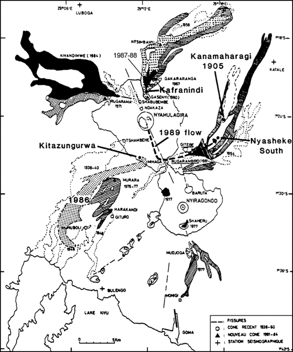 |
Figure 6. Map of the Nyamuragira/Nyiragongo area by N. Zana (1984), appended with vents and flows through 1988. The heavy dashed line indicates the approximate path of the 1989 flow. |
Geological Summary. Africa's most active volcano, Nyamulagira (also known as Nyamuragira), is a massive high-potassium basaltic shield about 25 km N of Lake Kivu and 13 km NNW of the steep-sided Nyiragongo volcano. The summit is truncated by a small 2 x 2.3 km caldera that has walls up to about 100 m high. Documented eruptions have occurred within the summit caldera, as well as from the numerous flank fissures and cinder cones. A lava lake in the summit crater, active since at least 1921, drained in 1938, at the time of a major flank eruption. Recent lava flows extend down the flanks more than 30 km from the summit as far as Lake Kivu; extensive lava flows from this volcano have covered 1,500 km2 of the western branch of the East African Rift.
Information Contacts: B. Louant, GEOVAR, Kigali, Rwanda.