Report on Nyamulagira (DR Congo) — September 1989
Scientific Event Alert Network Bulletin, vol. 14, no. 9 (September 1989)
Managing Editor: Lindsay McClelland.
Nyamulagira (DR Congo) Landsat data suggest continuing activity at April vent
Please cite this report as:
Global Volcanism Program, 1989. Report on Nyamulagira (DR Congo) (McClelland, L., ed.). Scientific Event Alert Network Bulletin, 14:9. Smithsonian Institution. https://doi.org/10.5479/si.GVP.SEAN198909-223020
Nyamulagira
DR Congo
1.408°S, 29.2°E; summit elev. 3058 m
All times are local (unless otherwise noted)
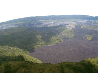
Data recorded 4 August at about 0930 by the Landsat TM show a hot area (10 km E of the summit crater, near Kimanura cone) with thermal radiation in TM band 7 (2.08-2.35 µm). The hot area occupied ~5 pixels (each 30 x 30 m), with temperatures averaging ~200°C across each pixel. D. Rothery noted that the thermal sources were probably hotter than 200°, but occupied only a fraction of each pixel. Although no flows were detected leaving Kimanura vent, Rothery suggested that it was probably still active. [Rothery adds "Following this report, personal communications from Henry-Luc Hody and Bernard Louant revealed that the radiant pixels were coincident with a fumarole field that was active between at least August 1989 and April 1990. Thus, the Landsat observation is one of the earliest and clearest demonstrations that high surface temperatures associated with fumaroles can be detected by short-wavelength infrared satellite imaging."] The April-May flows were still warm and showed thermal anomalies in the traditional thermal infrared band 6 (10.5-12.5 µm). No thermal radiance was detected at shorter wavelengths.
Geological Summary. Africa's most active volcano, Nyamulagira (also known as Nyamuragira), is a massive high-potassium basaltic shield about 25 km N of Lake Kivu and 13 km NNW of the steep-sided Nyiragongo volcano. The summit is truncated by a small 2 x 2.3 km caldera that has walls up to about 100 m high. Documented eruptions have occurred within the summit caldera, as well as from the numerous flank fissures and cinder cones. A lava lake in the summit crater, active since at least 1921, drained in 1938, at the time of a major flank eruption. Recent lava flows extend down the flanks more than 30 km from the summit as far as Lake Kivu; extensive lava flows from this volcano have covered 1,500 km2 of the western branch of the East African Rift.
Information Contacts: D. Rothery, Open Univ.

