Report on Soufriere St. Vincent (Saint Vincent and the Grenadines) — 21 April-27 April 2021
Smithsonian Institution / US Geological Survey
Weekly Volcanic Activity Report, 21 April-27 April 2021
Managing Editor: Sally Sennert.
Please cite this report as:
Global Volcanism Program, 2021. Report on Soufriere St. Vincent (Saint Vincent and the Grenadines) (Sennert, S, ed.). Weekly Volcanic Activity Report, 21 April-27 April 2021. Smithsonian Institution and US Geological Survey.
Soufriere St. Vincent
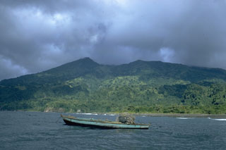
Saint Vincent and the Grenadines
13.33°N, 61.18°W; summit elev. 1220 m
All times are local (unless otherwise noted)
University of the West Indies Seismic Research Centre (UWI-SRC) reported that eruptive activity at Soufrière St. Vincent (often simply referred to as “La Soufriere”) was relatively low during 21-27 April with the exception of one explosive period. During 20-21 April seismicity was characterized by a few rockfalls and volcano-tectonic (VT) earthquakes, and an increasing number of small long-period (LP) and hybrid earthquakes. Sulfur dioxide emissions were again measured from a boat near the W coast, revealing a flux of 350 tons per day. At around 1108 on 22 April explosions produced an ash plume that rose as high as 8 km (26,200 ft) a.s.l. and drifted mainly N over the sea. High-level seismic tremor began at 1109 and lasted for about 20 minutes. Pyroclastic flows were generated early in the eruption and traveled down the W flank, reaching the sea within five minutes. Lahar signals were recorded later that day at about 2100. According to National Emergency Management Organisation (NEMO) the total number of displaced people was 13,154 by 21 April, with 6,208 people in 85 public shelters and 6,790 people (1,618 families) in private shelters. There were no casualties caused by the eruption. In a 22 April press release the Argyle International Airport announced that the ash cleanup was ongoing and that the Cargo Terminal was scheduled to open the next day.
Seismicity dropped to low levels after the explosive event and remained at low levels through 27 April; only a few LP, hybrid and VT earthquakes were recorded. On 23 April the sulfur dioxide flux was 992 tons per day, recorded again from the W coast. A diffuse steam plume rose from the crater on 24 April. Satellite data most recently from 24 April, and seismic data suggested likely cycles of crater dome growth and destruction. During an overflight on 26 April scientists observed white steam plumes rising from several locations on the crater floor, though visibility was poor. No lava dome was visible, but a possible spine-like protrusion was seen through the clouds. Seismic signals indicating lahars were again recorded. Lahars in the Red and Orange zones were recorded by the seismic network at 0900 and 1000 on 27 April, during and after rainfall. The volcano Alert Level remained at Red.
Geological Summary. Soufrière St. Vincent is the northernmost and youngest volcano on St. Vincent Island. The NE rim of the 1.6-km wide summit crater is cut by a crater formed in 1812. The crater itself lies on the SW margin of a larger 2.2-km-wide caldera, which is breached widely to the SW as a result of slope failure. Frequent explosive eruptions after about 4,300 years ago produced pyroclastic deposits of the Yellow Tephra Formation, which cover much of the island. The first historical eruption took place in 1718; it and the 1812 eruption produced major explosions. Much of the northern end of the island was devastated by a major eruption in 1902 that coincided with the catastrophic Mont Pelée eruption on Martinique. A lava dome was emplaced in the summit crater in 1971 during a strictly effusive eruption, forming an island within a lake that filled the crater. A series of explosive eruptions in 1979 destroyed the 1971 dome and ejected the lake; a new dome was then built.
Sources: University of the West Indies Seismic Research Centre (UWI-SRC), National Emergency Management Organisation (NEMO), Government of Saint Vincent and the Grenadines, Advanced geospatial Data Management Platform (ADAM), Argyle International Airport Inc.