Report on Sao Jorge (Portugal) — 23 March-29 March 2022
Smithsonian Institution / US Geological Survey
Weekly Volcanic Activity Report, 23 March-29 March 2022
Managing Editor: Sally Sennert.
Please cite this report as:
Global Volcanism Program, 2022. Report on Sao Jorge (Portugal) (Sennert, S, ed.). Weekly Volcanic Activity Report, 23 March-29 March 2022. Smithsonian Institution and US Geological Survey.
Sao Jorge
Portugal
38.65°N, 28.08°W; summit elev. 1053 m
All times are local (unless otherwise noted)
A seismic swarm beneath the W half of São Jorge began at 1605 on 19 March, with earthquakes along the Manadas volcanic fissure system between Velas (S side of the island) and Fajã do Ouvidor (N coast). CIVISA raised the Alert Level to V2 and then V3 (on a scale of V0-V6) during the morning of 20 March, and finally to V4 that afternoon. On 22 March Proteção Civil e Bombeiros dos Açores noted that, although no official evacuations had been issued, vulnerable people such as patients in the Velas health center were being moved to other locations on the island. Supplies were being distributed to São Jorge Island and residents were encouraged to prepare in case of a volcanic eruption. On 23 March a VONA was issued, announcing that the Aviation Color Code was raised to Yellow (on a four-color scale). The total estimated population of the island was around 8,400 people; according to a news report, about 1,250 residents left the island during 23-24 March. Most of the earthquakes were low magnitude, M 1.6-3.3, though about 209 of them were felt by residents; the largest event, a M 3.8, was detected near Velas at 2256 on 29 March. By 30 March a total of about 20,000 events had been recorded. Besides the increased seismicity, CIVISA noted that ground-based Global Navigation Satellite System (GNSS) data showed inflation, which was also suggested by satellite-based data processed by partners.
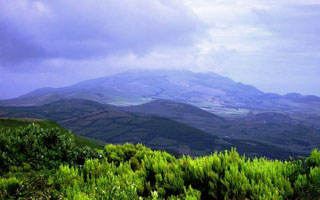
Geological Summary. The dominantly basaltic São Jorge Island is 55 km long and 6.5 km wide. It was formed by fissure eruptions beginning in the eastern part of the island. The western two-thirds of the island contains youthful, fissure-fed lava flows resembling those on neighboring Pico Island. Lava effused from three locations above the south-central coast during 1580, producing flows that reached the ocean. In 1808 a series of explosions took place from vents along the south-central crest of the island; one of the vents produced a lava flow that reached the southern coast. Submarine eruptions have also been reported on several occasions from a submarine ridge to the SE. The 1964 event offshore W of Velas was considered "probable" by Madiera and Brum da Silveira (2003), who also provided 14C dates for several other Holocene eruptions.
Sources: Portuguese American Journal, Centro de Informação e Vigilância Sismovulcânica dos Açores (CIVISA), Proteção Civil e Bombeiros dos Açores, U.S. News, Reuters, Açoriano Oriental, Açoriano Oriental