Report on Bagana (Papua New Guinea) — 12 July-18 July 2023
Smithsonian Institution / US Geological Survey
Weekly Volcanic Activity Report, 12 July-18 July 2023
Managing Editor: Sally Sennert.
Please cite this report as:
Global Volcanism Program, 2023. Report on Bagana (Papua New Guinea) (Sennert, S, ed.). Weekly Volcanic Activity Report, 12 July-18 July 2023. Smithsonian Institution and US Geological Survey.
Bagana
Papua New Guinea
6.137°S, 155.196°E; summit elev. 1855 m
All times are local (unless otherwise noted)
An explosive eruption at Bagana on 15 July was similar to one that occurred on 7 July. According to the Darwin VAAC an eruption at around 0830 on 15 July produced an ash plume that rose to 16.5 km (54,000 ft) a.s.l. by 1000 and drifted N based on satellite images. The plume was visible continuing to drift N in an image from 1900 but had dissipated by 2150. Ground-based reports indicated that pyroclastic flows had occurred in the vicinity of the volcano; small deposits confined to one drainage were inspected by RVO during an overflight on 17 July, and were confirmed to be from the 7 July event. The Autonomous Bougainville Government (ABG) issued a statement on 17 July noting significant impacts of ashfall in local communities. According to the National Disaster Centre, ashfall from the first event lasted until 10 July; an eruption was also reported by RVO on 14 July. Ashfall (presumably from events on 7 and 15 July) impacted about 8,111 people in Torokina, South Bougainville, including Tsito/Vuakovi, Gotana (9 km SW), Koromaketo, Kenaia, Longkogari, Kenbaki, Piva (13 km SW), and Atsinima (27km WNW) and in the Tsitovi district according to ABG. Significant ashfall was also reported in Ruruvu (22 km N) in the Wakunai District of Central Bougainville. The Alert Level was at Stage 3 (the third level on a four-level scale), confirmed by RVO the evening before. An evacuation was called for the villages in Wakunai, where heavy ashfall had contaminated water sources; the communities of Ruruvu, Togarau, Kakarapaia, Karauturi, Atao, and Kuritaturi were asked to evacuate to a disaster center at the Wakunai District Station within 24 hours. Communities in Torokina, nearest to Bagana, were to immediately evacuate to the Piva District station.
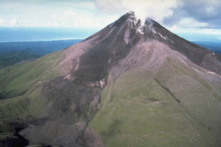
Geological Summary. Bagana volcano, in a remote portion of central Bougainville Island, is frequently active. This massive symmetrical cone was largely constructed by an accumulation of viscous andesitic lava flows. The entire edifice could have been constructed in about 300 years at its present rate of lava production. Eruptive activity is characterized by non-explosive effusion of viscous lava that maintains a small lava dome in the summit crater, although occasional explosive activity produces pyroclastic flows. Lava flows with tongue-shaped lobes up to 50 m thick and prominent levees descend the flanks on all sides.
Sources: Autonomous Bougainville Government, Rabaul Volcano Observatory (RVO), Darwin Volcanic Ash Advisory Centre (VAAC), Papua New Guinea National Disaster Centre

