Report on Kuchinoerabujima (Japan) — 27 March-2 April 2024
Smithsonian Institution / US Geological Survey
Weekly Volcanic Activity Report, 27 March-2 April 2024
Managing Editor: Sally Sennert.
Please cite this report as:
Global Volcanism Program, 2024. Report on Kuchinoerabujima (Japan) (Sennert, S, ed.). Weekly Volcanic Activity Report, 27 March-2 April 2024. Smithsonian Institution and US Geological Survey.
Kuchinoerabujima
Japan
30.443°N, 130.217°E; summit elev. 657 m
All times are local (unless otherwise noted)
JMA reported that the number of shallow volcanic earthquakes at Kuchinoerabujima increased during June and July 2023, fluctuated at elevated levels, began to decrease in mid-January 2024, and continued to decrease through March. The epicenters were mainly located near Furudake Crater, with some located near Shindake Crater (just N of Furudake). Sulfur dioxide emissions shared a similar pattern with increases starting in July 2023, peaks of 200-400 tons per day (t/d) during August-September, and a gradual decrease to less than 100 t/d by 18 March 2024. A geothermal area near Furudake Crater expanded and temperatures increased during October-December 2023 but beginning in January 2024 both the temperatures and the size decreased. No changes to the geothermal area near the fissure on the W side of Shindake Crater were observed during March. At 1400 on 27 March the Alert Level was lowered to 2 (on a scale of 1-5) with restrictions to access encompassing only the crater area. JMA noted that seismic activity continued to be recorded near the crater, and that the sulfur dioxide emissions and the level of activity at the geothermal areas remained at higher levels than before activity increased in June 2023.
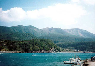
Geological Summary. A group of young stratovolcanoes forms the eastern end of the irregularly shaped island of Kuchinoerabujima in the northern Ryukyu Islands, 15 km W of Yakushima. The Furudake, Shindake, and Noikeyama cones were erupted from south to north, respectively, forming a composite cone with multiple craters. All historical eruptions have occurred from Shindake, although a lava flow from the S flank of Furudake that reached the coast has a very fresh morphology. Frequent explosive eruptions have taken place from Shindake since 1840; the largest of these was in December 1933. Several villages on the 4 x 12 km island are located within a few kilometers of the active crater and have suffered damage from eruptions.

