Seismicity apparently triggered by M 7.5 earthquake hundreds of kilometers away
Southern California's largest earthquake since 1952, M 7.5 on 28 June, appeared to trigger seismicity at several volcanic centers in California. It was centered roughly 200 km E of Los Angeles. In the following, David Hill describes post-earthquake activity at Long Valley caldera, and Stephen Walter discusses the USGS's seismic network, and the changes it detected at Lassen, Shasta, Medicine Lake, and the Geysers.
In recent years, the USGS northern California seismic network has relied upon Real-Time Processors (RTPs) to detect, record, and locate earthquakes. However, a film recorder (develocorder) collects data from 18 stations in volcanic areas, primarily to detect long-period earthquakes missed by RTPs. The film recorders proved useful in counting the post-M 7.5 earthquakes, most of which were too small to trigger the RTPs.
The film record was scanned for the 24 hours after the M 7.5 earthquake, noting the average coda duration for each identified event. Some events may have been missed because of seismogram saturation by the M 7.5 earthquake. Marked increases in microseismicity were observed at Lassen Peak, Medicine Lake caldera, and the Geysers (table 1). No earthquakes were observed at Shasta, but the lack of operating stations on the volcano limited the capability to observe small events.
Table 1. Number of earthquakes at northern California volcanic centers during 24-hour periods following major earthquakes on 25 April (40.37°N, 124.32°W; M 7.0) and 28 June (34.18°N, 116.47°W; M 7.5) 1992. Events with coda durations less than or equal to 10 seconds and greater than 10 seconds are tallied separately. Earthquakes were identified from film records of seismograms from nearby stations. Courtesy of Stephen Walter.
| Date | Lassen | Shasta | Medicine Lake | Geysers | ||||
| Codas (seconds) | <= 10 | > 10 | <= 10 | > 10 | <= 10 | > 10 | <= 10 | > 10 |
| 25 Apr 1992 | 0 | 0 | 0 | 1 | 0 | 0 | 7 | 2 |
| 28 Jun 1992 | 8 | 14 | 1 | 5 | 12 | 0 | 46 | 4 |
Film was also scanned for the 24 hours following the M 7.0 earthquake at 40.37°N, 124.32°W (near Cape Mendocino) on 25 April. Although smaller than the 28 June earthquake, its epicenter was only 20-25% as far from the volcanoes. Furthermore, both the 25 April main shock and a M 6.5 aftershock were felt at the volcanic centers, but no felt reports were received from these areas after the 28 June earthquake. Only the Geysers showed any possible triggered events after the 25 April shock. However, background seismicity at the Geysers is higher than at the other centers, and is influenced by fluid injection and withdrawal associated with intensive geothermal development.
Lassen Report. Of the three major Holocene volcanoes in the California Cascades, Lassen (~800 km NNW of the epicenter) had the strongest response to the 28 June earthquake (figure 1). About 10 minutes after the S-wave's arrival and while surface waves were still being recorded, a M 2.8 event occurred south of Lassen Peak. Film records showed 9 more earthquakes in the first hour, and 22 events were identified during the first 24 hours. Although most were M 1 or smaller, at least two and perhaps as many as four were of magnitude greater than or equal to 2. Nine were detected by the RTP system. The best preliminary locations were concentrated ~3 km SW of Lassen Peak at
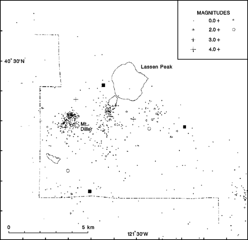 |
Figure 1. Seismic events in the Lassen area that were apparently triggered by the M 7.5 southern California earthquake of 28 June 1992 (circles) compared to 1978-90 seismicity in the region (crosses). Squares mark seismic stations. Courtesy of S. Walter. |
Information Contacts: Stephen Walter and David Hill, MS 977, U.S. Geological Survey, 345 Middlefield Road, Menlo Park, California 94025 USA.
The Global Volcanism Program has no Weekly Reports available for Lassen Volcanic Center.
Reports are organized chronologically and indexed below by Month/Year (Publication Volume:Number), and include a one-line summary. Click on the index link or scroll down to read the reports.
Seismicity apparently triggered by M 7.5 earthquake hundreds of kilometers away
Southern California's largest earthquake since 1952, M 7.5 on 28 June, appeared to trigger seismicity at several volcanic centers in California. It was centered roughly 200 km E of Los Angeles. In the following, David Hill describes post-earthquake activity at Long Valley caldera, and Stephen Walter discusses the USGS's seismic network, and the changes it detected at Lassen, Shasta, Medicine Lake, and the Geysers.
In recent years, the USGS northern California seismic network has relied upon Real-Time Processors (RTPs) to detect, record, and locate earthquakes. However, a film recorder (develocorder) collects data from 18 stations in volcanic areas, primarily to detect long-period earthquakes missed by RTPs. The film recorders proved useful in counting the post-M 7.5 earthquakes, most of which were too small to trigger the RTPs.
The film record was scanned for the 24 hours after the M 7.5 earthquake, noting the average coda duration for each identified event. Some events may have been missed because of seismogram saturation by the M 7.5 earthquake. Marked increases in microseismicity were observed at Lassen Peak, Medicine Lake caldera, and the Geysers (table 1). No earthquakes were observed at Shasta, but the lack of operating stations on the volcano limited the capability to observe small events.
Table 1. Number of earthquakes at northern California volcanic centers during 24-hour periods following major earthquakes on 25 April (40.37°N, 124.32°W; M 7.0) and 28 June (34.18°N, 116.47°W; M 7.5) 1992. Events with coda durations less than or equal to 10 seconds and greater than 10 seconds are tallied separately. Earthquakes were identified from film records of seismograms from nearby stations. Courtesy of Stephen Walter.
| Date | Lassen | Shasta | Medicine Lake | Geysers | ||||
| Codas (seconds) | <= 10 | > 10 | <= 10 | > 10 | <= 10 | > 10 | <= 10 | > 10 |
| 25 Apr 1992 | 0 | 0 | 0 | 1 | 0 | 0 | 7 | 2 |
| 28 Jun 1992 | 8 | 14 | 1 | 5 | 12 | 0 | 46 | 4 |
Film was also scanned for the 24 hours following the M 7.0 earthquake at 40.37°N, 124.32°W (near Cape Mendocino) on 25 April. Although smaller than the 28 June earthquake, its epicenter was only 20-25% as far from the volcanoes. Furthermore, both the 25 April main shock and a M 6.5 aftershock were felt at the volcanic centers, but no felt reports were received from these areas after the 28 June earthquake. Only the Geysers showed any possible triggered events after the 25 April shock. However, background seismicity at the Geysers is higher than at the other centers, and is influenced by fluid injection and withdrawal associated with intensive geothermal development.
Lassen Report. Of the three major Holocene volcanoes in the California Cascades, Lassen (~800 km NNW of the epicenter) had the strongest response to the 28 June earthquake (figure 1). About 10 minutes after the S-wave's arrival and while surface waves were still being recorded, a M 2.8 event occurred south of Lassen Peak. Film records showed 9 more earthquakes in the first hour, and 22 events were identified during the first 24 hours. Although most were M 1 or smaller, at least two and perhaps as many as four were of magnitude greater than or equal to 2. Nine were detected by the RTP system. The best preliminary locations were concentrated ~3 km SW of Lassen Peak at
|
Figure 1. Seismic events in the Lassen area that were apparently triggered by the M 7.5 southern California earthquake of 28 June 1992 (circles) compared to 1978-90 seismicity in the region (crosses). Squares mark seismic stations. Courtesy of S. Walter. |
Information Contacts: Stephen Walter and David Hill, MS 977, U.S. Geological Survey, 345 Middlefield Road, Menlo Park, California 94025 USA.
This compilation of synonyms and subsidiary features may not be comprehensive. Features are organized into four major categories: Cones, Craters, Domes, and Thermal Features. Synonyms of features appear indented below the primary name. In some cases additional feature type, elevation, or location details are provided.
Cones |
||||
| Feature Name | Feature Type | Elevation | Latitude | Longitude |
| Brokeoff Mountain | Stratovolcano | 2815 m | 40° 27' 0" N | 121° 33' 0" W |
|
Cinder Cone
Black Butte |
Pyroclastic cone | 2105 m | 40° 33' 0" N | 121° 19' 0" W |
| Hat Mountain | Cone | 2345 m | 40° 30' 0" N | 121° 25' 0" W |
| Prospect Peak | Shield volcano | 2541 m | 40° 34' 0" N | 121° 21' 0" W |
| Raker Peak | Cone | 2281 m | 40° 32' 0" N | 121° 28' 0" W |
| West Prospect Peak | Shield volcano | 2490 m | 40° 36' 0" N | 121° 23' 0" W |
Craters |
||||
| Feature Name | Feature Type | Elevation | Latitude | Longitude |
| Crescent Crater | Crater | 2635 m | 40° 30' 0" N | 121° 30' 0" W |
Domes |
||||
| Feature Name | Feature Type | Elevation | Latitude | Longitude |
| Bumpass Mountain | Dome | 2668 m | 40° 28' 0" N | 121° 30' 0" W |
| Chaos Crags | Dome | 2592 m | 40° 31' 0" N | 121° 31' 0" W |
| Eagle Peak | Dome | 2811 m | 40° 29' 0" N | 121° 31' 0" W |
| Helen, Mount | Dome | |||
|
Lassen Peak
St. Joseph's, Mount Saint Joseph's, Mount |
Dome | 3187 m | 40° 29' 31" N | 121° 30' 29" W |
| Reading Peak | Dome | 2652 m | 40° 28' 0" N | 121° 28' 0" W |
| Ski Heil Peak | Dome | 2706 m | 40° 29' 0" N | 121° 31' 0" W |
| Sunflower Flat | Dome | 2222 m | 40° 33' 0" N | 121° 31' 0" W |
| Vulcans Castle | Dome | 2570 m | 40° 29' 0" N | 121° 32' 0" W |
Thermal |
||||
| Feature Name | Feature Type | Elevation | Latitude | Longitude |
| Boiling Springs Lake | Hot Spring | 40° 26' 0" N | 121° 24' 0" W | |
| Bumpass Hell | Thermal | 2410 m | 40° 28' 0" N | 121° 30' 0" W |
| Devils Kitchen | Thermal | 40° 26' 30" N | 121° 26' 0" W | |
| Domingo Spring | Hot Spring | 40° 22' 0" N | 121° 21' 0" W | |
| Drakesbad | Thermal | 40° 26' 30" N | 121° 25' 0" W | |
| Growler Hot Springs | Hot Spring | 40° 23' 30" N | 121° 30' 0" W | |
| Little Hot Springs Valley | Hot Spring | 40° 27' 0" N | 121° 31' 0" W | |
| Morgan Hot Springs | Hot Spring | 40° 23' 0" N | 121° 31' 0" W | |
| Sulfur Works | Thermal | 2170 m | 40° 27' 0" N | 121° 32' 0" W |
| Terminal Geyser | Geyser | 40° 25' 0" N | 121° 23' 0" W | |
|
|
||||||||||||||||||||||||||
There is data available for 5 confirmed Holocene eruptive periods.
1914 May 30 - 1917 Jun 29 Confirmed Eruption Max VEI: 3
| Episode 1 | Eruption Episode | Lassen Peak | |||||||||||||||||||||||||||||||||||||||||||||||||||||||||||||||||||||||||||||||
|---|---|---|---|---|---|---|---|---|---|---|---|---|---|---|---|---|---|---|---|---|---|---|---|---|---|---|---|---|---|---|---|---|---|---|---|---|---|---|---|---|---|---|---|---|---|---|---|---|---|---|---|---|---|---|---|---|---|---|---|---|---|---|---|---|---|---|---|---|---|---|---|---|---|---|---|---|---|---|---|---|
| 1914 May 30 - 1917 Jun 29 | Evidence from Observations: Reported | |||||||||||||||||||||||||||||||||||||||||||||||||||||||||||||||||||||||||||||||
|
List of 14 Events for Episode 1 at Lassen Peak
| ||||||||||||||||||||||||||||||||||||||||||||||||||||||||||||||||||||||||||||||||
[ 1850 Aug - 1851 ] Discredited Eruption
1666 (?) Confirmed Eruption Max VEI: 3 (?)
| Episode 1 | Eruption Episode | Cinder Cone | |||||||||||||||||||||||||||||||||||||||
|---|---|---|---|---|---|---|---|---|---|---|---|---|---|---|---|---|---|---|---|---|---|---|---|---|---|---|---|---|---|---|---|---|---|---|---|---|---|---|---|---|
| 1666 (?) - Unknown | Evidence from Sidereal: Dendrochronology | |||||||||||||||||||||||||||||||||||||||
|
List of 6 Events for Episode 1 at Cinder Cone
| ||||||||||||||||||||||||||||||||||||||||
[ 1650 (?) ] Uncertain Eruption
| Episode 1 | Eruption Episode | Chaos Crags | |||||||||||||||||||||||||||||
|---|---|---|---|---|---|---|---|---|---|---|---|---|---|---|---|---|---|---|---|---|---|---|---|---|---|---|---|---|---|---|
| 1650 (?) - Unknown | Evidence from Unknown | |||||||||||||||||||||||||||||
|
List of 4 Events for Episode 1 at Chaos Crags
| ||||||||||||||||||||||||||||||
0980 ± 300 years Confirmed Eruption
| Episode 1 | Eruption Episode | Chaos Crags | |||||||||||||||||||||||||||||||||||||||
|---|---|---|---|---|---|---|---|---|---|---|---|---|---|---|---|---|---|---|---|---|---|---|---|---|---|---|---|---|---|---|---|---|---|---|---|---|---|---|---|---|
| 0980 ± 300 years - Unknown | Evidence from Isotopic: 14C (calibrated) | |||||||||||||||||||||||||||||||||||||||
|
List of 6 Events for Episode 1 at Chaos Crags
| ||||||||||||||||||||||||||||||||||||||||
0880 ± 300 years Confirmed Eruption
| Episode 1 | Eruption Episode | Chaos Crags | |||||||||||||||||||||||||||||||||||||||
|---|---|---|---|---|---|---|---|---|---|---|---|---|---|---|---|---|---|---|---|---|---|---|---|---|---|---|---|---|---|---|---|---|---|---|---|---|---|---|---|---|
| 0880 ± 300 years - Unknown | Evidence from Isotopic: 14C (calibrated) | |||||||||||||||||||||||||||||||||||||||
|
List of 6 Events for Episode 1 at Chaos Crags
| ||||||||||||||||||||||||||||||||||||||||
0800 ± 300 years Confirmed Eruption
| Episode 1 | Eruption Episode | Chaos Crags | |||||||||||||||||||||||||||||||||||||||
|---|---|---|---|---|---|---|---|---|---|---|---|---|---|---|---|---|---|---|---|---|---|---|---|---|---|---|---|---|---|---|---|---|---|---|---|---|---|---|---|---|
| 0800 ± 300 years - Unknown | Evidence from Isotopic: 14C (calibrated) | |||||||||||||||||||||||||||||||||||||||
|
List of 6 Events for Episode 1 at Chaos Crags
| ||||||||||||||||||||||||||||||||||||||||
There is data available for 1 deformation periods. Expand each entry for additional details.
| Start Date: 1996 | Stop Date: 2000 | Direction: Subsidence | Method: InSAR |
| Magnitude: Unknown | Spatial Extent: 40.00 km | Latitude: Unknown | Longitude: Unknown |
Remarks: Deformation area centered 5 km SE of Lassen Peak | |||
Reference List: Poland et al. 2004b.
Full References:
Poland, M., G. Bawden, M. Lisowski, and D. Dzurisin, 2004. Newly discovered subsidence at Lassen Peak, southern Cascade Range, California, from InSAR and GPS. Eos Trans. AGU, 85(47), Fall Meet. Suppl., Abstract G51A-0068.
There is no Emissions History data available for Lassen Volcanic Center.
 The blocky surface of Chaos Jumbles in the foreground was produced by collapse of a portion of the Chaos Crags lava dome complex in the background about 1650 CE. The cold rock avalanche traveled 5 km from its source, and may have occurred in the absence of any eruptive activity. Three successive lobes of the avalanche cover an area of 8 km2.
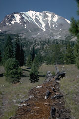 The tree stump and strip of red bark fragments in the foreground are the remnants of one of the many trees blown down radially away from the volcano by a pyroclastic surge on May 22, 1915, during the paroxysmal phase of the 1914-1917 eruption of Lassen Peak. The Devastated Area in the background remained sparsely vegetated for many decades following the eruption.
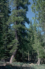 The trunks of the large ponderosa pine tree at the left and the smaller birch to the right in the Lost Creek valley NE of Lassen Peak were bent over by a mudflow from an eruption in May 1915. After the eruption vertical growth of the trees resumed. The mudflows traveled 50 km from the volcano, destroying bridges, farmlands, and farm buildings.
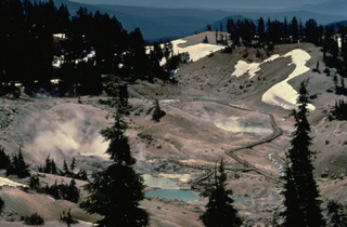 Bumpass Hell, the largest hydrothermal area at Lassen volcano, located south of Lassen Peak, contains steaming fumaroles and mudpots. It was named after its discoverer, a noted hunter and mountain man who suffered severe burns when he broke through the thin crust of the thermal area.
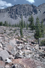
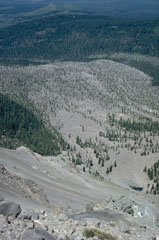 Chaos Jumbles, a debris avalanche-deposit formed by collapse of Chaos Crags about 1650 CE, is seen from the top of the avalanche scarp. The avalanche traveled up to 5 km in three lobes now covered with varying degrees of vegetation. The avalanche was emplaced as a cold rockfall avalanche; there is no direct evidence for an associated explosive eruption.
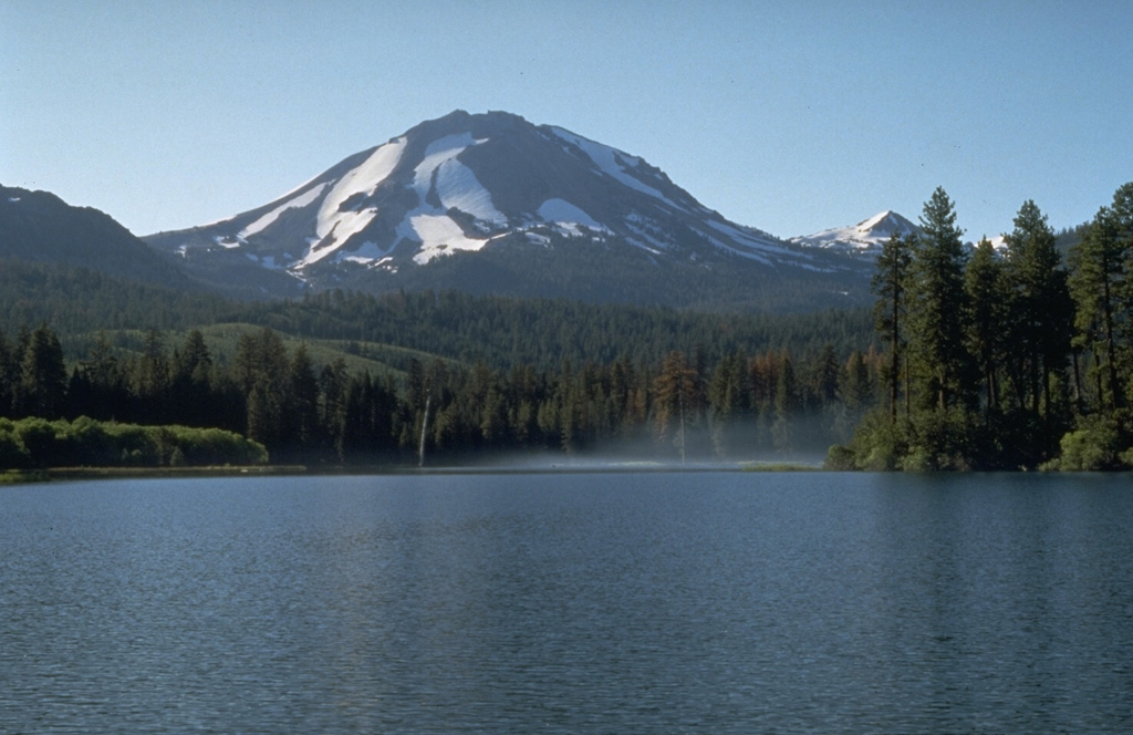
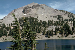 The massive dacitic lava dome of Lassen Peak rises above Lake Helen on the south side of the volcano. Plugs of dark dacitic lava exposed near the summit are surrounded by vast aprons of lighter-colored talus associated with growth of the lava dome.
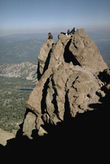 Hikers perch on a small pinnacle of dacitic lava that forms the high point of Lassen Peak, the southernmost major volcano in the Cascade Range that stretches from southern British Columbia to northern California. Lassen Peak is a large dacitic lava dome that last erupted from 1914 to 1917.
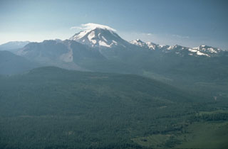 An aerial view of cloud-capped Lassen Peak from the NW shows the Chaos Crags lava dome complex on its left, the source of rockfall avalanche in 1650 CE, and the older Brokeoff stratovolcano and post-caldera lava domes on the right. Lassen Peak was the source of California's latest eruption, that lasted from 1914 to 1917.
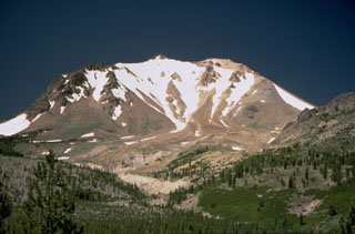 The sparsely vegetated Devastated Zone on the NE flank of Lassen Peak was swept by a pyroclastic surge on May 22, 1915, during the paroxysmal phase of the 1914-1917 eruption. The pyroclastic surge destroyed forests, and was accompanied by mudflows that traveled down Lost Creek and Hat Creek valleys.
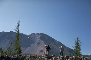 U.S. Geological Survey volcanologists conduct Electronic Distance Measurement surveys NW of Lassen Peak as part of a monitoring program at Lassen volcano. Chaos Crags lava dome rises in the background. The large scarp at the left was formed during collapse of part of Chaos Crags about 1650 CE.
 Lassen Peak, rising above Manzanita Lake on the NW, is the focal point of the Lassen volcanic center, a concentration of volcanic features covering much of Lassen National Park. The massive lava dome forming Lassen Peak was constructed about 25,000 years ago and was the site of California's most recent eruption during 1914-1917. Chaos Crags, a lava dome complex on the north flank, and the aptly named Cinder Cone to the NE, have also erupted within the past 1200 years.
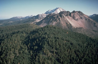 Lassen Peak rises in the background behind the Chaos Crags, a group of dacitic lava domes on Lassen's north flank. The Chaos Crags were formed during a series of eruptions about 1100 to 1000 years ago in which early explosive eruptions and pyroclastic flows were followed by growth of a complex of five lava domes. The area of light-colored talus on the right side is the source of a large debris avalanche from Chaos Crags about 1650 CE.
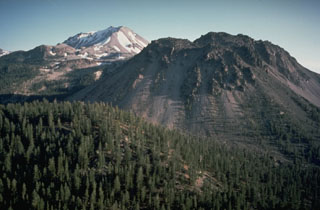 Chaos Crags in the foreground and Lassen Peak in the background are large lava dome complexes in the southern Cascade Range. Chaos Crags consists of a group of six overlapping rhyodacite lava domes that erupted around 1,100 years ago. Lassen last erupted during 1914-17.
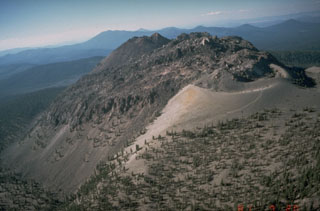 The Chaos Crags lava dome complex on the north flank of Lassen Peak, seen here from the south, was formed at the end of an eruptive period about 1100-1000 years ago. A tephra ring from associated explosive eruptions forms the light-colroed area at the middle right.
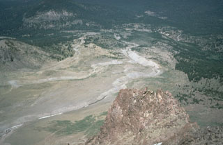 The Devastated Area swept by pyroclastic surges during an explosion on May 22, 1915 is seen here from the NE flank of Lassen Peak. The May 22 produced an eruption plume as high as 9 km, a pyroclastic surge that swept the area seen here, and a series of three lahars, the two largest of which swept down Lost Creek to the NE. The area as far as the distant flank of forested Raker Peak at the upper left was affected by the May 22 pyroclastic surge. Revegetation has begun to cover the distal parts of the May 1915 deposits.
 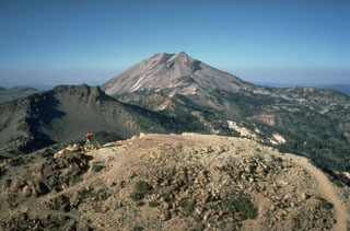 Lassen Peak, seen from Brokeoff volcano to the SW, is one of a series of dacitic lava domes erupted during the past 25,000 years along the northern edge of a caldera on the northern flank of Brokeoff volcano. Lassen Peak is the largest and most recently active of these domes.
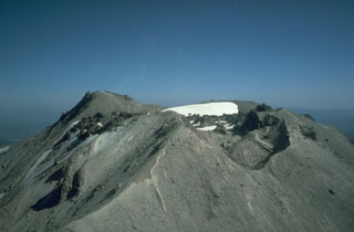 The summit of Lassen Peak contains a lava flow and several craters that formed during the 1914-1917 eruption. Lava flowed out of the crater through low points in the eastern and western crater rims. The NW crater in the foreground (right) formed during explosions near the end of the eruption in 1917.
 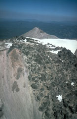 In May 1915, a year after the start of the eruption, lava flowed through low points in the eastern and western crater rims and descended the upper flanks. The western flow shown in this photo reached about 500 m down the flank. On 19-20 May 1915 the eastern flow fragmented and mixed with snowmelt, forming a debris flow that traveled 35 km down Lost Creek and Hat Creek valleys, destroying bridges and farm buildings.
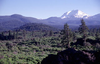 Potato Butte, the forested cinder cone at the left-center, is seen here from the rim of the Hat Creek vent with snow-covered Lassen Peak in the background. The Potato Butte cinder cones and lava flows were erupted around 65,000-75,000 years ago. The prominent 30,000-year-old Hat Creek lava flow traveled nearly 30 km from a fissure vent near the town of Old Station. An undated, but younger-looking flow originated from a cinder cone near West Prospect Peak, west of Potato Butte.
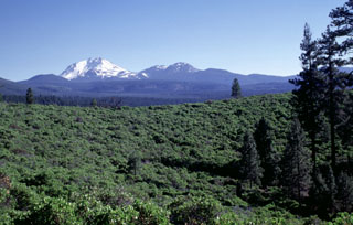 The green Manzanita-covered slope in the foreground is part of the circular rim of South Potato Butte, one of two cinder cones forming Potato Butte. The two cinder cones fed youthful-looking lava flows down the Hat Creek graben. Snow-covered Lassen Peak rises in the distance, with the Chaos Crags lava dome complex to its right.
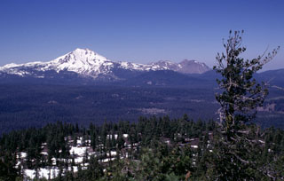 Snow-capped Lassen Peak is seen here from the summit of Prospect Peak shield volcano at the NE end of Lassen Volcanic National Park. The unvegetated, largely snow-free peaks on the right horizon are the Chaos Crags, a complex of dacitic lava domes last active about 1100 years ago. The Twin Lakes sequence of andesitic lava shields and cones forms the lake-studded area of the Central Plateau in the center of the photo.
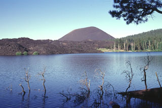 The aptly named Cinder Cone, a symmetrical pyroclastic cone at the NE end of the Lassen volcanic center, is seen here from the NE across Butte Lake. The unvegetated lava flow at the left originated from the cone. Although there is a report of an eruption from Cinder Cone in 1850 CE, recent work suggests that the cone and associated lava flows all formed during a brief eruptive interval lasting at most a few decades about 230-425 radiocarbon years ago. Lava flows traveled to the NE and SE, forming Snag Lake and Butte Lake.
 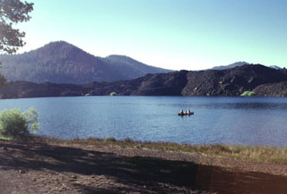 Butte Lake in NE Lassen Volcanic National Park was formed when the blocky lava flow seen across the lake dammed local drainages. The flow was one of five accompanying the eruption that formed Cinder Cone several hundred years ago. This marks the NW-most extent of lava flows from Cinder Cone.
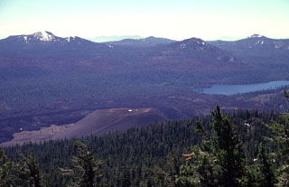 The unvegetated pyroclastic cone in the foreground, seen from near the summit of Prospect Peak, is Cinder Cone in NE Lassen Volcanic National Park. Cinder Cone, which was formed during an eruption several hundred years ago, was the source of an extensive series of lava flows that can be seen on the far side of the cone. The flows dammed up local drainages, forming two lakes, one of which is Snag Lake, seen here SSE of the cone.
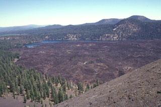 Lava flows traveled about 3.5 km to the north and south from Cinder Cone, blocking drainages and forming two lakes. The northern lake, Butte Lake, is seen here from the summit of Cinder Cone. The quartz-bearing basaltic lava flows originated from vents at the SE flank of the pyroclastic cone. The old Emigrant Trail connecting Nevada with the Sacremento Valley winds through the trees at the left base of the cone.
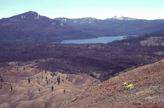 A series of lava flows from a vent on the SE flank of Cinder Cone traveled about 3.5 km to the north and south. Snag Lake, seen here to the south from the summit of Cinder Cone, was formed with the lava flow dammed up drainages. The colorful area at the lower left, known as the Painted Dunes, is an ash deposit oxidized by the heat of a still-hot underlying lava flow. The dark-colored main flow beyond the Painted Dunes was emplaced later during the same eruption, and is ash free.
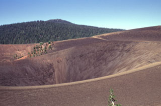 The summit of Cinder Cone contains nested craters with several crater rims created as a result of changes in vent location and eruption intensity. The scoria cone was formed during eruptions several hundred years ago in NE Lassen Volcanic National Park. Prospect Peak, an andesitic shield volcano capped by a small pyroclastic cone, is the forested peak in the background NW of Cinder Cone.
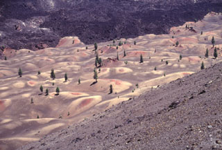 The colorful Painted Dunes at Cinder Cone in NE Lassen Volcanic National Park were formed when ash deposits from Cinder Cone were oxidized by a still-hot underlying lava flow. The mounded surface of the ash reflects the irregular topography of the underlying Painted Dunes lava flow. A black ash-free lava flow, also erupted from Cinder Cone at a later date during the same eruption, can be seen at the top of the photo.
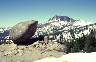 A roughly 3-m-high rounded glacial erratic at the Bumpass Hell parking lot is witness to the extensive glacial erosion that has affected much of Lassen Volcanic National Park. Brokeoff volcano in the background is the glacially eroded remnant of a large stratovolcano that formed begining about 600,000 years ago. At its peak the volcano may have reached a height of 3350 m. Glacial erosion of hydrothermally altered rocks at the core of the volcano has produced a large central depression.
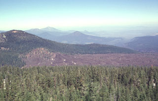 This view from Prospect Peak shows perhaps the youngest lava flow immediately north of the Lassen volcanic center. This sparsely vegetated flow originated from a small cinder cone (left-center) between Prospect and West Prospect (upper left) peaks, two young basaltic lava cones straddling the NE border of Lassen Volcanic National Park. The young, but undated andesitic flow traveled initially to the NE and then around the flank of West Prospect Peak to the NW.
The maps shown below have been scanned from the GVP map archives and include the volcano on this page. Clicking on the small images will load the full 300 dpi map. Very small-scale maps (such as world maps) are not included. The maps database originated over 30 years ago, but was only recently updated and connected to our main database. We welcome users to tell us if they see incorrect information or other problems with the maps; please use the Contact GVP link at the bottom of the page to send us email.
The following 58 samples associated with this volcano can be found in the Smithsonian's NMNH Department of Mineral Sciences collections, and may be availble for research (contact the Rock and Ore Collections Manager). Catalog number links will open a window with more information.
| Catalog Number | Sample Description | Lava Source | Collection Date |
|---|---|---|---|
| NMNH 111123-101 | Quartz Basalt | CINDER CONE | -- |
| NMNH 111123-101 | Quartz Basalt | -- | -- |
| NMNH 111123-1242 | Basalt | -- | -- |
| NMNH 111123-1426 | Dacite | -- | -- |
| NMNH 111123-1449 | Quartz Basalt | CINDER CONE | -- |
| NMNH 111123-791 | Quartz Basalt | LASSEN PEAK | -- |
| NMNH 111123-792 | Quartz Basalt | LASSEN PEAK | -- |
| NMNH 111123-793 | Pumice | LASSEN PEAK | -- |
| NMNH 111123-794 | Quartz Basalt | LASSEN PEAK | -- |
| NMNH 111123-795 | Quartz Basalt | LASSEN PEAK | -- |
| NMNH 111123-796 | Quartz Basalt | LASSEN PEAK | -- |
| NMNH 111123-82 | Dacite | -- | -- |
| NMNH 111123-82 | Dacite | -- | -- |
| NMNH 111123-95 | Tuffaceous Sand | -- | -- |
| NMNH 111123-95 | Volcanic Sand | CINDER CONE | -- |
| NMNH 111123-96 | Tephra | CINDER CONE | -- |
| NMNH 112407 | Andesite-Dacite | LASSEN PEAK | 1 Jan 1970 |
| NMNH 113619-4 | Gypsum | -- | -- |
| NMNH 113619-5 | Mirabilite | -- | -- |
| NMNH 113619-6 | Volcanic Ash | -- | -- |
| NMNH 113619-7 | Sulfur | -- | -- |
| NMNH 114901 | Volcanic Dust | -- | -- |
| NMNH 115559-1 | Andesite-Dacite | LASSEN PEAK | -- |
| NMNH 115559-2 | Andesite-Dacite | LASSEN PEAK | -- |
| NMNH 116137-1 | Pumice | -- | -- |
| NMNH 116137-2 | Dacite | -- | -- |
| NMNH 116137-3 | Banded Dacite | -- | -- |
| NMNH 116465 | Andesite-Dacite | -- | 4 Jun 1905 |
| NMNH 2072 | Quartz Basalt | CINDER CONE | -- |
| NMNH 22923 | Volcanic Cinder | -- | -- |
| NMNH 22926 | Basalt | -- | -- |
| NMNH 38364 | Perlite | -- | -- |
| NMNH 38604 | Quartz Basalt | CINDER CONE | -- |
| NMNH 70589 | Quartz Basalt | CINDER CONE | -- |
| NMNH 70597 | Dacite | CINDER CONE | -- |
| NMNH 70598 | Quartz Basalt | CINDER CONE | -- |
| NMNH 91416 | Dacite | -- | -- |
| NMNH 91417 | Dacite | -- | -- |
| NMNH 91419 | Dacite | -- | -- |
| NMNH 91420 | Dacite | -- | -- |
| NMNH 91421 | Dacite | -- | -- |
| NMNH 91422 | Dacite Volcanic Breccia | -- | -- |
| NMNH 91425 | Dacite | -- | -- |
| NMNH 91426 | Lava | -- | -- |
| NMNH 91430 | Volcanically Scorched Pine Needles | -- | -- |
| NMNH 91431 | Volcanic Dust | -- | -- |
| NMNH 91433-1 | Dacite | -- | -- |
| NMNH 91433-10 | Basalt | -- | -- |
| NMNH 91433-11 | Hornblende Andesite | -- | -- |
| NMNH 91433-12 | Alunite | -- | -- |
| NMNH 91433-2 | Dacite | -- | -- |
| NMNH 91433-3 | Dacite | -- | -- |
| NMNH 91433-4 | Dacite | -- | -- |
| NMNH 91433-5 | Rhyolite Glass | -- | -- |
| NMNH 91433-6 | Rhyolite | -- | -- |
| NMNH 91433-7 | Andesite | -- | -- |
| NMNH 91433-8 | Andesite | -- | -- |
| NMNH 91433-9 | Alunite Rock | -- | -- |
| Copernicus Browser | The Copernicus Browser replaced the Sentinel Hub Playground browser in 2023, to provide access to Earth observation archives from the Copernicus Data Space Ecosystem, the main distribution platform for data from the EU Copernicus missions. |
| MIROVA | Middle InfraRed Observation of Volcanic Activity (MIROVA) is a near real time volcanic hot-spot detection system based on the analysis of MODIS (Moderate Resolution Imaging Spectroradiometer) data. In particular, MIROVA uses the Middle InfraRed Radiation (MIR), measured over target volcanoes, in order to detect, locate and measure the heat radiation sourced from volcanic activity. |
| MODVOLC Thermal Alerts | Using infrared satellite Moderate Resolution Imaging Spectroradiometer (MODIS) data, scientists at the Hawai'i Institute of Geophysics and Planetology, University of Hawai'i, developed an automated system called MODVOLC to map thermal hot-spots in near real time. For each MODIS image, the algorithm automatically scans each 1 km pixel within it to check for high-temperature hot-spots. When one is found the date, time, location, and intensity are recorded. MODIS looks at every square km of the Earth every 48 hours, once during the day and once during the night, and the presence of two MODIS sensors in space allows at least four hot-spot observations every two days. Each day updated global maps are compiled to display the locations of all hot spots detected in the previous 24 hours. There is a drop-down list with volcano names which allow users to 'zoom-in' and examine the distribution of hot-spots at a variety of spatial scales. |
|
WOVOdat
Single Volcano View Temporal Evolution of Unrest Side by Side Volcanoes |
WOVOdat is a database of volcanic unrest; instrumentally and visually recorded changes in seismicity, ground deformation, gas emission, and other parameters from their normal baselines. It is sponsored by the World Organization of Volcano Observatories (WOVO) and presently hosted at the Earth Observatory of Singapore.
GVMID Data on Volcano Monitoring Infrastructure The Global Volcano Monitoring Infrastructure Database GVMID, is aimed at documenting and improving capabilities of volcano monitoring from the ground and space. GVMID should provide a snapshot and baseline view of the techniques and instrumentation that are in place at various volcanoes, which can be use by volcano observatories as reference to setup new monitoring system or improving networks at a specific volcano. These data will allow identification of what monitoring gaps exist, which can be then targeted by remote sensing infrastructure and future instrument deployments. |
| Volcanic Hazard Maps | The IAVCEI Commission on Volcanic Hazards and Risk has a Volcanic Hazard Maps database designed to serve as a resource for hazard mappers (or other interested parties) to explore how common issues in hazard map development have been addressed at different volcanoes, in different countries, for different hazards, and for different intended audiences. In addition to the comprehensive, searchable Volcanic Hazard Maps Database, this website contains information about diversity of volcanic hazard maps, illustrated using examples from the database. This site is for educational purposes related to volcanic hazard maps. Hazard maps found on this website should not be used for emergency purposes. For the most recent, official hazard map for a particular volcano, please seek out the proper institutional authorities on the matter. |
| IRIS seismic stations/networks | Incorporated Research Institutions for Seismology (IRIS) Data Services map showing the location of seismic stations from all available networks (permanent or temporary) within a radius of 0.18° (about 20 km at mid-latitudes) from the given location of Lassen Volcanic Center. Users can customize a variety of filters and options in the left panel. Note that if there are no stations are known the map will default to show the entire world with a "No data matched request" error notice. |
| UNAVCO GPS/GNSS stations | Geodetic Data Services map from UNAVCO showing the location of GPS/GNSS stations from all available networks (permanent or temporary) within a radius of 20 km from the given location of Lassen Volcanic Center. Users can customize the data search based on station or network names, location, and time window. Requires Adobe Flash Player. |
| DECADE Data | The DECADE portal, still in the developmental stage, serves as an example of the proposed interoperability between The Smithsonian Institution's Global Volcanism Program, the Mapping Gas Emissions (MaGa) Database, and the EarthChem Geochemical Portal. The Deep Earth Carbon Degassing (DECADE) initiative seeks to use new and established technologies to determine accurate global fluxes of volcanic CO2 to the atmosphere, but installing CO2 monitoring networks on 20 of the world's 150 most actively degassing volcanoes. The group uses related laboratory-based studies (direct gas sampling and analysis, melt inclusions) to provide new data for direct degassing of deep earth carbon to the atmosphere. |
| Large Eruptions of Lassen Volcanic Center | Information about large Quaternary eruptions (VEI >= 4) is cataloged in the Large Magnitude Explosive Volcanic Eruptions (LaMEVE) database of the Volcano Global Risk Identification and Analysis Project (VOGRIPA). |
| EarthChem | EarthChem develops and maintains databases, software, and services that support the preservation, discovery, access and analysis of geochemical data, and facilitate their integration with the broad array of other available earth science parameters. EarthChem is operated by a joint team of disciplinary scientists, data scientists, data managers and information technology developers who are part of the NSF-funded data facility Integrated Earth Data Applications (IEDA). IEDA is a collaborative effort of EarthChem and the Marine Geoscience Data System (MGDS). |

