Report on Gamalama (Indonesia) — 13 September-19 September 2023
Smithsonian Institution / US Geological Survey
Weekly Volcanic Activity Report, 13 September-19 September 2023
Managing Editor: Sally Sennert.
Please cite this report as:
Global Volcanism Program, 2023. Report on Gamalama (Indonesia) (Sennert, S, ed.). Weekly Volcanic Activity Report, 13 September-19 September 2023. Smithsonian Institution and US Geological Survey.
Gamalama
Indonesia
0.81°N, 127.3322°E; summit elev. 1714 m
All times are local (unless otherwise noted)
Although there was no eruptive activity reported, in a 19 September press release, PVMBG noted that the number of daily deep volcanic earthquakes at Gamalama increased in early September and remained above average. The seismic network recorded a total of 16 deep volcanic earthquake events on 8 September and an average of nine events per day through 18 September; 1-2 events per day are generally recorded. The number of earthquakes indicating emissions also increased during 8-18 September, though diffuse white plumes only rose as high as 100 m above the summit whereas typically they can rise as high as 300 m. PVMBG noted that the most likely hazard would be a phreatic event that could ejected material within the 1.5-km radius, though ash may be carried farther by wind. The Alert Level remained at 2 (on a scale of 1-4); visitors and residents were warned not to approach the crater within a 1.5-km radius.
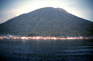
Geological Summary. Gamalama is a near-conical stratovolcano that comprises the entire island of Ternate off the western coast of Halmahera, and is one of Indonesia's most active volcanoes. The island was a major regional center in the Portuguese and Dutch spice trade for several centuries, which contributed to the extensive documentation of activity. Three cones, progressively younger to the north, form the summit. Several maars and vents define a rift zone, parallel to the Halmahera island arc, that cuts the volcano; the S-flank Ngade maar formed after about 14,500–13,000 cal. BP (Faral et al., 2022). Eruptions, recorded frequently since the 16th century, typically originated from the summit craters, although flank eruptions have occurred in 1763, 1770, 1775, and 1962-63.
Source: Pusat Vulkanologi dan Mitigasi Bencana Geologi (PVMBG, also known as CVGHM)