
The Servicio Nacional de Geología y Minería (SERNAGEOMIN) reported lower levels of activity at Copahue during 16-30 November. Sulfur dioxide emissions were low, averaging 529 ± 79 tons per day (t/d) with a maximum value of 907 t/d detected on 24 November. No thermal anomalies were identified in satellite images. Gas plumes rose 280 m above the crater rim and did not contain ash. No crater incandescence was observed at night. Deformation data showed a minor change from deflation to inflation. Seismic data indicated a more stable pattern. The water lake in the summit crater had returned and grown to 9,340 square meters by 30 November. In general activity levels were low. On 6 December the Alert Level was lowered to Green (the lowest level on a four-color scale).
Source: Servicio Nacional de Geología y Minería (SERNAGEOMIN)
Two thermal anomalies during November 2021
Copahue is located along the Chile-Argentina border and contains an eastern summit crater with an acidic 300-m-wide crater lake that has exhibited fumarolic activity. The current eruption period began in July 2021 and has been characterized by ash plumes, frequent sulfur dioxide emissions, seismicity, and gas-and-steam emissions (BGVN 46:11). Weak thermal anomalies were also detected. This report covers activity from November 2021 through April 2022, which describes the end of the last eruption period with two thermal anomalies in early November. Information primarily comes from the Servicio Nacional de Geología y Minería (SERNAGEOMIN) Observatorio Volcanológico de Los Andes del Sur (OVDAS) and various satellite data.
Activity was relatively low during November 2021 and consisted of 19 volcano-tectonic (VT) type events and two long-period (LP) events. Gas-and-steam emissions rose less than 1.2 km above the summit. Two weak thermal anomalies were detected in the summit crater on 1 and 6 November 2021, according to Sentinel-2 infrared satellite images (figure 68). No further thermal activity was detected after 6 November through April 2022. Sulfur dioxide data obtained using Differential Absorption Optical Spectroscopy (DOAS) showed an average value of 486 ± 68 tons/day (t/d) and a maximum value of 1,850 t/d on 4 November.
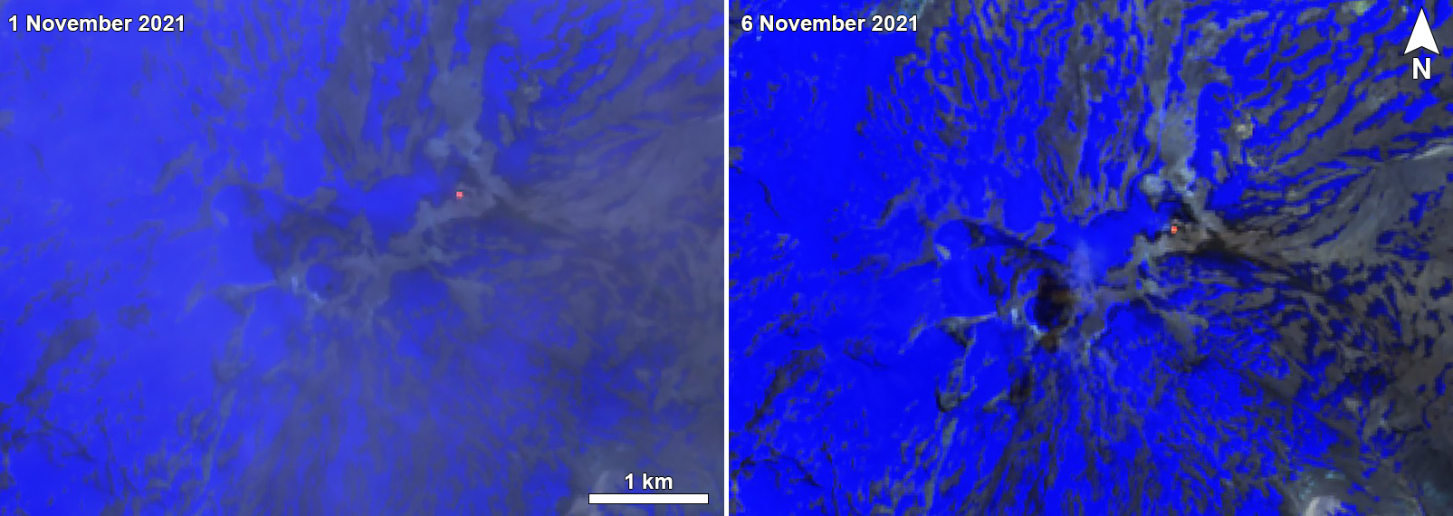 |
Figure 68. Sentinel-2 infrared satellite images showed a small thermal anomaly in the Copahue summit crater on 1 (left) and 6 (right) November 2021. Images using “Atmospheric penetration” rendering (bands 12, 11, 8a). Courtesy of Sentinel Hub Playground. |
During December 2021 through April 2022, seismic activity consisted of 136 VT-type, seven LP-type, and one tremor type (TR) events. Gas-and-steam emissions rose 300-320 m high. Thermal anomalies were no longer observed in satellite imagery. Sulfur dioxide emissions ranged from 213-415 t/d, with a daily maximum value of 1,634 t/d on 28 March.
Information Contacts: Servicio Nacional de Geología y Minería (SERNAGEOMIN), Observatorio Volcanológico de Los Andes del Sur (OVDAS), Avda Sta María No. 0104, Santiago, Chile (URL: http://www.sernageomin.cl/, https://twitter.com/Sernageomin); Sentinel Hub Playground (URL: https://www.sentinel-hub.com/explore/sentinel-playground).
2024: October
| December
2022: November
2021: June
| August
2020: June
| July
| September
| November
2019: February
| April
| September
| October
2018: March
| April
| June
| August
| November
| December
2017: May
| June
| July
| August
| November
2016: January
| February
| March
| June
| July
| September
| October
| November
| December
2015: September
| October
| November
| December
2014: March
| April
| July
| September
| October
| November
2013: January
| March
| May
| June
| November
2012: December
The Servicio Nacional de Geología y Minería (SERNAGEOMIN) reported lower levels of activity at Copahue during 16-30 November. Sulfur dioxide emissions were low, averaging 529 ± 79 tons per day (t/d) with a maximum value of 907 t/d detected on 24 November. No thermal anomalies were identified in satellite images. Gas plumes rose 280 m above the crater rim and did not contain ash. No crater incandescence was observed at night. Deformation data showed a minor change from deflation to inflation. Seismic data indicated a more stable pattern. The water lake in the summit crater had returned and grown to 9,340 square meters by 30 November. In general activity levels were low. On 6 December the Alert Level was lowered to Green (the lowest level on a four-color scale).
Source: Servicio Nacional de Geología y Minería (SERNAGEOMIN)
The Servicio Nacional de Geología y Minería (SERNAGEOMIN) reported that during 15-24 October surficial activity at Copahue increased based on analysis by Observatorio Volcánico de los Andes del Sur (OVDAS). Tremor signals slightly intensified on 15 October. Sulfur dioxide emissions increased on 15 October and averaged 2,900-3,000 tons per day (t/d) during 17-19 October, higher than the average of 2,400 t/d more typically observed. Sulfur dioxide emissions were detected with both satellite images and Differential Optical Absorption Spectroscopy (DOAS) instruments. Beginning on 16 October episodic intensifications of a thermal anomaly in El Agrio Crater were identified in satellite data with the most intense anomaly recorded on 19 October. Gas-and-steam emissions rose no higher than 300 m above the crater rim and contained ash starting on 17 October; the ash content was denser on 19 October. Gas-and-ash plumes on 19 October deposited ash in an area extending 2.9 km SE of the vent. By 24 October activity had decreased; sulfur dioxide emissions, a thermal anomaly, and ash emissions were no longer being detected. SERNAGEOMIN noted that an increase may occur again and raised the Alert Level to Yellow (the second lowest level on a four-color scale). SENAPRED declared a Yellow Alert (the middle level on a three-color scale) for residents of the Alto Biobío municipality and access to an area within 500 m of El Agrio Crater was restricted to the public.
The Servicio Geológico Minero Argentino (SEGEMAR) maintained an Alert Level of Green (the lowest level on a four-color scale) for Argentina, based on Argentine Volcano Monitoring Observatory (OAVV) analysis. SEGEMAR noted that the crater lake had dried up during the previous few weeks due to seasonal changes in rainfall. Weekly averages of sulfur dioxide emissions were less than 2,000 t/d with a peak of 6,270 t/d on 16 October based on TROPOMI satellite data. Gas-and-steam plumes were visible during 20-24 October when weather conditions allowed for visual observations. Tremor levels decreased after 19 October; an increase recorded on 24 October may have been due to weather. SEGEMAR noted that a possible phreatic eruption could impact an area within 1 km of the crater.
Sources: Servicio Nacional de Geología y Minería (SERNAGEOMIN); Servicio Geológico Minero Argentino (SEGEMAR); Sistema y Servicio Nacional de Prevención y Repuesta Ante Desastres (SENAPRED)
Servicio Nacional de Geología y Minería (SERNAGEOMIN) reported nighttime crater incandescence at Copahue on 16 October. According to Servicio Geológico Minero Argentino (SEGEMAR), webcam images recorded an increase in surface activity at 0430 on 19 October, which consisted of an ash emission that rose 200 m above the crater and drifted SE. The Alert Level remained at Green (the lowest level on a four-color scale) and the public was reminded to stay 500 m away from the crater.
Sources: Servicio Nacional de Geología y Minería (SERNAGEOMIN); Servicio Geológico Minero Argentino (SEGEMAR)
Based on information from Observatorio Argentino de Vigilancia Volcánica (OAVV), SERNAGEOMIN and SEGEMAR reported a minor increase of activity at Copahue. RSAM values based on volcanic tremor began to increase on 13 November. Weather conditions prevented views of the volcano during 13-14 November. On 15 November an increase in the magnitudes of tremor signals was accompanied by increased and denser gas emissions rising 200 m above El Agrio Crater. The emissions, seen in webcam images, were mostly whitish and contained particulate material. The Alert Level remained at Green (the lowest level on a four-color scale) and the public was reminded to stay 500 m away from the crater.
Sources: Servicio Nacional de Geología y Minería (SERNAGEOMIN); Servicio Geológico Minero Argentino (SEGEMAR)
SERNAGEOMIN and SEGEMAR reported increased activity at Copahue during 9-10 August, characterized as increased gas emissions, ash emissions, and crater incandescence. During the morning of 9 August gas-and-steam emissions increased and sulfur dioxide flux was as high as 7,200 tons per day. Crater incandescence was visible in nighttime webcam views and was intense during the early hours of 10 August. An ash plume rose 300 m above the crater rim and drifted N and NNW. Seismicity remained stable; data suggested no rising magma. The Alert Level remained at Green (the lowest level on a four-color scale).
Sources: Servicio Nacional de Geología y Minería (SERNAGEOMIN); Servicio Geológico Minero Argentino (SEGEMAR)
SERNAGEOMIN and SEGEMAR reported increased activity at Copahue, beginning with minor, sporadic increases in tremor first detected at the end of May. During 30 June-2 July tremor was elevated and volume of water in the crater lake decreased significantly. Coincidently crater incandescence was visible in nighttime webcam views and gas emissions increased. Residents reported volcanic gas odors. Increased gas-and-steam emissions during 1100-1400 on 2 July contained minor amounts of ash that left visible deposits on the SE and ENE flanks. The Alert Level remained at Green (the lowest level on a four-color scale).
Sources: Servicio Nacional de Geología y Minería (SERNAGEOMIN); Servicio Geológico Minero Argentino (SEGEMAR)
SERNAGEOMIN reported that during 1-15 November activity at Copahue decreased to low levels. Passive gas emissions generally rose 200-300 m above the vent, though on 15 November they rose 760 m. The report also noted no changes to deformation, low levels of sulfur dioxide emissions, low seismicity, partial restoration of the crater lake, and the absence of nighttime crater incandescence since late October. The Alert Level was lowered to Green (the lowest level on a four-color scale) on 15 November. ONEMI cancelled the Yellow Alert for the Alto Biobío municipality, but declared a “Preventive Early Warning” ensuring continued surveillance of the area and coordination within the Civil Protection System.
Source: Servicio Nacional de Geología y Minería (SERNAGEOMIN)
SERNAGEOMIN reported continuing activity at Copahue during 1-15 September. Webcams recorded gas-and-ash plumes rising as high as 1.1 km, sometimes associated with nighttime crater incandescence. The plumes drifted 6-15 km SW and SE. Sulfur dioxide emissions were high, averaging 1,499 tonnes per day (ranging from 1,148 to 1,850 tonnes per day), with a high value of 3,435 on 12 September. Two thermal anomalies were identified in satellite images. The Alert Level was remained at Yellow (the second lowest level on a four-color scale). ONEMI maintained the Yellow Alert (the middle level on a three-color scale) for residents of the Alto Biobío municipality and access to an area within 1 km of El Agrio Crater was restricted to the public.
Sources: Servicio Nacional de Geología y Minería (SERNAGEOMIN); Oficina Nacional de Emergencia-Ministerio del Interior (ONEMI)
SERNAGEOMIN reported continuing activity at Copahue during 16-31 August. Webcams recorded gas-and-ash plumes rising as high as 1.7 km, sometimes associated with nighttime crater incandescence. The plumes drifted in multiple directions as far as 4.3 km N, 9 km NE, 8 km E, 4 km SE, 4 km SW, 9 km W, and 4.4 km NW. Sulfur dioxide emissions were high, averaging 2,641 tonnes per day (ranging from 2,029 to 3,253 tonnes per day), with a high value of 4,627 on 27 August. The Alert Level was remained at Yellow (the second lowest level on a four-color scale). ONEMI maintained the Yellow Alert (the middle level on a three-color scale) for residents of the Alto Biobío municipality and access to an area within 1 km of El Agrio Crater was restricted to the public.
Sources: Servicio Nacional de Geología y Minería (SERNAGEOMIN); Oficina Nacional de Emergencia-Ministerio del Interior (ONEMI)
SERNAGEOMIN and SEGEMAR reported that elevated seismicity (continuous tremor) at Copahue was recorded on 16 July and accompanied by ash emissions observed by local residents. Sulfur dioxide emissions were anomalous on 4, 6, and 20 July; values were 2,100 and 1,713 tons per day on 2 and 4 July, respectively, on the high end of normal values. On 20 July residents of La Araucanía described an odor indicating hydrogen sulfide gas emissions. On 23 July the Alert Level was raised to Yellow (the second lowest level on a four-color scale). ONEMI raised a Yellow Alert (the middle level on a three-color scale) for residents of the Alto Biobío municipality and access to an area within 1 km of El Agrio Crater was restricted to the public.
Sources: Servicio Nacional de Geología y Minería (SERNAGEOMIN); Servicio Geológico Minero Argentino (SEGEMAR); Oficina Nacional de Emergencia-Ministerio del Interior (ONEMI)
SERNAGEOMIN reported that an ash plume from Copahue was visible on 16 July. The Alert Level remained at Green (the lowest level on a four-color scale) and the public was reminded to stay 500 m away from El Agrio crater.
Source: Servicio Nacional de Geología y Minería (SERNAGEOMIN)
SERNAGEOMIN reported that conditions at Copahue had returned to normal levels and seismicity was low. The Alert Level was lowered to Green (second lowest level on a four-color scale) on 7 July.
Source: Servicio Nacional de Geología y Minería (SERNAGEOMIN)
On 17 June OVDAS-SERNAGEOMIN reported increased activity at Copahue during the previous days, characterized by low-altitude gas emissions containing particulate matter. A period of increased seismicity was recorded in the afternoon on 16 June accompanied by crater incandescence and emissions visible in webcam images.
The report noted that very-long-period earthquakes had been recorded in previous months, and a series of volcano-related seismic events were detected in an area SSW of the volcano on 20 March. Additionally, satellite images showed a reduction in the size of the crater lake. These recent changes coupled with increased seismicity prompted SERNAGEOMIN to raise the Alert Level to Yellow (second lowest level on a four-color scale) and restrict access to an area within 1 km of El Agrio Crater. ONEMI raised a Yellow Alert (the middle level on a three-color scale) for residents of the Alto Biobío municipality.
Sources: Servicio Nacional de Geología y Minería (SERNAGEOMIN); Oficina Nacional de Emergencia-Ministerio del Interior (ONEMI)
OVDAS-SERNAGEOMIN and ONEMI reported that during 2-7 October a webcam at Copahue recorded white and gray emissions rising as high as 300 m above the El Agrio Crater rim and drifting ENE, SE, and SSE. By 7 October the number and intensity of seismic events detected at Copahue had decreased to low levels. The volcano Alert Level was lowered to Yellow (second lowest level on a four-color scale). ONEMI maintained the Yellow Alert (the middle level on a three-color scale) for residents, and stated that the public should stay at least 1 km away from El Agrio Crater.
Sources: Oficina Nacional de Emergencia-Ministerio del Interior (ONEMI); Servicio Nacional de Geología y Minería (SERNAGEOMIN); Servicio Geológico Minero Argentino (SEGEMAR)
On 30 September OVDAS-SERNAGEOMIN, ONEMI, and SEGEMAR reported that three long-period (LP) earthquakes with notable magnitudes were located about 5.8 km NE of Copahue’s El Agrio Crater. In addition, abundant LP and volcano-tectonic (VT) signals with relatively lower magnitudes were also located in the same area. Some of the events were felt by residents of Caviahue (10 km E) and Copahue 7 km NE) in Argentina. SERNAGEOMIN raised the Alert Level to Orange (second highest level on a four-color scale) and ONEMI updated the Yellow Alert (the middle level on a three-color scale) for residents, noting a restriction for entering a 5-km radius from El Agrio Crater. The seismic network recorded a local M 3.1 VT earthquake at 2340 on 30 September, and a local M 3.7 VT event at 0628 on 1 October. The report also noted that 14 lower-energy events (largest was M 2.4) were recorded.
Sources: Oficina Nacional de Emergencia-Ministerio del Interior (ONEMI); Servicio Nacional de Geología y Minería (SERNAGEOMIN); Servicio Geológico Minero Argentino (SEGEMAR)
OVDAS-SERNAGEOMIN reported that a long-period (LP) earthquake at Copahue recorded at 1657 on 11 September correlated with an infrasound signal from an explosion; a gas-and-ash emission rose to low heights. A larger explosion, recorded at 2245 along with an LP earthquake, produced a plume that rose 250 m above the crater rim. Incandescent deposits around the vent were visible at night, and a 3-km-long ash deposit, covering an area of 3.4 square kilometers, was visible on the ESE flank. The Alert Level remained at Yellow (second lowest level on a four-color scale); SERNAGEOMIN recommended no entry into a restricted area within 500 m of the crater. ONEMI maintained the Alert Level at Yellow (the middle level on a three-color scale) for the municipality of Alto Biobío.
Sources: Servicio Nacional de Geología y Minería (SERNAGEOMIN); Oficina Nacional de Emergencia-Ministerio del Interior (ONEMI)
OVDAS-SERNAGEOMIN reported that seismicity at Copahue increased at 1250 on 9 September, characterized by increased amplitude of continuous tremor. Anomalies in the seismic signals suggested elevated surface activity, though cloudy weather prevented visual observations. According to the Buenos Aires VAAC diffuse steam emissions recorded by the webcam on 10 September rose to 3.5 km (11,000 ft) a.s.l. and possibly contained minor amounts of ash. The Alert Level remained at Yellow (second lowest level on a four-color scale); SERNAGEOMIN recommended no entry into a restricted area within 500 m of the crater. ONEMI maintained the Alert Level at Yellow (the middle level on a three-color scale) for the municipality of Alto Biobío.
Sources: Servicio Nacional de Geología y Minería (SERNAGEOMIN); Oficina Nacional de Emergencia-Ministerio del Interior (ONEMI); Buenos Aires Volcanic Ash Advisory Center (VAAC)
On 5 April OVDAS-SERNAGEOMIN reported that seismicity at Copahue increased during 1-31 March, characterized by abundant volcano-tectonic earthquakes and increases in long-period and very-long-period earthquakes. In addition, the level of the lake water in El Agrio crater had dropped compared to previous months. The Alert Level was raised to Yellow (second highest level on a four-color scale); SERNAGEOMIN recommended no entry into a restricted area within 500 m of the crater. ONEMI raised the Alert Level to Yellow (the middle level on a three-color scale) for the municipality of Alto Biobío.
Source: Servicio Nacional de Geología y Minería (SERNAGEOMIN)
On 6 February OVDAS-SERNAGEOMIN lowered the Alert Level for Copahue to Green, the lowest level on a four-color scale, noting the return of the crater lake and infrequent surficial activity. In addition, data from the geodetic monitoring network showed only slight deformation during the previous three months. ONEMI lowered the Alert Level to Green (the lowest level on a three-color scale) for the municipality of Alto Biobío.
Sources: Oficina Nacional de Emergencia-Ministerio del Interior (ONEMI); Servicio Nacional de Geología y Minería (SERNAGEOMIN)
The Buenos Aires VAAC reported that on 6 December a pilot observed ash from Copahue at an altitude of 3 km (10,000 ft) a.s.l. Ash was not visible in satellite data and could not be confirmed by unavailable webcams. An ash emission observed by a pilot and identified in satellite images on 7 December rose to 3 km (10,000 ft) a.s.l. and drifted SW.
Source: Buenos Aires Volcanic Ash Advisory Center (VAAC)
The Buenos Aires VAAC reported that on 2 December a narrow ash plume from Copahue was visible in satellite images drifting ESE.
Source: Buenos Aires Volcanic Ash Advisory Center (VAAC)
The Buenos Aires VAAC reported that during 14-15 August diffuse steam emissions with possible ash were visible in webcam views rising to an altitude of 3.6 km (12,000 ft) a.s.l.
Source: Buenos Aires Volcanic Ash Advisory Center (VAAC)
According to ONEMI, OVDAS-SERNAGEOMIN reported that during 16-31 July there were 107 volcano-tectonic events recorded at Copahue, and 266 earthquakes indicating fluid movement. Webcams recorded gas-and-ash plumes rising from El Agrio crater as high as 1.5 km and nighttime incandescence. The Alert Level remained at Yellow (second highest level on a four-color scale); SERNAGEOMIN recommended no entry into a restricted area within 1 km of the crater. ONEMI maintained an Alert Level Yellow (the middle level on a three-color scale) for the municipality of Alto Biobío.
Sources: Oficina Nacional de Emergencia-Ministerio del Interior (ONEMI); Servicio Nacional de Geología y Minería (SERNAGEOMIN)
The Buenos Aires VAAC reported that on 24 June diffuse steam emissions with possible ash were visible in webcam views rising to an altitude of 3.6 km (12,000 ft) a.s.l.
Source: Buenos Aires Volcanic Ash Advisory Center (VAAC)
According to ONEMI, OVDAS-SERNAGEOMIN reported that during 1-31 March there were 83 volcano-tectonic events recorded at Copahue, and 204 earthquakes indicting fluid movement. Tremor levels increased on 24 March, the same day as the phreatic explosion, though by the next day decreased to baseline levels. Webcams recorded gas plumes rising from El Agrio crater as high as 1 km. During an overflight on 3 April scientists observed the crater lake, and continuous white gas plumes rising almost 400 m. The Alert Level remained at Yellow (second highest level on a four-color scale); SERNAGEOMIN recommended no entry into a restricted area within 1 km of the crater. ONEMI maintained an Alert Level Yellow (the middle level on a three-color scale) for the municipality of Alto Biobío.
Sources: Oficina Nacional de Emergencia-Ministerio del Interior (ONEMI); Servicio Nacional de Geología y Minería (SERNAGEOMIN)
According to ONEMI, OVDAS-SERNAGEOMIN reported that a hydrothermal explosion at Copahue was recorded on 24 March, along with increased tremor. The Alert Level was raised to Yellow (second highest level on a four-color scale); SERNAGEOMIN recommended no entry into a restricted area within 1 km of the crater. ONEMI maintained an Alert Level Yellow (the middle level on a three-color scale) for the municipality of Alto Biobío.
Source: Oficina Nacional de Emergencia-Ministerio del Interior (ONEMI)
Based on satellite and webcam views, the Buenos Aires VAAC reported that during 21 and 24-27 November thin and diffuse steam plumes containing minor amounts of ash rose from Copahue and drifted E and NE. The plumes rose to altitudes of 3.3-3.6 km (11,000-12,000 ft) a.s.l. during 25-26 November.
Source: Buenos Aires Volcanic Ash Advisory Center (VAAC)
According to ONEMI, OVDAS-SERNAGEOMIN reported that during 16-31 July surficial activity at Copahue had decreased. The webcam recorded constant gas emissions with sporadic ash rising no more than 280 m from El Agrio crater. Crater incandescence was visible during favorable weather conditions. The Alert Level remained at Yellow (second highest level on a four-color scale); SERNAGEOMIN recommended no entry into a restricted area within 1 km of the crater. ONEMI maintained an Alert Level Yellow (the middle level on a three-color scale) for the municipality of Alto Biobío.
Source: Oficina Nacional de Emergencia-Ministerio del Interior (ONEMI)
Based on webcam and satellite images the Buenos Aires VAAC reported that during 16-17 July steam-and-ash plumes rose from Copahue to altitudes of 3-3.4 km (10,000-11,000 ft) a.s.l. and drifted N and NW.
Source: Buenos Aires Volcanic Ash Advisory Center (VAAC)
Based on webcam and satellite images the Buenos Aires VAAC reported that during 7-8 July steam plumes with minor amounts of ash rose from Copahue to altitudes of 4-4.3 km (13,000-14,000 ft) a.s.l. and drifted ESE.
Source: Buenos Aires Volcanic Ash Advisory Center (VAAC)
OVDAS-SERNAGEOMIN reported that during 5-15 June the seismic network at Copahue detected long-period earthquakes. Gas plumes constantly rose from El Agrio crater and on several days contained ash. The highest plume, detected on 5 June, rose 300 m and drifted E. The Buenos Aires VAAC reported that on 1 July the webcam recorded a steam-and-gas plume with minor ash near the summit. The Alert Level remained at Yellow (the second lowest on a four-color scale); SERNAGEOMIN recommended no entry into a restricted area within 1 km of the crater.
Sources: Servicio Nacional de Geología y Minería (SERNAGEOMIN); Buenos Aires Volcanic Ash Advisory Center (VAAC)
OVDAS-SERNAGEOMIN reported that webcams recorded an increase in ash emissions at Copahue on 4 June. There were no significant changes in the magnitude or number of earthquakes recorded by the seismic network. The report noted that due to inclement weather making visual observations difficult, the observatory did not know if the ash emission began in the early hours of 4 June, or the day before. The Alert Level was raised to Yellow (the second lowest on a four-color scale); SERNAGEOMIN recommended no entry into a restricted area within 1 km of the crater.
Source: Servicio Nacional de Geología y Minería (SERNAGEOMIN)
Based on satellite and webcam images, the Buenos Aires VAAC reported that during 28-30 December continuous gas-and-ash emissions from Copahue rose to altitudes of 3.6-3.9 km (12,000-13,000 ft) a.s.l. and drifted S, SSE, ESE, and E.
Source: Buenos Aires Volcanic Ash Advisory Center (VAAC)
Based on satellite and webcam images, the Buenos Aires VAAC reported that during 21-23 December gas-and-ash plumes from Copahue rose to altitudes of 3.6-3.9 km (12,000-13,000 ft) a.s.l. and drifted SE and ESE.
Source: Buenos Aires Volcanic Ash Advisory Center (VAAC)
According to ONEMI, OVDAS-SERNAGEOMIN reported that during the first two weeks of December activity at Copahue continued to be dominated by weak Strombolian explosions, likely from a pyroclastic cone forming on the floor of El Agrio crater. The Alert Level remained at Yellow (second highest level on a four-color scale); SERNAGEOMIN recommended no entry into a restricted area within 1.5 km of the crater. ONEMI maintained an Alert Level Yellow (the middle level on a three-color scale) for the municipality of Alto Biobío.
Based on satellite and webcam images, the Buenos Aires VAAC reported that during 13-20 December gas-and-ash plumes from Copahue rose to altitudes of 3-3.9 km (10,000-13,000 ft) a.s.l. and drifted NE, ENE, E, and SE.
Sources: Oficina Nacional de Emergencia-Ministerio del Interior (ONEMI); Buenos Aires Volcanic Ash Advisory Center (VAAC)
Based on satellite and webcam images, the Buenos Aires VAAC reported that during 7-9 and 11 December diffuse gas, water vapor, and ash plumes from Copahue rose to altitudes of 3-3.3 km (10,000-11,000 ft) a.s.l. and drifted NE, E, ESE, and SW. Inclement weather mostly prevented observations on 10 December.
Source: Buenos Aires Volcanic Ash Advisory Center (VAAC)
Based on satellite and webcam images, the Buenos Aires VAAC reported that during 30 November-4 December and on 6 December diffuse gas, water vapor, and ash plumes from Copahue rose to altitudes of 3.3-4.2 km (11,000-14,000 ft) a.s.l. and drifted S, SE, and E.
On 2 December OVDAS-SERNAGEOMIN reported that activity at Copahue continued to be dominated by weak Strombolian explosions likely from a pyroclastic cone forming on the floor of El Agrio crater. The Alert Level remained at Yellow (second highest level on a four-color scale); SERNAGEOMIN recommended no entry into a restricted area within 1.5 km of the crater. ONEMI maintained an Alert Level Yellow (the middle level on a three-color scale) for the municipality of Alto Biobío.
Sources: Servicio Nacional de Geología y Minería (SERNAGEOMIN); Oficina Nacional de Emergencia-Ministerio del Interior (ONEMI); Buenos Aires Volcanic Ash Advisory Center (VAAC)
Based on satellite and webcam images, the Buenos Aires VAAC reported that during 23-25 and 27-29 November diffuse steam-and-ash plumes rose from Copahue to altitudes of 3.3-5.2 km (11,000-17,000 ft) a.s.l. and drifted SW, SE, and N. The Alert Level remained at Yellow; SERNAGEOMIN recommended no entry into a restricted area within 1.5 km of the crater.
Sources: Buenos Aires Volcanic Ash Advisory Center (VAAC); Servicio Nacional de Geología y Minería (SERNAGEOMIN)
Based on satellite and webcam images, the Buenos Aires VAAC reported that during 16-18 and 21-22 November diffuse steam-and-ash plumes rose from Copahue to altitudes of 3.3-3.6 km (11,000-12,000 ft) a.s.l. and drifted NE, ENE, E, and WNW. On 17 November OVDAS-SERNAGEOMIN reported that activity continued to be dominated by weak Strombolian explosions likely from a pyroclastic cone forming on the floor of El Agrio crater. The Alert Level remained at Yellow; SERNAGEOMIN recommended no entry into a restricted area within 1.5 km of the crater.
Sources: Servicio Nacional de Geología y Minería (SERNAGEOMIN); Buenos Aires Volcanic Ash Advisory Center (VAAC)
Based on satellite and webcam images, the Buenos Aires VAAC reported that during 9-12 November gas, steam, and ash plumes rose from Copahue to altitudes of 3.3-3.6 km (11,000-12,000 ft) a.s.l. and drifted SE, E, and NE.
Source: Buenos Aires Volcanic Ash Advisory Center (VAAC)
Based on satellite and webcam images, the Buenos Aires VAAC reported that during 4-5 and 7-8 November gas and water vapor plumes with minor ash content rose from Copahue to altitudes of 3.3-3.9 km (11,000-13,000 ft) a.s.l. and drifted E and NE.
Source: Buenos Aires Volcanic Ash Advisory Center (VAAC)
Based on satellite and webcam images, the Buenos Aires VAAC reported that during 27-30 October gas and water vapor plumes with minor ash content remained near Copahue's summit. The plumes drifted NE on 27 October and E on 30 October.
Source: Buenos Aires Volcanic Ash Advisory Center (VAAC)
The Buenos Aires VAAC reported that on 23 September the webcam at Copahue recorded steam-and-gas emissions possibly containing minor amounts of ash.
Source: Buenos Aires Volcanic Ash Advisory Center (VAAC)
OVDAS- SERNAGEOMIN reported that during 16-30 June the eruption at Copahue was characterized by phreato-magmatic explosions and Strombolian activity. On 4 July, SERNAGEOMIN posted on their social media page photos from an overflight showing Strombolian activity from a crater atop of a pyroclastic cone which was forming on the floor of El Agrio crater. Based on webcam and satellite views, the Buenos Aires VAAC reported that during 7-8 July diffuse gas-and-steam plumes with minor amounts of ash rose to an altitude of 3 km (10,000 ft) a.s.l. and drifted E and SE. The Alert Level remained at Yellow; SERNAGEOMIN recommended no entry into a restricted area within 1.5 km of the crater.
Sources: Servicio Nacional de Geología y Minería (SERNAGEOMIN); Buenos Aires Volcanic Ash Advisory Center (VAAC)
The Buenos Aires VAAC reported that on 11 June the webcam at Copahue recorded steam-and-gas emissions possibly containing minor amounts of ash.
Source: Buenos Aires Volcanic Ash Advisory Center (VAAC)
The Buenos Aires VAAC reported that during 23-26 March webcam and satellite images detected steam-and-ash emissions rising above Copahue’s crater to altitudes of 3-3.3 km (10,000-11,000 ft) a.s.l. and drifting NE, SE, and S.
Source: Buenos Aires Volcanic Ash Advisory Center (VAAC)
The Buenos Aires VAAC reported that during 11 and 13-16 March webcam and satellite images detected steam-and-ash emissions rising above Copahue’s crater to altitudes of 3.3-3.7 km (11,000-12,000 ft) a.s.l. and dissipating near the summit.
Source: Buenos Aires Volcanic Ash Advisory Center (VAAC)
The Buenos Aires VAAC reported that during 5-7 March a webcam recorded minor stream-and-gas emissions near Copahue’s crater; on 7 March the emissions drifted SE and ESE at altitudes of 3-3.7 km (10,000-12,000 ft) a.s.l.
Source: Buenos Aires Volcanic Ash Advisory Center (VAAC)
Based on satellite and webcam views, the Buenos Aires VAAC reported that during 24-25 and 28 February steam plumes containing minor amounts of ash rose from Copahue and drifted E at altitudes of 3.3-4.3 km (11,000-14,000 ft) a.s.l.
Source: Buenos Aires Volcanic Ash Advisory Center (VAAC)
Based on satellite and webcam views, the Buenos Aires VAAC reported that on 17 and 20 February steam plumes containing minor amounts of ash rose from Copahue and drifted SE at an altitude of 3.3 km (11,000 ft) a.s.l. Only gas emissions were visible on 19 February.
Source: Buenos Aires Volcanic Ash Advisory Center (VAAC)
Based on satellite and webcam views, the Buenos Aires VAAC reported that during 10-16 February Copahue generated almost continuous steam plumes containing minor amounts of ash that rose to altitudes of 3-3.6 km (10,000-12,000 ft) a.s.l. and drifted NE, E, SE, S, and SW.
Source: Buenos Aires Volcanic Ash Advisory Center (VAAC)
Based on satellite and webcam views, the Buenos Aires VAAC reported that during 3-9 February Copahue generated almost continuous steam plumes containing minor amounts of ash that rose to altitudes of 3-3.6 km (10,000-12,000 ft) a.s.l. and drifted as far as 150 km ENE, ESE, SE, and S.
Source: Buenos Aires Volcanic Ash Advisory Center (VAAC)
Based on satellite and webcam views, the Buenos Aires VAAC reported that during 28 January-2 February Copahue generated almost continuous steam plumes containing minor amounts of ash that rose to altitudes of 3-3.6 km (10,000-12,000 ft) a.s.l. and drifted as far as 160 km SE and SW.
Source: Buenos Aires Volcanic Ash Advisory Center (VAAC)
Based on satellite and webcam views, the Buenos Aires VAAC reported that during 20-23 January almost continuous steam plumes from Copahue contained minor amounts of ash and drifted as far as 150 km W, S, SE, and E.
Source: Buenos Aires Volcanic Ash Advisory Center (VAAC)
Based on a SIGMET and webcam views, the Buenos Aires VAAC reported that on 13 and 16 January continuous gas-and-steam plumes from Copahue contained minor amounts of ash and drifted SE.
Source: Buenos Aires Volcanic Ash Advisory Center (VAAC)
Based on satellite and webcam views, the Buenos Aires VAAC reported that on 6 January a gas and steam plume from Copahue with minor amounts of ash rose to an altitude of 4.6 km (15,000 ft) a.s.l.
Source: Buenos Aires Volcanic Ash Advisory Center (VAAC)
Based on satellite and webcam views, the Buenos Aires VAAC reported that on 30 December diffuse gas and steam plumes possibly containing ash drifted SSE. The next day ash emissions drifted SW.
Source: Buenos Aires Volcanic Ash Advisory Center (VAAC)
Based on satellite and webcam views, the Buenos Aires VAAC reported that during 24-25, 27, and 29 December diffuse ash plumes from Copahue rose to altitudes of 3-3.6 km (10,000-12,000 ft) a.s.l. and drifted SE.
Source: Buenos Aires Volcanic Ash Advisory Center (VAAC)
Based on satellite and webcam views, the Buenos Aires VAAC reported that during 18-20 December steam and gas emissions with minor amounts of ash rose to altitudes of 3-3.6 km (10,000-12,000 ft) a.s.l. Plumes drifted N on 18 December and 55-150 km SSE and SE on 19 December. During 20-22 December the webcam recorded continuous ash emissions drifting short distances.
Source: Buenos Aires Volcanic Ash Advisory Center (VAAC)
SERNAGEOMIN reported that during 16-30 November continuous ash emissions from explosions at Copahue's El Agrio crater were recorded by the webcam; plumes rose as high as 1.3 km above the crater on 29 November. Satellite images detected ash plumes drifting as far as 560 km SE and ESE. During an overflight on 28 November scientists observed the absence of the acidic lake and a growing pyroclastic cone. Impact craters from ballistics ejected during minor explosions were within a radius of 300 m of El Agrio. Satellite images detected a thermal anomaly during 28-29 November. The Alert Level remained at Yellow; SERNAGEOMIN recommended no entry into a restricted area within 1.5 km of the crater. ONEMI maintained Level Yellow for the community of Alto Biobío (40 km W) in the Biobío region (since 3 June 2013).
Source: Servicio Nacional de Geología y Minería (SERNAGEOMIN)
SERNAGEOMIN reported that at 1930 on 19 November tremor amplitude at Copahue began to oscillate. At 0305 on 20 November crater incandescence was coincident with small explosions that produced ash plumes. The Alert Level remained at Yellow; SERNAGEOMIN recommended no entry into a restricted area within 1.5 km of the crater. ONEMI maintained Level Yellow for the community of Alto Biobío (40 km W) in the Biobío region (since 3 June 2013).
Based on webcam images, the Buenos Aires VAAC reported continuous emissions of water vapor and gas with minor amounts of ash on 20 November; ash was not detected in satellite images.
Sources: Servicio Nacional de Geología y Minería (SERNAGEOMIN); Oficina Nacional de Emergencia-Ministerio del Interior (ONEMI); Buenos Aires Volcanic Ash Advisory Center (VAAC)
According to the Buenos Aires VAAC, the webcam recorded weak emissions of steam, gas, and possibly minor amounts of ash rising from Copahue during 16-18 October.
Source: Buenos Aires Volcanic Ash Advisory Center (VAAC)
According to the Buenos Aires VAAC, a pilot observed a gray plume rising from Copahue to altitudes of 6.1-7.6 km (20,000-25,000 ft) a.s.l. and drifting NE on 11 October. Satellite images indicated no ash; the webcam recorded continuous emissions of water vapor and gas, and low-levels of ash. The next day the webcam recorded weak steam-and-gas emissions possibly with minor amounts of ash drifting SE.
Source: Buenos Aires Volcanic Ash Advisory Center (VAAC)
On 6 October SERNAGEOMIN reported that beginning at 0202 observers noted sporadic crater glow at Copahue, indicative of small explosions in Agrio Crater. A grayish plume rose 200 m above the crater and drifted SE. SERNAGEOMIN lowered the Alert Level to Yellow and recommended no entry into a restricted area within 2.5 km of the crater. ONEMI maintained Level Yellow for the community of Alto Biobío (40 km W) in the Biobío region (since 3 June 2013).
Sources: Servicio Nacional de Geología y Minería (SERNAGEOMIN); Oficina Nacional de Emergencia-Ministerio del Interior (ONEMI)
The Buenos Aires VAAC reported that on 26 November diffuse steam-and-gas emissions from Copahue, recorded by the ODVAS webcam and satellite images, possibly contained a small amount of ash. The plume rose to altitudes of 3.4-3.7 km (11,000-12,000 ft) a.s.l. and drifted 65 km E. On 30 November a pilot observation and webcam views revealed a diffuse and continuous plume near the summit. During 1-2 December a diffuse plume was detected in satellite images while the webcam recorded continuous ash emissions.
Source: Buenos Aires Volcanic Ash Advisory Center (VAAC)
The Buenos Aires VAAC reported that during 15-16 November diffuse steam-and-gas emissions from Copahue recorded by the ODVAS webcam contained a small amount of ash.
Source: Buenos Aires Volcanic Ash Advisory Center (VAAC)
On 24 October SERNAGEOMIN reported a continuing downward trend of seismicity at Copahue and that emissions had become more diffuse with only minute amounts of tephra in some plumes. A small mud lake had also formed in the crater. SERNAGEOMIN lowered the Alert Level to Yellow and recommended no entry into a restricted area within 3 km of the crater. ONEMI maintained Level Yellow for Alto Biobío (40 km W) in the Biobío region (since 3 June 2013).
Source: Servicio Nacional de Geología y Minería (SERNAGEOMIN)
SERNAGEOMIN reported that on 15 October gray ash plumes rose 300 m above Copahue’s El Agrio Crater and four explosions were recorded. Plumes on 17 October were generally white and rose 100 m; no explosions were detected. Seismicity was low on 18 October. Plumes on 19 October rose 300 m. Six explosions associated with ash emissions were recorded. Incandescence from the crater was detected in the evening. On 20 October the network recorded 12 explosions with associated ash emissions. During 20-21 October plumes rose 200 m, and crater incandescence at night was noted. SERNAGEOMIN maintained the Alert Level at Orange, and ONEMI maintained Level Yellow for Alto Biobío (40 km W) in the Biobío region (since 3 June 2013).
Source: Servicio Nacional de Geología y Minería (SERNAGEOMIN)
SERNAGEOMIN reported that two explosions from Copahue’s El Agrio Crater occurred at 0752 and 1349 on 11 October, and generated dark gray ash plumes that rose at most 3.6 km above the crater. Some minor explosions were detected after the second explosion. Incandescence in the vicinity of the crater was observed at night. The Alert Level was raised to Orange. Cameras near the volcano recorded dark gray ash plumes rising to a maximum height of 1.9 km and drifting 35 km NE on 12 October, 2.2 km and drifting E on 13 October, and 0.4 km and drifting E on 14 October. Minor explosions continued to be detected.
Source: Servicio Nacional de Geología y Minería (SERNAGEOMIN)
The Buenos Aires VAAC reported that during 6-7 October diffuse steam-and-gas emissions from Copahue detected in satellite images contained a small amount of ash. The webcam showed that the emission source was near the summit.
Source: Buenos Aires Volcanic Ash Advisory Center (VAAC)
On 26 September a special volcanic activity report issued by OVDAS-SERNAGEOMIN noted a seismic swarm at Copahue; between 1600 and 1900 the seismic network recorded 140 long-period events. Cameras near the volcano recorded increased emissions; mostly white plumes with some ash rose 200-500 m and drifted SE. The report also noted that swarms had been recorded in late July and during 1-16 September. The Alert Level remained at Yellow.
Source: Servicio Nacional de Geología y Minería (SERNAGEOMIN)
On 14 September SERNAGEOMIN reported elevated seismicity from Copahue. A seismic swarm occurred during 1200-1900 comprising 389 LP earthquakes; epicenters were within the crater area and hypocenters were at depths less than 3 km. SERNAGEOMIN noted that this unrest was similar to that from May and October 2013. Web cameras located nearby captured a persistent vapor plume that reached ~250 m above the crater and drifted ~700 m ENE. The Alert Level remained at Yellow.
Source: Servicio Nacional de Geología y Minería (SERNAGEOMIN)
SERNAGEOMIN reported that a phreatic explosion from Copahue occurred at 2023 on 4 July that deposited bombs (less than 12 cm in diameter), lapilli (less than 4 cm), ash, and gray clay smelling strongly of sulfuric acid along the E flank of the crater. During an overflight on 7 July, OVDAS officials observed the deposit and measured a moderate amount of gas emissions (an average of 4,000 tons per day of SO2), a relatively low level of water in the crater, and low temperatures of the fumaroles within El Agrio crater. DOAS stations had measured up to 18,000 tons/day of SO2 on the day of the explosion. An anomalous tremor signal was detected at 0823 on 5 July that was associated with an explosion from El Agrio crater; a microphone installation 13 km E also detected an acoustic signal. The explosion generated a plume 1,000 m above the crater. The Alert Level remained at Yellow.
Source: Servicio Nacional de Geología y Minería (SERNAGEOMIN)
On 4 April OVDAS-SERNAGEOMIN reported that activity at Copahue continued to fluctuate at an elevated level however did not indicate an impending eruption. The Alert Level was lowered to Yellow.
Source: Servicio Nacional de Geología y Minería (SERNAGEOMIN)
OVDAS-SERNAGEOMIN reported that cameras installed around Copahue recorded white gas plumes rising 100-600 m above the crater during 25-29 March; clouds prevented observations on 30 March. Sulfur dioxide measurements in tons per day were 270 on 26 March, 1,400 on 27 March, 2,000 on 28 March, 1,400 on 29 March, and 920 on 30 March. The Alert Level remained at Orange.
Source: Servicio Nacional de Geología y Minería (SERNAGEOMIN)
OVDAS-SERNAGEOMIN reported that a gradual increase of volcanic tremor was detected at Copahue starting at 0230 on 20 March; from 0230 to 1100 the signal fluctuated and intense periods lasted up to 3 hours. Cameras showed minimal activity at the surface while concentrations of sulfur dioxide increased. The Alert Level was raised to Orange. Residents and visitors were prohibited within a 3-km radius of the active crater. During 21-24 March gas plumes rose at most 500 m and drifted E. Seismicity continued to increase.
Source: Servicio Nacional de Geología y Minería (SERNAGEOMIN)
Based on satellite images, the Buenos Aires VAAC reported that on 21 November a 5-km-wide steam plume possibly containing ash extended over 35 km SE of Copahue. A few hours later the webcam recorded a possible ash plume drifting SE at low altitudes.
Source: Buenos Aires Volcanic Ash Advisory Center (VAAC)
Based on ODVAS webcam views and satellite images, the Buenos Aires VAAC reported that on 15 November a low-level diffuse plume from Copahue drifted almost 40 km NW. Later that night a thermal anomaly was detected by satellite and light from a full moon allowed webcam views of a possible ash emission. The next day steam-and-gas emissions were observed with the webcam. The Alert Level remained at Yellow.
Source: Buenos Aires Volcanic Ash Advisory Center (VAAC)
OVDAS-SERNAGEOMIN reported that during 16-31 October the webcam installed 18 km SW of Copahue recorded steady fumarolic activity from Del Agrio Crater, which produced plumes that rose 1.8 km above the crater rim. On 28 October the plume changed color, suggesting ash content, and was accompanied by a small explosion recorded at 1252. The Alert Level remained at Yellow.
Source: Servicio Nacional de Geología y Minería (SERNAGEOMIN)
Based on web camera views, the Buenos Aires VAAC reported that on 26 June steam-and-gas emissions from Copahue possibly contained ash. Ash was not detected in clear satellite images.
Source: Buenos Aires Volcanic Ash Advisory Center (VAAC)
OVDAS-SERNAGEOMIN reported that during 11-12 June seismicity at Copahue had significantly decreased with respect to the previous 24-hour period; the majority of the signals were low-magnitude hybrid events, detected at an average rate of one per hour. White plumes recorded by a web camera rose at most 100 m and drifted E. Seismicity remained low during 12-13 June; an average of one event per hour continued to be detected. Meteorological cloud cover prevented views of the crater. The Alert Level remained at Orange.
Source: Servicio Nacional de Geología y Minería (SERNAGEOMIN)
OVDAS-SERNAGEOMIN reported that during 4-11 June white plumes recorded by a web camera rose at most 200 m above Copahue and drifted N and E. During 4-5 June seismicity had decreased with respect to the previous 24-hour period; the majority of the signals were low-magnitude hybrid events, detected at an average rate of 42 per hour. During 5-6 June seismicity was similar to the previous period, with an average of 50 events per hour being detected. Seismicity increased during 6-7 June; an average of 84 events per hour was detected. During 7-8 June seismicity fluctuated with a high average of 124 events per hour then decreased to a low average of 8 events per hour; the overall average was 62 events per hour. Seismicity decreased during 8-9 June; only 5 events per hour were detected. On 9 June OVDAS-SERNAGEOMIN scientists aboard an overflight to locate sites for the installation of three additional seismic stations observed fumaroles inside Del Agrio Crater, and gas emissions that rose at most 200 m and drifted NE. They noted that no lava dome was present. During 9-10 June the number of earthquakes increased to an average of 20 events per hour. The Alert Level remained at Orange.
Source: Servicio Nacional de Geología y Minería (SERNAGEOMIN)
OVDAS-SERNAGEOMIN reported that during 28-29 May seismicity at Copahue had decreased with respect to the previous 24-hour period; the majority of the signals were low-magnitude hybrid events, detected at an average rate of 127 per hour. Meteorological cloud cover prevented visual observations. During 29-30 May seismicity again decreased; earthquakes were detected at a rate of 40 events per hour. A camera near the volcano recorded a white plume that rose 100-200 m and drifted SE. The seismic network continued to record a downward trend during 30-31 May, with 120 events per hour detected during the night. By the time of the release of the report at 1700 on 31 May about 20 events per hour were being detected. Visual observations were again inhibited due to weather conditions. About 42 events per hour were recorded during 31 May-1 June, about 52 events per hour were detected during 1-2 June, and about 102 events per hour were detected during 2-3 June. A small plume rose 80 m above the crater during 2-3 June. ONEMI reported on 3 June that about 280 people, of 2,440 people, remained within the 25-km evacuation zone. That same day SERNAGEOMIN lowered the Alert Level to Orange.
Sources: Servicio Nacional de Geología y Minería (SERNAGEOMIN); Oficina Nacional de Emergencia-Ministerio del Interior (ONEMI)
OVDAS-SERNAGEOMIN reported that a gradual increase of seismicity at Copahue had been detected since 15 May. A camera recorded periodic small explosions and corresponding ash emissions, along with nighttime incandescence. On 19 May satellite images detected increased sulfur dioxide emissions, which produced a plume that rose 300 m above the crater and drifted SE. Images from 20 and 22 May showed large plumes drifting 100 km SE that appeared translucent gray, suggesting a significant presence of volcanic gases. On 23 May the Alert Level was raised to Orange.
On 24 May cameras recorded white plumes that mostly rose 250-400 m; at 1900 a plume rose 1.9 km, and another drifted NE. Seismicity increased sharply during 24-25 May. The seismic network detected 8,556 low-magnitude earthquakes with an average of 356 events per hour, and a gap of a few seconds between events. Seismicity increased again during 25-26 May, with an average of 455 events per hour, and then decreased to 269 events per hour during 26-27 May. An explosion on 26 May generated crater incandescence and a plume that rose 400 m. Weather conditions often prevented views during 25-27 May.
On 27 May OVDAS-SERNAGEOMIN noted that the intensity and type of seismicity observed in recent days, in conjunction with the deformation data, suggested the rise of a magmatic body to shallow depths. The Alert Level was raised to Red. According to ONEMI, the government ordered a precautionary evacuation of the 2,440 people living within a radius of 25 km. During 27-28 May seismic signals were detected at an average rate of 130 events per hour. Cloud cover prevented visual observations. ONEMI noted that 44 people had evacuated by 28 May.
Sources: Servicio Nacional de Geología y Minería (SERNAGEOMIN); Oficina Nacional de Emergencia-Ministerio del Interior (ONEMI)
OVDAS-SERNAGEOMIN reported that an explosion from Copahue at 1015 on 7 May recorded by a webcam produced a gas, steam, and ash plume that rose 350 m and drifted SE. Incandescence from the crater was visible at night. The Alert Level was raised to Yellow.
Source: Servicio Nacional de Geología y Minería (SERNAGEOMIN)
Based on analysis of satellite imagery and a pilot observation, the Buenos Aires VAAC reported that on 28 March steam-and-gas emissions with small amounts of ash rose from Copahue.
Source: Buenos Aires Volcanic Ash Advisory Center (VAAC)
OVDAS-SERNAGEOMIN reported that during 29 January-4 February the web camera near Copahue recorded white gas plumes rising 350-1,550 m above the crater and drifting E and SE. Seismicity fluctuated but mostly remained at low levels. The Alert Level was lowered to Yellow on 4 February.
The Buenos Aires VAAC noted that although a pilot reported an ash plume between the altitudes of 3-4.6 km (10,000-15,000 ft) a.s.l., no ash was detected in mostly clear satellite images. The VAAC also noted that steam with possible diffuse ash was recorded by the OVDAS webcam.
Sources: Servicio Nacional de Geología y Minería (SERNAGEOMIN); Buenos Aires Volcanic Ash Advisory Center (VAAC)
OVDAS-SERNAGEOMIN reported that during 22-28 January the web camera near Copahue recorded white gas plumes rising 100-800 m above the crater and drifting E and SE. Seismicity remained at low levels. An explosion at 2355 on 22 January produced a gas plume (with no ash) that rose 1.45 km above the crater. The Alert Level remained at Orange.
Source: Servicio Nacional de Geología y Minería (SERNAGEOMIN)
OVDAS-SERNAGEOMIN reported that the web camera near Copahue recorded white gas plumes rising 250-1,300 m above the crater during 15-18 January and drifting W and NW. Seismicity remained at low levels. The Alert Level was lowered from Orange to Yellow on 18 January.
A seismic swarm of long-period earthquakes started at 1420 on 22 January. The earthquakes were initially deep but became shallower, and volcano-tectonic events were more frequently detected, until the next report posted at 2200. Web camera and satellite images did not show any changes. The Alert Level was raised to Orange.
Source: Servicio Nacional de Geología y Minería (SERNAGEOMIN)
OVDAS-SERNAGEOMIN reported that the web camera near Copahue recorded white gas plumes rising 0.9-1.5 km above the crater during 9-15 January and drifting NNE, E, ESE, and SSE. Incandescence from the crater was observed on some nights. Satellite images showed plumes drifting 10 km E and SSE during 10-12 January. The Alert Level remained at Orange.
Source: Servicio Nacional de Geología y Minería (SERNAGEOMIN)
OVDAS-SERNAGEOMIN reported that seismicity at Copahue during 31 December, and 2 and 4-5 January indicated magma movement focused at 4 km below the crater and moving to shallower depths. On 5 January seismicity increased as well as gray emissions observed with a web camera. The Alert Level was raised to Orange. Incandescence on the crater was noted during 5-6 January, and plumes rose 200 m above the crater and drifted E during 5-7 January.
Based on analysis of satellite imagery, the Buenos Aires VAAC reported that on 2 January a diffuse gas-and-ash plume drifted 93 km NE and E. During 2-3 January web cameras near the volcano recorded steam-and-gas plumes drifting E and dissipating near the summit.
Sources: Servicio Nacional de Geología y Minería (SERNAGEOMIN); Buenos Aires Volcanic Ash Advisory Center (VAAC)
OVDAS-SERNAGEOMIN reported that during 25-29 December white plumes observed with a web camera installed near Copahue rose 450-850 m and drifted NE and E. Plumes detected in satellite imagery drifting 16 km NE on 26 December. Incandescence from the crater was observed at night during 26-28 December; explosions were detected during 27-28 December. Seismicity had decreased during the reporting period. The Alert Level was lowered to Yellow on 29 December.
Source: Servicio Nacional de Geología y Minería (SERNAGEOMIN)
OVDAS-SERNAGEOMIN reported increased seismicity at Copahue on 22 December. Seismicity fluctuated but was high and indicated that emissions from what was thought to be a phreatic eruption varied between white gas and dark ash plumes. The plumes rose 1-1.5 km above the crater and were observed in satellite imagery drifting 400 km SE. The Alert Level was raised to Orange.
Scientists aboard an overflight observed a low plume rising 1.5 km above a vent in Del Agrio Crater, in the same area as the previous eruption in 2000, and drifting SE. The scientists noted that at 1600 the emissions changed from ash to gas. Later that day web cameras showed incandescence from the crater reflecting in the clouds. The Alert Level was raised to Red, and people within a 15-km-radius and along drainages were warned about potential increases in activity or lahars.
On 23 December incandescence from the crater increased with explosions, as high as 450 m. Strombolian activity ejected incandescent blocks, and mostly white plumes turned dark during explosions. The plumes rose 1 km and drifted SE. On 24 December seismicity decreased. The camera recorded crater incandescence which increased to heights of 200 m with explosions. Incandescent blocks were again ejected with Strombolian explosions. Plumes rose 300 m and drifted SE; they were mostly white, but turned dark with ash during explosions. The Alert Level was lowered to Orange. On 25 December seismicity decreased to low values and tremor was not detected. Cloud cover obscured web camera views. Diffuse plumes visible in satellite images drifted 70 km SE.
Source: Servicio Nacional de Geología y Minería (SERNAGEOMIN)
Reports are organized chronologically and indexed below by Month/Year (Publication Volume:Number), and include a one-line summary. Click on the index link or scroll down to read the reports.
Small explosions and mudflows; strong sulfur odors
A series of explosions started [at Copahue (figure 1)] on 31 July at about 0900 and continued until 1133 [all times are Chile local time]. Photographs taken 10 km NE of the volcano (at Los Copahues thermal springs, Argentina) show small, cauliflower-shaped columns emerging from the E (Del Agrio) crater. Ash clouds were rapidly dispersed by SW winds, and a strong sulfur smell was noted in the area. Renewed explosions began at around 1800 and continued until about 0300 the next morning, also producing ash columns and a sulfur smell. Earthquakes had begun to be felt in the area on 30 July.
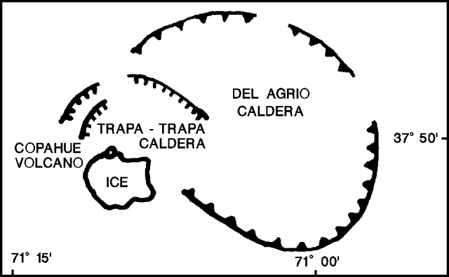 |
Figure 1. Schematic view of the Copahue complex, showing the position of the historically active summit crater with respect to the Del Agrio and Trapa-Trapa calderas. Adapted from a map by O. González-Ferrán. |
Hugo Moreno overflew the summit on 1 August at 1700. Solfataric activity was intense in the E crater, and snow had melted on the inner crater walls and rim. Pyroclastic-fall deposits covered ~ 1.5 km2 of the upper NE flank, and light ashfall extended 4-5 km NE. The bottom of the active crater had previously been filled by a green, highly sulfuric, acid lake (pH about 1.5), which appeared to be covered by a grayish, cracked ash blanket. Small debris-flow deposits could be seen for 3-4 km along Del Agrio stream, which drains the crater lake through a small notch in the E rim.
An explosion occurred on 2 August at 0330, and fine lapilli-fall (2-16 mm diameter) was reported 30 minutes later at Caviahue village, 15 km SE of the volcano, where hotels were filled with tourists. Small phreatic explosions occurred at 15-minute intervals during the morning. Field observations by Daniel Delpino revealed that lapilli-sized pumice to 7 mm in diameter had fallen on the volcano's snow-covered flanks. About 90% of the ejecta were accessory fragments, including rounded sulfur-rich vesicular particles. Only ~ 10% were believed to be juvenile. Four small debris flows were identified, one toward the E (Del Agrio stream), the other three toward the S (into Chile). These coalesced into one flow that turned SW along the Lomín river, which flows into one of Chile's major rivers, the Bíobío. The debris-flow deposits were a mixture of snow, ice, and pyroclastic material up to 1 m deep. Earthquakes were felt for the first time at Caviahue on 2 August between 2230 and 2245, when three had intensities of about MM II-III. An intense sulfur smell was noted throughout the area within the Del Agrio caldera that contains Caviahue and several lakes.
Some of the 300 tourists at a hotel in Caviahue suffered from headaches, and they were advised to leave the area. A 20-km restricted zone around the volcano was recommended by Hugo Moreno. Additional visitors were prevented from entering the Caviahue area. There are few towns near the volcano in Chile. Guallalí is 20 km SW and Trapatrapa is 17 km NW, but many houses and small settlements are distributed along the Lomín/Bíobío and Queco rivers. The Chilean electricity enterprise (ENDESA) was warned of potential hazards because the Pangue and Ralco hydroelectric projects have camps along the Bíobío river, 45 and 35 km from the volcano, respectively.
Univ de la Frontera seismologists installed two MEQ-800 seismic stations at the E foot of the volcano on 5 August, one 9 km from the active crater (near Caviahue), the other 18 km away (in Cajón Chico). During the first 8 hours, 150 harmonic tremor events were recorded (figure 2), with frequencies of 0.9-1.3 Hz. The next day, 815 events were recorded, including a 2.5-minute long-period earthquake at 1858 associated with a phreatomagmatic explosion that generated a mushroom-shaped column 700 m high. Strong winds rapidly carried the column NE, leaving a dark-gray deposit on the recent NE-flank snowfall. No eruptive activity had been reported since the 2 August explosion, but bad weather had obscured the volcano until 30 minutes before the 6 August ash ejection.
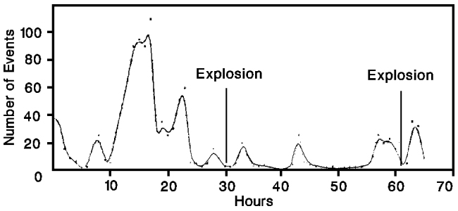 |
Figure 2. Number of tremor episodes per hour recorded by a seismic station (Caviahue), 9 km from the active crater at Copahue, 5-9 August 1992. Courtesy of the SAVO seismological team. |
Daniel Delpino, Luís Mas, and Hugo Moreno overflew the volcano by helicopter during the late morning of 7 August. An elliptical airfall deposit 11 km long and 2 km wide covered the NE flank. Several secondary, gravitationally generated, flows had occurred on steep unstable talus slopes near the crater. Ballistic blocks had produced numerous impact craters to ~ 1 m in diameter in this area. Moderate fumarolic activity was occurring in the crater. S of the v-shaped notch in the crater rim, very narrow red-brownish mudflows, probably overflows of muddy crater-lake water, extended no more than 150 m. The geologists landed ~ 2.5 km NE of the crater near the tephra-dispersion axis. The dominant airfall material was accretionary lapilli 0.3-1 cm in diameter, composed of very fine sulfur-rich dust spherulites. Most of the remainder of the deposit was also accessory material, including angular volcanic lithic fragments up to 3 cm across. Small globular to ribbon-shaped vesicular glassy fragments were also found, and were interpreted as juvenile hydroclastites. A new, less-voluminous debris-flow deposit had been emplaced along the Del Agrio stream, on top of the earlier deposit. Pale-brown muddy material extended about 200 m beyond the previous flow front, ~ 4.2 km from the crater. Another overflight late on 8 August showed small fumaroles in Del Agrio crater, but no other visible activity within the 2-km-long, ENE-WSW row of summit craters, or elsewhere outside of the Termas de Copahue area.
Seismicity declined after the 6 August explosion, remaining at low levels until tremor began to increase on 9 August at 0230. Between 0330 and 1230, 176 episodes of harmonic tremor were recorded, and 5 high-frequency events were detected during the same period. A 2.9-minute long-period earthquake occurred at 1057, probably marking a phreatic or phreatomagmatic explosion. However, the volcano was obscured by weather clouds, and the explosion could not be confirmed.
O. González-Ferrán visited the volcano on 12-13 August, with the support of the Chilean Air Force. The source of the explosions was a new vent, 100 m in diameter at the rim and 30 m across at the base, on the outer SW flank of the active crater (figure 3). Ash deposits evident during his fieldwork extended ENE and SE, to maximum distances of 4 and 6 km, respectively. Partial melting of the glacier, 5-40 m thick, that covers the older inactive summit craters and the SSW flank, had generated at least three jökulhlaups and a small lahar that extended ~ 6 km down the S flank toward the Lomín/Bíobío river system. An ~ 60-m-long fracture (f on figure 3) below the outflow of the crater lake was the source of another small mudflow that descended the Del Agrio river toward Del Agrio lake. The crater lake, ~ 300 m in diameter with 5-6 x 10⁵ m3 of acid water, continues to drain to the E at 2,716 m altitude. Lake level had dropped 8-10 m since the previous visit by González-Ferrán in 1990. Solfataras were active on the crater's S interior wall, and fresh landslides were visible on the SE interior wall. The glacier's headwall, 30-50 m high, is 80 m above the lake, and is the lake's main source of water.
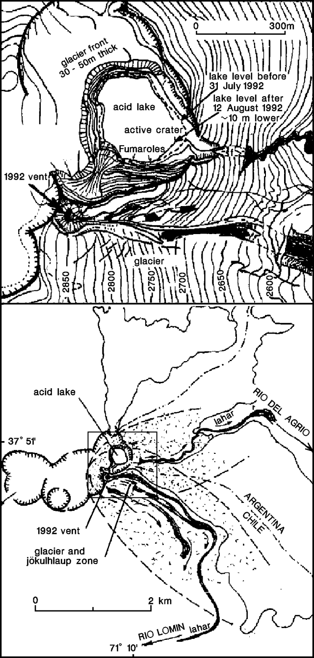 |
Figure 3. Sketch of the summit area (top) and locations of 1992 eruption deposits (bottom) at Copahue, 13 August 1992. The 60-m fracture that spawned a small mudflow in the Del Agrio river is marked with an "f". The approximate area shown by the summit-area sketch is enclosed by a box on the bottom drawing. Courtesy of O. González-Ferrán. |
Small earthquakes at 3.7 and 6.3 km depth were recorded at 0222 and 0226 on 14 August. A light-gray gas cloud extending 10 km SE from Del Agrio crater was seen at 0700. Daniel Delpino, Alberto Andolino, and Mario Deza reported strong effervescence and waves on the crater lake, which also showed strong fumarolic activity, at 1500. An explosion signal lasting 10 seconds was recorded at 1731. Four minutes later, a dense, light-gray gas cloud with dimensions of about 2 x 0.6 x 0.5 km descended ~ 4 km ESE, remaining there until about 0615 the next morning. A series of explosions and a strong increase in tremor, to 30-40 episodes/hour, began at 2100 on 14 August. During the night, the entire volcano was covered by a gaseous fog. Tremor activity was lower on 15 August, with about 20-25 episodes per hour between 0700 and 1700. Earthquakes were recorded at Caviahue at 0538, 0558, and 0645.
Information Contacts: D. Delpino, A. Bermudez, and M. Pérez, Dirección Provincial de Minería, Zapala, Argentina; H. Moreno, SERNAGEOMIN-SAVO, Temuco, Chile; G. Fuentealba and J. Cayupi, SAVO-Univ de la Frontera, Temuco, Chile; Oscar González-Ferrán, Univ de Chile.
Small explosions; earthquakes and tremor; pyroclastic sulfur ejected
Explosive activity at Copahue began on 31 July. Tephra from repeated moderate explosions was generally carried eastward, and mudflows extended several kilometers down streams draining the glaciated summit area. Airfall from the largest explosion, on 2 August, covered ~ 88 km2 and debris flows were generated within the valleys of the Agrio (Argentina) and Lomin (Chile) rivers. Tephra from the 6 August explosion covered ~ 23 km2, from the 31 July explosion ~ 1 km2 (figure 4). [All times are Chile local time.]
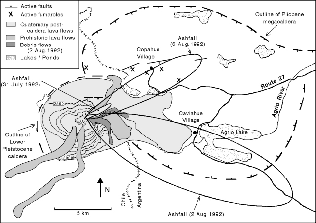 |
Figure 4. Preliminary geologic map of Copahue, showing outlines of Pliocene and Pleistocene calderas, post-caldera lava flows, faults, and fumaroles (not including the one in Del Agrio crater). Distribution of airfall tephra from the 3 main 1992 explosions is also shown. Contour interval, 100 m. Courtesy of A. Bermúdez and D. Delpino. |
Eruptive activity and seismicity, 15 August-20 October. Fumarolic activity was continuous through mid-October, occasionally accompanied by rhythmic explosions. Roaring noise typically preceded the rise of a vapor cloud by some minutes. Fumarolic activity and explosions originated from the same area in the S part of the crater lake. The entire lake was obscured by an intense vapor cloud on some days. The level of water in the lake remains unchanged. Successive explosions have melted the ice on the crater walls, leaving them completely ice-free (unusual at this time of year), and covered the walls with ejecta. Experienced mountaineers often climbed to the crater, reporting an intense sulfur smell and rapid development of eye irritation (perhaps from hydrochloric acid vapor).
The following is from the Grupo de Estudios Vulcanológicos, Proyecto Riesgo Volcánico de Neuquen.
Emission of the light-gray gas cloud reported 15 August was accompanied by increasing harmonic tremor activity (~ 40 episodes/hour) and three high-frequency shocks. Between 18 and 21 August, 80 long-period events were recorded, some of which coincided with phreatic and phreatomagmatic explosions. Material from some of the explosions remained inside Del Agrio crater, but on 19 August, mushroom-shaped columns ~20 and 50 m high were seen. At 1700, a phreatomagmatic explosion from Del Agrio crater fed a gray column ~100 m high. The column rapidly drifted SE, covering the flank with a dark-gray airfall deposit. A heavy snowstorm obscured the volcano 20-23 August, but when weather cleared on the 23rd, dark gray material was visible on the flank. Tremor episodes became increasingly frequent (~ 80/hour) 24-26 August, and nine new long-period events coincided with explosions that ejected dark-gray material. Event durations ranged to 2 minutes 10 seconds. Tremor was harmonic with some high-frequency activity, particularly on 25 August, when high-frequency tremor alternated with harmonic episodes at rates of ~100/hour. Fumarolic activity from Del Agrio crater was accompanied by a light-gray gas cloud on 24 August. Three high-frequency shocks and two long-period events were recorded on 27 August, as intense fumarolic activity formed a dense cloud that covered the crater and appeared to flow toward the E.
A strong increase in tremor episodes (to around 200/hour) characterized the period 28 August-3 September. Ten small high-frequency shocks were recorded 28-30 August. The largest, on 29 August at 1117, had an amplitude of 34 mm and a duration of 35 seconds. It was felt in Caviahue (15 km SE of the volcano) and was accompanied by an explosion sound. Intense fumarolic activity occurred inside the crater 1-2 September. Dense, white, mushroom-shaped clouds sometimes formed within the crater, and others rose 50 m above the summit. Some were light-gray, suggesting the presence of gases other than water vapor. On 3 September, two high-frequency shocks were detected, with a maximum amplitude of 21 mm. Intense tremor activity continued 4-9 September, including some high-frequency episodes.
Tremor decreased somewhat and became banded 10-17 September, with bands of less-frequent episodes (40-50/hour) of low amplitude alternating with those of more-frequent (100-150/hour) stronger tremor. Four small high-frequency shocks were recorded on 16 September (maximum amplitude, 17 mm) but no long-period events were detected. Tremor decreased in amplitude and duration 17-24 September, but was present on all seismograms. Some tremor was banded, and other episodes alternated with quiet periods. Three high-frequency events were recorded on 23 Spetember, one of which (at 0247) was felt at MM II in Caviahue. Four long-period events were registered during the period, but cloud cover and persistent snowfall prevented visual observations. The number of tremor episodes diminished drastically 25 September-11 October. Two patterns were evident, one with isolated periods of tremor on otherwise quiet records, the other (less common) in which weak harmonic tremor covered the seismogram, followed by quiet intervals of 2-5 minutes, then high-frequency tremor. A long-period event lasting 3 minutes on 1 October accompanied an explosion that ejected material. Tremor increased slightly 12-20 October, and five small high-frequency shocks were recorded.
Preliminary information from the Copahue geothermal field, 4 km NNE of Del Agrio crater, indicates no substantial changes. Snow continues to prevent road access to the geothermal field.
Petrology. Samples obtained from debris flows are composed of: lithics; rounded fragments of argillaceous white material; black, shiny fragments of uncertain composition; and small, globular to ribbon-shaped greenish particles. Proportions and size distributions of each component are still being determined. X-ray diffraction shows that the greenish particles are composed entirely of sulfur. Morphology and grain size resemble scoriae, with vesiculated surfaces and interiors. Some show elongation and separation into branches with ball-like terminations. Others are tiny spheres, sometimes deformed and flattened, or Pele's tears. Geologists proposed an eruptive mechanism producing pyroclastic sulfur scoriae similar to those at Poás (Bennett and Raccichini (1978) and Francis and others (1980).
Monitoring. An MEQ-800 seismograph owned by INPRES (Argentina's National Institute of Seismic Warning) and operated by residents of Caviahue municipality is positioned 7.5 km ESE of the active E (Del Agrio) crater. Seismic data and visual observations are telephoned daily to volcanologists Adriana Bermúdez and Daniel Delpino. After 1 September, Delpino left his monitoring post in Caviahue, but he and Bermúdez visit the volcano when activity warrants. Seismograms are sent once a week for reading by the volcanologists, and monthly to INPRES for final interpretation. The provincial government has established the Technical Group for Volcanological Studies to work on the Volcanic Risk Project of Neuquen Province, covering all active volcanoes in the province. A program of volcanological monitoring, detailed mapping, and preparation of a risk map for Copahue has the support of the provincial government. The limited seismic and volcanological monitoring have not revealed a consistent pattern of eruptive behavior at Copahue. For example, no relationship is apparent between increases in fumarolic and tremor activity, or between explosions and high-frequency shocks.
References. Bennett, F.D., and Raccichini, S.M., 1978, Subaqueous sulphur lake in Volcán Poás: Nature, v. 271, p. 342-344.
Francis, P., Thorpe, R., and Brown, G., 1980, Pyroclastic sulphur eruption at Poás volcano, Costa Rica: Nature, v. 283, p. 754-756.
Information Contacts: D. Delpino and A. Bermúdez, Dirección Provincial de Minería, Neuquen, Argentina.
Crater lake lies several meters below drainage notch
A late-March overflight made after a prolonged dry season enabled scientists to see Copahue with relatively low snow levels. The lake level was some meters below the prominent notch through which drainage occurs on the ESE side of the crater.
Light-gray mud deposits from recent overflow events extended halfway down the E flank. Deposits were also observed to the S and formed a small laharic fan of highly altered material near the head of the Río Lomín.
A pH of 2 was measured in Río Lomín in 1995; in contrast, during March the pH was neutral in the headwaters draining off the lahar fan. However, farther downstream the Río Lomím captures the Estero Turbío, which drains the S flank of the volcano and ran orange, presumably due to high acidity. After capturing Estero Turbío, Río Lomín reportedly became acidic and remained so all the way to its confluence with the Río Biobío, ~33 km from the volcano.
Information Contacts: Jose Antonio Naranjo, Servicio Nacional de Geología e Minería (SERNAGEOMIN), Av. Santa María 0104, Casilla 10465, Santiago, Chile; Hugo Moreno Roa, Observatorío Volcanogía de los Andes del Sur (OVDAS), Manantial 1710-Carmino del Alba, Temuco, Chile; Simon R. Young, British Geological Survey (BGS), Murchison House, West Mains Road, Edinburgh EH9 3LA, United Kingdom.
Frequent ash explosions and acidic mudflows starting on 1 July
An eruption of Copahue (figure 5) began on 1 July 2000. Ash-and-gas emissions, which have continued into late July, are considered to be Copahue's most vigorous activity in the past century. Reports were received from geologists in Argentina and Chile. Except where otherwise noted, Argentine geologists Adriana Bermúdez (CONICET) and Daniel Delpino (Civil Defense of Neuquén Province) reported information for 1-9 July, and Chilean geologists José Naranjo and Gustavo Fuentealba (both of SERNAGEOMIN) reported information from 10-13 July. The scientists submitted joint reports beginning on 13 July. All time references are to Argentina local time; Chilean time is one hour earlier (GMT - 4 hours).
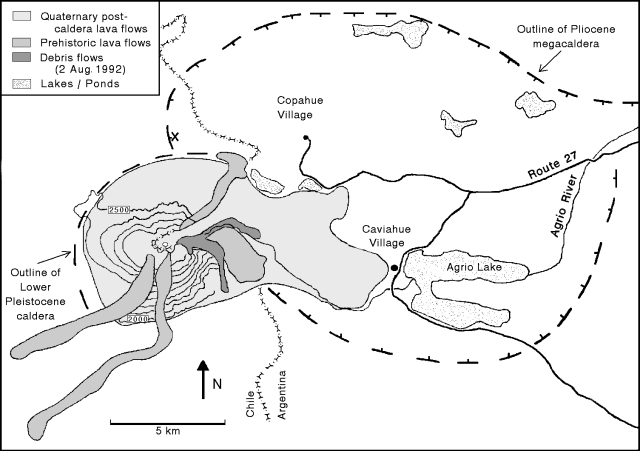 |
Figure 5. Preliminary geologic map of Copahue, showing outlines of Pliocene and Pleistocene calderas and post-caldera lava flows. Contour interval, 100 m. Modified from a previous map in BGVN 17:10. Courtesy of A. Bermúdez and D. Delpino. |
Initial explosions, 1-2 July. Although visibility was poor in late June, at 0030 and at 0430 on 1 July local Argentine police and gendarmerie (National Guard) reported ash mixed with heavy snowfall, as well as a strong sulfur smell. At around 1145, lapilli and ashfall became heavier, eventually covering the snow and the products of previous eruptions around the summit. At 1200 the gendarmerie reported lapilli falling 7.5 km NE of the volcano, in the village of Copahue, Argentina. The alert status was set at yellow; the village's emergency committee restricted tourist access and helped to evacuate 200 people.
Explosions continued throughout 2 July with increasing intensity. Lapilli, ash, and sporadic bombs (15 cm in diameter) fell 8-9 km E on the town of Caviahue, Argentina, with up to 15 cm of materials from the day's explosions eventually being deposited in some areas (figure 6). Until 2345 there were explosions of varying intensities. Preliminary results of an examination of the deposits revealed that they were composed of a very fine silica, sulfur particles, accidental rock fragments from the conduit, and juvenile materials. In Caviahue, visibility was practically zero due to ash particles in the air, and heavy ashfall cut off power for several hours. By midday, eruption plumes blowing SE reached Loncopué, a small village 50 km from the volcano.
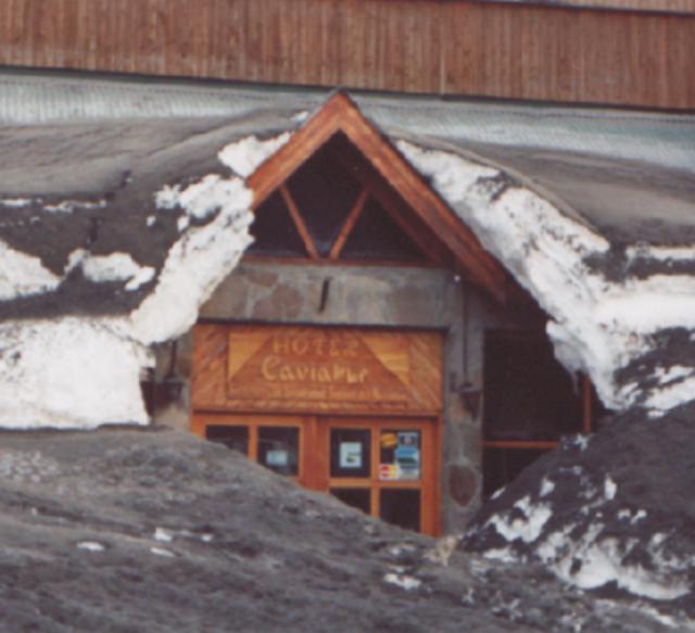 |
Figure 6. Ashfall from the frequent eruptions that began [1 July] at Copahue and heavy snowfall have affected the reliability of power and potable water resources in the town of Caviahue, a popular ski area 8-9 km E of the volcano. Although the town is no longer under official evacuation, many inhabitants have not returned to battle current conditions. Courtesy of A. Bermúdez and D. Delpino. |
Alert status was raised to orange on 2 July when ash was dispersed as far as 100 km away from the crater and the plume covered a total area of 2,000 km2. Maximum ash accumulation of 3-5 cm occurred over an area of 6 km2, including the town of Caviahue and the W sector of Lake Caviahue. Due to the ashfall, the surface of Lake Caviahue changed color from its normal deep blue to gray-green, and a water sample taken had a pH of 2.l.
Tests by Argentine geologists on ash samples deposited in Caviahue revealed a grain-size distribution of 15% coarse ash (> 1 mm), 80% fine ash (0.5-1.0 mm), and 5% fine ash dust (< 0.5 mm). The coarse ash contained a small quantity of juvenile and lapilli-sized (3-6 mm) accidental fragments; the juvenile materials were dark gray vitric scoria. Non-juvenile accessory materials accounted for 7-10% of the coarse ash and consisted primarily of white-gray silica from the bottom of the crater lake. The fine ash-sized particles had similar components and characteristics.
Irregularly shaped dark gray scoriae, 3-8 cm in size, were found as far as 12 km N of the crater; scoriae completely covered the area within a 1.0-1.5 km radius around the crater. The scoriae contained spherical vesicles 3-5 mm in diameter. Cooling cracks marked the scoriae's surfaces and their shapes had been modified during flight.
Ashfall was also reported 60 km SE of the volcano in the town of Loncopué, where the stream closest to the volcano had cloudy brown-gray waters.
Continuing activity through 25 July. Activity decreased after 2345 on 2 July. The only explosion of 3 July, at 1720 in the main crater, deposited tephra on the flanks and generated a dense, dark gray ash plume that blew NW and produced a local ashfall. According to the Buenos Aires Volcanic Ash Advisory Center, the ash plume reached an altitude of 10.6 km and blew NE. On 4 July there were explosions at 1030, 1830, and 2000. In the town of Caviahue, Delpino noted a strong sulfur smell and great booming sounds that caused windows to shake. A dark gray ash plume rose 2 km above the summit. Bermúdez and Delpino reported that at 0020 on 5 July a new cycle of rhythmic explosions began; by 1325 a total of 37 explosions had occurred. The biggest explosion, at 0515, generated a pyroclastic surge down the E and N slopes.
A report was received on 5 July from Ralco-Lepoy, a town 30 km SW of the volcano, indicating that dead fish had washed up along the banks of the Lomín river. The Lomín, as well as the Agrio river, which drain the acidic, active crater, were marked by a deep, dark-colored gully but there was no evidence of lahars. However, it is possible that ashfall covered up the evidence. The dead fish found along the Lomín River on 5 July confirmed that acidic mudflows from the crater had been channeled down this river. Chilean geologists Naranjo and Fuentealba recommended that states bordering the Lomín river (to the SW) and Queuco to Trapa-Trapa (to the N) be alerted that an acidic mudflow was moving down the river. Accordingly, authorities noted that inhabitants should be evacuated outside of an enforced safety radius. It was also recommended that professionals regularly measure the pH of affected Lomín drainages, meteorological reports be kept up to date, and that town officials periodically reevaluate the yellow alert.
Naranjo and Fuentealba also noted that at 2030 on 5 July a patrol of carabineros (Chilean National Guard) approached the volcano on horseback and observed small dark ash emissions moving SE from the volcano.
Observers in Argentina during the night of 5-6 July reported an incandescent pyroclastic emission flowing down the cone and, at one point, a white light emanating from the crater for ~15 seconds. In the same time interval, gendarmerie officers from Copahue village described "an orange-red light coming up from the crater." It is thought that the light was produced when magma rose to the surface but did not spill over the crater walls. They also noted the vertical ejection of large incandescent blocks that fell back into the crater, as well as smaller incandescent fragments that fell onto the volcano's slopes, rolled downhill, and broke up into smaller pieces.
On 6 July, Delpino reported to Naranjo and Fuentealba from Caviahue that the eruption was Strombolian with explosion pulses every 1-2 hours. Winds blew ash S of Caviahue without any ashfall in the town. There was no evidence of lahars or floods. Throughout the morning of 6 July snow continued, and there was zero visibility of the volcano.
Bermúdez and Delpino reported that during 0100-1020 on 7 July, loud explosions and ash emissions occurred at 15-minute intervals. At about 2000, the wind changed, blowing W, and ash began falling over Caviahue. About 1 mm of ashfall was observed from 20 km W of the crater.
The same day, ice blocks 15-20 cm in diameter, as well as ash and lapilli, were carried down the swollen Agrio river from the volcano's permanent ice cap. At 1300, a sample of the river water taken at the bridge near Caviahue had a pH of 2, and at 2000 a sample from the same location had a pH of 1.5. The Dulce stream source lies 4.5 km E of the cone and it flows 5.5 km W of the cone into Lake Caviahue. Ashfall altered the stream's typical pH of 7 to a pH of 2.5. Preliminary investigations by Argentina's Provincial Water Division also indicated an increased iron content.
A loud explosion summit at 0300 on 8 July awakened citizens of Caviahue; a day-long ash emission moved SE through clear skies. On 9 July at 0100 a glowing light was seen over the crater, but cloud cover obscured visual observations throughout the day.
Naranjo and Fuentealba reported that on 10 July, explosions were gray to dark brown and it is thought that the ash fell over a 25 km2 area to the W, in the direction of Chile. Ash reached the summit of neighboring Callaqui volcano, covering it in gray ash. Samples from this ashfall taken 4 km W of the active crater were found to contain juvenile volcanic glass fragments, 0.3-0.5 mm in diameter.
During 1200-1230 on 12 July, a Chilean overflight revealed that explosions inside the active crater (El Agrio) occurred at 1- to 3-minute intervals, ejecting fine material up to 500 m above the crater. This material was dispersed via a plume of fine ash and gases moving NNE for more than 250 km. Observers reported that 1-2 mm of fine ash was deposited in the village of Copahue. Throughout the day, activity increased and, at 2300, there was an explosion heard in Caviahue that was thought to have deposited 1-2 cm of ash 5 km NNE of Copahue. On 12 July, scientists noted that Copahue was in an eruptive phase of lower intensity (a Volcano Explosivity Index, VEI, of 1) compared to that seen on 1-2 July (an inferred VEI of 2).
At 1100 on 13 July, explosions generated white-gray to bluish gas emissions rising 200-300 m over the crater. A gas cloud with a strong sulfur odor remained trapped in the Agrio valley over a 10 km2 area; it later descended, and strong winds spread it over a 20 km2 area. At 2310, an explosion produced a 1-km-high plume and incandescent fragments were ejected onto the flanks of the cone reaching up to 1 km from the crater. The plume covered Caviahue, obscuring the moon, but there was no ashfall on the town.
A Chilean helicopter flight on the morning of 13 July observed explosions emitting pale gray ash columns up to 300 m above the crater rim. Winds dispersed the ash ENE to Caviahue. Carabineros sampling water at the source of the Lomín river found it slightly acidic (pH = 5-6).
At 1250 on 13 July, an eruption plume that rose 3-5 km over the crater was reported by military and civilian pilots. The column dispersed to the NE and was a reddish-brown color. Reports from Caviahue stated that on 15 July the eruption stayed at the same intensity as previous days, and fine ash was dispersed to the N. Ash samples from 13 July were found to have an andesitic composition and to include juvenile fragments, the presence of which indicates the volcano's potential to produce even larger explosions. Water samples from the Lomín river on the same date revealed high fluorine and sulfate levels.
At 1700-1730 on 16 July, and also between 0300 and 0400 on 17 July, a dusting of ash fell over Caviahue and there was a strong sulfur smell in the air. At 0905 on 18 July, a civilian pilot reported a pale gray ash column at 3.5-4 km above sea level (just over the top of the cordillera) dispersed over 10 km to the volcano's NNW. At this time, the ongoing eruptions were considered to be of VEI 1. Ash from the weak explosions was dispersed by low winds as it escaped from the crater.
At 2206 on 19 July, members of the gendarmerie reported that a series of explosions continued to generate columns of ash and water vapor 0.5-1.0 km above the crater. The plumes dispersed to the NE depositing a fine dusting of ash over the village of Copahue. A strong sulfurous odor was reported at 2100 in Caviahue. On 20 July activity remained low, and no noises or odors were detected. Winds carried the gas-and-ash plume NNE, depositing a light ashfall over the N sector of Caviahue.
On 21 July, light ashfall dusted Caviahue and, although the crater was obscured, ash columns were sighted rising above the summit and through the clouds to heights of 700-1,000 m. At 1048 (Argentina), Caviahue residents heard a series of rhythmic explosions occurring every 2-5 minutes for one hour. The plume carried ash NNE toward Trapa-Trapa. The volcano was obscured by cloud cover on 22 July but intermittent explosions continued emitting ash plumes carried NE toward Trapa-Trapa.
A seismological team from the Southern Andes Volcanological Observatory (OVDAS) installed a portable seismic station on 21 July at a spot ~2 km NNW of the active crater in the vicinity of Trapa-Trapa, Chile. After taking 15 hours of readings, the team left on 23 July after cold temperatures had prematurely reduced battery power. These readings were fortunately during a time of elevated activity, and registered seismic events generally correlated with visual observations. Despite this similarity, it was impossible to establish an exact correlation between the periodicity of the explosions (occurring every 1-3 minutes) and their microseismic signals at distance.
During the stay of the seismic team, no ashfall was reported in the Queco river region and no correlation was established between seismicity and sporadic thundering sounds reported by villagers in the area. These sounds have been attributed to chunks of the ice cap breaking off and rolling down Copahue's flanks. Due to over 3 m of snowfall, access to the area is difficult.
Explosions of low to intermediate intensity continued emitting ash-and-gas plumes on 23 July. The clouds continued to partially obscure the volcano, but at 1930 an ash column blew E toward Caviahue. On 24 July, the active crater was producing small explosions and dark gray ash emissions; a dusting of ash fell over Caviahue. When the Argentina gendarmerie and the Chilean carabineros compared respective observations no discrepancies were found.
Two pilots reported a strong sulfur odor at 1.8-2.1 km altitude, ~250 km WSW of Copahue on 25 July. At 1000 another pilot reported an ash plume extending 200 km WNW from the summit; plume height was ~2 km and width was 10-15 km. Although this explosion was not seen from Caviahue, a light ashfall fell over the town.
Due to the continued frequent ashfalls over Caviahue, town officials decided to reestablish a yellow alert. The prolonged fall of fluorine-rich ash has posed a possible problem for grazing animals in the affected fields, but heavy snowfall has made it less likely that vegetation will absorb the fluorine.
Background. Volcan Copahue is a composite cone constructed along the Chile-Argentina border. The cone lies within an 8-km-wide caldera formed 0.6 million years ago at a spot near the NW rim of the Pliocene, 20 x 15 km Del Agrio caldera. Copahue's eastern summit crater, part of a 2-km-long, ENE-WSW line of nine craters, contains an acidic crater lake (also referred to as Del Agrio) and displays intense fumarolic activity. Infrequent explosive eruptions have been recorded since the 18th century. Eruptions in 1992 and 1995 produced several phreatic and phreatomagmatic explosions and emissions that contained higher levels of water vapor but lower ash particle content than the current eruption. The current eruption has been of longer duration than either of the previous two.
The Agrio river emerges from a crack in the edifice of the volcano 50 m below the active El Agrio crater. The river water is highly acidic and has a yellow color. Near Caviahue, the Agrio river enters the Caviahue lake basin. The lake is formed by 2 glacial finger lakes over a 9.2 km2 area and is a reservoir of acidic water.
Most residents of Copahue village leave each winter, but Caviahue's population of 400 can grow to 10,000 during the ski season. Eruption-related damage has cut off power and potable water, and there remains an inability to keep ski slopes cleared of ash. In late July there were reportedly only about 419 people staying in Caviahue.
Information Contacts: Adriana Bermúdez, National Council of Scientific and Technical Research (CONICET) and the National University of Comahue, Buenos Aires 1400, Neuquén Capital, Argentina; Daniel Delpino, Advisor to the Civil Defense of Neuquén Province, Argentina and the National University of Comahue, Buenos Aires 1400, Neuquén Capital, Argentina; José Naranjo, National Geology and Mining Service (SERNAGEOMIN), P.O. Box 10465, Avda. Santa Maria 0104, Providencia, Santiago, Chile; Gustavo Fuentealba, Southern Andes Volcanological Observatory (OVDAS), SERNAGEOMIN, P.O. Box 10465, Avda. Santa Maria 0104, Providencia, Santiago, Chile; Buenos Aires Volcanic Ash Advisory Center, Argentina (URL: http://www.ssd.noaa.gov/ VAAC/OTH/AG/messages.html).
Continued ash explosions and tremor during August-October
The most vigorous eruptive activity at Copahue in the last century began on 1 July 2000 (BGVN 25:06). Lapilli, ash, and sporadic bombs fell within 9 km of the crater, and ash was dispersed as far as 100 km away on the second day of eruptions. Frequent explosions throughout July generated ash columns that often caused ashfall over the villages of Copahue to the N and Caviahue to the E.
Between 0700 and 1200 on 4 August, Ramon Ortíz and technician Erwin Medel (OVDAS) installed a portable seismic station in the Queuco river valley, 16 km N of Copahue. The instrument detected a fracture-type earthquake that probably originated from the volcano, but the depth could not be determined. During 3-5 August, explosions were not noted in the Trapatrapa sector, and acidic rainfall in the Queuco river valley has not occurred since mid-July. According to residents of Caviahue, on 5 August gray spots were observed on the snow, possibly caused by fine ashfall. Apparently, eruptive activity during the previous two weeks included a greater amount of steam as a result of melting snow. A strong sulfur odor was detected in Caviahue on the night of 7 August, but there was no ashfall.
Seismic data and observations from Caviahue indicated increased activity starting on 9 August. Explosions that morning generated columns up to 4,500 m altitude that dispersed W over Chilean territory, into the Trapatrapa valley area, and during afternoon towards the Lomín river valley. The elevated activity continued through at least 1600 on 10 August, with small explosions at intervals of 5-10 or more minutes. On the night of 15 August incandescence in the crater was observed from Caviahue. Up to fist-sized fragments ejected during explosions fell back into the crater. People who approached the crater reported steam explosions composed of white clouds alternating with dark-gray ash emissions. Explosions occurred every 4-5 minutes.
A ski instructor from Caviahue, Daniel Maniero, observed the volcano under clear conditions on the evening of 17 August. Around 2100 that night intermittent incandescence in the crater was followed by thundering noises at intervals of 5 minutes. Clouds reflected crater incandescence on the night of 19 August. Maniero also reported that loud explosions every 8-10 seconds were heard near the crater on 20 August. During 20-21 August intermittent black ash clouds rose not more than 300 m, causing local ashfall around the crater.
Scientists from SERNAGEOMIN-OVDAS, Eliza Calder and Ramon Ortiz, monitored seismicity in the Trapatrapa area, ~16 km NNW of the volcano, from the afternoon of 18 August to 1100 on 19 August. They observed low and weak gray clouds. Between 1839 on 18 August and 0940 on 19 August one long-period earthquake was detected at 0036 on 19 August. According to the Argentina Gendarmerie, during that night there was a strong explosion. Seismic registries showed low-level seismicity without high-frequency earthquakes.
On 19, 21, and 23 August there were strong explosions with dark ash clouds. On the morning of 22 August an observer using binoculars on a commercial flight noted steam clouds extending 5 km N and S of the crater area as well as explosions that rose up to 500 m above the cloud layer located at ~3,000 m altitude. Direct observations carried out at 1000 on 1 September indicated the development of small explosions in the interior of the crater, where an increase in both ash accumulation and the diameter of the explosion crater were observed. The crater measured ~50 m across. Another eruptive cloud was observed from a commercial aircraft (LAN flight 991) on the morning of 2 September; it dispersed toward the N at a height of 700-1,000 m above the crater (3,700-4,000 m altitude).
Data registered by the MEQ-800 seismic station maintained by Instituto Nacional de Prevención Sísmica (INPRES) of San Juan, Argentina during 11 August-4 September, and registries obtained by a digital seismic station at the Volcanólogico Observatory (OVDAS) of SERNAGEOMIN, Chile, in the locality of Caviahue, Argentina, were used to correlate seismic and volcanic activity. Correlations were made between some periods of tremor, or periods of intense tremor separated by quiescent periods, that corresponded with later ash emissions. On 15 August rockfall events were detected. Long-period events were registered on 20 (140 seconds) and 21 August (120 and 104 seconds).
The new OVDAS station consists of an L4C seismometer with an analog-digital card converter, and a portable HP 2000 XL computer. The station was installed in Caviahue, 7 km from the crater, and buried to a depth of 70 cm to protect it from wind effects. The registered microseismic activity in Caviahue was significantly better than data obtained in Trapatrapa, over 15 km NW of the volcano in Chile. Data collection began at 0900 on 26 September. The activity consisted of short-period events associated with volcanic activity. Some events were associated with small crater explosions. A long-period event at 1946 on 23 September was followed approximately 4 hours later by a small ash emission. Although it is not always possible to directly correlate the recorded seismicity with eruptive events, it is evident that there is a close correlation between long-period events and later ash emissions. The appearance of tremor bands is also important and considered precursory to ash emission.
At dawn on 23 September, observers in Caviahue saw intense gaseous emissions in pulses of 30-60 seconds that rose up to 150 m above the crater and dispersed NNE. During that night the crater appeared incandescent. On 24 September the presence of snow was verified in the crater interior, indicating a reduction in temperature. Activity with similar characteristics occurred during the first half of October. Seismographs installed in the area detected microseismic tremors on 17 October. Between 1145 and 1245 of 18 October, constant steam emission occurred along with some denser emanations of brown color and fine ash. The inner crater diameter had not changed noticeably since mid-September, except for a new levee that resulted from wall collapse. On 19 October a thermal anomaly was detected by the GOES satellite, but there were no explosions.
Information Contacts: José Antonio Naranjo, Jefe, Departamento Geología Aplicada, Servicio Nacional de Geología y Minería (URL: http://www.sernageomin.cl/); Gustavo Fuentealba, Paola Peña, Eliza Calder, and Ramón Ortíz, Servicio Nacional de Geología y Minería, OVDAS (URL: http://www.sernageomin.cl/); Adriana M. Bermúdez, Investigadora Científica, CONICET, Argentina; Daniel H. Delpino, Asesor Dirección Provincial de Defensa Civil de la Provincia del Neuqué.
Crater lake geochemical study suggests recent magma intrusion
The following summary describes Copahue's crater lake activity during 1992-2000 as presented by Varekamp and others (2001). Copahue erupted sporadically in the 1990's with a series of explosions, and later in July 2000. The 1992 and 1995 eruptions were phreatic and ejected fragmented, hydrothermally altered rocks, and copious amounts of liquid sulfur. In contrast, the July 2000 eruption (BGVN 25:06, 25:09) was phreato-magmatic and was characterized by explosions that ejected incandescent juvenile material and chilled sulfur fragments; dark ash covered an area up to 50 km from the source.
Data gathered during 1997-2000 by Varekamp and others (2001) suggested that Copahue acts as a "beehive" volcano, meaning that void spaces were generated by near-congruent rock dissolution, and these spaces were subsequently filled by accumulating liquid sulfur and precipitated silica. During the phreatic eruptions of 1992 and 1995, much of that liquid sulfur was ejected; in contrast the phreato-magmatic eruptions of 2000 left the hydrothermal system largely intact. The RFE/Cl ratio (RFE = rock-forming elements = Ca + Na + Mg + K + Al + Fe) measured in the crater lake water increased dramatically in July 2000. This spike was interpreted by Varekamp and others (2001) to be a result of a recent intrusion of fresh magma and therefore more interaction between water and newly solidified rock.
Varekamp and others (2001) concluded that "Integration of [data from the Upper Rio Agrio river] and the modeled volcanic fluxes into the crater lake provide the following parameters for the whole Copahue system in November 1999: an energy flux of ~32 MW, an equivalent sulfur gas input of ~344 t SO2/d, a net rock removal rate of about 12,000 m3/yr, and an elemental sulfur accumulation rate of about 11,600 m3/yr." The eruption of large amounts of liquid sulfur in 1992 and 1995 strongly supported inferences about gradual elemental sulfur accumulation inside the volcano. Analyses also suggested that the eruptions of Copahue during 2000 were preceded by a dramatic increase of volcanically-derived elements into the crater lake. The authors further concluded that "The evolution of the crater lake fluids during the twentieth century suggest a gradual awakening of Copahue volcano". Continued monitoring of crater lake temperature and composition would be useful to assess future volcanic activity.
Other studies. Varekamp and others (2004) concluded that Copahue represented "a rare example of the occurrence of hydrothermal fluids on the surface of the earth from a deep source with a strong magmatic signal." Varekamp (2004) noted that Copahue "has a volcanic spring-fed acid river with deposits of red hematite in the streambed and abundant gypsum mineralization, and these fluids are saturated with K-jarosite. This riverbed may be a modern terrestrial analog of the Opportunity Rover landing site on the planet Mars." Another paper (Varekamp and others, 2006) described the geochemistry and isotopic characteristics of the Caviahue-Copahue volcanic complex; they discuss the roles of crust and sediments from the subducting slab as contributions to the magma systems.
According to the Chilean National Service of Geology and Mining (SERNAGEOMIN), Copahue had been quiet since its last major eruption in 2000 until recently. A new eruption took place in mid-2012; subsequent reports will discuss this event.
References. Varekamp, J.C., 2004, Copahue Volcano: A Modern Terrestrial Analog for the Opportunity Landing Site?, Eos, v. 85, no. 41, p. 401 and 407.
Varekamp, J.C., Ouimette, A.P., Hermán, S.W., Bermúdez, A., and Delpino, D., 2001, Hydrothermal element fluxes from Copahue, Argentina: A "beehive" volcano in turmoil, Geology, v. 29, no. 11, p. 1059-1062.
Varekamp, J.C., Ouimette, A.P., and Kreulen, R., 2004, The magmato-hydrothermal system of Copahue volcano, Argentina, in Wanty, R.B., and Seal, R.R., (eds), Water Rock Interaction: Proceedings of the Eleventh International Symposium on Water Rock Interaction, WRI-11, 27 June-2 July 2004, Saratoga Springs, NY, v. 1, p. 215-218, Taylor and Francis Group, London.
Varekamp, J.C., deMoor, J.M., Merrill, M.D., Colvin, A.S., Goss, A.R., Vroon, P.Z., and Hilton, D.R., 2006, Geochemistry and isotopic characteristics ofthe Caviahue-Copahue volcanic complex, Province of Neuquen, Argentina, Geological Society of America Special Papers 2006, v. 407, pp. 317-342.
Information Contacts: J.C. Varekamp, Department of Earth & Environmental Sciences, 265 Church St., Wesleyan University, Middletown CT 06459-0139 USA; Servicio Nacional de Geología e Minería (SERNAGEOMIN), Av. Santa María 0104, Casilla 10465, Santiago, Chile (URL: http://www.sernageomin.cl/).
Small ash eruptions during 2012-2013
Our last report on Copahue volcano described the phreato-magmatic eruption of July 2000 (BGVN 25:06). Up until July 2012, activity at Copahue was characterized by passive degassing. In this report, we summarize the changes registered from Copahue which culminated in minor ash eruptions. According to Instituto Nacional de Prevención Sísmica (INPRES), a phreatic eruption occurred on 19 July 2012 and Servicio Nacional de Geologia y Mineria (SERNAGEOMIN) reported that ash emissions continued intermittently during December 2012-December 2013.
INPRES and Forte and others (2012) noted that seismicity increased in the region of Copahue after the Mw 8.8 earthquake that occurred 3 km W of the Chilean shoreline on 27 February 2010. This activity was coincident with a progressive increase in fumarolic activity from the crater lake, El Agrio. A dense plume of vapor and acidic gases were frequently observed between 200-300 meters above the crater rim (figure 7).
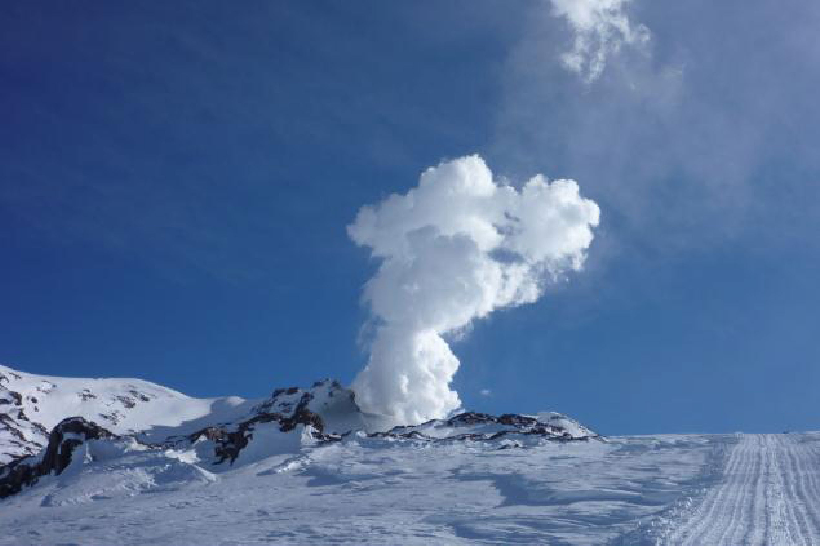 |
Figure 7. Vapor and acidic gases rose in a column from Copahue crater lake on 17 July 2012. Courtesy of Nicolas Sieburger, a local guide who frequented the area. |
According to Vélez and others (2011), differential interferometry (DInSAR) studies performed with ENVISAT radar images of Copahue's flanks suggested changes in deformation trends dominated by deflation during 2003-2008 and inflation during November-December 2011. A deformation map constructed between November 2011 and Aril 2012 showed uplift with displacements up to 7 cm (Vélez, 2012).
During March 2012, acidic water from the crater lake and hot springs on the E flank of the volcano was analyzed by Caselli and others (2012) and Agusto and others (in progress). The acidity (pH2, Cl, and F) showed unusually high values. These investigators also highlighted a significant decrease in the level of Copahue's crater lake waterline.
In July 2012, several seismic events of high and low frequency spectral content were reported by INPRES. Simultaneously, intense bubbling was observed in the SW area of Copahue's crater at an interval of 1 to 3 minutes (figure 8). A small explosion was reported on 17 July 2012 and photographed by a local guide (figure 9); it consisted of phreatic manifestations up to 10 meters high.
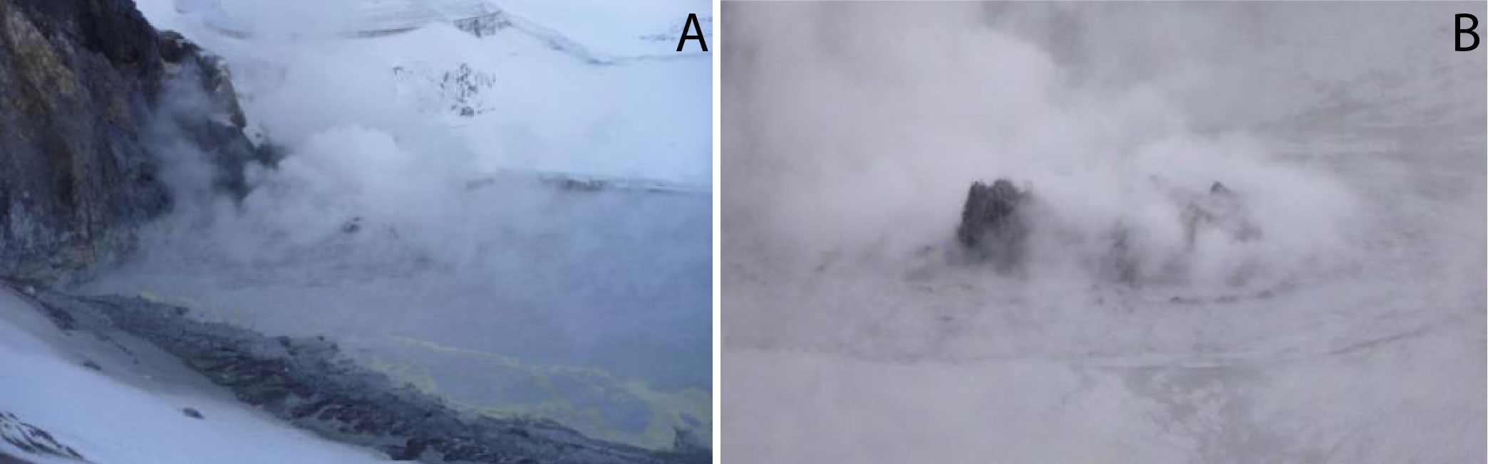 |
Figure 8. The crater lake of Copahue volcano on 17 July 2012: (A) the main emission point of intense bubbling was associated with steam, gas, and patches of sulfur floating on the lake surface; (B) detail of the area of bubbling. Courtesy of NicolÁs Sieburger. |
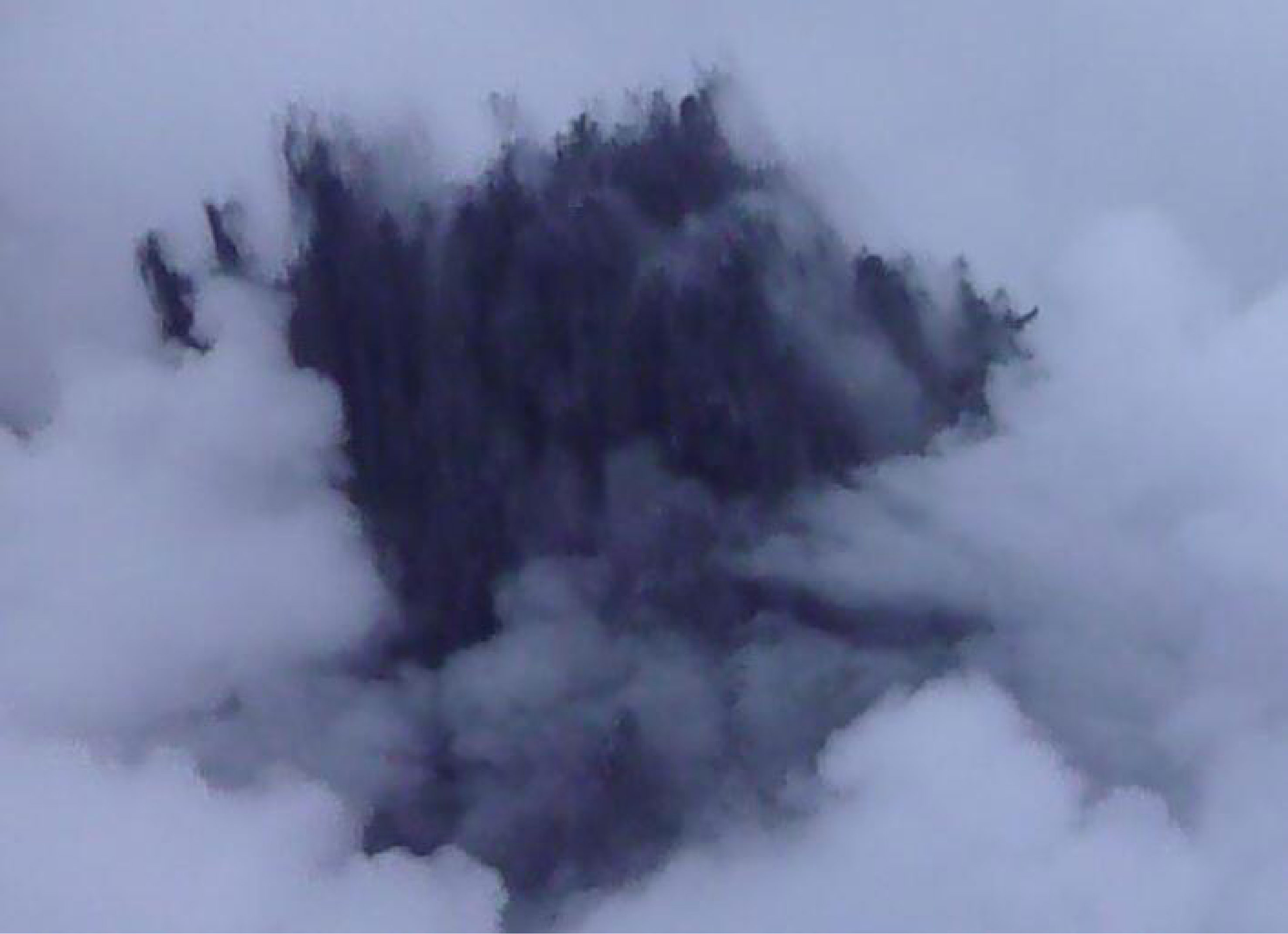 |
Figure 9. A phreatic explosion from the SW sector of Copahue's crater lake during 17 July 2012. Although this photo lacks a scale and includes local clouds and/or steam, it is clear that the eruption plume was nearly black in color. Courtesy of Nicolás Sieburger. |
On 19 July 2012, another phreatomagmatic explosion occurred with emissions of pyroclastic material that, according to SERNAGEOMIN, producing a plume that extending for ~18 km ESE (figure 10). The resulting proximal tephra included ash and fine- and coarse-sized lapilli up to 20 cm in diameter. A sample of this event recovered from the crater mainly consisted of sulfur-rich clasts with a low percentage of pumice fragments, scoriae fragments, irregular argillaceous white material, and accidental fragments. The pyroclastic material sampled displayed variable sizes (3-4 mm in diameter), mostly including globular morphology, and contained vesicles. Other morphologies included perfect spheres and elongated forms and like deformed drops (figure 11, A and B). Regarding glassy particles, different classes were identified according presence, size and shape of the vesicles, as vitreous pumiceous shards, platy, cuspate and blocky glass shards (figure 11 C and D). Further details of the particle morphology were obtained with SEM analysis (figure 12). Vitreous fragments showed similar composition to those described in 2000 eruption.
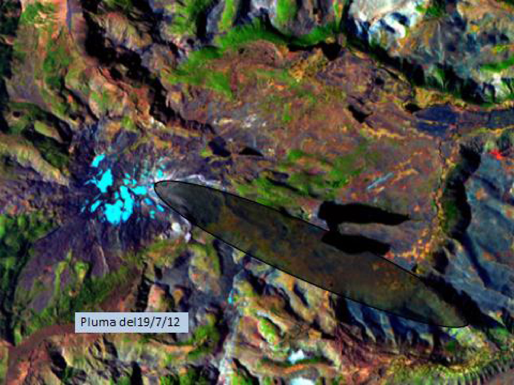 |
Figure 10. In this false-color Landsat satellite image of Copahue, the region affected by the 19 July 2012 ash plume is within the 20 km long, ESE-trending ellipse. Courtesy of Laura Vélez (GESVA). |
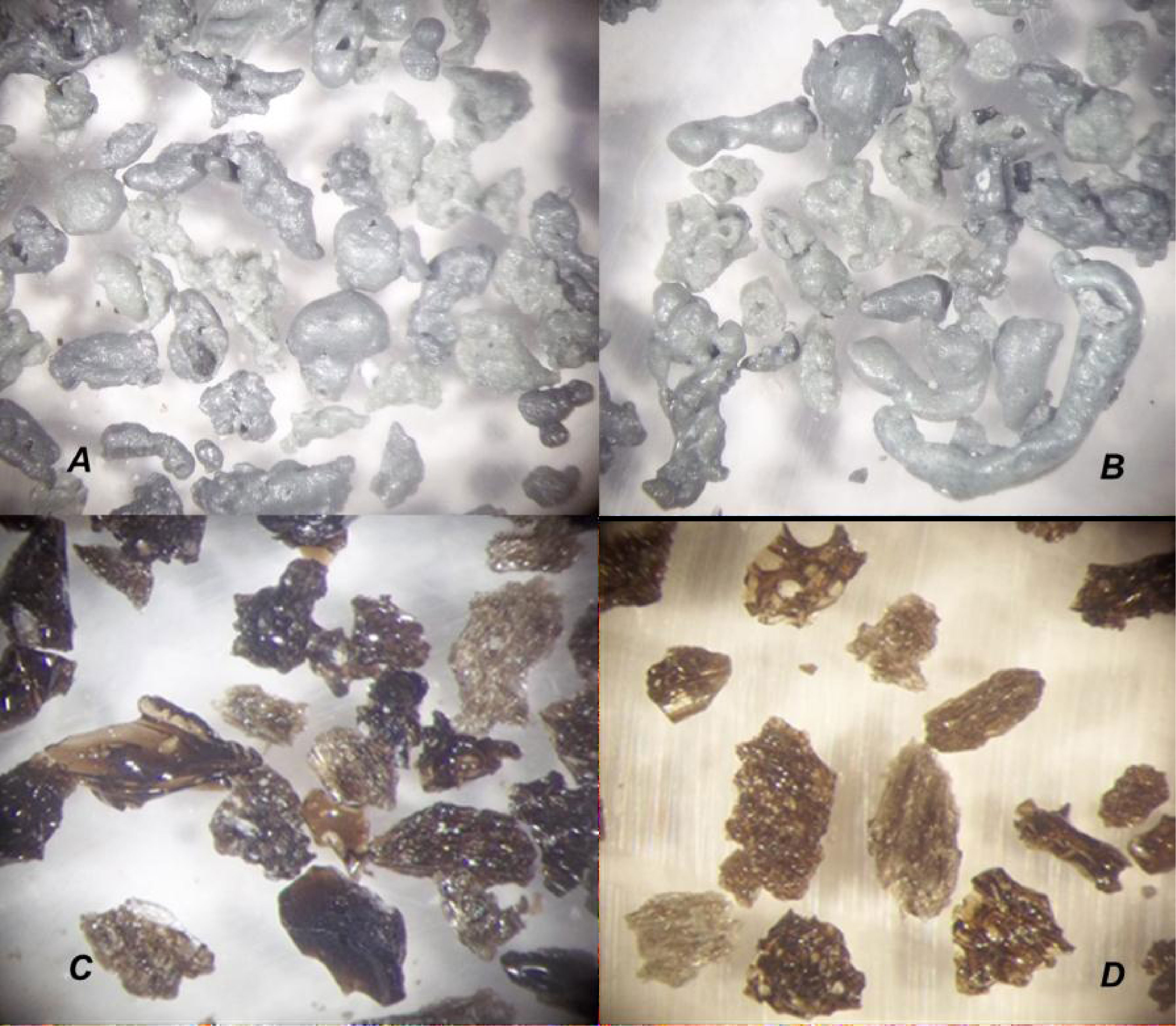 |
Figure 11. Low magnification photo micrographs looking at key components from Copahue's July 2012 tephra deposits. Fragments shown are less than 4 mm in diameter and were chosen to highlight morphologic differences between sulfur particles (A and B) and vitreous shards (C and D). Photograph by R. Daga, Laboratorio Análisis por Activación Neutrónica (CAB-CNEA). |
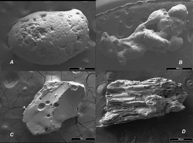 |
Figure 12. Scanning Electron Microscope (SEM) images of particles deposited from Copahue's July 2012 eruption. Images as follows: (A) subspherical sulfur particle; (B) botryoidal sulfur particle; (C) blocky and glassy particle; (D) fibrous glassy particles. Note the scale bars represent 500 μm for images A, C, and D while the scale bar for B is 1000 μm. Photograph by R. Daga, Laboratorio Análisis por Activación Neutrónica (CAB-CNEA). |
A seismic array from the Grupo de Estudio y Seguimiento de Volcanes Activos (GESVA) had been installed near the town of Caviahue and it registered a wide range of seismicity during July 2012. GESVA documented volcano-tectonic events, hybrid events, long period events, tremor at various frequency ranges including harmonic tremor, and explosions. Several seismic swarms were reported during the phreatomagmatic eruption on 19 July 2012. GESVA is an investigative program within the geological department of the University of Buenos Aires.
On 26 July 2012 GESVA researchers conducted a new survey of the crater lake. All physical and chemical parameters showed high values with temperatures of 60°C at the lake margin, high acidity (pH
Continued unrest December 2012-December 2013. The Observatorio Volcanológico de los Andes del Sur-Servicio Nacional de Geologia y Mineria (OVDAS-SERNAGEOMIN) reported on 22 December 2012 an alert change from Orange to Red Alert at Copahue. This report highlighted the onset of harmonic tremor which lasted for 5 minutes and was immediately followed by two explosions. A camera maintained by OVDAS (~18 km SE) captured images of incandescence up to 200 m above the crater that correlated with the timing of the explosions. The observed height of the plume was between 1-1.5 km and it drifted SE (Figure 13).
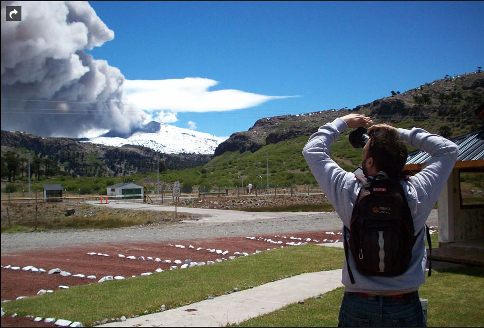 |
Figure 13. This photographer captured scenes of the rising ash plume from Copahue on 23 December 2012. The lighter cloud in the background is probably a non-volcanic, lenticular cloud, a feature often associated with mountains. Photograph from the Municipio Caviahue-Copahue courtesy of La Nación. |
Local newspapers reported that, on 23 December, ashfall and sulfur odors were limited to the proximal towns of Zapala (~150 km SE) and Cutral Co (~210 km SE). There were some reports of local citizens self-evacuating from the area due to anticipated ashfall. People within 15 km of the volcano and along drainages were warned about a potential increase in activity potentially including lahars. The municipalities of Villa La Angostura and Bariloche, located ~340 km S within Argentina, were not at risk during this event. In contrast, they had experienced heavy ashfall in 2011 due to Puyehue-Córdon Caulle's eruption.
The Buenos Aires Volcanic Ash Advisory Center (VAAC) reported at 1400 on 22 December 2012 that satellite images revealed a 110 km ash plume extending SE of Copahue; the plume was white and gray (figure 14). The plume persisted in satellite images during the next day, although its aerial extent later became restricted near the summit. By 24 December, the 22 December ash was only detected in an isolated area over the Atlantic Ocean.
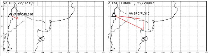 |
Figure 14. The Buenos Aires VAAC released maps for the observed (left) and forecasted (right) location of Copahue's ash plume from 22 December 2012. A 12 hour and 18 hour forecast was also released that extended the plume due E, reaching the Atlantic Ocean. Later images disclosed a detached plume out over the Atlantic Ocean (see text). Courtesy of Buenos Aires VAAC. |
VAAC reports indicated minor and possible ash emissions at the volcano on the following dates: 27, 28, and 30 December 2012; 2, 5, 9, and 10 January 2013; on 4 February; 28 and 29 March; on 12 April; on 15 November (possible ash was reported on 21 and 22 November). VAAC reports were also released intermittently during January-November 2013 due to gas emissions.
SERNAGEOMIN reduced the Alert Level from Red to Orange on 23 December 2012. The level was reduced again, on 28 December to Yellow, and was maintained until 5 January 2013 when seismicity increased (including three spasmodic tremor events). The webcamera also documented an increase in degassing that appeared to be gray and drifting E on 5 January; the Buenos Aires VAAC was able to track this minor ash plume. Alert Level Orange status continued until 17 January when it was decreased to Yellow.
The Alert Level fluctuated later in January (to and from Orange Alert) based on changing conditions which frequently included seismic swarms. One significant swarm, for example, occurred on 22 January.
Periodic incandescence was observed during February-May and SERNAGEOMIN reported small explosions of gas with minor ash on 7 and 15 May. On 19 May, OMI (Ozone Monitoring Instrument) detected elevated SO2 emissions within 300 m above the crater. During 20 and 22 May, satellite images detected gray-colored plume that drifted up to 100 km SE. On 23 May, incandescence was observed as well as an increase in SO2 flux as measured by the OMI satellite measurements; that activity triggered an increase in Alert Level to Orange.
Red Alert was announced one time in 2013 when, on 27 May, a seismic swarm began at a time of high RSAM measurements. An evacuation order was declared by SERNAGEOMIN that day for an area surrounding the volcano with a 25 km radius; they stated that the intensity and type of seismicity observed in the last few days and the deformation of the volcanic edifice suggested the rise of a magmatic body. Army trucks and buses were made available for the ~2,240 residents within that area, primarily those living in Alto Bío Bío. The swarm continued for several days into June. The Alert Level was reduced to Orange by 3 June. Local news sources reported that residents were authorized to begin returning to their homes on 6 June. The Alert Level was reduced to Yellow on 12 June and was maintained through the rest of 2013.
On 4 June 2013, the Hyperion sensor onboard the satellite EO-1 observed Copahue at 1333 UTC and a thermal anomaly was detected from the summit area of the volcano (figure 15). The calculated temperatures ranged from ~377 to ~647°C (personal communication, Ashley Davies, NASA Jet Propulsion Laboratory).
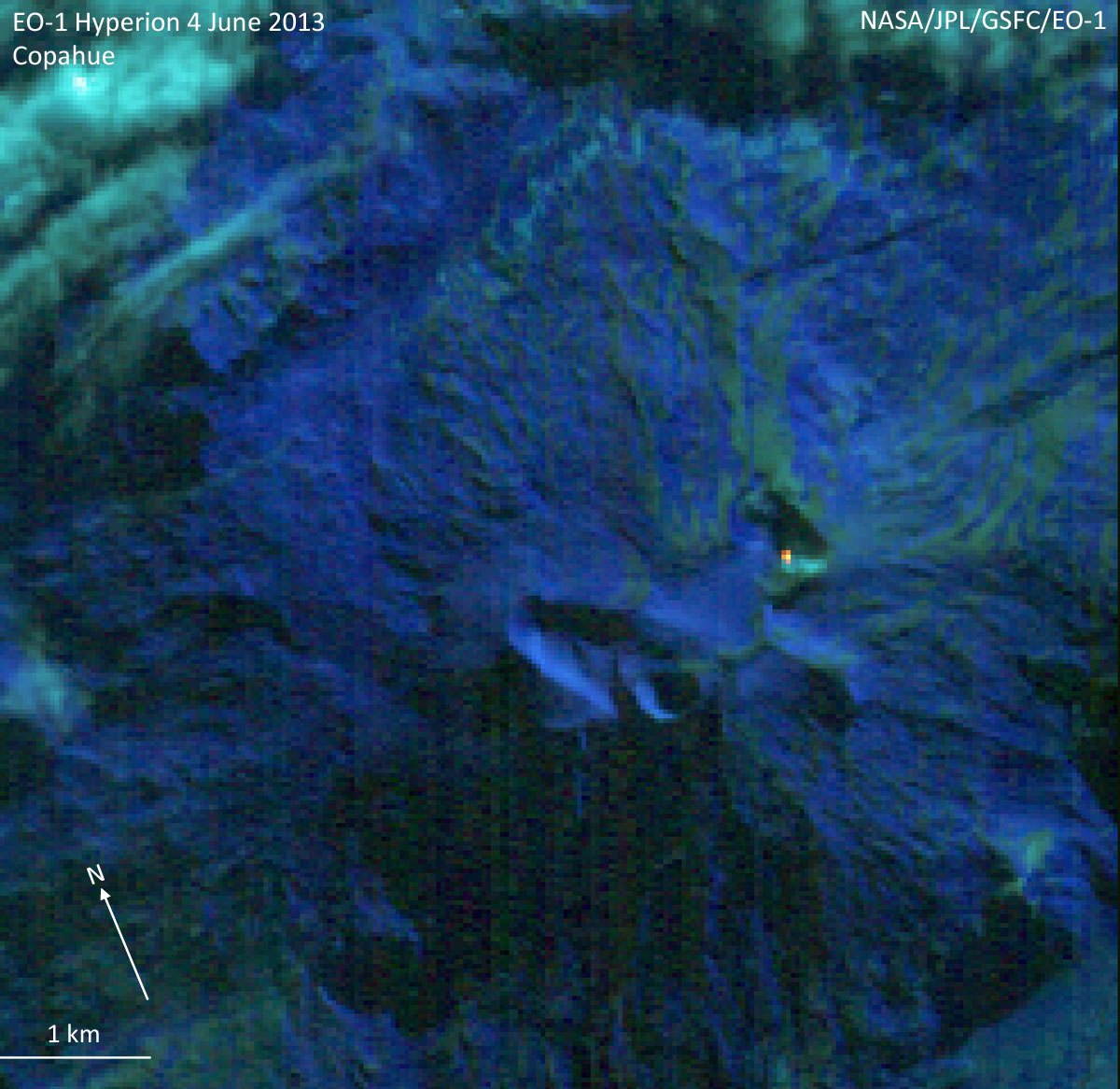 |
Figure 15. This satellite image captured a small point of elevated temperatures with the Hyperion sensor onboard EO-1; it was acquired on 4 June 2013 and composed of bands 2,1,3 (RGB). The image was obtained at a spatial resolution of 30 m per pixel. The north arrow and scale are approximate. Courtesy of Ashley Davies, NASA Jet Propulsion Laboratory. |
An overflight of Copahue's summit was conducted on 9 June by OVDAS-SERNAGEOMIN in order to make observations of the area as reconnaissance for future installations of three seismometers. A 200 m plume was visible rising from the crater although no lava or lava dome was visible within the crater. There were sulfurous gas odors and the observers also noted that there were no indications of lahar flows outside of the crater.
On 23 and 26 August SERNAGEOMIN reported that incandescence was observed by the local webcamera; a possible ash event occurred on 26 June. Elevated SO2 emissions were also detected by the Ozone Monitoring Instrument (OMI) on 23 August and during 5 days in September. Incandescence was reported during the last week of September.
On 16, 23, and 28 October, ash was observed by the local webcameras; the most energetic event occurred on 28 October. Elevated SO2 was detected by OMI on during 21, 26, and 27 October.
SERNAGEOMIN reported in their November report that INSAR data from NASA determined that deformation of the edifice continued at a rate of 3.9 cm/year which was considered less than values measured earlier in the year. Incandescence was notable on 13 November and minor ash was reported on 16, 17, 18, 21, and 30 November. Elevated SO2was detected by OMI on 29 November.
Small explosions were recorded on 10 December but ash was not confirmed. The local webcamera captured a plume that reached ~1,100 m above the crater. This event was accompanied by low-frequency seismicity.
MODVOLC Alerts 2012-2013: Elevated temperatures were detected by the MODIS sensors onboard the Aqua and Terra satellites during 2012-2013 (table 1). The MODVOLC system generated alerts on 11 days during the two years of unrest. During 2013, the alerts occurred in January and May on two separate days. While the local, SERNAGEOMIN webcamera recorded incandescence (particularly at night), the satellite remote sensing capabilities contended with cloudcover that frequently masked the area. For example, in January 2013 alone, there were 4 notable cases of nighttime incandescence (on 5, 8, 9, and 11 January).
Table 1. The MODVOLC system generated several thermal alerts during January 2012-May 2013. No additional alerts were generated during June-December 2013. Courtesy of HIGP.
| Date | Number of Pixels |
| 22 Dec 2012 | 5 |
| 23 Dec 2012 | 2 |
| 24 Dec 2012 | 2 |
| 26 Dec 2012 | 1 |
| 27 Dec 2012 | 4 |
| 28 Dec 2012 | 2 |
| 29 Dec 2012 | 2 |
| 30 Dec 2012 | 2 |
| 01 Jan 2013 | 1 |
| 03 Jan 2013 | 2 |
| 05 Jan 2013 | 3 |
| 10 Jan 2013 | 1 |
| 12 Jan 2013 | 1 |
| 09 May 2013 | 1 |
References. Agusto, M. 2011. Estudio Geoquímico de Fluidos Volcánicos-Hidrotermales del complejo volcánico Copahue-Caviahue, y su Aplicación a Tareas de Seguimiento. Tesis de Doctorado. 296 páginas. Facultad de Cs. Exactas y Naturales. Universidad de Buenos Aires.
Agusto, M., Tassi, F., Capaccioni, B., Rouwet, D., Caselli. A., Vaselli, O. (en preparación). Chemical and isotopic compositions of fumarolic discharges from magmatic-hydrothermal system of Copahue volcano (Argentina). A combined (inorganic and organic) geochemical approach to understanding the origin of the fluid discharges.
Agusto, M., Caselli, A., Tassi, F., dos Santos Afonso, M., Vaselli. O. 2012. (aceptado). Caracterización y seguimiento geoquímico de las aguas Ácidas del sistema volcÁn Copahue - río Agrio: posible aplicación para la identificación de precursores eruptivos. Revista de la Asociación Geológica Argentina. ISSN 0004-4822.
Agusto, M., Vélez, ML., Caselli, A., Euillades, P., Tassi, F., Capaccioni, B., Vaselli, O. 2012. Correlación entre anomalías térmicas, geoquímicas y procesos deflacionarios en el volcán Copahue. XIII Congreso Geológico Chileno. Antofagasta, 2012. Actas: 429-431.
Caselli, A.T., Agusto M.R. y Fazio A., 2005. Cambios térmicos y geoquímicos del lago cratérico del volcán Copahue (Neuquén): posibles variaciones cíclicas del sistema volcánico. XVI Congreso Geológico Argentino, La Plata. Actas I: 751-756.
Caselli, A., Vélez, M.L., Agusto, M.R., Bengoa, C.L. Euillades, P.A. Ibañez, J.M., 2009. Copahue volcano (Argentina): A relationship between ground deformation, seismic activity and geochemical changes. Ed. Bean, Braiden, Lockmer, Martini and O'Brien.The VOLUME project.VOLcanoes: Understanding subsurface mass movement. Printed by jaycee. ISBN: 978-1-905254-39-2, pp 309-318.
Caselli, A., M. Agusto, B. Capaccioni, F. Tassi, G. Chiodini y D. Tardani. 2012. Aumento térmico y composicional de las aguas cratéricas del VolcÁn Copahue registradas durante el año 2012 (Neuquen, Argentina). XIII Congreso Geológico Chileno. Antofagasta, 2012. Actas: 435-436.
Forte, P., C. Bengoa, A. Caselli. 2012. AnÁlisis preliminar de la actividad sísmica del complejo volcÁnico Copahue-Caviahue mediante técnicas de array. XIII Congreso Geológico Chileno. Antofagasta, 2012. Actas: 568-570.
Ibañez J. M., Del Pezzo E., Bengoa, C., Caselli, A.T., Badi, G.A y J. Almendros. 2008. Volcanic tremor associated with the geothermal activity of Copahue volcano, Southern Andes region, Argentina. Journal of Volcanology and Geothermal Research (Elsevier, ISSN:0377-0273) 174: 284-294.
Tassi, F., Caselli, A., Vaselli, O., Agusto, M., Capecchiacci. F., 2007.Downstream composition of acidic volcanic waters discharged from Copahue crater lake (Argentina): the chemical evolution of Rio Agrio watershed. Federazione Italiana della Scienze della Tierra- FIST. Italia.
Varekamp, J.C., Ouimette, A.; HermÁn, S., Bermúdez, A.; Delpino, D., 2001. Hydrothermal element fluxes from Copahue, Argentina: A "beehive" volcano in turmoil. Geology, 29 (11): 1059-1062.
Varekamp, J.C., Ouimette, A.P., Herman, S.W., Flynn, K.S., Bermudez, A., Delpino, D., 2009. Naturally acid waters from Copahue volcano, Argentina. Applied Geochemistry 24, 208-220.
Vélez, M.L., 2011. Análisis de la deformación asociada al comportamiento de sistemas volcÁnicos activos: Volcán Copahue. Tesis Doctoral. Facultad Ciencias Exactas y Naturales - Universidad de Buenos Aires, 154 p.
Velez, M. L., Euillades, P., Caselli, A., Blanco, M., Díaz, J.M., 2011, Deformation of Copahue volcano: Inversion of InSAR data using a genetic algorithm, Journal of Volcanology and Geothermal Research, 202: 117-126.
Information Contacts: Observatorio Volcanológico de los Andes del Sur-Servicio Nacional de Geologia y Mineria (OVDAS-SERNAGEOMIN), Avda Sta María No. 0104, Santiago, Chile (URL: http://www.sernageomin.cl/); Alberto Caselli and Laura Vélez, Grupo de Estudio y Seguimiento de Volcanes Activos (GESVA), Departamento Ciencias Geológicas, FCE y N, Universidad de Buenos Aires, Buenos Aires , Argentina (URL: http://www.gesva.gl.fcen.uba.ar/); D. Pablo Groeber (UBA-CONICET), FCEyN - UBA (URL: http://www.ifibyne.fcen.uba.ar/new/); G. Badi, Departamento de Sismología e I. M., Facultad de Ciencias Astronómicas y Geofísicas, Universidad Nacional de La Plata (URL: http://www.fcaglp.unlp.edu.ar/ciencia-y-tecnica/); R. Daga, Laboratorio AnÁlisis por Activación Neutrónica (CAB-CNEA) - CONICET y C. Cotaro, y C. Ayala, Grupo de Caracterización de materiales (CAB-CNEA) (URL: http://www2.cab.cnea.gov.ar/); P. Euillades, L. Euillades, M. Blanco, and S. Balbarani, Instituto CEDIAC - Facultad de Ingeniería Universidad Nacional de Cuyo (URL: https://fing.uncu.edu.ar/); M. Araujo, Instituto Nacional de Prevención Sísmica (INPRES) (URL: http://www.inpres.gov.ar/); Buenos Aires Volcanic Ash Advisory Center (VAAC) (URL: http://www.smn.gov.ar/vaac/buenosaires/productos.php); Hawai'i Institute of Geophysics and Planetology (HIGP) MODVOLC Thermal Alerts System, School of Ocean and Earth Science and Technology (SOEST), Univ. of Hawai'i, 2525 Correa Road, Honolulu, HI 96822, USA (URL: http://modis.higp.hawaii.edu/); Simon Carn, NASA Global Sulfur Dioxide Monitoring, Aura/OMI (URL: https://so2.gsfc.nasa.gov/); La Nación, Buenos Aires, Argentina (URL: http://www.lanacion.com.ar/1539643-entro-en-erupcion-el-volcan-copahue); Dia a Dia, Buenoes Aires, Argentina (URL: http://www.diaadia.com.ar).
Eruptions during July-December 2014 and September 2015 into 2016
After 12 years of passive degassing, Copahue became more active in 2012-2013 with an increase in seismicity, minor ash explosions (of which at least some were phreatic or phreatomagmatic), and increased fumarolic activity from the crater lake (BGVN 38:09). Except where otherwise noted, observations were provided by the Observatorio Volcanológico de los Andes del Sur-Servicio Nacional de Geologia y Mineria (OVDAS-SERNAGEOMIN); the Buenos Aires Volcanic Ash Advisory Center (VAAC) also provided frequent reports of ash plumes.
This report covers the period from January 2014 to January 2016. Small explosions were recorded on 10 December 2013, the final activity of an eruption that began in December 2012; the volcano was quiet in subsequent months. Seismic unrest and elevated sulfur dioxide emissions began again in March 2014. A phreatic explosion on 4 July was followed by earthquake swarms and eventually significant ash explosions during 6 October-2 December 2014. Eruptive activity resumed around 20 September 2015 and was continuing as of late January 2016.
Activity during March-December 2014. A gradual increase of volcanic tremor was detected starting at 0230 on 20 March 2014; from 0230 to 1100 the signal fluctuated and intense periods lasted up to 3 hours. Cameras showed minimal surface activity, while SO2 concentrations increased. The Alert Level was raised to Orange (second highest level), and residents and visitors were prohibited within a 3-km radius of the active crater. During 21-24 March, gas plumes rose as high as 500 m and drifted E. Seismicity continued to increase.
Cameras installed around the volcano recorded white gas plumes rising 100-600 m above the crater during 25-29 March; clouds prevented observations on 30 March. SO2 measurements in metric tons per day (t/d) were 270 on 26 March, 1,400 on 27 March, 2,000 on 28 March, 1,400 on 29 March, and 920 on 30 March. On 4 April 2014 activity continued to fluctuate at an elevated level, but not at a level that would suggest an impending eruption; the Alert Level was lowered to Yellow.
A phreatic explosion on 4 July deposited bombs (less than 12 cm in diameter), lapilli (less than 4 cm), ash, and gray clay smelling strongly of sulfuric acid along the E flank of the crater. During an overflight on 7 July, OVDAS-SERNAGEOMIN officials observed the deposit and measured a moderate amount of SO2 emissions (average 4,000 t/d), a relatively low water level in the crater, and low fumarole temperatures within El Agrio crater. DOAS stations had measured up to 18,000 t/d of SO2 on the day of the explosion. An anomalous tremor signal was detected at 0823 on 5 July that was associated with an explosion from the crater; a microphone installation 13 km E also detected an acoustic signal. The explosion generated a plume 1,000 m above the crater.
On 14 September 2014 there was seismicity, with a seismic swarm of 389 long-period earthquakes; epicenters were within the crater area and hypocenters were at depths less than 3 km. Web cameras captured a persistent vapor plume that reached ~250 m above the crater and drifted ~700 m ENE. On 26 September a special volcanic activity report issued by OVDAS-SERNAGEOMIN noted a seismic swarm of 140 long-period events. Cameras recorded increased emissions; mostly white plumes with some ash rose 200-500 m and drifted SE. The report also noted that swarms had been recorded in late July and during 1-16 September.
The Buenos Aires VAAC reported that during 6-7 October, satellite images detected diffuse steam-and-gas emissions with a small amount of ash that originated from near the summit. Two explosions from the crater on 11 October, reported by OVDAS-SERNAGEOMIN, generated dark gray ash plumes that rose as high as 3.6 km above the crater. Some minor explosions were detected after the second explosion. Incandescence in the vicinity of the crater was observed at night. The Alert Level was raised to Orange. Cameras recorded dark gray ash plumes rising to a maximum height of 1.9 km and drifting 35 km NE on 12 October, 2.2 km and drifting E on 13 October, and 0.4 km and drifting E on 14 October. Minor explosions continued to be detected.
On 15 October gray ash plumes rose 300 m above the crater and four explosions were recorded. Plumes on 17 October were generally white and rose 100 m; no explosions were detected. Seismicity was low on 18 October. On 19 October, six explosions associated with ash emissions were recorded, plumes rose 300 m, and incandescence from the crater was seen in the evening. The network recorded 12 explosions with associated ash emissions the next day. During 20-21 October, plumes rose 200 m (figure 16), and crater incandescence at night was noted. Seismicity continued decreasing on 24 October, and emissions had become more diffuse with only minute amounts of tephra in some plumes. A small mud lake had also formed in the crater. The Alert Level was reduced to Yellow.
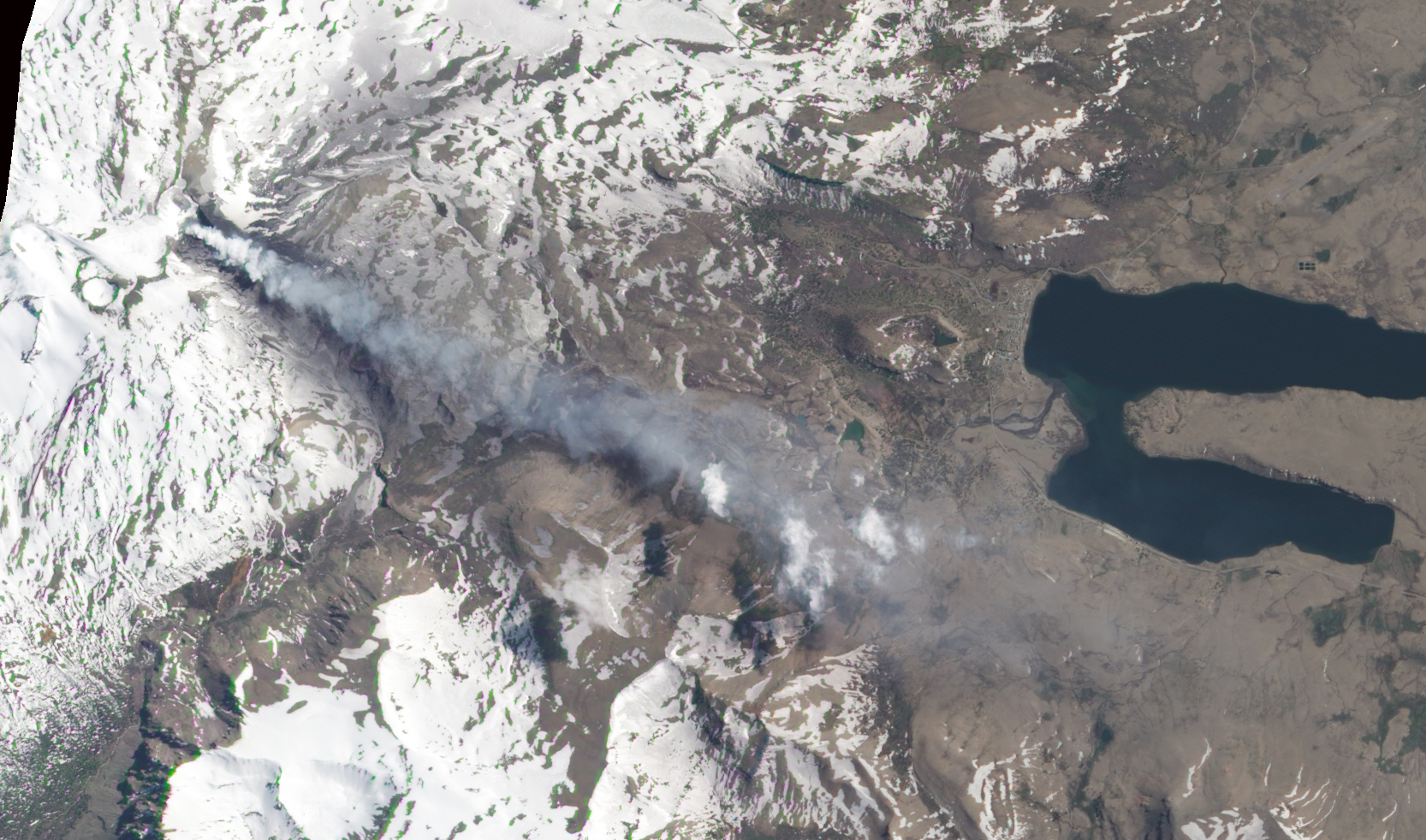 |
Figure 16. Natural-color satellite image of Copahue showing a volcanic plume streaming SE from the volcano on 21 October 2014. Image was acquired by the Advanced Land Imager (ALI) on Earth Observing-1. Courtesy of NASA Earth Observatory. |
The Buenos Aires VAAC reported that during 15-16 November 2014, diffuse steam-and-gas emissions containing a small amount of ash were detected by the webcam. The VAAC reported that on 26 November diffuse steam-and-gas emissions, seen in webcam and satellite images, may have contained a small amount of ash. The plume rose to altitudes of 3.4-3.7 km and drifted 65 km E. On 30 November a pilot observation and webcam views revealed a diffuse and continuous plume near the summit. During 1-2 December a diffuse plume was detected in satellite images, while the webcam recorded continuous ash emissions.
Activity during September 2015-January 2016. OVDAS-SERNAGEOMIN reported on 22 September 2015 that during the previous several days, web cameras had detected small explosions in the crater that dispersed incandescent material nearby. This activity, coupled with increased seismicity, increased SO2 emission levels, elevated emission temperatures, and partial loss of the crater lake, suggested a new eruption phase.
On 6 October 2015 observers noted sporadic crater glow, indicative of small explosions in El Agrio Crater. A grayish plume rose 200 m above the crater and drifted SE. According to the Buenos Aires VAAC, a pilot observed a gray plume rising to altitudes of 6.1-7.6 km and drifting NE on 11 October. Satellite images indicated no ash; the webcam recorded continuous emissions of steam and gas, and low levels of ash. The next day the webcam recorded weak steam-and-gas emissions, possibly with minor amounts of ash drifting SE. The VAAC also reported that the webcam recorded weak emissions of steam, gas, and possibly minor amounts of ash during 16-18 October.
Tremor amplitude began to oscillate on 19 November. On 20 November, crater incandescence coincided with small explosions that produced ash plumes. The Buenos Aires VAAC reported that, on 20 November, the webcam detected a continuous emission of steam and gas with minor amounts of ash; ash was not detected in satellite images.
During 16-30 November continuous ash explosions at the crater were recorded by the webcam; plumes rose as high as 1.3 km above the crater on 29 November. Satellite images detected ash plumes drifting as far as 560 km SE and ESE. During an overflight on 28 November, scientists observed the absence of the crater lake and a growing pyroclastic cone. Impact craters from ballistics ejected during minor explosions were within a radius of 300 m of the crater.
Based on satellite and webcam views, the Buenos Aires VAAC reported that during 18-20 December, steam and gas emissions with minor amounts of ash rose to altitudes of 3-3.6 km. Plumes drifted N on 18 December and 55-150 km SSE and SE on 19 December. During 20-22 December the webcam recorded continuous ash emissions drifting short distances. Diffuse ash plumes on 24-25, 27, and 29 December rose to altitudes of 3-3.6 km and drifted SE. On 30 December, diffuse gas and steam plumes possibly containing ash drifted SSE. The next day ash emissions drifted SW.
Based on satellite and webcam views, the Buenos Aires VAAC reported that on 6 January 2016 a gas and steam plume with minor amounts of ash rose to an altitude of 4.6 km. On 13 and 16 January, continuous gas-and-steam plumes containing minor amounts of ash drifted SE. During 20-23 January, almost continuous steam plumes containing minor amounts of ash drifted as far as 150 km W, S, SE, and E. During 28 January-2 February, almost continuous steam plumes containing minor amounts of ash rose to altitudes of 3-3.6 km and drifted as far as 160 km SE and SW. The Alert Level remained at Yellow.
The only MODIS/MODVOLC thermal anomalies during the reporting period were on 25 December 2015 (1 pixel), 30 December 2015 (2 pixels), and 31 December 2015 (1 pixel). The MIROVA (Middle InfraRed Observation of Volcanic Activity) volcano hotspot detection system, also based on analysis of MODIS data, detected one hotspot within 5 km of the volcano during the last week of April 2015 and numerous hotspots within 5 km from the middle of October through January 2016; the radiative power of the anomalies were all in the low or moderate range.
Information Contacts: Observatorio Volcanológico de los Andes del Sur-Servicio Nacional de Geologia y Mineria (OVDAS-SERNAGEOMIN), Avda Sta María No. 0104, Santiago, Chile (URL: http://www.sernageomin.cl/); Oficina Nacional de Emergencia-Ministerio del Interior (ONEMI) (National Office of Emergency of the Interior Ministry)(URL: http://www.onemi.cl/); Buenos Aires Volcanic Ash Advisory Center (VAAC) (URL: http://www.smn.gov.ar/vaac/buenosaires/productos.php); Hawai'i Institute of Geophysics and Planetology (HIGP) MODVOLC Thermal Alerts System, School of Ocean and Earth Science and Technology (SOEST), Univ. of Hawai'i, 2525 Correa Road, Honolulu, HI 96822, USA (URL: http://modis.higp.hawaii.edu/)
Eruptive activity consisting of Strombolian explosions and gas-and-ash plumes ends in late December 2016
Recent activity at Copahue through January 2016 (BGVN 41:03) consisted of gas and steam plumes with minor amounts of ash. This report, based on information obtained from the Buenos Aires Volcanic Ash Advisory Center (VAAC), the Southern Andes Volcanological Observatory (OVDAS), and the Servicio Nacional de Geología y Minería (National Geology and Mining Service) (SERNAGEOMIN), covers similar activity from mid-January through December 2016. Volcano Alert Levels were maintained by SERNAGEOMIN (on a four-color scale) and by the Chilean Oficina Nacional de Emergencia del Ministerio del Interior (National Office of Emergency of the Interior Ministry) (ONEMI), on a three-color scale), for alerts to individual communes in the region.
Reports from the Buenos Aires VAAC between 13 January and 26 March 2016, based on Significant Meteorological Information (SIGMET) notices, satellites, and webcam views, indicated continuous gas-and-steam plumes containing minor amounts of ash. The plumes rose as high as 3.3-4.3 km altitude (during 24-25 and 28 February) and drifted as far as 160 km (trending SE and SW) between 28 January and 2 February, and more generally as far as 150 km in a variety of directions.
The Buenos Aires VAAC next reported steam-and-gas emissions, possibly containing minor amounts of ash on 11 June, based on webcam recordings. OVDAS-SERNAGEOMIN reported an eruption during 16-30 June characterized by phreato-magmatic explosions and Strombolian activity. During an overflight on 3 July, SERNAGEOMIN scientists observed Strombolian activity from a pyroclastic cone that was forming on the floor of El Agrio crater (figure 17).
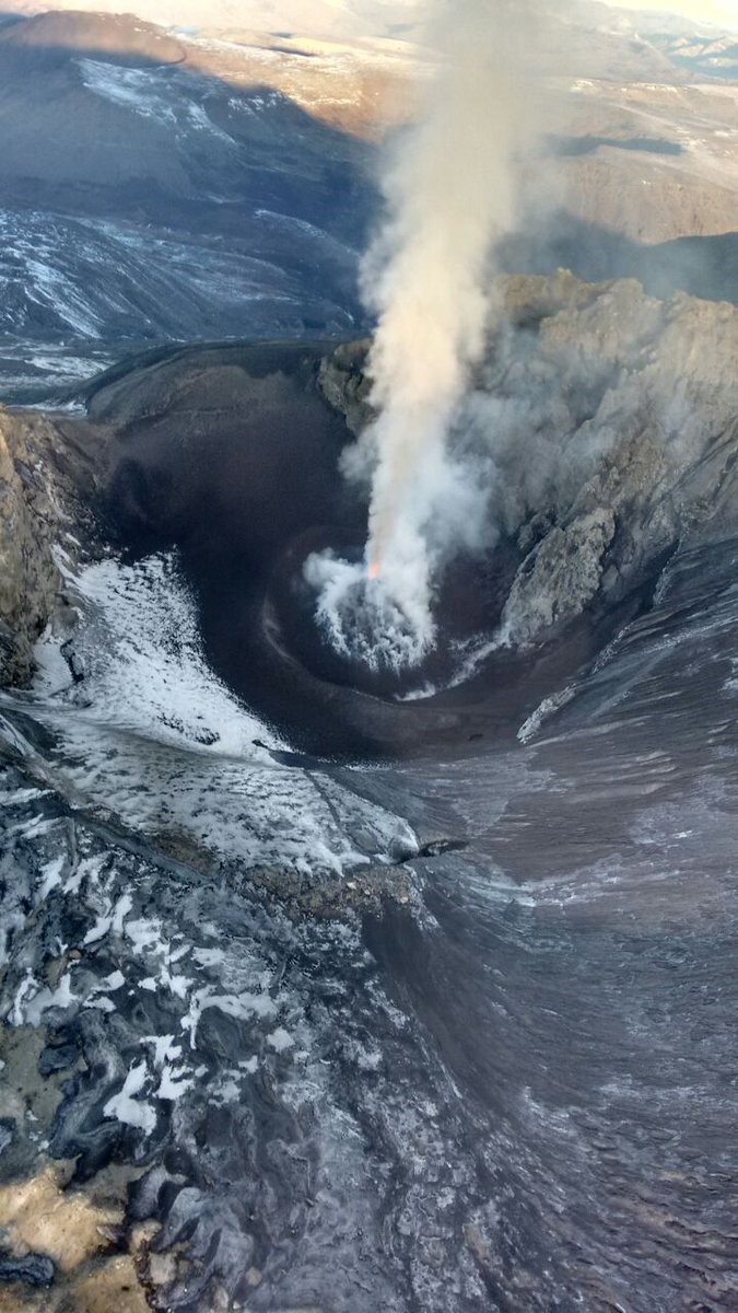 |
Figure 17. Photo taken during an overflight of Copahue on 3 July 2016 showing Strombolian activity from a pyroclastic cone on the floor of El Agrio crater. Courtesy of SERNAGEOMIN. |
Based on webcam and satellite views, the Buenos Aires VAAC reported that during 7-8 July diffuse gas-and-steam plumes with minor amounts of ash rose to an altitude of 3 km and drifted E and SE. The Alert Level remained at Yellow (second highest level on a four-color scale).
Activity renewed in September and lasted through December 2016. Based on satellite and webcam images, notices from the Buenos Aires VAAC after 23 September described gas and water vapor plumes with minor ash content rising above the summit. The plumes rose as high as 5.2 km a.s.l. (during 23-25 and 27-29 November) and drifted based on wind direction SW, S, SSE, ESE, SE, E, ENE, NE, and N. On 2 December OVDAS-SERNAGEOMIN reported that activity continued to be dominated by weak Strombolian explosions, likely from a pyroclastic cone forming on the floor of El Agrio crater. The last VAAC reports of activity during 2016 were for gas-and-ash emissions to altitudes of 3.6-3.9 km drifting in S and E directions.
The only MODVOLC thermal anomaly during the entire reporting period was on 26 October 2016 (1 pixel). The MIROVA volcano hotspot detection system, also based on analysis of MODIS data, detected low level thermal anomalies that became more frequent during the latter part of June through early July 2016 and thereafter occurred less often. The last anomalies recorded by MIROVA (as of early April 2017) were in about the third week of December 2016 (figure 18).
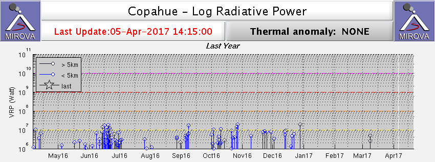 |
Figure 18. Plot of thermal anomalies at Copahue as recorded by the MIROVA system (Log Radiative Power), April 2016-March 2017. Courtesy of MIROVA. |
At some point after the December 2016 activity, SERNAGEOMIN lowered the Alert Level to Green, the lowest of the four levels. No additional reports of activity were issued from any agency through March 2017.
Information Contacts: Servicio Nacional de Geología y Minería, (SERNAGEOMIN), Observatorio Volcanológico de Los Andes del Sur (OVDAS), Avda Sta María No. 0104, Santiago, Chile ( URL: http://www.sernageomin.cl/); Oficina Nacional de Emergencia - Ministerio del Interior (ONEMI), Beaucheff 1637/1671, Santiago, Chile (URL: http://www.onemi.cl/); Buenos Aires Volcanic Ash Advisory Center (VAAC), Servicio Meteorológico Nacional-Fuerza Aérea Argentina, 25 de mayo 658, Buenos Aires, Argentina (URL: http://www.smn.gov.ar/vaac/buenosaires/inicio.php?lang=es); Hawai'i Institute of Geophysics and Planetology (HIGP), MODVOLC Thermal Alerts System, School of Ocean and Earth Science and Technology (SOEST), Univ. of Hawai'i, 2525 Correa Road, Honolulu, HI 96822, USA (URL: http://modis.higp.hawaii.edu/); MIROVA (Middle InfraRed Observation of Volcanic Activity), a collaborative project between the Universities of Turin and Florence (Italy) supported by the Centre for Volcanic Risk of the Italian Civil Protection Department (URL: http://www.mirovaweb.it/).
Ash emissions and incandescence during June-July 2017; ongoing degassing with sporadic ash
Recent activity at Copahue through December 2016 consisted of gas and steam plumes with minor amounts of ash. Eruptive activity ended in late December 2016, but ash emissions began again in early June 2017. Distinct ash emissions decreased after July, and crater incandescence was no longer reported. However, persistent tremor and degassing with sporadic ash continued through 2017.
This report through December 2017 is based on information obtained from the Buenos Aires Volcanic Ash Advisory Center (VAAC), the Southern Andes Volcanological Observatory (OVDAS), and the Servicio Nacional de Geología y Minería (National Geology and Mining Service) (SERNAGEOMIN). Volcano Alert Levels are set by SERNAGEOMIN (on a four-color scale) and by the Chilean Oficina Nacional de Emergencia del Ministerio del Interior (National Office of Emergency of the Interior Ministry) (ONEMI), on a three-color scale), for alerts to individual communities in the region.
OVDAS-SERNAGEOMIN reported that webcams recorded an increase in ash emissions on 4 June 2017. There were no significant changes in the magnitude or number of earthquakes recorded by the seismic network. The report noted that due to inclement weather making visual observations difficult, the observatory did not know if the ash emission began in the early hours of 4 June, or the day before. On the same day, OVDAS-SERNAGEOMIN raised the Alert Level to Yellow; ONEMI set a Yellow Alert for the communities of Villarrica, Pucón, and Curarrehue in La Araucanía, and for Panguipulli in Los Ríos.
During 5-15 June 2017 the seismic network detected long-period earthquakes. Gas plumes constantly rose from El Agrio crater and on several days contained ash. The highest plume, detected on 5 June, rose 300 m and drifted E.
The Buenos Aires VAAC reported that on 1 July the webcam recorded a steam-and-gas plume with minor ash near the summit. Webcam and satellite images analyzed by the Buenos Aires VAAC showed that during 7-8 July steam plumes with minor amounts of ash rose to altitudes of 4-4.3 km altitude and drifted ESE. During 16-17 July similar plumes rose to altitudes of 3-3.4 km and drifted N and NW. According to ONEMI, OVDAS-SERNAGEOMIN reported that during 16-31 July surficial activity had decreased. The webcam recorded constant gas emissions with sporadic ash rising no more than 280 m from El Agrio crater. Crater incandescence was visible during clear weather. The Alert Level remained at Yellow, and SERNAGEOMIN recommended no entry closer than 1 km of the crater. ONEMI continued an Alert Level of Yellow for the municipality of Alto Biobío.
In August, activity continued to decrease. Degassing was constant and sometimes contained ash. Plumes did not exceed 500 m in height and incandescence was absent. During the first half of the month, 23 seismic events occurred, 20 of which were volcanic-tectonic; tremor associated with the degassing was constant. During the latter half of August, SERNAGEOMIN lowered the Alert Level to Green. Because gas emissions continued, SERNAGEOMIN suggested that the public stay beyond a radius of 500 m of the active crater.
SERNAGEOMIN reports for November and December indicated that some seismic activity continued. In November, 337 earthquakes occurred, 261 of which were volcanic-tectonic. Tremor associated with degassing continued, and incandescence was reported on some days. Based on satellite and webcam views, the Buenos Aires VAAC reported that during 21 and 24-27 November diffuse steam plumes containing minor amounts of ash rose and drifted E and NE. Plumes rose to altitudes of 3.3-3.6 km during 25-26 November.
On 2 December, one volcanic-tectonic earthquake occurred at 1758 local time. More than 20 volcanic-tectonic earthquakes occurred about 2245 on 5 December. The SERNAGEOMIN report for December noted persistent tremor associated with gas and ash emissions, and that constant gas plumes with sporadic ash rising to a maximum height of 1,300 m above the summit was recorded by the web camera. The Alert Level remained Green through December 2017.
Information Contacts: Servicio Nacional de Geología y Minería, (SERNAGEOMIN), Observatorio Volcanológico de Los Andes del Sur (OVDAS), Avda Sta María No. 0104, Santiago, Chile (URL: http://www.sernageomin.cl/); Oficina Nacional de Emergencia - Ministerio del Interior (ONEMI), Beaucheff 1637/1671, Santiago, Chile (URL: http://www.onemi.cl/); Buenos Aires Volcanic Ash Advisory Center (VAAC), Servicio Meteorológico Nacional-Fuerza Aérea Argentina, 25 de mayo 658, Buenos Aires, Argentina (URL: http://www.smn.gov.ar/vaac/buenosaires/).
Phreatic explosion in March; possible ash emissions June 2018
The most recent activity from Copahue originates in the El Agrio crater, which has permanent fumarolic activity and an acidic lake. During 2017, ash emissions began in early June, but decreased after July, although tremor and degassing with occasional ash continued for the remainder of the year (BGVN 43:01). The volcano is monitored by the Servicio Nacional de Geología y Minería (SERNAGEOMIN). This report discusses activity during January-June 2018.
According to the Oficina Nacional de Emergencia-Ministerio del Interior (ONEMI), SERNAGEOMIN reported that a hydrothermal explosion was recorded on 24 March 2018, along with increased tremor. The Alert Level was raised to Yellow (second highest level on a four-color scale); SERNAGEOMIN recommended no entry into a restricted area within 1 km of the crater. ONEMI maintained its own Alert Level of Yellow (the middle level on a three-color scale) for the municipality of Alto Biobío (25 km SW).
Based on SERNAGEOMIN information, ONEMI reported that during 1-31 March 2018 there were 83 volcano-tectonic events recorded and 204 earthquakes indicting fluid movement. Tremor levels increased on 24 March, the same day as a phreatic explosion, though by the next day it had decreased to baseline levels. Webcams recorded gas plumes rising from El Agrio crater as high as 1 km. During an overflight on 3 April, scientists observed continuous white gas plumes rising almost 400 m.
The Buenos Aires Volcanic Ash Advisory Center (VAAC) reported that on 24 June diffuse steam emissions possibly containing ash were visible in webcam views rising to an altitude of 3.6 km.
Information Contacts: Oficina Nacional de Emergencia - Ministerio del Interior (ONEMI), Beaucheff 1637/1671, Santiago, Chile (URL: http://www.onemi.cl/); Servicio Nacional de Geología y Minería (SERNAGEOMIN), Observatorio Volcanológico de Los Andes del Sur (OVDAS), Avda Sta María No. 0104, Santiago, Chile (URL: http://www.sernageomin.cl/); Buenos Aires Volcanic Ash Advisory Center (VAAC), Servicio Meteorológico Nacional-Fuerza Aérea Argentina, 25 de mayo 658, Buenos Aires, Argentina (URL: http://www.smn.gov.ar/vaac/buenosaires/inicio.php).
Frequent emissions and small ash plumes continue from July through 7 December 2018
Copahue, on the border of Chile and Argentina, has frequent small ash eruptions and gas-and-steam plumes. The volcano alert was raised from Green to Yellow (on a scale going from green, yellow, orange, to red) on 24 March 2018 due to an increase in seismic activity and a phreatic explosion. Copahue has a dozen craters with recent activity focused at the Agrio crater, which contains a persistent fumarole field and a crater lake. This report summarizes activity from July through December 2018 and is based on reports issued by Servicio Nacional de Geología y Minería (SERNAGEOMIN) Observatorio Volcanológico de Los Andes del Sur, (OVDAS), Oficina Nacional de Emergencia - Ministerio del Interior (ONEMI), Buenos Aires Volcanic Ash Advisory Center (VAAC), and satellite data.
Throughout July, Copahue produced gas-and-steam and ash plumes that deposited ash on and away from the slopes of the volcano (figure 19). From 1 to 15 July degassing was continuous with a maximum plume height of 300 m above the crater. A more energetic gas-and-steam plume was produced on 18 July (figure 20). Persistent gas and ash plumes during 16-31 July rose up to 1,500 m above the crater. Nighttime incandescence was present throughout the month.
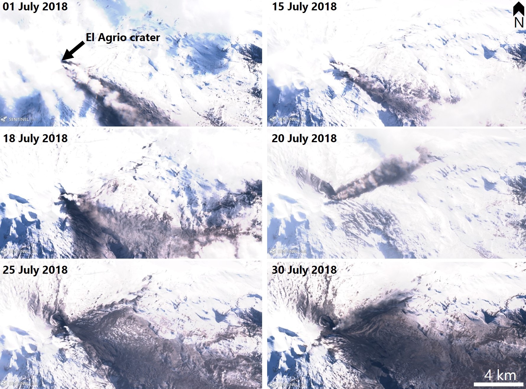 |
Figure 19. Sentinel-2 natural color satellite images of Copahue that show plumes and dark ash deposition throughout July 2018. The location of the active Agrio crater is indicated by the black arrow in the upper left image. Sentinel-2 Natural Color images (bands 12, 11, 14) courtesy of Sentinel Hub Playground. |
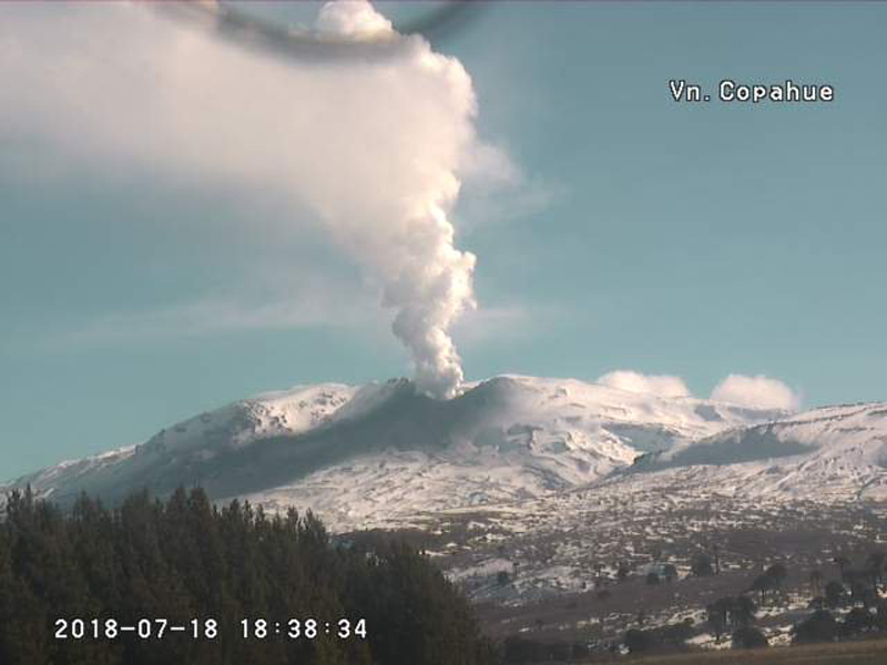 |
Figure 20. Energetic degassing at Copahue related to hydrothermal activity on 18 July 2018. Webcam image courtesy of SERNAGEOMIN-OVDAS. |
Throughout August intermittent gas-and-steam and ash plumes continued due to the interaction of the hydrothermal and magmatic system within the volcano (figure 21). Notices were issued by the Buenos Aires VAAC on 14 and 15 August for diffuse steam plumes possibly containing ash up to an altitude on 3.6 km. Constant degassing, intermittent ash plumes, and nighttime incandescence continued through September (figure 22).
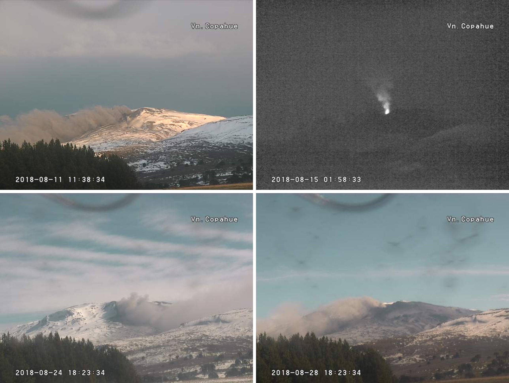 |
Figure 21. Low-level ash-and-gas emission at Copahue on 11, 24, and 28 of August 2018, and a plume and incandescence on 15 August. Webcam images courtesy of SERNAGEOMIN-OVDAS via CultureVolcan and Roberto Impaglione. |
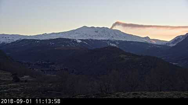 |
Figure 22. A plume from Copahue on 1 September 2018. Webcam image courtesy of SERNAGEOMIN-OVDAS via Roberto Impaglione. |
During September, October, and November, variable gas-and-steam and ash plumes were accompanied by visible incandescence at night. Continuous ash emission was observed from 16 to 30 November (figure 23); similar activity with plume heights up to 800 m from 1 to 6 December. On 2 December a Buenos Aires VAAC notice was issued for a narrow ash plume that drifted ESE. During 6-7 December an ash plume that rose up to 3 km altitude and drifted towards the SW was accompanied by a seismic swarm. No further ash emissions were noted through the end of the year.
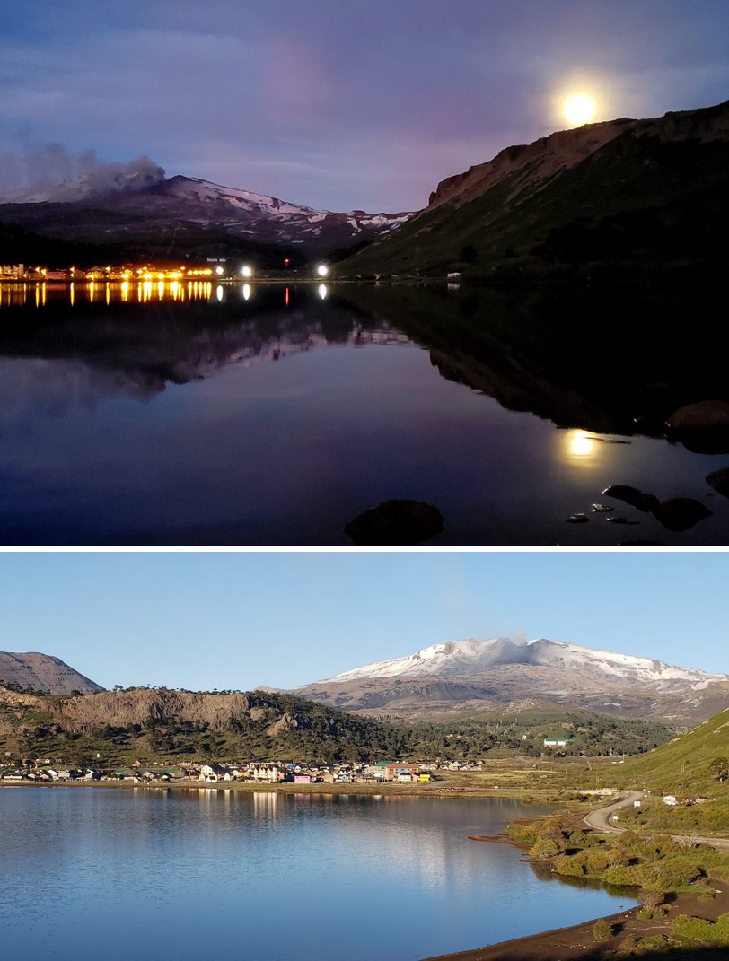 |
Figure 23. A low-lying plume at Copahue on the morning of 23 November 2018. Courtesy of Valentina. |
MIROVA (Middle InfraRed Observation of Volcanic Activity) data showed intermittent minor thermal activity at the summit from July through December. There were no thermal anomalies detected by the MODVOLC algorithm for this time period. Twenty cloud-free Sentinel-2 satellite images revealed elevated thermal activity (hotspots) within Agrio crater throughout the reporting period (figure 24).
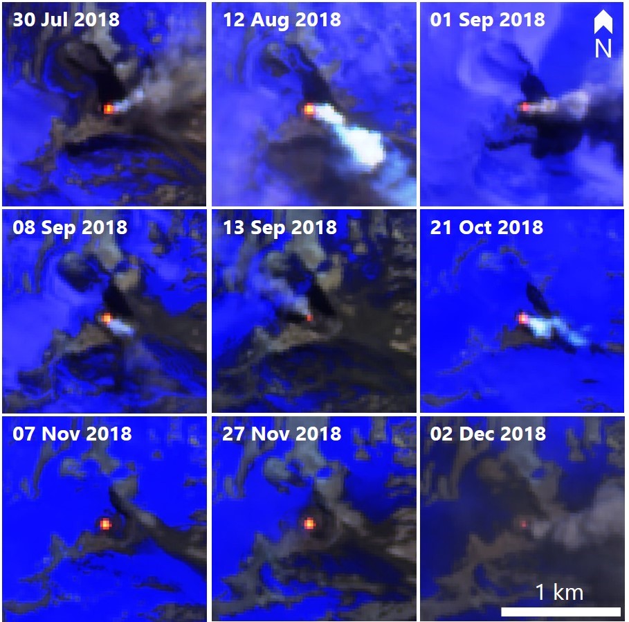 |
Figure 24. Thermal activity in the Copahue crater during 2018 seen in Sentinel-2 infrared images. The orange-yellow areas indicate high temperatures within the active Agrio crater. Courtesy of Sentinel Hub Playground. |
Information Contacts: Servicio Nacional de Geología y Minería (SERNAGEOMIN), Observatorio Volcanológico de Los Andes del Sur (OVDAS), Avda Sta María No. 0104, Santiago, Chile (URL: http://www.sernageomin.cl/); Oficina Nacional de Emergencia - Ministerio del Interior (ONEMI), Beaucheff 1637/1671, Santiago, Chile (URL: http://www.onemi.cl/); Buenos Aires Volcanic Ash Advisory Center (VAAC), Servicio Meteorológico Nacional-Fuerza Aérea Argentina, 25 de mayo 658, Buenos Aires, Argentina (URL: http://www.smn.gov.ar/vaac/buenosaires/inicio.php); Sentinel Hub Playground (URL: https://www.sentinel-hub.com/explore/sentinel-playground); MIROVA (Middle InfraRed Observation of Volcanic Activity), a collaborative project between the Universities of Turin and Florence (Italy) supported by the Centre for Volcanic Risk of the Italian Civil Protection Department (URL: http://www.mirovaweb.it/); Valentina (URL: https://twitter.com/valecaviahue, Twitter: @valecaviahue); Roberto Impaglione (URL: https://twitter.com/robimpaglione, Twitter: @robimpaglione); CultureVolcan (URL: https://twitter.com/CultureVolcan, Twitter: @CultureVolcan).
New ash emissions begin in early August; intermittent and ongoing through October 2019
Most of the large edifice of Copahue lies high in the central Chilean Andes, but the active, acidic-lake filled El Agrio crater lies on the Argentinian side of the border at the W edge of the Pliocene Caviahue caldera. Infrequent mild-to-moderate explosive eruptions have been recorded since the 18th century. The most recent eruptive episode with ash plumes lasted from early June 2017 to early December 2018. After 8 months of quiet, renewed phreatic explosions and ash emissions began in August 2019 and were ongoing through October 2019. This report summarizes activity from January through October 2019 and is based on reports issued by Servicio Nacional de Geología y Minería (SERNAGEOMIN) Observatorio Volcanológico de Los Andes del Sur (OVDAS), Buenos Aires Volcanic Ash Advisory Center (VAAC), satellite data, and photographs from nearby residents.
Intermittent steam plumes were reported from the El Agrio crater at the summit during January-July 2019, but no ash emissions were seen. An increase in seismicity and changes in the crater lake level during March led SERNAGEOMIN to increase the Alert Level from Green to Yellow at the beginning of April. Fluctuating tremor signals in the first week of August coincided with satellite imagery that showed the appearance of dark material, possibly ash, on the snow around the summit crater. The first thermal anomaly appeared on 3 September and the first clear ash explosions were recorded on 11 September. Eruptive activity was intermittent through the end of the month; a series of larger explosions beginning on 30 September caused SERNAGEOMIN to raise the Alert Level from Yellow to Orange. A period of more intense explosive activity lasted through the first week of October. The larger explosions then ceased, but during the rest of October there were continuing observations of seismicity, ash emissions, and incandescent ejecta, along with multiple thermal anomalies in the summit area.
Observations during January-April 2019. Copahue remained at Alert Level Yellow with a 1-km exclusion radius during January 2019 after ash emission in December 2018. Ongoing degassing was reported with white plumes from El Agrio crater rising to 355 m (figure 25). The Alert Level was lowered to Green at the end of the month, and the exclusion radius was reduced to 500 m, although intermittent low-level seismicity in the region continued. SERNAGEOMIN reported a M 3.2 earthquake about 10 km NE of the summit, 2 km deep, on 29 January 2019. The acidic lake inside El Agrio crater was quiet at the end of the month (figure 26).
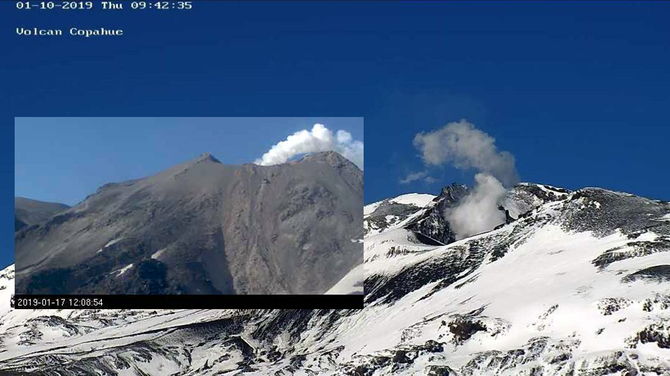 |
Figure 25. Degassing of steam from Copahue on 10 and 17 (inset) January 2019. Courtesy of OPTIC Neuquén (10 January) and SERNAGEOMIN (17 January). |
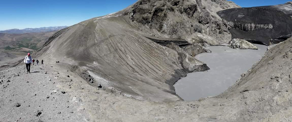 |
Figure 26. El Agrio crater at Copahue on 31 January 2019. Courtesy of Valentina Sepulveda, Hotel Caviahue. |
Steam plumes occasionally rose to 180 m above the crater during February 2019. A swarm of 117 volcano-tectonic (VT) seismic events on 22-23 February 2019 was located about 14 km NE of the volcano, with the largest events around a M 3.5. Steam plumes rose to about 280 m above the crater during March. SERNAGEOMIN noted an increase in seismicity during the month, and a decrease in the lake level within El Agrio crater. This led them to increase the Alert Level to Yellow (second on a four-level scale) at the beginning of April. Emissions remained minimal during April (figure 27); an 80 m high steam plume was reported on 4 April. The lake level continued to fall, based on satellite imagery, and a M 3.1 earthquake was reported on 29 April located about 10 km NE of the summit about 10 km deep.
 |
Figure 27. Clear skies revealed no activity from the summit of Copahue on 7 or April 2019. The volcano was quiet throughout the month, although the Alert Level remained at Yellow. Image taken near Caviahue, 10 km E in Argentina. Courtesy of Valentina Sepulveda, Hotel Caviahue. |
Observations during May-July 2019. Sporadic episodes of low-altitude steam plume degassing were noted during May 2019, but otherwise very little surface activity was reported (figure 28). On 13 May, a steam plume reached 160 m above the crater rim, and on 28 May, the tallest plume rose 200 m above the crater. Hybrid-type earthquakes were recorded early in the month, followed by a slow increase in the amplitude of the tremor signal. Seismicity increased slightly during the second half of the month with activity concentrated closer to the summit crater. A weak SO2 plume was recorded by satellite instruments on 23 May. The level of the lake began increasing during the second half of the month.
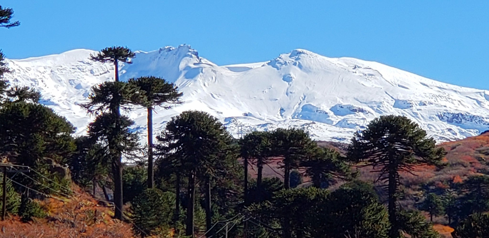 |
Figure 28. No surface activity was visible at Copahue on 5 May 2019, but seismicity increased slowly during the month. Image taken near Caviahue. Courtesy of Valentina Sepulveda, Hotel Caviahue. |
SERNAGEOMIN reported tremor signals with fluctuating amplitude throughout June 2019. Repeated episodes of low-altitude white degassing occurred around the El Agrio crater. On 7 June, a 300 m plume was observed above the crater; the level of the crater lake was variable. On 17 June a 400-m-tall white plume was observed above the crater. Seismicity, although low, increased during the second half of the month. Multiple episodes of low-altitude white degassing occurred around the active crater all during July 2019 (figure 29). On 9 July a plume rose about 450 m above the crater. On 16 July a white plume rose 250 m above the crater. SENAGEOMIN noted a rise in the rate of seismicity during the first half of the month; the tremor signal continued with fluctuating amplitude. Satellite instruments detected small SO2 plumes on 4 and 9 July (figure 30).
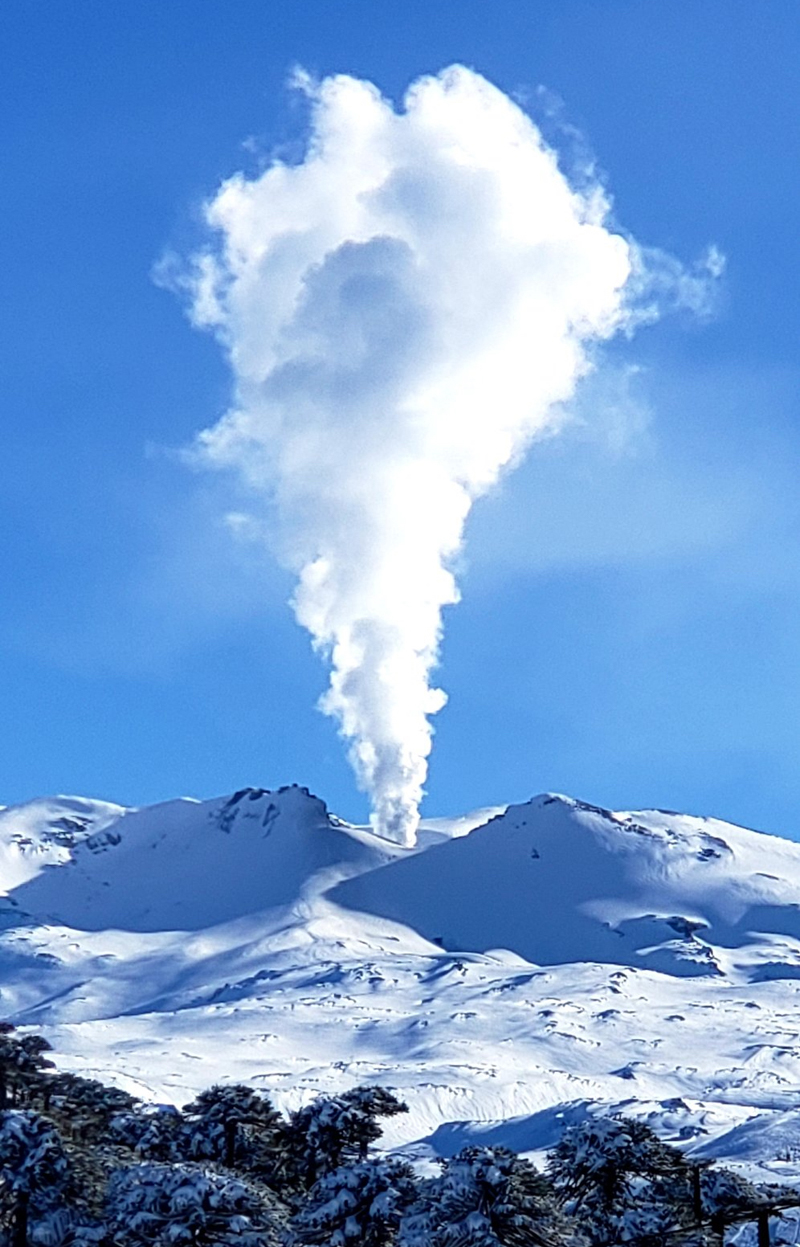 |
Figure 29. A steam plume rose a few hundred meters above the summit of Copahue on 23 July 2019. Courtesy of Valentina Sepulveda, Hotel Caviahue. |
 |
Figure 30. The TROPOMI instrument on the Sentinel-5P satellite detected small SO2 plumes at Copahue on 4 and 9 July 2019. Courtesy of NASA Goddard Space Flight Center. |
Activity during August-October 2019. Sentinel-2 satellite imagery from 2, 4, 7, and 9 August suggested the ejection of particulate material (figure 31), with dark streaks in the snow extending a few hundred meters E and SE from the crater. Images from the community of Caviahue on 3 and 4 August show distinct discoloration of the snow around the E side of the summit crater (figures 32 and 33). Small but discernible SO2 plumes were detected by satellite instruments on 2, 3, 16, 19, 30, and 31 August. Fluctuating tremor signals continued during August with several episodes of low-altitude white degassing from the El Agrio crater; a white plume on 5 August rose 380 m above the crater. The lake level continued to drop and the Alert Level remained at Yellow.
 |
Figure 31. Sentinel 2 satellite imagery of Copahue from late July and early August 2019 show fresh dark material deposited over the fresh winter snow, suggesting recent ejecta from the El Agrio crater. Top left: The summit was covered with fresh snow on 25 July 2019. Top right: A dark streak extends E then N from the El Agrio crater on 2 August. Bottom left: A streak of dark material trends SE from the crater over the snow on 4 August. Bottom Right: On 7 August a different streak extends E from the crater while fresh snow has covered the earlier streak. Courtesy of Sentinel Hub Playground. |
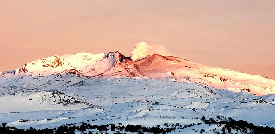 |
Figure 32. At sunset on 3 August 2019, darker material was visible on the snow on the E side of the summit of Copahue; a dense steam plume rose from El Agrio crater. Courtesy of Valentina Sepulveda, Hotel Caviahue. |
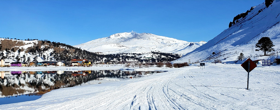 |
Figure 33. Particulates covered the fresh snow near the summit of Copahue on 4 August 2019, as seen from the community of Caviahue, about 10 km E. A steam plume rose from El Agrio crater. Courtesy of Valentina Sepulveda, Hotel Caviahue. |
Distinct SO2 plumes were again captured by satellite instruments on 1, 3, and 5-7 September 2019 (figure 34). The first thermal signature in nine months also appeared in Sentinel-2 satellite imagery on 3 September (figure 35). Midday on 9 September, seismometers recorded an increase in the amplitude of a continuous tremor. High clouds prevented clear views of the crater and no ash emissions were observed. Beginning on 11 September, low-energy long-period (LP) events were associated with infrasound signals and low-energy explosions that produced small ash plumes. The largest explosion produced a plume 250 m above the crater. Incandescence and high-temperature ejecta were observed around the emission point. The ash drifted ESE about 3 km. Ten explosions were reported between 11 and 12 September, associated with low-intensity acoustic signals and ash emissions. Plumes reached 430 m above the crater rim on 12 September. Ash deposits on the snow were visible in in Sentinel-2 images on 11 and 13 September, extending about 6 km E from El Agrio crater (figure 35). Images from the ground on 12 September indicated fresh ash on the E flank (figure 36).
 |
Figure 34. Small but distinct SO2 plumes from Copahue were measured by the TROPOMI instrument on the Sentinel 5P satellite on 1 and 3 September 2019, and additionally on 5-7 September. Courtesy of NASA Goddard Space Center. |
 |
Figure 35. Sentinel-2 satellite images indicated thermal activity and ash emissions at Copahue on 3, 11, and 13 September 2019. Left: The first thermal anomaly in nine months appeared on 3 September. Middle: An ash streak trended E across the snow from El Agrio crater on 11 September. On 13 September, the streak was a wider cone that extended ESE for about 6 km. Courtesy of Sentinel Hub Playground. |
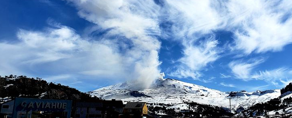 |
Figure 36. Ash deposits coated snow on the E flank of Copahue on 12 September 2019, while a steam plume drifted SE from the crater, as seen from the community of Caviahue about 10 km E in Argentina. Courtesy of Valentina Sepulveda, Hotel Caviahue. |
Although fresh snow had covered any ash deposits by 16 September 2019 (figure 37), small thermal anomalies appeared in Sentinel-2 imagery on 16 and 21 September. SO2 plumes were measured by satellite instruments on 21 and 25 September. Photos from Caviahue on 25 September showed ash on the E flank and a steam-and-ash plume drifting NE (figure 38). Ashfall on the snow was visible in satellite imagery on 26 September, and covered a larger area on 28 September; there was also a substantial thermal anomaly that day (figure 39).
 |
Figure 37. Fresh snow had covered over recent ash emissions at Copahue by 16 September 2019; thermal anomalies were detected in satellite data from the summit crater the same day. Courtesy of Valentina Sepulveda, Hotel Caviahue. |
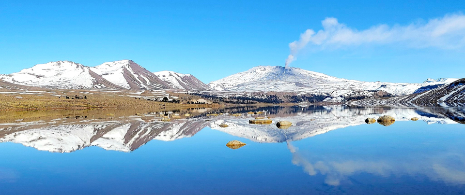 |
Figure 38. On a clear 25 September 2019 fresh ash covered snow on the E flank of Copahue, and an ash and steam plume was drifting NE from the El Agrio crater. The mountains are reflected in Lago Caviahue located about 12 km E in Argentina. Courtesy of Valentina Sepulveda, Hotel Caviahue. |
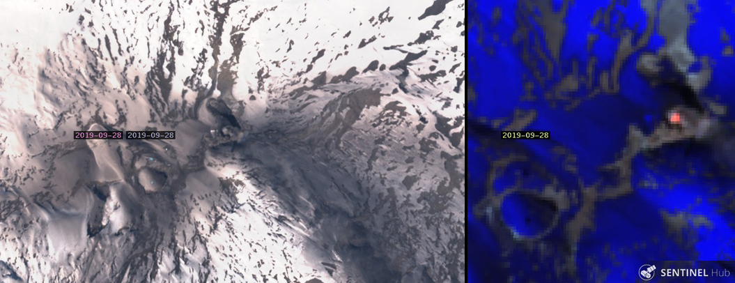 |
Figure 39. Sentinel-2 imagery of Copahue on 28 September showed ashfall in a large area around the summit and a small ash plume (left); a substantial thermal anomaly was also visible within the El Agrio crater (right). Courtesy of Sentinel Hub Playground. |
During the late afternoon of 30 September, three high-energy LP earthquakes were reported located 5.8 km NE of the El Agrio crater. They were accompanied by abundant lower energy earthquakes in the same area. The VT earthquakes were equivalent to a M 3.5. Inhabitants of Caviahue (12 km E) reported feeling several of the events; atmospheric conditions prevented observation of the summit. This sudden increase in seismicity prompted SERNGEOMIN to raise the Alert Level to Orange and increase the radius of the area of potential impact to 5 km. Seismicity (VT, LP and tremor earthquakes) continued at a high rate into 1 October. Argentina's geologic hazards and mining agency, Servicio Geologico Minero Argentino (SEGEMAR) also issued a notice of the increased warning level on 30 September (figure 40).
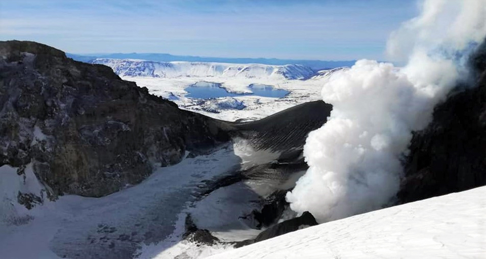 |
Figure 40. A dense steam plume rises from the active crater at Copahue in this image looking due E towards Caviahue and Lago Caviahue, 12 km E. The rim of the Caviahue caldera is in the distance. Argentina's SEGEMAR posted this photograph (undated) with their notice of the increase in warning level on 30 September 2019. Courtesy of SEGEMAR. |
Cameras near the volcano detected ash plumes associated with explosions around the crater at 0945 on 1 October 2019 which continued throughout the first week of the month. Satellite imagery showed streaks of dark ash over snow trending SE and E and from the summit on 1 and 8 October (figure 41). Five separate explosions were recorded during 1-2 October. Persistent degassing was accompanied by episodes of ash emissions and incandescence at night. Seismicity continued during 2-3 October, but poor weather mostly obscured visual evidence of activity; a few pulses of white and gray emissions were observed. Seismic events were located 5-7 km NE at a depths of 0.7-1.7 km, and continued for several days. Clearer skies on 4 October revealed steam plumes and pulses of ash rising from El Agrio crater. Incandescence was visible at night. A ground-based image showed ash covering the E flank and an ash plume drifting NE down the flank (figure 42). The Buenos Aires VAAC reported weak ash emissions on 4 October moving NE at 3.4 km altitude. The webcam showed continuous ash emission from the summit during 4-5 October.
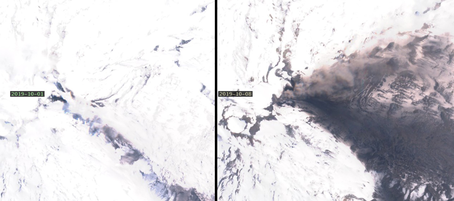 |
Figure 41. Sentinel-2 satellite imagery of Copahue showed dark streaks trending SE and E from the summit in early October. On 1 October 2019 (left) there was a narrow streak of ash to the SE and a steam plume drifting the same direction. On 8 Octobe0r (right), a wide cone of ashfall covered the E flank, and a plume of gray ash drifted NE over the edge of the deposit. Courtesy of Sentinel Hub Playground. |
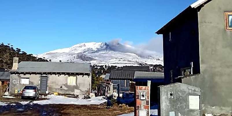 |
Figure 42. Gray ash covered areas of Copahue's E flank on 4 October 2019 and an ash plume drifted NE down the flank. Image from Caviahue, about 10 km E. Courtesy of Valentina Sepulveda, Hotel Caviahue. |
White steam plumes with pulses of ash and incandescence at night were observed on 5 and 6 October. Seismic activity decreased on 6 October. The following day, SERNAGEOMIN lowered the Alert Level to Yellow and reduced the restricted zone to 1,000 m around the summit crater. While seismicity had decreased, ash emissions continued from low-level pulsating explosions which produced ash plumes that drifted E (figure 43). They observed that the total area to that date affected by ashfall was about 24.5 km2, extending up to 5 km W and 6 km E from the summit. They also noted that a pyroclastic cone about 130 m across had appeared inside the crater. Ash emissions and explosions with incandescent ejecta continued during the second week of October (figure 44). A change in wind direction created a several-kilometer-long streak of ash trending SW from the summit by 13 October; a strong thermal anomaly that day indicated continued activity (figure 45). SO2 plumes were recorded by satellite instruments on 1, 3, 4, and 13 October.
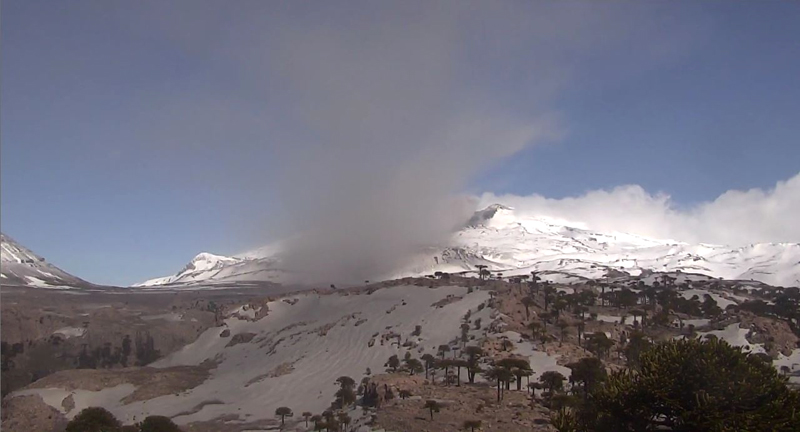 |
Figure 43. Ash and steam drifted E from the summit of Copahue on 7 October 2019, the day that SERNAGEOMIN lowered the Alert Level from Orange to Yellow. Courtesy of SEGEMAR. |
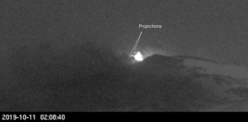 |
Figure 44. Incandescent ejecta was visible at the summit of Copahue overnight on 11 October 2019 in the image from a local webcam. Courtesy of Culture Volcan. |
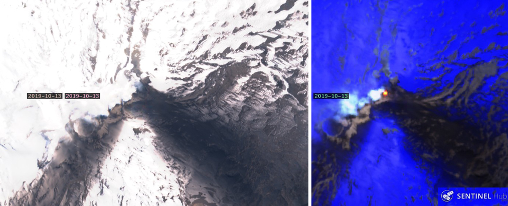 |
Figure 45. A new dark streak of ash on snow trended SW from the El Agrio crater at Cophahue on 13 October 2019. The strong thermal anomaly the same day indicated the level of eruptive activity was still high. Natural color image based on bands 4,3, and 2; Atmospheric penetration rendering based on bands 12, 11, and 8a. Courtesy of Sentinel Hub Playground. |
Seismicity continued for the rest of October, but no explosions were recorded. Sulfur dioxide emissions were recorded by satellite instruments on 18, 22, 23, and 30 October (figure 46). When weather permitted, constant degassing with episodes of ash emissions from the crater were visible during the day and incandescence appeared at night. Satellite imagery on 18, 23, and 28 October showed substantial ash plumes drifting in different directions from the summit. A large area around the summit crater was covered with dark ash on 18 and 23 October. Fresh snowfall had covered most of the area by 28 October, and the narrow dark streak trending SE underneath the ongoing ash plume was the only surface covered with material (figure 47). Distinct thermal anomalies appeared in satellite images on 16, 18, 23, and 31 October. A number of thermal alerts were recorded by the MIROVA system as well during the second half of the month.
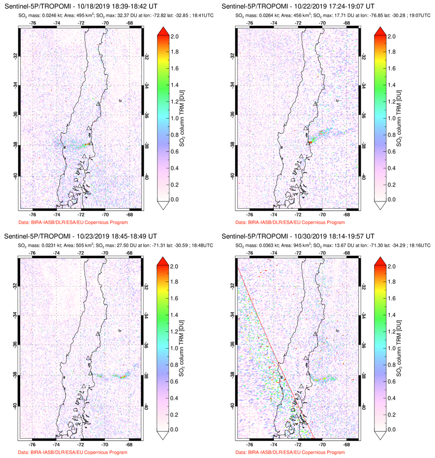 |
Figure 46. The TROPOMI instrument on the Sentinel-5P satellite recorded SO2 emissions from Copahue on 18, 22, 23, and 30 October 2019. Satellite imagery on also showed ash plumes on 18 and 23 October. Courtesy of NASA Goddard Space Flight Center. |
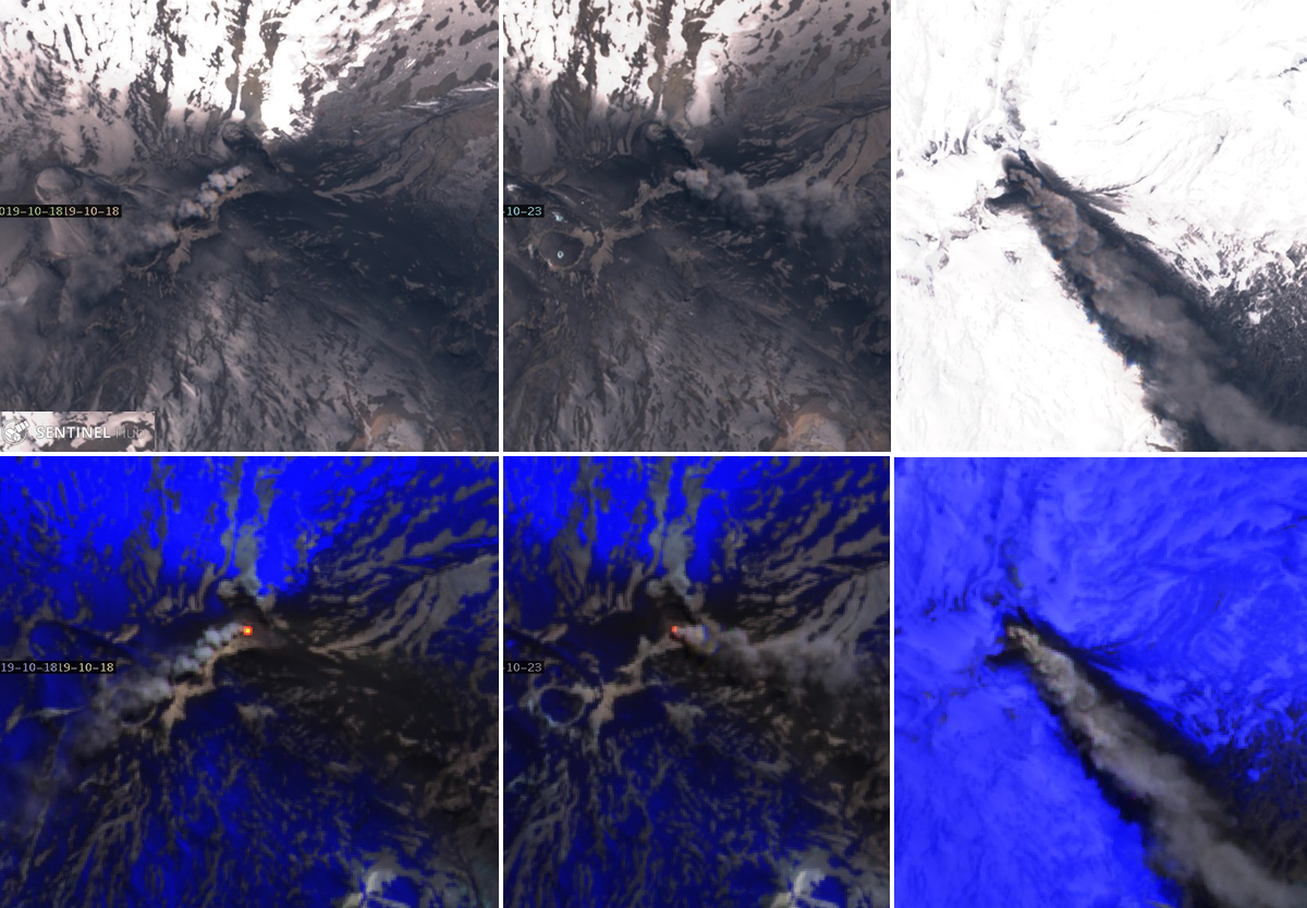 |
Figure 47. Distinct ash plumes and dark ashfall over snow on 18, 23, and 28 October 2019 at Copahue indicated ongoing eruptive activity (top row) through the end of the month. The large area of ash-covered snow visible on 18 and 23 October was covered with fresh snowfall by 28 October when the dense ash plume drifting SE left only a narrow dark trail of ashfall in the fresh snow underneath (right). Strong thermal anomalies were apparent on 18 and 23 October but obscured by dense ash on 28 October (bottom row). Natural color image based on bands 4, 3, and 2; atmospheric penetration rendering based on bands 12, 11, and 8a. Courtesy of Sentinel Hub Playground. |
The highest plume noted by SERNAGEOMIN during the second half of the month rose 1,200 m above the crater on 22 October 2019 (figure 48). The Buenos Aires VAAC reported ash emissions from the summit visible in webcams almost every day in October. On 16 October, an ash plume was seen in satellite imagery moving SE at 3.4 km altitude under mostly clear skies; the webcam showed continuous ash emission. A faint plume was barely seen moving S in satellite imagery at 3.4 km altitude on 18 October; the webcam revealed continuous emission of gases and possible dilute volcanic ash. The VAAC reported ash emissions daily from 18-25 October. Drift directions varied from SE, moving to NE on 21-23 October, and back to E and SE the following days. The altitudes ranged from 3.0 to 4.3 km. On 20 October, the plume extended about 80 km SE. The ash appeared as pulses moving NE on 22 and 23 October at 4.3 km altitude. Emissions reappeared in satellite imagery on 28 and 30-31 October, drifting SE and NE at 3.4-3.7 km altitude; incandescence was visible overnight on 30-31 October from the webcam.
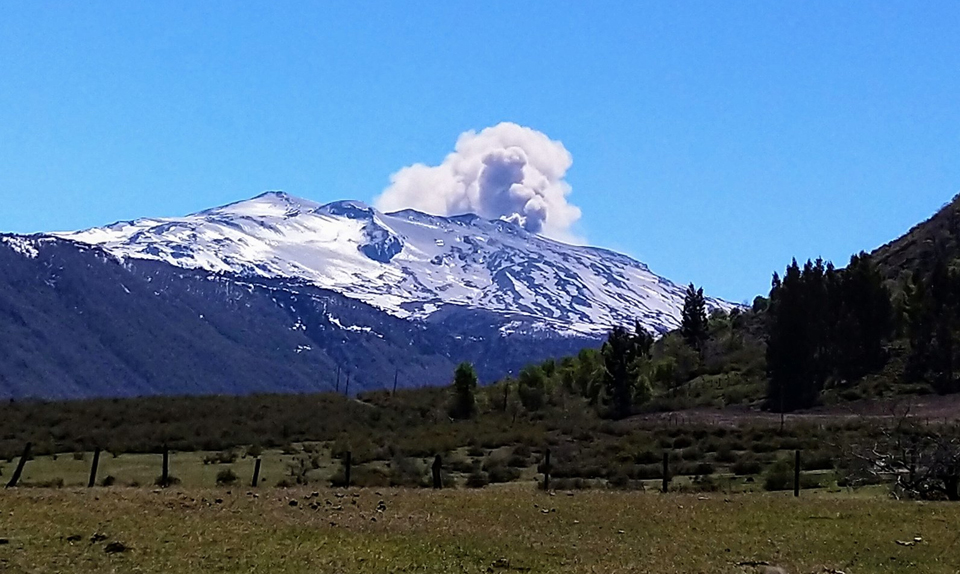 |
Figure 48. A plume of ash and steam from Copahue rose 1,200 m above the summit on 22 October 2019 and drifted NE. It was clearly visible from 25 km SW of the volcano in the El Barco Indigenous community of Alto Biobío, Chile, along with ash-covered snow on the SW flank. Courtesy of EveLyN. |
Information Contacts: Servicio Nacional de Geología y Minería (SERNAGEOMIN), Observatorio Volcanológico de Los Andes del Sur (OVDAS), Avda Sta María No. 0104, Santiago, Chile (URL: http://www.sernageomin.cl/); OPTIC Neuquén, Oficina Provincial de Tecnologías de la Información y la Comunicación- Gobierno de la Provincia del Neuquén, Neuquén, Argentina (URL: https://www.neuqueninforma.gob.ar/tag/optic/, Twitter: @OPTIC_Nqn, https://twitter.com/OPTIC_Nqn); Global Sulfur Dioxide Monitoring Page, Atmospheric Chemistry and Dynamics Laboratory, NASA Goddard Space Flight Center (NASA/GSFC), 8800 Greenbelt Road, Goddard, Maryland, USA (URL: https://so2.gsfc.nasa.gov/); Sentinel Hub Playground (URL: https://www.sentinel-hub.com/explore/sentinel-playground); Valentina Sepulveda, Hotel Caviahue, Caviahue, Argentina (URL: https://twitter.com/valecaviahue, Twitter:@valecaviahue); Cultur Volcan, Journal d'un volcanophile, (URL: https://laculturevolcan.blogspot.com, Twitter: @CulturVolcan); EveLyn, Twitter: @EveCaCid (URL: https://twitter.com/EveCaCid/status/1186663015271321601).
Ash emissions end on 12 November; lake returns to El Agrio Crater in December 2019
Most of the large edifice of Copahue lies high in the central Chilean Andes, but the active El Agrio crater lies on the Argentinian side of the border at the W edge of the Pliocene Caviahue caldera. Infrequent mild-to-moderate explosive eruptions have been recorded since the 18th century. The most recent eruptive episode began with phreatic explosions and ash emissions on 2 August 2019 that continued until mid-November 2019. This report summarizes activity from November 2019 through February 2020 and is based on reports issued by Servicio Nacional de Geología y Minería (SERNAGEOMIN) Observatorio Volcanológico de Los Andes del Sur (OVDAS), Buenos Aires Volcanic Ash Advisory Center (VAAC), satellite data, and photographs from nearby residents.
MIROVA data indicated a few weak thermal anomalies during mid-October to mid-November 2019. Multiple continuous ash emissions were reported daily until mid-November when activity declined significantly. By mid-December the lake inside El Agrio crater had reappeared and occasional steam plumes were the only reported surface activity at Copahue through February 2020.
The Buenos Aires VAAC and SERNAGEOMIN both reported continuous ash emissions during 1-9 November 2019 that were visible in the webcam. Satellite imagery recorded the plumes drifting generally E or NE at 3.0-4.3 km altitude (figure 49). Most of the emissions on 10 November were steam (figure 50). The last pulse of ash emissions occurred on 12 November with an ash plume visible moving SE at 3 km altitude in satellite imagery and a strong thermal anomaly (figure 51). The following day emissions were primarily steam and gas. SERNAGEOMIN noted the ash emissions rising around 800 m above El Agrio crater and also reported incandescence visible during most nights through mid-November. During the second half of November the constant degassing was primarily water vapor with occasional nighttime incandescence. Steam plumes rose 450 m above the crater on 27 November.
 |
Figure 49. Continuous ash emissions at Copahue during 1-9 November 2019 were visible in Sentinel-2 satellite imagery on 2 and 7 November 2019 drifting NE. Natural color rendering uses bands 4,3, and 2. Courtesy of Sentinel Hub Playground. |
 |
Figure 50. Most of the emissions from Copahue on 10 November 2019 were steam. Left image courtesy of Valentina Sepulveda, taken from Caviahue, Argentina. Right image courtesy of Sentinel Hub Playground, natural color rendering using bands 4, 3, and 2. |
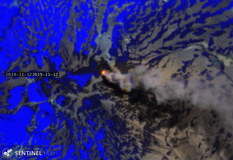 |
Figure 51. A strong thermal anomaly and an ash plume at Copahue were visible in Sentinel-2 satellite imagery on 12 November 2019. Courtesy of Sentinel Hub Playground, Atmospheric penetration rendering bands 12, 11, and 8A. |
Nighttime incandescence was last observed in the SERNAGEOMIN webcam on 1 December; SERNAGEOMIN lowered the alert level from Yellow to Green on 15 December 2019. Throughout December degassing consisted mainly of minor steam plumes (figure 52), the highest plume rose to 300 m above the crater on 18 December, and minor SO2 plumes persisted through the 21st (figure 53),. By mid-December the El Agrio crater lake was returning and satellite images clearly showed the increase in size of the lake through February (figure 54). The only surface activity reported during January and February 2020 was occasional white steam plumes rising near El Agrio crater.
 |
Figure 52. Small wisps of steam were the only emissions from Copahue on 3 December 2019. Courtesy of Valentina Sepulveda, taken from Caviahue, Argentina. |
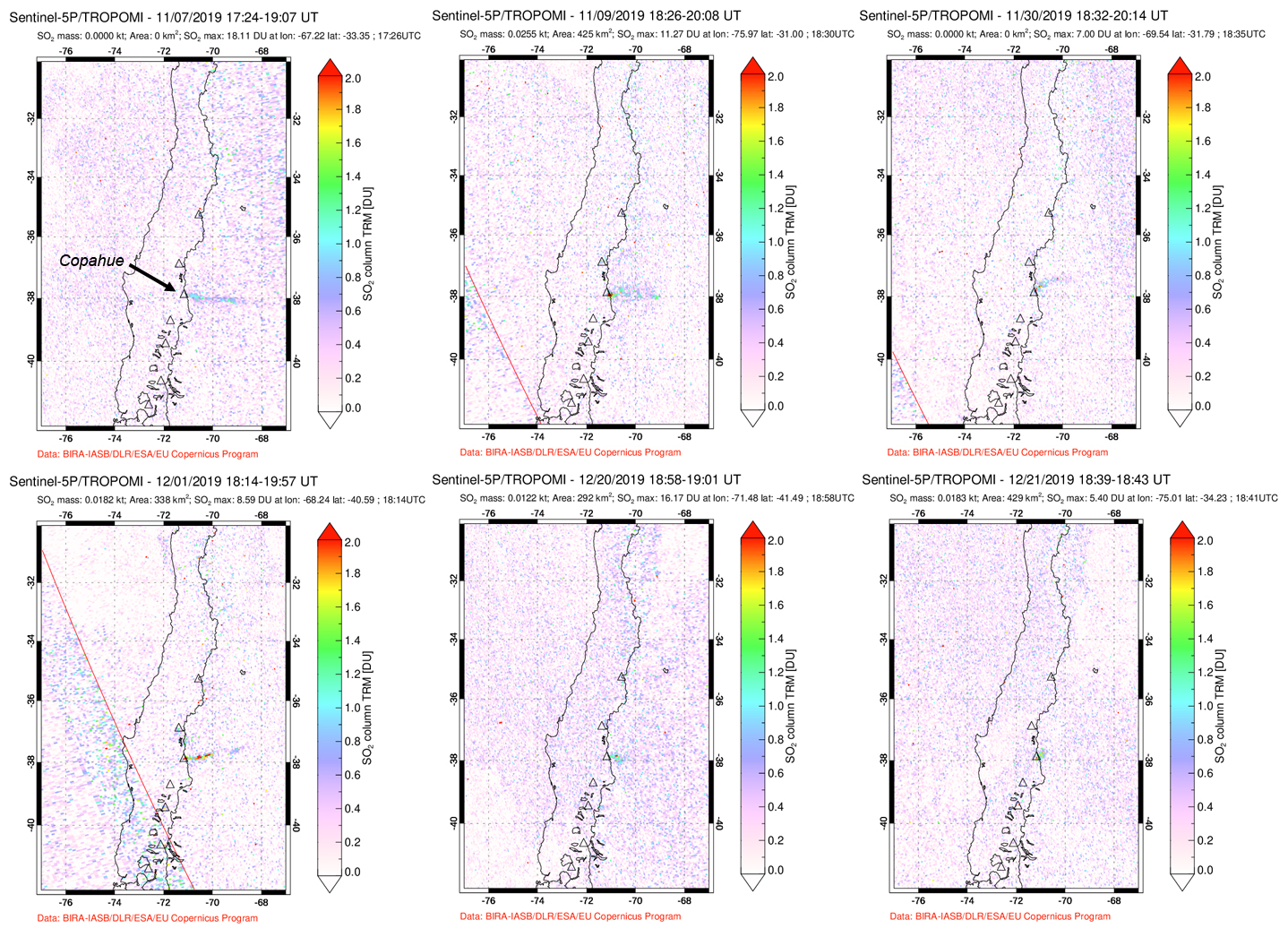 |
Figure 53. Small plumes of SO2 were recorded at Copahue during November and December 2019. Top row: 7, 9, and 30 November. Bottom row: 1, 20, and 21 December. Courtesy of Global Sulfur Dioxide Monitoring Page, NASA. |
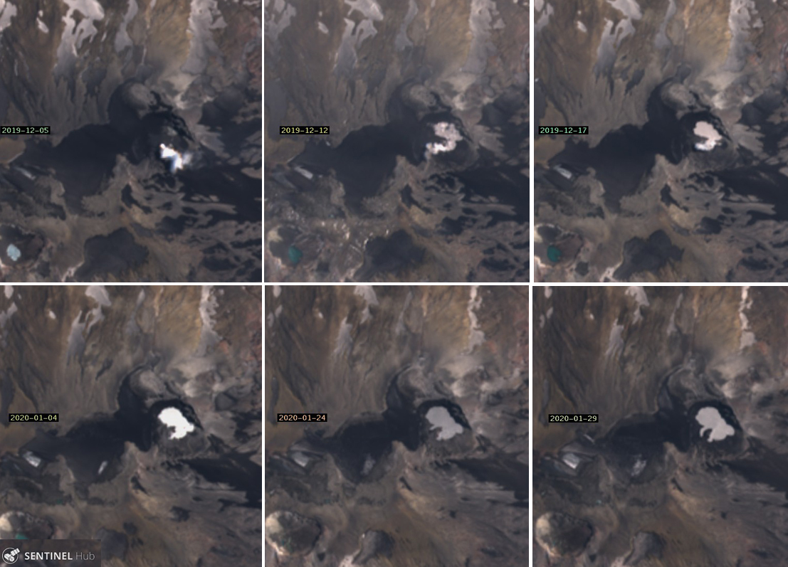 |
Figure 54. The lake within El Agrio crater reappeared between 5 and 12 December 2019 and continued to grow in size through the end of January 2020. Top row (left to right): There was no lake inside the crater on 5 December 2019, only a small steam plume rising from the vent. The first water was visible on 12 December and was slightly larger a few days later on 17 December. Bottom row (left to right): the lake was significantly larger on 4 January 2020 filling an embayment close to the steam vent. Fingers of water filled in areas of the crater as the water level rose on 24 and 29 January. Courtesy of Sentinel Hub Playground. |
Information Contacts: Servicio Nacional de Geología y Minería (SERNAGEOMIN), Observatorio Volcanológico de Los Andes del Sur (OVDAS), Avda Sta María No. 0104, Santiago, Chile (URL: http://www.sernageomin.cl/); MIROVA (Middle InfraRed Observation of Volcanic Activity), a collaborative project between the Universities of Turin and Florence (Italy) supported by the Centre for Volcanic Risk of the Italian Civil Protection Department (URL: http://www.mirovaweb.it/); Sentinel Hub Playground (URL: https://www.sentinel-hub.com/explore/sentinel-playground); Global Sulfur Dioxide Monitoring Page, Atmospheric Chemistry and Dynamics Laboratory, NASA Goddard Space Flight Center (NASA/GSFC), 8800 Greenbelt Road, Goddard, Maryland, USA (URL: https://so2.gsfc.nasa.gov/); Valentina Sepulveda, Hotel Caviahue, Caviahue, Argentina (URL: https://twitter.com/valecaviahue, Twitter:@valecaviahue).
New eruption in June-October 2020 with crater incandescence, ash plumes, and local ashfall
Copahue is an elongated composite cone located along the Chile-Argentina border. The E summit crater consists of an acidic 300-m-wide crater lake which is characterized by intense fumarolic activity. Previous activity consisted of continuous gas-and-ash emissions during early November 2019, accompanied by nighttime incandescence, minor SO2 plumes, and the reappearance of the lake in the El Agrio crater during early December 2019 (BGVN 45:03). This report, covering March-November 2020, describes an eruption with gas-and-ash plumes from mid-June through late October, accompanied by thermal anomalies visible in satellite imagery and small SO2 plumes. Primary information for this report comes from the Servicio Nacional de Geología y Minería (SERNAGEOMIN) Observatorio Volcanológico de Los Andes del Sur (OVDAS), the Buenos Aires Volcanic Ash Advisory Center (VAAC), and various satellite data.
Activity during March-May 2020 was relatively low and consisted primarily of seismicity, sulfur dioxide emissions, and occasional white gas-and-steam emissions rising 300-900 m above the El Agrio crater. On 20 March a series of volcano-tectonic seismic events were detected SSW of the volcano; satellite images showed a decrease in the size of the crater lake. SO2 emissions had daily averages of 487-636 tons, with the highest value reaching 1,884 tons/day on 16 May. During April slight subsidence was reported in the crater, occurring at a maximum rate of 0.3 cm/month.
Activity during most of June and July consisted of occasional white gas-and-steam emissions rising 350-500 m above the El Agrio crater and SO2 emissions averaging 592-1,950 tons/day; a high value of 1,897 tons/day was reported on 13 June. However, on 16 June a period of increased seismicity was accompanied by crater incandescence and gas emissions containing some ash. SO2 plumes increased slightly in July with values of 2,100 and 1,713 tons/day on 2 and 4 July, respectively. Another ash plume was observed by local residents on 16 July, accompanied by elevated seismicity and SO2 emissions of 4,684 tons/day. On 20 July residents of La Araucanía described an odor that indicated hydrogen sulfide gas emissions. A photo on 23 July showed an ash plume rising above the crater (figure 55).
 |
Figure 55. Photo of a gas-and-ash plume rising from Copahue on 23 July 2020. Courtesy of Valentina Sepulveda, taken from Caviahue, Argentina. |
Beginning in early August, and continuing through September 2020, the Sentinel-2 MODIS Thermal Volcanic Activity graph provided by the MIROVA system identified a small cluster of thermal anomalies in the summit area (figure 56). Thermal anomalies during this time were also captured in Sentinel-2 thermal satellite imagery, showing a persistent hotspot of varying strength in the summit crater (figure 57). This thermal activity was accompanied by small sulfur dioxide plumes identified by the TROPOMI instrument on the Sentinel-5P satellite, which exceeded two Dobson Units (DU). Distinct SO2 emissions greater than two DUs were detected on 6, 11, 21, 22, and 29 August, 1 and 6 September, and 4 and 15 October (figure 58).
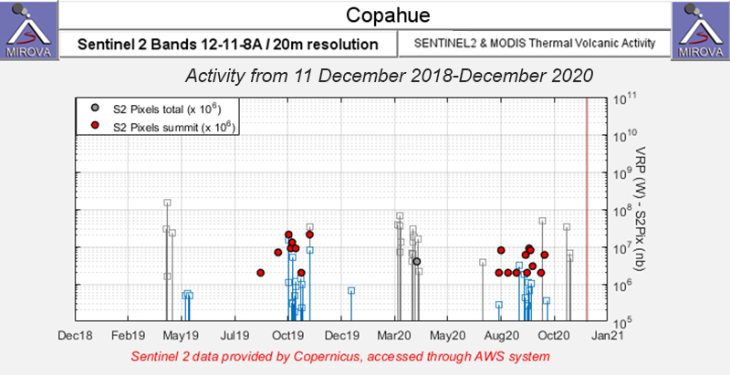 |
Figure 56. A small cluster of thermal anomalies were detected in the summit area of Copahue (red dots) during early August through September 2020 as recorded by the Sentinel-2 MODIS Thermal Volcanic Activity data (bands 12, 11, 8A). Courtesy of MIROVA. |
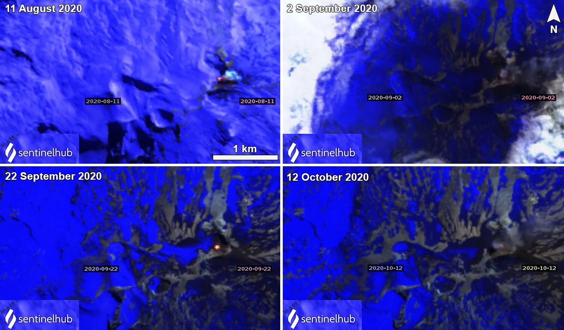 |
Figure 57. Sentinel-2 thermal satellite imagery showed a thermal anomaly (bright yellow-orange) at Copahue during August-October 2020. Images using “Atmospheric penetration” rendering (bands 12, 11, 8a). Courtesy of Sentinel Hub Playground. |
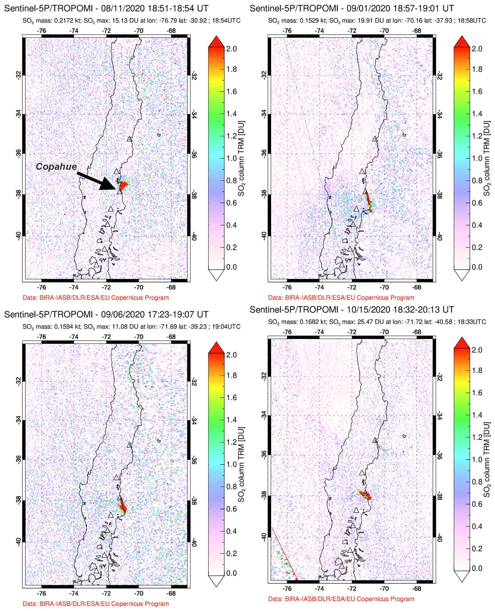 |
Figure 58. Small SO2 plumes were recorded at Copahue during August-October 2020. Top row: 11 August and 1 September 2020. Bottom row: 6 September and 15 October 2020. Courtesy of the NASA Global Sulfur Dioxide Monitoring Page. |
During August, approximately 133 explosive events were detected, in addition to the gas-and-steam and SO2 emissions (figure 59). On 3 August pulses of ash emissions were reported by SERNAGEOMIN, which resulted in a 2.2-km-long tephra deposit estimated to have a volume of 1 km3. Gray gas-and-ash emissions were observed on 6 August, followed by a thermal anomaly detected in satellite imagery beginning on 8 August. Sulfur dioxide emissions were elevated compared to previous months, measuring an average of 2,641 tons/day with high values of 4,498 tons/day on 12 August that increased to 4,627 tons/day by 27 August. During 16-31 August webcams recorded gas-and-ash plumes rising as high as 1.7 km altitude and were sometimes accompanied by nighttime crater incandescence. Plumes drifted in multiple directions as far as 4.3 km N, 9 km NE, 8 km E, 4 km SE, 4 km SW, 9 km W, and 4.4 km NW.
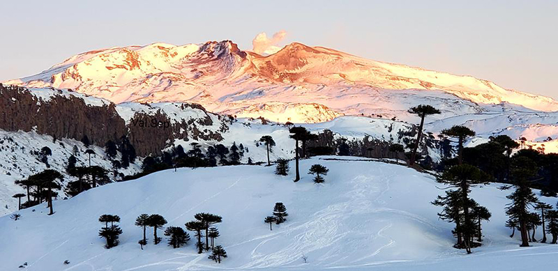 |
Figure 59. Photo of a white gas-and-steam plume rising from Copahue on 12 August 2020. Courtesy of Valentina Sepulveda, taken from Caviahue, Argentina. |
Elevated activity continued into September with 2-10 explosive events detected during the month; during 1-15 September webcams recorded gas-and-ash plumes rising to 1.1 km altitude, drifting 6-15 km SW and SE, which were sometimes accompanied by nighttime crater incandescence (figure 60). On 7 September a Buenos Aires VAAC advisory reported an ash plume rising to 3.7 km altitude drifting SE. On 11 September a webcam showed a weak gas emission, possibly containing some ash. Three episodes of gas-and-steam plumes were reported, rising 100-1,040 m above the crater, sometimes accompanied by incandescence. SO2 emissions were in the 1,499-1,714 tons/day range, with a high value of 4,522 tons/day on 28 September. SERNAGEOMIN reported repetitive explosions in the acid lake area alongside fumarolic activity, ejecting some material 1.7 km N, 1.2 km SE, and 4 km E of the crater.
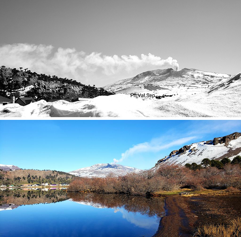 |
Figure 60. Photos of gas-and-steam plumes rising from Copahue on 6 September (top) and 28 September (bottom) 2020. Courtesy of Valentina Sepulveda, taken from Caviahue, Argentina. |
Persistent activity in October consisted of gas-and-steam plumes, ash emissions, and SO2 emissions. The gas-and-steam plumes rose 1.4 km above the crater, occasionally accompanied by nighttime incandescence. On 5 October the SO2 emissions were at a high value of 3,824 tons/day. During 12-15 October ash emissions resulted in a wide distribution of ashfall that reached 6.8 km NE, 7 km SE, and 6.7 km SW (figure 61). A pilot reported an ash plume rose to 3.7 km altitude drifting SE, according to a VAAC advisory, though the plume was not visible in satellite data. Sentinel-2 satellite imagery recorded strong gas-and-ash plumes during August-October, drifting generally S and E, which resulted in ash deposits on the nearby flanks (figure 62). Continued emissions had covered all of the flanks with ash by late October.
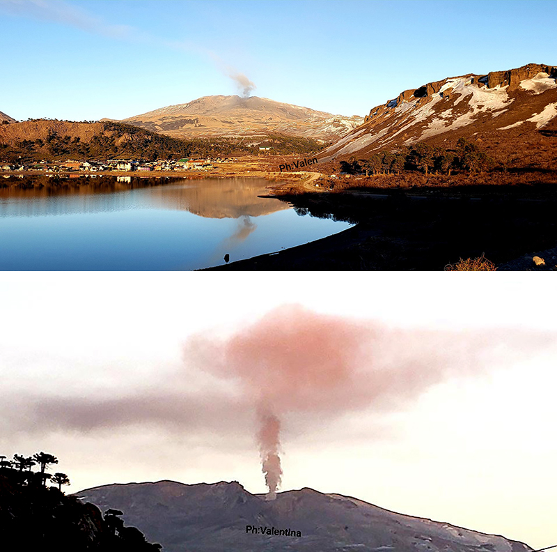 |
Figure 61. Photos of a gas-and-ash plume rising from Copahue on 13 October (top) and 15 October (bottom) 2020. Courtesy of Valentina Sepulveda, taken from Caviahue, Argentina. |
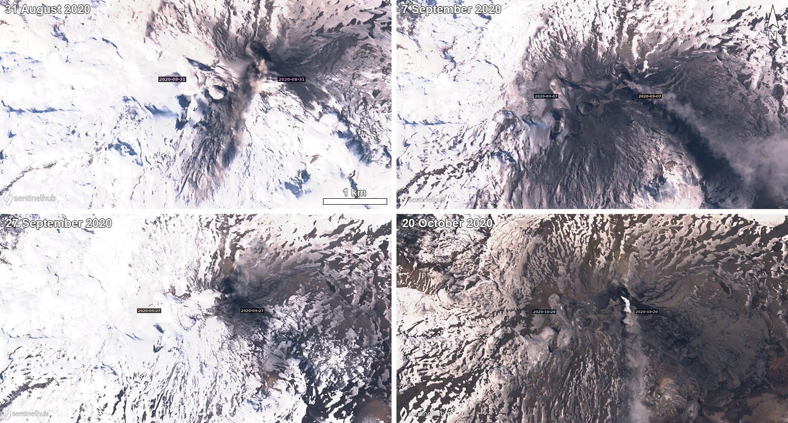 |
Figure 62. Sentinel-2 images showing ash gas-and-ash plumes rising from Copahue during August-October 2020, resulting in some ashfall in the nearby areas. The ash plume on 31 August (top left) is drifting S with ashfall observed on the N and S flanks. The ash plume on 7 September (top right) is drifting SE with ashfall on the E and S flanks. The ash plume on 27 September (bottom left) is drifting E and N with ashfall on the NE flanks. The ash plume on 20 October (bottom right) is drifting S with ashfall on all the flanks due to continued activity. Images using “Natural color” rendering (bands 4, 3, 2). Courtesy of Sentinel Hub Playground. |
Similar activity during November decreased, primarily characterized by gas-and-steam plumes and SO2 emissions. White gas-and-steam emissions, possibly with some ash content, were observed with a webcam on 9 and 12 November, accompanied by low but continuous seismicity. During 11-12 November SO2 emissions were at a high value of 904 tons/day. A white gas-and-steam plume was observed on 15 November rising 760 m above the crater; typical degassing rose 200-300 m above the crater, according to SERNAGEOMIN. The daily average of SO2 emissions ranged 366-582 tons.
Information Contacts: Servicio Nacional de Geología y Minería (SERNAGEOMIN), Observatorio Volcanológico de Los Andes del Sur (OVDAS), Avda Sta María No. 0104, Santiago, Chile (URL: http://www.sernageomin.cl/); MIROVA (Middle InfraRed Observation of Volcanic Activity), a collaborative project between the Universities of Turin and Florence (Italy) supported by the Centre for Volcanic Risk of the Italian Civil Protection Department (URL: http://www.mirovaweb.it/); Global Sulfur Dioxide Monitoring Page, Atmospheric Chemistry and Dynamics Laboratory, NASA Goddard Space Flight Center (NASA/GSFC), 8800 Greenbelt Road, Goddard, Maryland, USA (URL: https://so2.gsfc.nasa.gov/); Sentinel Hub Playground (URL: https://www.sentinel-hub.com/explore/sentinel-playground); Valentina Sepulveda, Hotel Caviahue, Caviahue, Argentina (URL: https://twitter.com/valecaviahue, Twitter: @valecaviahue).
Notable ash plume on 10 August 2021; frequent SO2 emissions and nighttime incandescence
Copahue, located along the Chile-Argentina border, contains an E summit crater with an acidic 300-m-wide crater lake that has been characterized by intense fumarolic activity. Common activity includes gas-and-ash plumes, crater incandescence, and local ashfall (BGVN 45:12). This report updates activity from November 2020 through October 2021, describing a single ash plume on 10 August 2021 along with dominantly gas-and-steam emissions, volcano-tectonic tremors, and occasional nighttime incandescence. Information primarily comes from the Servicio Nacional de Geología y Minería (SERNAGEOMIN) Observatorio Volcanológico de Los Andes del Sur (OVDAS), the Buenos Aires Volcanic Ash Advisory Center (VAAC), and various satellite data.
Activity during November-December 2020 was relatively low. On 31 October and 1-2 November 2020 pilot reports noted ash plumes, though they were not observed in satellite or webcam data. However, Sentinel-2 natural color satellite imagery from 1 November showed ash deposits on the E flank (figure 63) SERNAGEOMIN reported that 80 volcano-tectonic tremor events were recorded during November. White gas-and-steam emissions were also detected rising 200-300 m above the crater and on 15 November they rose 760 m high; no nighttime incandescence was observed since October. Sulfur dioxide emissions were measured using Differential Optical Absorption Spectroscopy (DOAS) and recorded an average value of 366 ± 129 tons/day (t/d) during November, the highest of which was 578 t/d on 21 November. Similar activity continued in December, with 57 volcano-tectonic tremors and 543 long-period tremors (LP). Gas-and-steam emissions rose 740 m above the crater, based on webcam images. The average SO2 value was 642 ± 85 t/d with a daily maximum value of 1,952 t/d on 14 December.
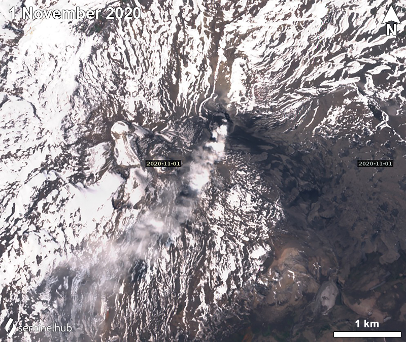 |
Figure 63. Sentinel-2 satellite image showing a strong gas-and-ash plume drifting SW from Copahue on 1 November 2020. Ash deposits (dark gray) were visible on the E flank. Images using “Natural color” rendering (bands 4, 3, 2). Courtesy of Sentinel Hub Playground. |
Similar low activity continued into January 2021, with 116 volcano-tectonic tremors and 4 LP events. Gas-and-steam emissions rose 240 m above the crater, which included SO2 emissions that was an average value of 327 ± 40 t/d; the daily maximum value was 631 t/d on 15 January. During February 198 volcano-tectonic events and 7 LP events were detected. SO2 emissions averaged 254 ± 34 t/d with a daily maximum value of 701 t/d on 4 February.
The number of seismic events during March decreased to 31 volcano-tectonic events and 3 LP events. Gas-and-steam emissions rose 260-320 m above the crater; the average SO2 value was 332 ± 45 t/d with a maximum value of 731 t/d on 11 March. Another 31 volcano-tectonic events and 1 LP event were detected in April. SO2 emissions averaged 430 ± 24 t/d. The highest value was 800 t/d on 14 April.
During May 24 volcano-tectonic events and 5 LP events were detected as degassing plumes rose 200 m above the crater. The average SO2 value was 392 ± 50 t/d with a maximum daily value of 783 t/d on 12 May. Volcano-tectonic tremors continued to decline to 2 LP events during June. During 30 June to 2 July tremor was elevated and the volume of the water in the crater lake decreased significantly. Nighttime incandescence was visible in webcam images, accompanied by gas-and-steam emissions. Similarly, beginning in June and going through November 2021, the Sentinel-2 MODIS Thermal Volcanic Activity graph provided by the MIROVA system identified a small cluster of thermal anomalies in the summit area (figure 64). Weak thermal anomalies in the summit crater were also captured in Sentinel-2 infrared satellite images that were sometimes accompanied by white gas-and-steam plumes (figure 65). Residents reported smelling a gaseous smell. DOAS measurements recorded an average SO2 value of 1,515 ± 761 t/d with a daily maximum value of 14,389 t+/d on 2 July.
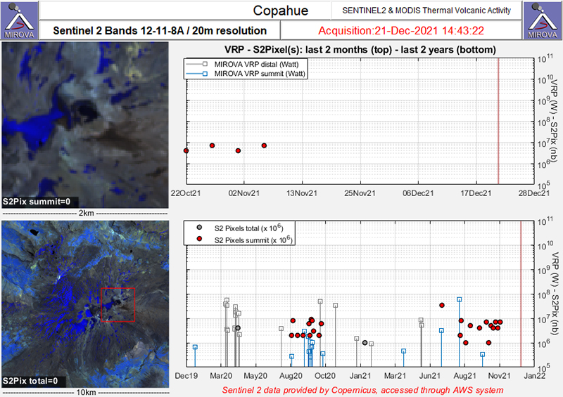 |
Figure 64. Two clusters of thermal anomalies were detected in the summit area of Copahue (red dots) during early August through September 2020 and June through early November 2021 as recorded by the Sentinel-2 MODIS Thermal Volcanic Activity data (bands 12, 11, 8A). Courtesy of MIROVA. |
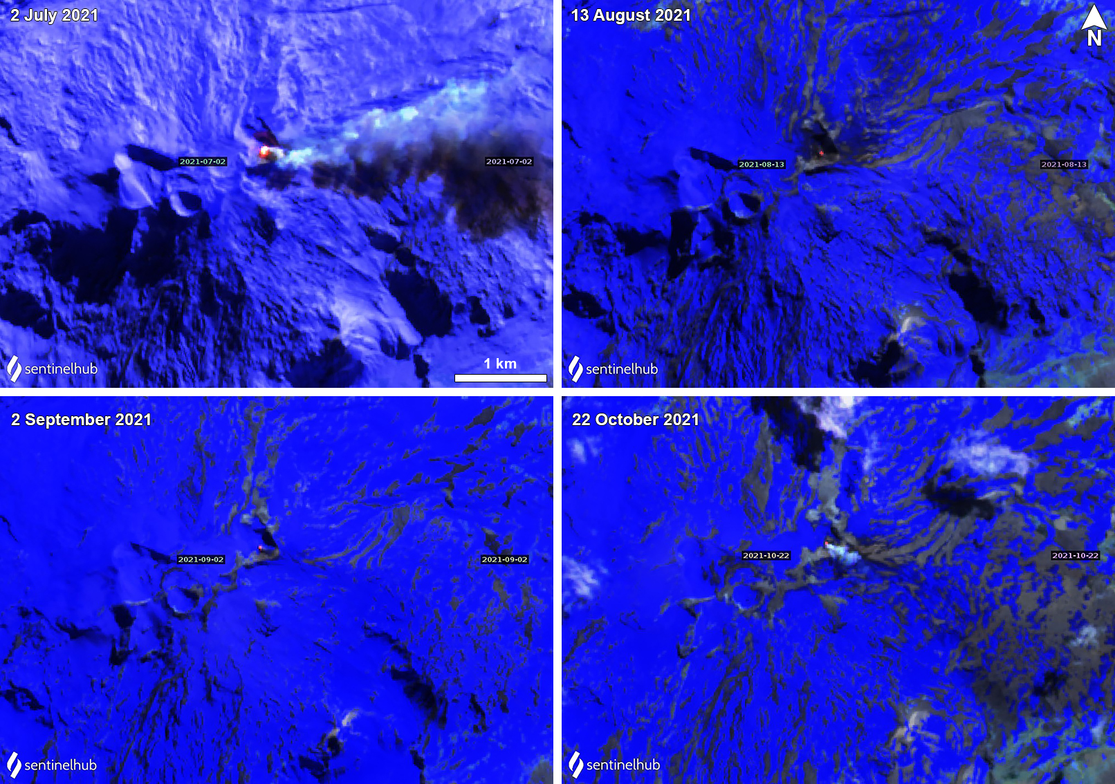 |
Figure 65. Sentinel-2 infrared satellite images showed a small, but persistent, thermal anomaly in the Copahue summit crater on 2 July (top left), 13 August (top right), 2 September (bottom left), and 22 October (bottom right) 2021. These were sometimes accompanied by white gas-and-steam plumes, as seen on 2 July and 22 October 2021. Images using “Atmospheric penetration” rendering (bands 12, 11, 8a). Courtesy of Sentinel Hub Playground. |
By July, both seismicity and degassing increased: 68 volcano-tectonic signals were detected and 2 LP events. Gas-and-steam plumes rose 540 m high and occasional nighttime incandescence was visible from the summit crater. On 2 July minor ash deposits were visible on the SE and ENE flanks. The average SO2 value was 862 ± 103 t/d with a daily maximum value of 2,134 t/d on 14 July.
During August, the number of volcano-tectonic events decreased to 15, though LP events rose to 18. Increased gas-and-ash emissions and periods of crater incandescence were reported during 9-10 August, based on information from SERNAGEOMIN. An ash plume was reported by the Buenos Aires VAAC during 10 August 2021 that rose to 3.4 km altitude and drifted N and NW, which was also confirmed in satellite and webcam images (figure 66). Distinct sulfur dioxide plumes accompanied this activity, identified by the TROPOMI instrument on the Sentinel-5P satellite, which exceeded two Dobson Units (DU) (figure 67). Thermal anomalies were detected intermittently throughout the month, accompanied by an average of 922 ± 146 t/d SO2 emissions, the highest value of which was 3,190 t/d on 24 August.
 |
Figure 66. Photo of an ash plume rising from Copahue on 10 August 2021 at 1400. Courtesy of Valentina Sepulveda. |
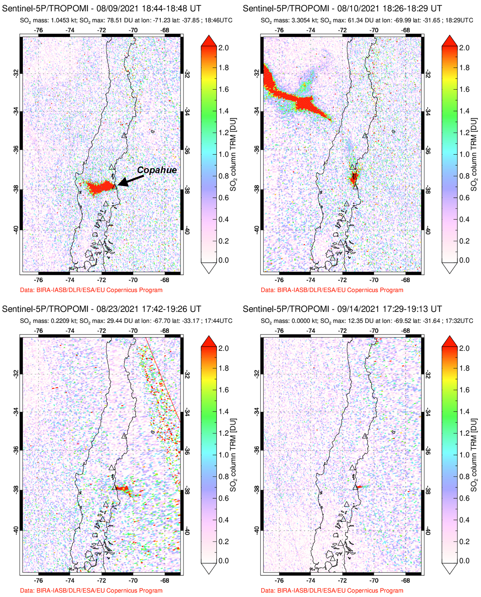 |
Figure 67. Distinct SO2 plumes were recorded at Copahue coincident with the ash plume during 9-10 August 2021. The plume drifted W on 9 August (top left) and strongly NW on 10 August (top right) 2021. Smaller plumes drifted E on 23 August (bottom left) and 14 September (bottom right) 2021. Courtesy of the NASA Global Sulfur Dioxide Monitoring Page. |
Activity during September consisted of 21 volcano-tectonic earthquakes and 2 LP events. Gas-and-steam emissions rose 1.2 km above the crater, accompanied by occasional thermal anomalies. DOAS measurements recorded an average SO2 value of 963 ± 115 t/d with a daily maximum value of 2,571 t/d on 14 September. The number of tremor events declined again during October to 11 volcano-tectonic events and 2 LP events. Gas-and-steam plumes rose 880 m above the crater, accompanied by thermal anomalies.
Information Contacts: Servicio Nacional de Geología y Minería (SERNAGEOMIN), Observatorio Volcanológico de Los Andes del Sur (OVDAS), Avda Sta María No. 0104, Santiago, Chile (URL: http://www.sernageomin.cl/); MIROVA (Middle InfraRed Observation of Volcanic Activity), a collaborative project between the Universities of Turin and Florence (Italy) supported by the Centre for Volcanic Risk of the Italian Civil Protection Department (URL: http://www.mirovaweb.it/); Global Sulfur Dioxide Monitoring Page, Atmospheric Chemistry and Dynamics Laboratory, NASA Goddard Space Flight Center (NASA/GSFC), 8800 Greenbelt Road, Goddard, Maryland, USA (URL: https://so2.gsfc.nasa.gov/); Sentinel Hub Playground (URL: https://www.sentinel-hub.com/explore/sentinel-playground); Valentina Sepulveda, Hotel Caviahue, Caviahue, Argentina (URL: https://twitter.com/valecaviahue, Twitter: @valecaviahue).
Two thermal anomalies during November 2021
Copahue is located along the Chile-Argentina border and contains an eastern summit crater with an acidic 300-m-wide crater lake that has exhibited fumarolic activity. The current eruption period began in July 2021 and has been characterized by ash plumes, frequent sulfur dioxide emissions, seismicity, and gas-and-steam emissions (BGVN 46:11). Weak thermal anomalies were also detected. This report covers activity from November 2021 through April 2022, which describes the end of the last eruption period with two thermal anomalies in early November. Information primarily comes from the Servicio Nacional de Geología y Minería (SERNAGEOMIN) Observatorio Volcanológico de Los Andes del Sur (OVDAS) and various satellite data.
Activity was relatively low during November 2021 and consisted of 19 volcano-tectonic (VT) type events and two long-period (LP) events. Gas-and-steam emissions rose less than 1.2 km above the summit. Two weak thermal anomalies were detected in the summit crater on 1 and 6 November 2021, according to Sentinel-2 infrared satellite images (figure 68). No further thermal activity was detected after 6 November through April 2022. Sulfur dioxide data obtained using Differential Absorption Optical Spectroscopy (DOAS) showed an average value of 486 ± 68 tons/day (t/d) and a maximum value of 1,850 t/d on 4 November.
|
Figure 68. Sentinel-2 infrared satellite images showed a small thermal anomaly in the Copahue summit crater on 1 (left) and 6 (right) November 2021. Images using “Atmospheric penetration” rendering (bands 12, 11, 8a). Courtesy of Sentinel Hub Playground. |
During December 2021 through April 2022, seismic activity consisted of 136 VT-type, seven LP-type, and one tremor type (TR) events. Gas-and-steam emissions rose 300-320 m high. Thermal anomalies were no longer observed in satellite imagery. Sulfur dioxide emissions ranged from 213-415 t/d, with a daily maximum value of 1,634 t/d on 28 March.
Information Contacts: Servicio Nacional de Geología y Minería (SERNAGEOMIN), Observatorio Volcanológico de Los Andes del Sur (OVDAS), Avda Sta María No. 0104, Santiago, Chile (URL: http://www.sernageomin.cl/, https://twitter.com/Sernageomin); Sentinel Hub Playground (URL: https://www.sentinel-hub.com/explore/sentinel-playground).
|
|
||||||||||||||||||||||||||
There is data available for 21 confirmed Holocene eruptive periods.
2024 Oct 16 ± 1 days - 2024 Oct 27 ± 1 days Confirmed Eruption (Explosive / Effusive) VEI: 1
| Episode 1 | Eruption (Explosive / Effusive) | |||||||||||||||||||||||||
|---|---|---|---|---|---|---|---|---|---|---|---|---|---|---|---|---|---|---|---|---|---|---|---|---|---|
| 2024 Oct 16 ± 1 days - 2024 Oct 27 ± 1 days | Evidence from Observations: Reported | ||||||||||||||||||||||||
|
List of 3 Events for Episode 1
|
|||||||||||||||||||||||||
2021 Jul 2 - 2021 Nov 6 Confirmed Eruption (Explosive / Effusive) VEI: 1
| Episode 1 | Eruption (Explosive / Effusive) | ||||||||||||||||||||||||||||||
|---|---|---|---|---|---|---|---|---|---|---|---|---|---|---|---|---|---|---|---|---|---|---|---|---|---|---|---|---|---|---|
| 2021 Jul 2 - 2021 Nov 6 | Evidence from Observations: Reported | |||||||||||||||||||||||||||||
|
List of 4 Events for Episode 1
|
||||||||||||||||||||||||||||||
2020 Jun 16 - 2020 Nov 2 Confirmed Eruption (Explosive / Effusive) VEI: 2
| Episode 1 | Eruption (Explosive / Effusive) | Agrio Crater | ||||||||||||||
|---|---|---|---|---|---|---|---|---|---|---|---|---|---|---|---|
| 2020 Jun 16 - 2020 Nov 2 | Evidence from Observations: Reported | ||||||||||||||
|
List of 1 Events for Episode 1 at Agrio Crater
|
|||||||||||||||
2019 Aug 2 - 2019 Nov 12 (?) Confirmed Eruption (Explosive / Effusive) VEI: 2
| Episode 1 | Eruption (Explosive / Effusive) | Agrio Crater | ||||||||||||||
|---|---|---|---|---|---|---|---|---|---|---|---|---|---|---|---|
| 2019 Aug 2 - 2019 Nov 12 (?) | Evidence from Observations: Reported | ||||||||||||||
|
List of 1 Events for Episode 1 at Agrio Crater
|
|||||||||||||||
2017 Jun 4 - 2018 Dec 7 Confirmed Eruption (Explosive / Effusive) VEI: 1
| Episode 1 | Eruption (Explosive / Effusive) | El Agrio Crater | |||||||||||||||||||||||||||||||||||||||||||||||||||||||||||||||||||||||||||||||||||||||||
|---|---|---|---|---|---|---|---|---|---|---|---|---|---|---|---|---|---|---|---|---|---|---|---|---|---|---|---|---|---|---|---|---|---|---|---|---|---|---|---|---|---|---|---|---|---|---|---|---|---|---|---|---|---|---|---|---|---|---|---|---|---|---|---|---|---|---|---|---|---|---|---|---|---|---|---|---|---|---|---|---|---|---|---|---|---|---|---|---|---|---|
| 2017 Jun 4 - 2017 Aug 20 ± 10 days | Evidence from Observations: Reported | |||||||||||||||||||||||||||||||||||||||||||||||||||||||||||||||||||||||||||||||||||||||||
|
List of 16 Events for Episode 1 at El Agrio Crater
|
||||||||||||||||||||||||||||||||||||||||||||||||||||||||||||||||||||||||||||||||||||||||||
| Episode 2 | Eruption (Explosive / Effusive) | El Agrio Crater | |||||||||||||||||||||||||||||||||||||||
|---|---|---|---|---|---|---|---|---|---|---|---|---|---|---|---|---|---|---|---|---|---|---|---|---|---|---|---|---|---|---|---|---|---|---|---|---|---|---|---|---|
| 2017 Nov 21 - 2017 Dec 31 (on or before) | Evidence from Observations: Reported | |||||||||||||||||||||||||||||||||||||||
|
List of 6 Events for Episode 2 at El Agrio Crater
|
||||||||||||||||||||||||||||||||||||||||
| Episode 3 | Eruption (Explosive / Effusive) | El Agrio Crater | ||||||||||||||||||||||||||||||||||
|---|---|---|---|---|---|---|---|---|---|---|---|---|---|---|---|---|---|---|---|---|---|---|---|---|---|---|---|---|---|---|---|---|---|---|---|
| 2018 Mar 24 - 2018 Mar 24 | Evidence from Observations: Reported | ||||||||||||||||||||||||||||||||||
|
List of 5 Events for Episode 3 at El Agrio Crater
|
|||||||||||||||||||||||||||||||||||
| Episode 4 | Eruption (Explosive / Effusive) | El Agrio Crater | |||||||||||||||||||||||||||||||||||||||||||||||||||||||||||||||||||||||||||||||||||||||||||||||||||||||||||||||||||||||||||||||||||||||||||
|---|---|---|---|---|---|---|---|---|---|---|---|---|---|---|---|---|---|---|---|---|---|---|---|---|---|---|---|---|---|---|---|---|---|---|---|---|---|---|---|---|---|---|---|---|---|---|---|---|---|---|---|---|---|---|---|---|---|---|---|---|---|---|---|---|---|---|---|---|---|---|---|---|---|---|---|---|---|---|---|---|---|---|---|---|---|---|---|---|---|---|---|---|---|---|---|---|---|---|---|---|---|---|---|---|---|---|---|---|---|---|---|---|---|---|---|---|---|---|---|---|---|---|---|---|---|---|---|---|---|---|---|---|---|---|---|---|---|---|---|---|
| 2018 Jun 24 - 2018 Dec 7 | Evidence from Observations: Reported | |||||||||||||||||||||||||||||||||||||||||||||||||||||||||||||||||||||||||||||||||||||||||||||||||||||||||||||||||||||||||||||||||||||||||||
|
List of 26 Events for Episode 4 at El Agrio Crater
|
||||||||||||||||||||||||||||||||||||||||||||||||||||||||||||||||||||||||||||||||||||||||||||||||||||||||||||||||||||||||||||||||||||||||||||
2015 Sep 18 ± 3 days - 2017 Feb 22 Confirmed Eruption (Explosive / Effusive) VEI: 2
| Episode 1 | Eruption (Explosive / Effusive) | Agrio Crater | ||||||||||||||||||||||||||||||||||||||||||||||||||||||||||||||||||||||||||||||||||||||||||||||||||||||||||||||||||||||||||||||||||||||||||||||||||||||||||||||||||||||||||||||
|---|---|---|---|---|---|---|---|---|---|---|---|---|---|---|---|---|---|---|---|---|---|---|---|---|---|---|---|---|---|---|---|---|---|---|---|---|---|---|---|---|---|---|---|---|---|---|---|---|---|---|---|---|---|---|---|---|---|---|---|---|---|---|---|---|---|---|---|---|---|---|---|---|---|---|---|---|---|---|---|---|---|---|---|---|---|---|---|---|---|---|---|---|---|---|---|---|---|---|---|---|---|---|---|---|---|---|---|---|---|---|---|---|---|---|---|---|---|---|---|---|---|---|---|---|---|---|---|---|---|---|---|---|---|---|---|---|---|---|---|---|---|---|---|---|---|---|---|---|---|---|---|---|---|---|---|---|---|---|---|---|---|---|---|---|---|---|---|---|---|---|---|---|---|---|---|
| 2015 Sep 18 ± 3 days - 2016 Mar 26 | Evidence from Observations: Reported | ||||||||||||||||||||||||||||||||||||||||||||||||||||||||||||||||||||||||||||||||||||||||||||||||||||||||||||||||||||||||||||||||||||||||||||||||||||||||||||||||||||||||||||||
|
List of 33 Events for Episode 1 at Agrio Crater
|
|||||||||||||||||||||||||||||||||||||||||||||||||||||||||||||||||||||||||||||||||||||||||||||||||||||||||||||||||||||||||||||||||||||||||||||||||||||||||||||||||||||||||||||||
| Episode 2 | Eruption (Explosive / Effusive) | Agrio Crater | |||||||||||||||||||||||||||||||||||||||||||||||||
|---|---|---|---|---|---|---|---|---|---|---|---|---|---|---|---|---|---|---|---|---|---|---|---|---|---|---|---|---|---|---|---|---|---|---|---|---|---|---|---|---|---|---|---|---|---|---|---|---|---|---|
| 2016 Jun 11 - 2016 Jul 8 | Evidence from Observations: Reported | |||||||||||||||||||||||||||||||||||||||||||||||||
|
List of 8 Events for Episode 2 at Agrio Crater
|
||||||||||||||||||||||||||||||||||||||||||||||||||
| Episode 3 | Eruption (Explosive / Effusive) | Agrio Crater | |||||||||||||||||||||||||||||||||||||||||||||||||||||||||||||||||||||||||||||||||||||||||||||||||||||||||||||||||||||||
|---|---|---|---|---|---|---|---|---|---|---|---|---|---|---|---|---|---|---|---|---|---|---|---|---|---|---|---|---|---|---|---|---|---|---|---|---|---|---|---|---|---|---|---|---|---|---|---|---|---|---|---|---|---|---|---|---|---|---|---|---|---|---|---|---|---|---|---|---|---|---|---|---|---|---|---|---|---|---|---|---|---|---|---|---|---|---|---|---|---|---|---|---|---|---|---|---|---|---|---|---|---|---|---|---|---|---|---|---|---|---|---|---|---|---|---|---|---|---|---|---|
| 2016 Sep 23 - 2017 Feb 22 | Evidence from Observations: Reported | |||||||||||||||||||||||||||||||||||||||||||||||||||||||||||||||||||||||||||||||||||||||||||||||||||||||||||||||||||||||
|
List of 22 Events for Episode 3 at Agrio Crater
|
||||||||||||||||||||||||||||||||||||||||||||||||||||||||||||||||||||||||||||||||||||||||||||||||||||||||||||||||||||||||
2014 Jul 4 - 2014 Dec 2 Confirmed Eruption (Explosive / Effusive) VEI: 2
| Episode 1 | Eruption (Explosive / Effusive) | El Agrio Crater | |||||||||||||||||||||||||||||||||||||||||||||||||||||||||||||||||||||||||||||||||||||||||||||||||||||||||||||||||||||||||||||||||||||||||||||||||||||
|---|---|---|---|---|---|---|---|---|---|---|---|---|---|---|---|---|---|---|---|---|---|---|---|---|---|---|---|---|---|---|---|---|---|---|---|---|---|---|---|---|---|---|---|---|---|---|---|---|---|---|---|---|---|---|---|---|---|---|---|---|---|---|---|---|---|---|---|---|---|---|---|---|---|---|---|---|---|---|---|---|---|---|---|---|---|---|---|---|---|---|---|---|---|---|---|---|---|---|---|---|---|---|---|---|---|---|---|---|---|---|---|---|---|---|---|---|---|---|---|---|---|---|---|---|---|---|---|---|---|---|---|---|---|---|---|---|---|---|---|---|---|---|---|---|---|---|---|---|---|---|
| 2014 Jul 4 - 2014 Dec 2 | Evidence from Observations: Reported | |||||||||||||||||||||||||||||||||||||||||||||||||||||||||||||||||||||||||||||||||||||||||||||||||||||||||||||||||||||||||||||||||||||||||||||||||||||
|
List of 28 Events for Episode 1 at El Agrio Crater
|
||||||||||||||||||||||||||||||||||||||||||||||||||||||||||||||||||||||||||||||||||||||||||||||||||||||||||||||||||||||||||||||||||||||||||||||||||||||
2012 Dec 22 - 2013 Dec 10 Confirmed Eruption (Explosive / Effusive) VEI: 2
| Episode 1 | Eruption (Explosive / Effusive) | Agrio Crater | |||||||||||||||||||||||||||||||||||||||||||||||||||||||||||||||||||||||||||||||||||||||||||||||||||||||||||||||||||||||||||||||||||||||||||||||||||||||||||||||||||||||||||||||||||||||||||||
|---|---|---|---|---|---|---|---|---|---|---|---|---|---|---|---|---|---|---|---|---|---|---|---|---|---|---|---|---|---|---|---|---|---|---|---|---|---|---|---|---|---|---|---|---|---|---|---|---|---|---|---|---|---|---|---|---|---|---|---|---|---|---|---|---|---|---|---|---|---|---|---|---|---|---|---|---|---|---|---|---|---|---|---|---|---|---|---|---|---|---|---|---|---|---|---|---|---|---|---|---|---|---|---|---|---|---|---|---|---|---|---|---|---|---|---|---|---|---|---|---|---|---|---|---|---|---|---|---|---|---|---|---|---|---|---|---|---|---|---|---|---|---|---|---|---|---|---|---|---|---|---|---|---|---|---|---|---|---|---|---|---|---|---|---|---|---|---|---|---|---|---|---|---|---|---|---|---|---|---|---|---|---|---|---|---|---|---|---|---|---|
| 2012 Dec 22 - 2013 Dec 10 | Evidence from Observations: Reported | |||||||||||||||||||||||||||||||||||||||||||||||||||||||||||||||||||||||||||||||||||||||||||||||||||||||||||||||||||||||||||||||||||||||||||||||||||||||||||||||||||||||||||||||||||||||||||||
|
List of 36 Events for Episode 1 at Agrio Crater
|
||||||||||||||||||||||||||||||||||||||||||||||||||||||||||||||||||||||||||||||||||||||||||||||||||||||||||||||||||||||||||||||||||||||||||||||||||||||||||||||||||||||||||||||||||||||||||||||
2012 Jul 17 - 2012 Jul 19 Confirmed Eruption (Explosive / Effusive) VEI: 2
| Episode 1 | Eruption (Explosive / Effusive) | El Agrio Crater | |||||||||||||||||||||||||||||||||||||||||||||||||||||||||||
|---|---|---|---|---|---|---|---|---|---|---|---|---|---|---|---|---|---|---|---|---|---|---|---|---|---|---|---|---|---|---|---|---|---|---|---|---|---|---|---|---|---|---|---|---|---|---|---|---|---|---|---|---|---|---|---|---|---|---|---|---|
| 2012 Jul 17 - 2012 Jul 19 | Evidence from Observations: Reported | |||||||||||||||||||||||||||||||||||||||||||||||||||||||||||
|
List of 10 Events for Episode 1 at El Agrio Crater
|
||||||||||||||||||||||||||||||||||||||||||||||||||||||||||||
2000 Jul 1 - 2000 Oct 18 Confirmed Eruption (Explosive / Effusive) VEI: 2
| Episode 1 | Eruption (Explosive / Effusive) | Agrio Crater | |||||||||||||||||||||||||||||||||||||||||||||||||||||||||||||||||||||||||||||||
|---|---|---|---|---|---|---|---|---|---|---|---|---|---|---|---|---|---|---|---|---|---|---|---|---|---|---|---|---|---|---|---|---|---|---|---|---|---|---|---|---|---|---|---|---|---|---|---|---|---|---|---|---|---|---|---|---|---|---|---|---|---|---|---|---|---|---|---|---|---|---|---|---|---|---|---|---|---|---|---|---|
| 2000 Jul 1 - 2000 Oct 18 | Evidence from Observations: Reported | |||||||||||||||||||||||||||||||||||||||||||||||||||||||||||||||||||||||||||||||
|
List of 14 Events for Episode 1 at Agrio Crater
|
||||||||||||||||||||||||||||||||||||||||||||||||||||||||||||||||||||||||||||||||
1995 Sep 16 ± 15 days Confirmed Eruption (Explosive / Effusive) VEI: 2
| Episode 1 | Eruption (Explosive / Effusive) | Agrio Crater | |||||||||||||||||||||||||||||
|---|---|---|---|---|---|---|---|---|---|---|---|---|---|---|---|---|---|---|---|---|---|---|---|---|---|---|---|---|---|---|
| 1995 Sep 16 ± 15 days - Unknown | Evidence from Observations: Reported | |||||||||||||||||||||||||||||
|
List of 4 Events for Episode 1 at Agrio Crater
|
||||||||||||||||||||||||||||||
1994 Dec 16 ± 15 days Confirmed Eruption (Explosive / Effusive) VEI: 2
| Episode 1 | Eruption (Explosive / Effusive) | Agrio Crater | |||||||||||||||||||||||||||||
|---|---|---|---|---|---|---|---|---|---|---|---|---|---|---|---|---|---|---|---|---|---|---|---|---|---|---|---|---|---|---|
| 1994 Dec 16 ± 15 days - Unknown | Evidence from Observations: Reported | |||||||||||||||||||||||||||||
|
List of 4 Events for Episode 1 at Agrio Crater
|
||||||||||||||||||||||||||||||
1992 Jul 22 - 1993 Jul 2 ± 182 days Confirmed Eruption (Explosive / Effusive) VEI: 2
| Episode 1 | Eruption (Explosive / Effusive) | Agrio Crater | |||||||||||||||||||||||||||||||||||||||||||||||||||||||||||
|---|---|---|---|---|---|---|---|---|---|---|---|---|---|---|---|---|---|---|---|---|---|---|---|---|---|---|---|---|---|---|---|---|---|---|---|---|---|---|---|---|---|---|---|---|---|---|---|---|---|---|---|---|---|---|---|---|---|---|---|---|
| 1992 Jul 22 - 1993 Jul 2 ± 182 days | Evidence from Observations: Reported | |||||||||||||||||||||||||||||||||||||||||||||||||||||||||||
|
List of 10 Events for Episode 1 at Agrio Crater
|
||||||||||||||||||||||||||||||||||||||||||||||||||||||||||||
1961 Jul 2 ± 182 days Confirmed Eruption (Explosive / Effusive) VEI: 2
| Episode 1 | Eruption (Explosive / Effusive) | ||||||||||||||||||||||||||||||
|---|---|---|---|---|---|---|---|---|---|---|---|---|---|---|---|---|---|---|---|---|---|---|---|---|---|---|---|---|---|---|
| 1961 Jul 2 ± 182 days - Unknown | Evidence from Observations: Reported | |||||||||||||||||||||||||||||
|
List of 4 Events for Episode 1
|
||||||||||||||||||||||||||||||
1960 Jul 2 ± 182 days Confirmed Eruption (Explosive / Effusive)
| Episode 1 | Eruption (Explosive / Effusive) | |||||||||||||||
|---|---|---|---|---|---|---|---|---|---|---|---|---|---|---|---|
| 1960 Jul 2 ± 182 days - Unknown | Evidence from Observations: Reported | ||||||||||||||
|
List of 1 Events for Episode 1
|
|||||||||||||||
1944 Confirmed Eruption (Explosive / Effusive)
| Episode 1 | Eruption (Explosive / Effusive) | |||||||||||||||
|---|---|---|---|---|---|---|---|---|---|---|---|---|---|---|---|
| 1944 - Unknown | Evidence from Observations: Reported | ||||||||||||||
|
List of 1 Events for Episode 1
|
|||||||||||||||
1937 Confirmed Eruption (Explosive / Effusive) VEI: 2 (?)
| Episode 1 | Eruption (Explosive / Effusive) | ||||||||||||||||||||
|---|---|---|---|---|---|---|---|---|---|---|---|---|---|---|---|---|---|---|---|---|
| 1937 - Unknown | Evidence from Observations: Reported | |||||||||||||||||||
|
List of 2 Events for Episode 1
|
||||||||||||||||||||
1867 (?) Confirmed Eruption (Explosive / Effusive) VEI: 2 (?)
| Episode 1 | Eruption (Explosive / Effusive) | ||||||||||||||||||||
|---|---|---|---|---|---|---|---|---|---|---|---|---|---|---|---|---|---|---|---|---|
| 1867 (?) - Unknown | Evidence from Observations: Reported | |||||||||||||||||||
|
List of 2 Events for Episode 1
|
||||||||||||||||||||
[ 1759 (?) ] Uncertain Eruption
| Episode 1 | Eruption (Explosive / Effusive) | |||||||||||||||||||||||||
|---|---|---|---|---|---|---|---|---|---|---|---|---|---|---|---|---|---|---|---|---|---|---|---|---|---|
| 1759 (?) - Unknown | Evidence from Unknown | ||||||||||||||||||||||||
|
List of 3 Events for Episode 1
|
|||||||||||||||||||||||||
1750 (?) Confirmed Eruption (Explosive / Effusive) VEI: 2
| Episode 1 | Eruption (Explosive / Effusive) | |||||||||||||||||||||||||
|---|---|---|---|---|---|---|---|---|---|---|---|---|---|---|---|---|---|---|---|---|---|---|---|---|---|
| 1750 (?) - Unknown | Evidence from Observations: Reported | ||||||||||||||||||||||||
|
List of 3 Events for Episode 1
|
|||||||||||||||||||||||||
0250 BCE (?) Confirmed Eruption (Explosive / Effusive)
| Episode 1 | Eruption (Explosive / Effusive) | ||||||||||||||||||||
|---|---|---|---|---|---|---|---|---|---|---|---|---|---|---|---|---|---|---|---|---|
| 0250 BCE (?) - Unknown | Evidence from Isotopic: 14C (uncalibrated) | |||||||||||||||||||
|
List of 2 Events for Episode 1
|
||||||||||||||||||||
6820 BCE (?) Confirmed Eruption (Explosive / Effusive)
| Episode 1 | Eruption (Explosive / Effusive) | ||||||||||||||||||||
|---|---|---|---|---|---|---|---|---|---|---|---|---|---|---|---|---|---|---|---|---|
| 6820 BCE (?) - Unknown | Evidence from Isotopic: 14C (uncalibrated) | |||||||||||||||||||
|
List of 2 Events for Episode 1
|
||||||||||||||||||||
This compilation of synonyms and subsidiary features may not be comprehensive. Features are organized into four major categories: Cones, Craters, Domes, and Thermal Features. Synonyms of features appear indented below the primary name. In some cases additional feature type, elevation, or location details are provided.
Synonyms |
||||
| Copahues, Los | Cupahue | Notuco | Trolope | Trilope | ||||
Craters |
||||
| Feature Name | Feature Type | Elevation | Latitude | Longitude |
| Caviahue
Agrio, del |
Caldera | |||
| El Agrio | Crater | 2740 m | 37° 51' 19.00" S | 71° 9' 38.00" W |
| Trapa-Trapa | Caldera | |||
Thermal |
||||
| Feature Name | Feature Type | Elevation | Latitude | Longitude |
| Chanchoco, Termas de | Thermal | |||
| Copahue, Baños | Thermal | |||
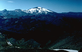 Volcán Copahue is a composite volcano constructed along the Chile-Argentina border within an 8-km-wide Pleistocene caldera. The eastern summit crater, part of a 2-km-long, ENE-WSW line of nine craters, contains the briny El Agrio crater lake and displays intense fumarolic activity. Infrequent explosive eruptions have been recorded since the 18th century from the 2965-m-high volcano.
  The broad glacier-covered summit of Volcán Copahue along the Chile/Argentina border is seen from the SE with conical Callaqui volcano in the distance. The lake-filled active crater of Copahue (lower center) has been the site of historical eruptions. The composite cone was constructed along the Chile/Argentina border within an 8-km-wide caldera formed 0.6 million years ago. The eastern summit crater is part of a 2-km-long, ENE-WSW line of nine craters that cuts across the western rim of the caldera.
 The small snow-free crater at the upper right, above and to the right of the light-colored area just right of the center of this NASA International Space Station image (with north to the upper left) is Trolon volcano. It lies in Argentina NE of the Caldera del Agrio (lower right), whose floor contains several lakes, including the U-shaped one at lower right near the SE caldera wall. Trolon is a lava-dome complex with two summit craters and a pyroclastic cone. Snow-covered Copahue volcano (bottom left-center) overlies the western rim of Caldera del Agrio.
There are no samples for Copahue in the Smithsonian's NMNH Department of Mineral Sciences Rock and Ore collection.
| Copernicus Browser | The Copernicus Browser replaced the Sentinel Hub Playground browser in 2023, to provide access to Earth observation archives from the Copernicus Data Space Ecosystem, the main distribution platform for data from the EU Copernicus missions. |
| MIROVA | Middle InfraRed Observation of Volcanic Activity (MIROVA) is a near real time volcanic hot-spot detection system based on the analysis of MODIS (Moderate Resolution Imaging Spectroradiometer) data. In particular, MIROVA uses the Middle InfraRed Radiation (MIR), measured over target volcanoes, in order to detect, locate and measure the heat radiation sourced from volcanic activity. |
| MODVOLC Thermal Alerts | Using infrared satellite Moderate Resolution Imaging Spectroradiometer (MODIS) data, scientists at the Hawai'i Institute of Geophysics and Planetology, University of Hawai'i, developed an automated system called MODVOLC to map thermal hot-spots in near real time. For each MODIS image, the algorithm automatically scans each 1 km pixel within it to check for high-temperature hot-spots. When one is found the date, time, location, and intensity are recorded. MODIS looks at every square km of the Earth every 48 hours, once during the day and once during the night, and the presence of two MODIS sensors in space allows at least four hot-spot observations every two days. Each day updated global maps are compiled to display the locations of all hot spots detected in the previous 24 hours. There is a drop-down list with volcano names which allow users to 'zoom-in' and examine the distribution of hot-spots at a variety of spatial scales. |
|
WOVOdat
Single Volcano View Temporal Evolution of Unrest Side by Side Volcanoes |
WOVOdat is a database of volcanic unrest; instrumentally and visually recorded changes in seismicity, ground deformation, gas emission, and other parameters from their normal baselines. It is sponsored by the World Organization of Volcano Observatories (WOVO) and presently hosted at the Earth Observatory of Singapore.
GVMID Data on Volcano Monitoring Infrastructure The Global Volcano Monitoring Infrastructure Database GVMID, is aimed at documenting and improving capabilities of volcano monitoring from the ground and space. GVMID should provide a snapshot and baseline view of the techniques and instrumentation that are in place at various volcanoes, which can be use by volcano observatories as reference to setup new monitoring system or improving networks at a specific volcano. These data will allow identification of what monitoring gaps exist, which can be then targeted by remote sensing infrastructure and future instrument deployments. |
| Volcanic Hazard Maps | The IAVCEI Commission on Volcanic Hazards and Risk has a Volcanic Hazard Maps database designed to serve as a resource for hazard mappers (or other interested parties) to explore how common issues in hazard map development have been addressed at different volcanoes, in different countries, for different hazards, and for different intended audiences. In addition to the comprehensive, searchable Volcanic Hazard Maps Database, this website contains information about diversity of volcanic hazard maps, illustrated using examples from the database. This site is for educational purposes related to volcanic hazard maps. Hazard maps found on this website should not be used for emergency purposes. For the most recent, official hazard map for a particular volcano, please seek out the proper institutional authorities on the matter. |
| IRIS seismic stations/networks | Incorporated Research Institutions for Seismology (IRIS) Data Services map showing the location of seismic stations from all available networks (permanent or temporary) within a radius of 0.18° (about 20 km at mid-latitudes) from the given location of Copahue. Users can customize a variety of filters and options in the left panel. Note that if there are no stations are known the map will default to show the entire world with a "No data matched request" error notice. |
| UNAVCO GPS/GNSS stations | Geodetic Data Services map from UNAVCO showing the location of GPS/GNSS stations from all available networks (permanent or temporary) within a radius of 20 km from the given location of Copahue. Users can customize the data search based on station or network names, location, and time window. Requires Adobe Flash Player. |
| DECADE Data | The DECADE portal, still in the developmental stage, serves as an example of the proposed interoperability between The Smithsonian Institution's Global Volcanism Program, the Mapping Gas Emissions (MaGa) Database, and the EarthChem Geochemical Portal. The Deep Earth Carbon Degassing (DECADE) initiative seeks to use new and established technologies to determine accurate global fluxes of volcanic CO2 to the atmosphere, but installing CO2 monitoring networks on 20 of the world's 150 most actively degassing volcanoes. The group uses related laboratory-based studies (direct gas sampling and analysis, melt inclusions) to provide new data for direct degassing of deep earth carbon to the atmosphere. |
| Large Eruptions of Copahue | Information about large Quaternary eruptions (VEI >= 4) is cataloged in the Large Magnitude Explosive Volcanic Eruptions (LaMEVE) database of the Volcano Global Risk Identification and Analysis Project (VOGRIPA). |
| EarthChem | EarthChem develops and maintains databases, software, and services that support the preservation, discovery, access and analysis of geochemical data, and facilitate their integration with the broad array of other available earth science parameters. EarthChem is operated by a joint team of disciplinary scientists, data scientists, data managers and information technology developers who are part of the NSF-funded data facility Integrated Earth Data Applications (IEDA). IEDA is a collaborative effort of EarthChem and the Marine Geoscience Data System (MGDS). |

