
Smithsonian Institution
Bulletin of the Global Volcanism Network, vol. 17, no. 10 (October 1992)
Managing Editor: Lindsay McClelland
Sumisujima (Japan) Small zone of discolored water
Please cite this report as:
Global Volcanism Program, 1992. Report on Sumisujima (Japan) (McClelland, L, ed.). Bulletin of the Global Volcanism Network, 17:10. Smithsonian Institution. https://doi.org/10.5479/si.GVP.BGVN199210-284080
A zone of discolored yellowish water 30 m [wide] and [6 km long] was observed by fishing crews at around 1100 on 7 October. A JMSA overflight on 9 October showed no anomaly. The volcano last erupted in 1916, ejecting tephra. Discoloration was seen at the shore and near the island in 1975, 1976, 1977, 1989, and August 1992.
[The following reported later in the VSJ Bulletin of Volcanic Eruptions provides additional information about the 7 October 1992 observation.]
"Shira-ne, a small rock mass of two pyroxene andesite 7.7 m below sea level, located about 7.5 km NE of Smith Rocks and about 500 km S of Tokyo, forms an E part of a submarine caldera about 8 km in diameter (figure 1). Smith Rocks, 136 m a.s.l., forming S rim of the caldera are of olivine basalt.
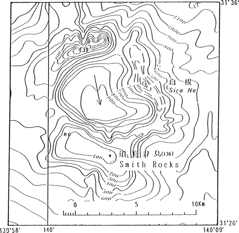 |
Figure 1. Submarine topography of Shira-ne and nearby area. |
"On October 7, 1992, yellow discolored water smelling sulfur was reported by a fishing boat (Daini-Odamaru), suggesting a submarine volcanic activity. The area of discoloration was 6 km long and 30 m wide."
"Reference: Hydrographic Department, Japan Maritime Safety Agency (1992): Recent activity of submarine volcanoes and volcanic islands. Rept. Coordinating Committee for Predication of Volcanic Eruption, No. 54, p. 77.
"(Communication from: H. Furukawa, Japan Maritime Safety Agency, Tsukiji 5-3-1, Chuo-ku, Tokyo 104, Japan.)"
Reference. Bulletin of Volcanic Eruptions, 1995, Annual Report of the World Volcanic Eruptions in 1992: Volcanological Society of Japan, no. 32, p. 134-135.
Information Contacts: JMA; JMSA.
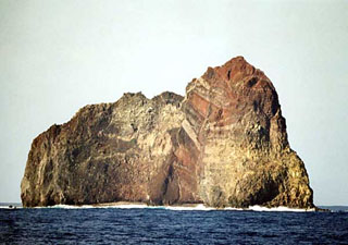
Geological Summary. Sumisujima (also known as Smith Rocks) is a steep-sided basaltic pinnacle that forms part of the outer southern flank of a 8-9 km submarine caldera that truncates a 20-km-wide seamount. The caldera was formed between about 60,000 and 30,000 years ago. The Shirane dacitic central cone, 3 km wide and 800 m high, rises to within 8 m of the ocean surface in the eastern side of the caldera, whose 600-700 m walls and outer flanks expose basaltic, andesitic, and rhyolitic rocks. Two large submarine cones, Sumisu Knolls No. 1 and 2, lie west of the caldera. Submarine eruptions have been reported from a number of locations near Sumisujima, the last of which occurred in 1916. Water discoloration has frequently been observed since the 1970's. In October 1992 a 6-km-long zone of discolored water was seen extending from the shallow Shirane rock mass near the eastern rim of the caldera, which rises to within 7 m of the ocean surface and is the youngest feature of the volcanic complex.


 Sumisujima