
Smithsonian Institution
Bulletin of the Global Volcanism Network, vol. 21, no. 1 (January 1996)
Managing Editor: Richard Wunderman
Karangetang (Indonesia) Small ash plumes, incandescent ejecta, and increased seismicity
Please cite this report as:
Global Volcanism Program, 1996. Report on Karangetang (Indonesia) (Wunderman, R, ed.). Bulletin of the Global Volcanism Network, 21:1. Smithsonian Institution. https://doi.org/10.5479/si.GVP.BGVN199601-267020
On 9 and 16 November "thunderclaps" were heard from the summit. A gray plume 500 m high was observed, and incandescent ejecta rose 10-50 m above the summit at night. On 17 December thunderclaps were heard again and ejecta rose 100 m above the summit. Seismicity increased from 26 October until the end of 1995. Daily counts of deep volcanic (A-type) earthquakes fluctuated up to 116 (figure 3).
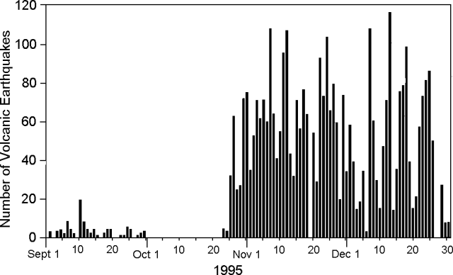 |
Figure 3. A-type seismicity at Karangetang, September-December 1995. Courtesy of VSI. |
Information Contacts: Wimpy S. Tjetjep (Director), Volcanological Survey of Indonesia (VSI), Jalan Diponegoro 57, Bandung, Indonesia.
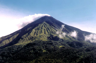
Geological Summary. Karangetang (Api Siau) volcano lies at the northern end of the island of Siau, about 125 km NNE of the NE-most point of Sulawesi. The stratovolcano contains five summit craters along a N-S line. It is one of Indonesia's most active volcanoes, with more than 40 eruptions recorded since 1675 and many additional small eruptions that were not documented (Neumann van Padang, 1951). Twentieth-century eruptions have included frequent explosive activity sometimes accompanied by pyroclastic flows and lahars. Lava dome growth has occurred in the summit craters; collapse of lava flow fronts have produced pyroclastic flows.


 Karangetang