Report on Sorikmarapi (Indonesia) — August 1996
Bulletin of the Global Volcanism Network, vol. 21, no. 8 (August 1996)
Managing Editor: Richard Wunderman.
Sorikmarapi (Indonesia) During May, "smoke" in vicinity reaches 10-km altitude
Please cite this report as:
Global Volcanism Program, 1996. Report on Sorikmarapi (Indonesia) (Wunderman, R., ed.). Bulletin of the Global Volcanism Network, 21:8. Smithsonian Institution. https://doi.org/10.5479/si.GVP.BGVN199608-261120
Sorikmarapi
Indonesia
0.6834°N, 99.5409°E; summit elev. 2145 m
All times are local (unless otherwise noted)
On the morning of 5 May 1996, Qantas Airlines reported "smoke" over Sumatra near Sorikmarapi to just above 10 km altitude. However, in a satellite pass about 2 hours earlier there was no evidence of an eruption.
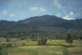
Geological Summary. Sorikmarapi is a forested stratovolcano with a 600-m-wide summit crater containing a lake and substantial sulfur deposits. A smaller upper SE flank crater (Danau Merah) also contains a crater lake; these two craters and a series of smaller explosion pits occur along a NW-SE line. Several solfatara fields are located on the E flank. Phreatic eruptions have occurred from summit and flank vents during the 19th and 20th centuries.
Information Contacts: Bureau of Meteorology, Northern Territory Regional Office, P.O. Box 735, Darwin NT 0801, Australia.