Report on Bulusan (Philippines) — September 2006
Bulletin of the Global Volcanism Network, vol. 31, no. 9 (September 2006)
Managing Editor: Richard Wunderman.
Bulusan (Philippines) Ten explosions recorded seismically between 21 March and 28 June 2006
Please cite this report as:
Global Volcanism Program, 2006. Report on Bulusan (Philippines) (Wunderman, R., ed.). Bulletin of the Global Volcanism Network, 31:9. Smithsonian Institution. https://doi.org/10.5479/si.GVP.BGVN200609-273010
Bulusan
Philippines
12.769°N, 124.056°E; summit elev. 1535 m
All times are local (unless otherwise noted)
On 19 March 2006, the Philippine Institute of Volcanology and Seismology (PHIVOLCS) raised the status of Bulusan from Zero Alert (no alert) to Alert Level 1 to reflect elevated seismic, fumarolic, and other unrest (BGVN 31:05). From that date until an ash explosion on 28 June 2006, 10 explosions were recorded (see table 3).
Table 3. Summary of significant events through late July 2006 at Bulusan . Numbering of explosion-type (E-type) quakes began 21 March 2006. Courtesy of Philippine Institute of Volcanology and Seismology (PHIVOLCS).
| Date | Local Time | Plume Altitude | Drift Direction | Comments |
| 19 Mar 2006 | -- | -- | -- | Seismic swarm which lasted until 21 Mar; Alert Level raised to 1. |
| 21 Mar 2006 | 2258 | 1.5 km | N, W, SW | 1st explosion-type (E-type) earthquake lasted 20 min; total of 4 E-type earthquakes recorded. |
| 08 Apr 2006 | 2000 | -- | -- | Lahar at Cogon spillway. |
| 09 Apr 2006 | 1036-1058 | -- | -- | Lahar at Cogon spillway. |
| 29 Apr 2006 | 1044 | 1.5 km | WSW, NW | 2nd E-type earthquake; total of three E-type earthquakes recorded. |
| 25 May 2006 | 2117-2130 | -- | -- | 3rd E-type earthquake; ash deposits, trace to 2 mm thick in Juban, Irosin. Cloud-covered summit. |
| 31 May 2006 | 1617 | 1.5 | W, WNW | 4th E-type earthquake. |
| 07 Jun 2006 | 2017-2030 | 2.0 | N, W, SW | 5th E-type earthquake; smaller E-type earthquake at 0225 on 8 Jun; Alert Level raised to 2. |
| 10 Jun 2006 | 1218 | 1.0 | NE, E | 6th E-type earthquake, lasting 25 min. |
| 13 Jun 2006 | 1904 | 1.5 | NW | 7th E-type earthquake, lasting 13 min. |
| 18 Jun 2006 | 1556 | 1.5 | W | 8th E-type earthquake. |
| 20 Jun 2006 | 2013 | -- | -- | 9th E-type earthquake ? mild; event not observed; seismic signal recorded for 17 min; rains generated some lahars. Cloud-covered summit. |
| 24 Jun 2006 | 2300 | -- | -- | Lahar at Cogon spillway. |
| 28 Jun 2006 | 0206 | -- | -- | 10th E-type earthquake; the associated volcanic event was not observed but seismic signal recorded as E-type earthquake lasted 4 min. Cloud-covered summit. |
| 29 Jun 2006 | 0800 | -- | -- | Continuous decline in activity; Alert Level lowered to 1. |
After the ash explosion of 28 June 2006, Bulusan's monitored parameters gradually decreased to near baseline levels. The daily count of volcanic earthquakes was very low, and SO2 emission rates and ground-deformation data revealed the volcano's deflated condition, indicating the absence of active magma ascent. Ash emission stopped and steaming from the active vents and fissures gradually returned to normal levels. Due to the decline in activity, on 29 July PHIVOLCS lowered the status of Bulusan from Alert Level 2 to 1.
On 10 October 2006 at 1256 UTC, the Tokyo Volcanic Ash Advisory Center announced that an eruption plume from Bulusan was visible on satellite imagery reaching altitudes of 3 km and drifting SW and SSE.
Unlike nearby Mayon volcano (~ 70 km NW) (see BGVN 31:08), no thermal anomalies were detected at Bulusan by satellite or recorded by the Hawai'i Institute of Geophysics and Planetology (HIGP) MODIS/ MODVOLC web site from the beginning of 2006 to 10 October 2006.
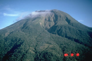
Geological Summary. Luzon's southernmost volcano, Bulusan, was constructed along the rim of the 11-km-diameter dacitic-to-rhyolitic Irosin caldera, which was formed about 36,000 years ago. It lies at the SE end of the Bicol volcanic arc occupying the peninsula of the same name that forms the elongated SE tip of Luzon. A broad, flat moat is located below the topographically prominent SW rim of Irosin caldera; the NE rim is buried by the andesitic complex. Bulusan is flanked by several other large intracaldera lava domes and cones, including the prominent Mount Jormajan lava dome on the SW flank and Sharp Peak to the NE. The summit is unvegetated and contains a 300-m-wide, 50-m-deep crater. Three small craters are located on the SE flank. Many moderate explosive eruptions have been recorded since the mid-19th century.
Information Contacts: Philippine Institute of Volcanology and Seismology (PHIVOLCS), University of the Philippines Campus, Diliman, Quezon City, Philippines (URL: http://www.phivolcs.dost.gov.ph); Tokyo Volcanic Ash Advisory Center (VAAC) (URL: http://www.jma.go.jp/jma/jma-eng/jma-center/vaac/index/html); HIGP MODIS Thermal Alert System, Hawai'i Institute of Geophysics and Planetology (HIGP), University of Hawaii at Manoa, 168 East-West Road, Post 602, Honolulu, HI 96822, USA (URL: http://modis.higp.hawaii.edu/).

