Report on Dukono (Indonesia) — October 2007
Bulletin of the Global Volcanism Network, vol. 32, no. 10 (October 2007)
Managing Editor: Richard Wunderman.
Dukono (Indonesia) Thermal anomalies indicate possible activity at Dukono in October 2007
Please cite this report as:
Global Volcanism Program, 2007. Report on Dukono (Indonesia) (Wunderman, R., ed.). Bulletin of the Global Volcanism Network, 32:10. Smithsonian Institution. https://doi.org/10.5479/si.GVP.BGVN200710-268010
Dukono
Indonesia
1.6992°N, 127.8783°E; summit elev. 1273 m
All times are local (unless otherwise noted)
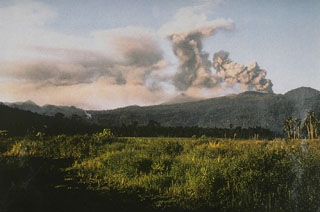
Based on visual observations, the Center of Volcanology and Geological Hazard Mitigation (CVGHM) reported that during the week of 18-25 June 2007 white-gray ash rose to 50-250 m above the summit. The hazard status of the volcano remained on level 2 (on a scale of 1-4).
No significant change of seismicity was noted with respect to previous weeks, and no thermal anomalies were measured during that week by the MODIS/MODVOLC satellite team (table 6). Subsequently, a sequence of thermal anomalies were measured by satellite between 10 August and 27 October 2007.
Table 6. Thermal anomalies at Dukono based on MODIS-MODVOLC imaging between 9 March 2007 and 27 November 2007 (continued from the list in BGVN 32:03). Courtesy of Hawai'i Institute of Geophysics and Planetology (HIGP) Thermal Alerts System.
| Date (UTC) | Time (UTC) | Pixels | Satellite |
| 09 Mar-09 Aug 2007 | -- | 0 | -- |
| 10 Aug 2007 | 1645 | 1 | Aqua |
| 27 Sep 2007 | 1350 | 1 | Terra |
| 02 Oct 2007 | 1705 | 1 | Aqua |
| 04 Oct 2007 | 1355 | 1 | Terra |
| 04 Oct 2007 | 1650 | 1 | Aqua |
| 11 Oct 2007 | 1405 | 1 | Terra |
| 13 Oct 2007 | 1350 | 1 | Terra |
| 13 Oct 2007 | 1645 | 2 | Aqua |
| 16 Oct 2007 | 1715 | 1 | Aqua |
| 18 Oct 2007 | 1410 | 2 | Terra |
| 18 Oct 2007 | 1705 | 1 | Aqua |
| 27 Oct 2007 | 1655 | 1 | Aqua |
| 28 Oct-27 Nov 2007 | -- | 0 | -- |
Geological Summary. The Dukono complex in northern Halmahera is on an edifice with a broad, low profile containing multiple peaks and overlapping craters. Almost continuous explosive eruptions, sometimes accompanied by lava flows, have occurred since 1933. During a major eruption in 1550 CE, a lava flow filled in the strait between Halmahera and the Gunung Mamuya cone, 10 km NE. Malupang Wariang, 1 km SW of the summit crater complex, contains a 700 x 570 m crater that has also had reported eruptions.
Information Contacts: Center of Volcanology and Geological Hazard Mitigation (CVGHM), Jalan Diponegoro 57, Bandung 40122, Indonesia (URL: http://vsi.esdm.go.id/); Hawai'i Institute of Geophysics and Planetology (HIGP) Thermal Alerts System, School of Ocean and Earth Science and Technology (SOEST), University of Hawai'i, 2525 Correa Road, Honolulu, HI 96822, USA (URL: http://modis.higp.hawaii.edu/).

