Report on Talang (Indonesia) — 25 April-1 May 2007
Smithsonian Institution / US Geological Survey
Weekly Volcanic Activity Report, 25 April-1 May 2007
Managing Editor: Sally Sennert.
Please cite this report as:
Global Volcanism Program, 2007. Report on Talang (Indonesia) (Sennert, S, ed.). Weekly Volcanic Activity Report, 25 April-1 May 2007. Smithsonian Institution and US Geological Survey.
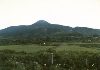
Talang
Indonesia
0.979°S, 100.681°E; summit elev. 2575 m
All times are local (unless otherwise noted)
CVGHM lowered the Alert Level at Talang to 2 (on a scale of 1-4) on 27 April.
Geological Summary. Talang is part of a large volcanic edifice just NW of Dibawah Lake. An older volcanic peak, Pasar Arbaao, is ~1.5 km W. The steep-sided Talang cone exhibits fumarolic activity but has no crater; it appears to have grown within a larger caldera. Recorded eruptions have mostly involved small-to-moderate explosive activity, first documented in the 19th century, that originated from a series of small craters in a valley on the NE flank.
Source: Pusat Vulkanologi dan Mitigasi Bencana Geologi (PVMBG, also known as CVGHM)