
Smithsonian Institution / US Geological Survey
Weekly Volcanic Activity Report, 5 December-11 December 2007
Managing Editor: Sally Sennert
Please cite this report as:
Global Volcanism Program, 2007. Report on Anatahan (United States) (Sennert, S, ed.). Weekly Volcanic Activity Report, 5 December-11 December 2007. Smithsonian Institution and US Geological Survey. https://volcano.si.edu/showreport.cfm?gvpvar=GVP.WVAR20071205-284200
Low-level tremor at Anatahan continued during 30 November-7 December. The Volcanic Alert Level remained at Advisory and the Aviation Color Code remained at Yellow.
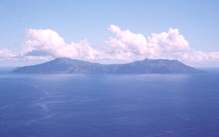
Geological Summary. The elongate, 9-km-long island of Anatahan in the central Mariana Islands consists of a large stratovolcano with a 2.3 x 5 km compound summit caldera. The larger western portion of the caldera is 2.3 x 3 km wide, and its western rim forms the island's high point. Ponded lava flows overlain by pyroclastic deposits fill the floor of the western caldera, whose SW side is cut by a fresh-looking smaller crater. The 2-km-wide eastern portion of the caldera contained a steep-walled inner crater whose floor prior to the 2003 eruption was only 68 m above sea level. A submarine cone, named NE Anatahan, rises to within 460 m of the sea surface on the NE flank, and numerous other submarine vents are found on the NE-to-SE flanks. Sparseness of vegetation on the most recent lava flows had indicated that they were of Holocene age, but the first historical eruption did not occur until May 2003, when a large explosive eruption took place forming a new crater inside the eastern caldera.


 Anatahan