
Smithsonian Institution / US Geological Survey
Weekly Volcanic Activity Report, 5 December-11 December 2012
Managing Editor: Sally Sennert
Please cite this report as:
Global Volcanism Program, 2012. Report on Paluweh (Indonesia) (Sennert, S, ed.). Weekly Volcanic Activity Report, 5 December-11 December 2012. Smithsonian Institution and US Geological Survey. https://volcano.si.edu/showreport.cfm?gvpvar=GVP.WVAR20121205-264150
Based on analyses of satellite imagery and wind data, the Darwin VAAC reported that on 6 and 8 December ash plumes from Paluweh rose to an altitude of 3.7 km (12,000 ft) a.s.l. and drifted 35-75 km NW, W, and SW.
Source: Darwin Volcanic Ash Advisory Centre (VAAC)
Geological Summary. Paluweh, also known as Rokatenda, forms the 8-km-wide island of Palu'e north of the volcanic arc that cuts across Flores Island. The broad irregular summit region contains overlapping craters up to 900 m wide and several lava domes. Several flank vents occur along a NW-trending fissure. A large eruption in 1928 included strong explosive activity accompanied by landslide-induced tsunamis and lava dome emplacement. Pyroclastic flows in August 2013 resulted in fatalities.


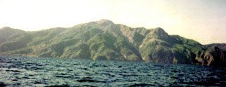 Paluweh