Report on Paluweh (Indonesia) — 19 June-25 June 2013
Smithsonian Institution / US Geological Survey
Weekly Volcanic Activity Report, 19 June-25 June 2013
Managing Editor: Sally Sennert.
Please cite this report as:
Global Volcanism Program, 2013. Report on Paluweh (Indonesia) (Sennert, S, ed.). Weekly Volcanic Activity Report, 19 June-25 June 2013. Smithsonian Institution and US Geological Survey.
Paluweh
Indonesia
8.32°S, 121.708°E; summit elev. 875 m
All times are local (unless otherwise noted)
Based on analyses of satellite imagery and wind data, the Darwin VAAC reported that on 19 June ash plumes from Paluweh rose to an altitude of 2.4 km (8,000 ft) a.s.l. and drifted over 35 km SE.
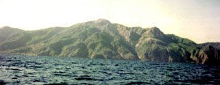
Geological Summary. Paluweh, also known as Rokatenda, forms the 8-km-wide island of Palu'e north of the volcanic arc that cuts across Flores Island. The broad irregular summit region contains overlapping craters up to 900 m wide and several lava domes. Several flank vents occur along a NW-trending fissure. A large eruption in 1928 included strong explosive activity accompanied by landslide-induced tsunamis and lava dome emplacement. Pyroclastic flows in August 2013 resulted in fatalities.

