
Smithsonian Institution / US Geological Survey
Weekly Volcanic Activity Report, 15 October-21 October 2014
Managing Editor: Sally Sennert
Please cite this report as:
Global Volcanism Program, 2014. Report on Karangetang (Indonesia) (Sennert, S, ed.). Weekly Volcanic Activity Report, 15 October-21 October 2014. Smithsonian Institution and US Geological Survey. https://volcano.si.edu/showreport.cfm?gvpvar=GVP.WVAR20141015-267020
Based on analyses of satellite imagery and wind data, the Darwin VAAC reported that on 20 October ash plumes from Karangetang rose to an altitude of 3 km (10,000 ft) a.s.l. and drifted 75 km NW.
Source: Darwin Volcanic Ash Advisory Centre (VAAC)
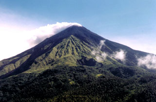
Geological Summary. Karangetang (Api Siau) volcano lies at the northern end of the island of Siau, about 125 km NNE of the NE-most point of Sulawesi. The stratovolcano contains five summit craters along a N-S line. It is one of Indonesia's most active volcanoes, with more than 40 eruptions recorded since 1675 and many additional small eruptions that were not documented (Neumann van Padang, 1951). Twentieth-century eruptions have included frequent explosive activity sometimes accompanied by pyroclastic flows and lahars. Lava dome growth has occurred in the summit craters; collapse of lava flow fronts have produced pyroclastic flows.


 Karangetang