Report on Ciremai (Indonesia) — 24 June-30 June 2015
Smithsonian Institution / US Geological Survey
Weekly Volcanic Activity Report, 24 June-30 June 2015
Managing Editor: Sally Sennert.
Please cite this report as:
Global Volcanism Program, 2015. Report on Ciremai (Indonesia) (Sennert, S, ed.). Weekly Volcanic Activity Report, 24 June-30 June 2015. Smithsonian Institution and US Geological Survey.
Ciremai
Indonesia
6.895°S, 108.408°E; summit elev. 3039 m
All times are local (unless otherwise noted)
According to the Darwin VAAC a pilot observed a small "smoke" plume rising from Cereme on 24 June; ash was not identified in satellite images.
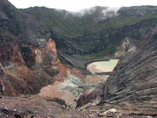
Geological Summary. The symmetrical Ciremai stratovolcano is located closer to the northern coast than other central Java volcanoes. A large crater, elongated in an E-W direction and formed by multiple vents, caps the summit of Gunung Ciremai, which was constructed on the northern rim of the 4.5 x 5 km Geger Halang caldera. A large landslide deposit to the north may be associated with the origin of the caldera, although collapse may rather be due to a voluminous explosive eruption (Newhall and Dzurisin, 1988). Eruptions have included explosive activity and lahars, primarily from the summit crater.