
Smithsonian Institution / US Geological Survey
Weekly Volcanic Activity Report, 31 January-6 February 2018
Managing Editor: Sally Sennert
Please cite this report as:
Global Volcanism Program, 2018. Report on Kīlauea (United States) (Sennert, S, ed.). Weekly Volcanic Activity Report, 31 January-6 February 2018. Smithsonian Institution and US Geological Survey. https://volcano.si.edu/showreport.cfm?gvpvar=GVP.WVAR20180131-332010
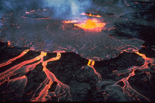
During 31 January-6 February HVO reported that the lava lake continued to rise, fall, and spatter in Kīlauea's Overlook crater. Webcams recorded incandescence from a small lava pond in a pit on the W side of Puʻu ʻŌʻō Crater. Surface lava flows were active above and on the pali, and on the coastal plain.
Source: US Geological Survey Hawaiian Volcano Observatory (HVO)
Geological Summary. Kīlauea overlaps the E flank of the massive Mauna Loa shield volcano in the Island of Hawaiʻi. Eruptions are prominent in Polynesian legends; written documentation since 1820 records frequent summit and flank lava flow eruptions interspersed with periods of long-term lava lake activity at Halemaʻumaʻu crater in the summit caldera until 1924. The 3 x 5 km caldera was formed in several stages about 1,500 years ago and during the 18th century; eruptions have also originated from the lengthy East and Southwest rift zones, which extend to the ocean in both directions. About 90% of the surface of the basaltic shield volcano is formed of lava flows less than about 1,100 years old; 70% of the surface is younger than 600 years. The long-term eruption from the East Rift Zone between 1983 and 2018 produced lava flows covering more than 100 km2, destroyed hundreds of houses, and added new coastline.


 Kīlauea