
Smithsonian Institution / US Geological Survey
Weekly Volcanic Activity Report, 3 October-9 October 2018
Managing Editor: Sally Sennert
Please cite this report as:
Global Volcanism Program, 2018. Report on Ibu (Indonesia) (Sennert, S, ed.). Weekly Volcanic Activity Report, 3 October-9 October 2018. Smithsonian Institution and US Geological Survey. https://volcano.si.edu/showreport.cfm?gvpvar=GVP.WVAR20181003-268030
Based on satellite images and model data, the Darwin VAAC reported that on 6 October an ash plume from Ibu rose to 1.8 km (6,000 ft) a.s.l. and drifted WSW.
Source: Darwin Volcanic Ash Advisory Centre (VAAC)
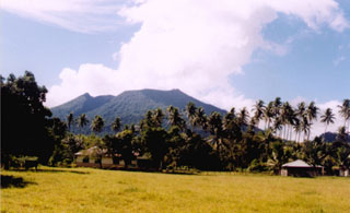
Geological Summary. The truncated summit of Gunung Ibu stratovolcano along the NW coast of Halmahera Island has large nested summit craters. The inner crater, 1 km wide and 400 m deep, has contained several small crater lakes. The 1.2-km-wide outer crater is breached on the N, creating a steep-walled valley. A large cone grew ENE of the summit, and a smaller one to the WSW has fed a lava flow down the W flank. A group of maars is located below the N and W flanks. The first observed and recorded eruption was a small explosion from the summit crater in 1911. Eruptive activity began again in December 1998, producing a lava dome that eventually covered much of the floor of the inner summit crater along with ongoing explosive ash emissions.


 Ibu
Ibu